Williamsport is a town in Washington County, Maryland, United States. The population was 1,868 at the 2000 census and 2,137 as of 2010.
| Name: | Williamsport town |
|---|---|
| LSAD Code: | 43 |
| LSAD Description: | town (suffix) |
| State: | Maryland |
| County: | Washington County |
| Incorporated: | 1823 |
| Elevation: | 407 ft (124 m) |
| Total Area: | 0.98 sq mi (2.55 km²) |
| Land Area: | 0.98 sq mi (2.55 km²) |
| Water Area: | 0.00 sq mi (0.00 km²) |
| Total Population: | 2,083 |
| Population Density: | 2,119.02/sq mi (817.91/km²) |
| ZIP code: | 21795 |
| Area code: | 301, 240 |
| FIPS code: | 2485100 |
| GNISfeature ID: | 0591561 |
| Website: | http://williamsportmd.gov/ |
Online Interactive Map
Click on ![]() to view map in "full screen" mode.
to view map in "full screen" mode.
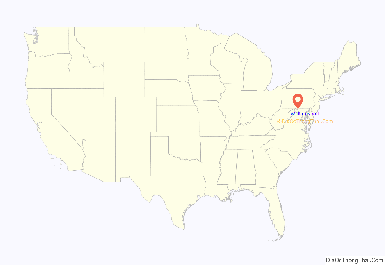
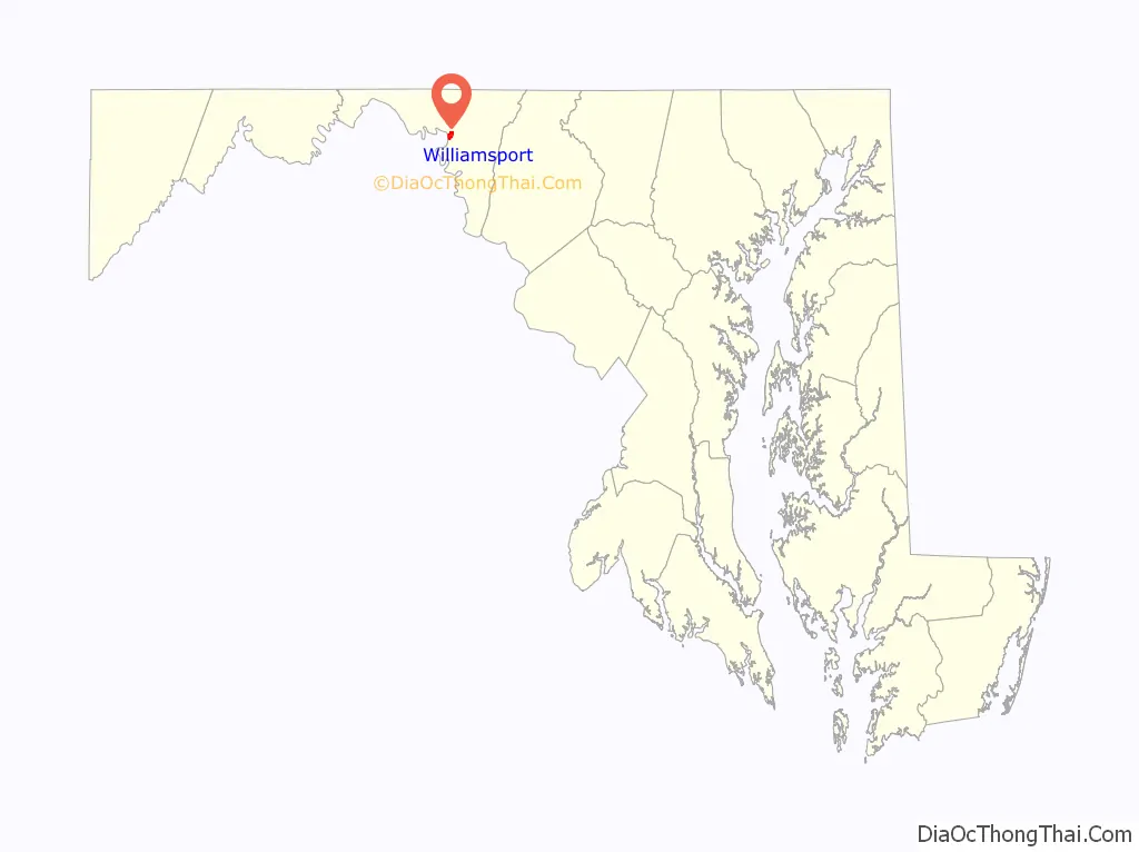
Williamsport location map. Where is Williamsport town?
History
The town lies on one of the early Native American trails between New York and the Carolinas. In the mid-18th century, tens of thousands of European settlers and pioneer families with their wagons followed the same route on the Great Wagon Road from Pennsylvania to Virginia and points south and west. In 1744, a ferry was established at the present site of Williamsport to carry the traffic across the Potomac River. Today’s travelers make the crossing on Interstate 81 a mile downriver from the town.
In 1755 the land tract of Thomas Cresap (Jr.) named “Leeds” at the future site of Williamsport would become an important supply depot for the Braddock expedition to capture the French fort Duquesne (at present Pittsburgh). Supplies were transported to this place both west from Rock Creek (today’s Georgetown) and south from Pennsylvania. Col. Thomas Dunbar’s 48th regiment of the British Army encamped here on May 1, 1755, before ferrying across the Potomac River and marching two days south to rejoin Sir Thomas Halkett’s 44th regiment north of Winchester, Virginia. Just over two months later Dunbar, the highest-ranking surviving, unwounded officer, would lead the remains of the tattered army through Williamsport to Frederick, Maryland on the retreat to Philadelphia.
The land of present-day Williamsport was previously owned by Otho Holland Williams, a Continental Army officer in the American Revolutionary War, and for whom the town is named.
Cedar Grove, Daniel Donnelly House, Elmwood, Rose Hill, Sprechers Mill House, Springfield Farm, Tammany, and the Williamsport Historic District are listed on the National Register of Historic Places.
Economic growth
In 1834, boats using a portion of the newly built Chesapeake and Ohio Canal were able to reach Williamsport from Washington, D.C. The canal itself was extended to Williamsport in 1835. The canal became an important commercial route which connected the area with the lower Potomac River region and the Chesapeake Bay, and later with the Cumberland, Maryland region as the canal construction continued westward. Williamsport became a very popular waterfront town which benefited the economy. In 1873, the Western Maryland Railway extended its line from Hagerstown to Williamsport, in order to gain access to canal traffic. Coal from Cumberland area mines was one of the principal commodities transferred from canal barges to rail cars at Williamsport.
Flooding
In 1863, during the Civil War, the overflowing flooding waters of the river prevented General Robert E. Lee’s army, on its retreat from Gettysburg, from crossing and making it safely into Virginia for several days. A large flood in 1924 caused extensive damage to the canal, which was then permanently shut down.
Williamsport Road Map

Williamsport city Satellite Map

Geography
Williamsport is located at 39°35′55″N 77°49′6″W / 39.59861°N 77.81833°W / 39.59861; -77.81833 (39.598496, −77.818464).
According to the United States Census Bureau, the town has a total area of 1.04 square miles (2.69 km), all land.
Williamsport is located 7.69 mi (12.38 km) southwest of Hagerstown and 16.23 mi (26.12 km) north of Martinsburg, West Virginia.
Climate
The climate in this area is characterized by hot, humid summers and generally mild to cool winters. According to the Köppen Climate Classification system, Williamsport has a humid subtropical climate, abbreviated “Cfa” on climate maps.
See also
Map of Maryland State and its subdivision: Map of other states:- Alabama
- Alaska
- Arizona
- Arkansas
- California
- Colorado
- Connecticut
- Delaware
- District of Columbia
- Florida
- Georgia
- Hawaii
- Idaho
- Illinois
- Indiana
- Iowa
- Kansas
- Kentucky
- Louisiana
- Maine
- Maryland
- Massachusetts
- Michigan
- Minnesota
- Mississippi
- Missouri
- Montana
- Nebraska
- Nevada
- New Hampshire
- New Jersey
- New Mexico
- New York
- North Carolina
- North Dakota
- Ohio
- Oklahoma
- Oregon
- Pennsylvania
- Rhode Island
- South Carolina
- South Dakota
- Tennessee
- Texas
- Utah
- Vermont
- Virginia
- Washington
- West Virginia
- Wisconsin
- Wyoming


