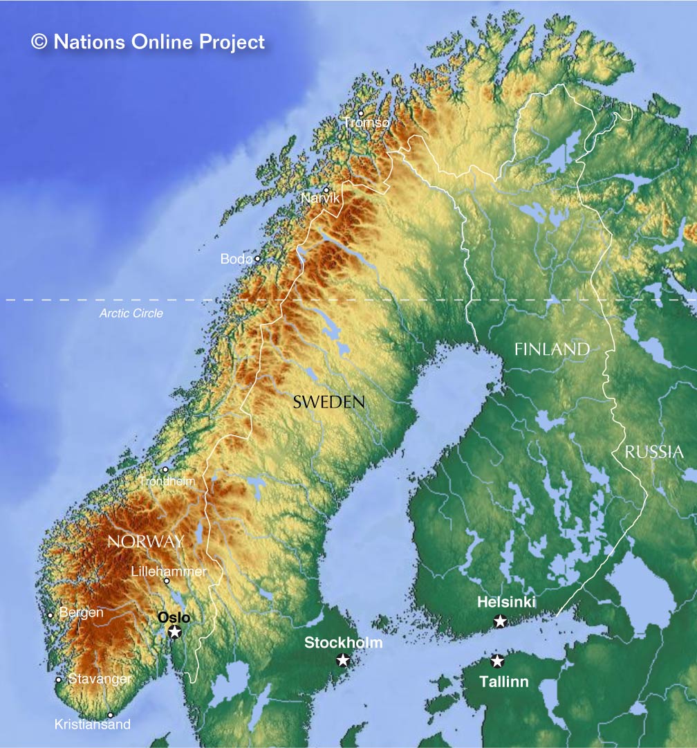
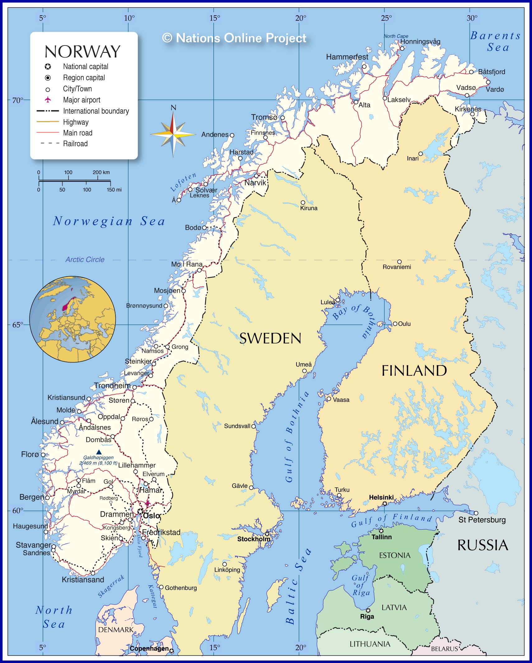
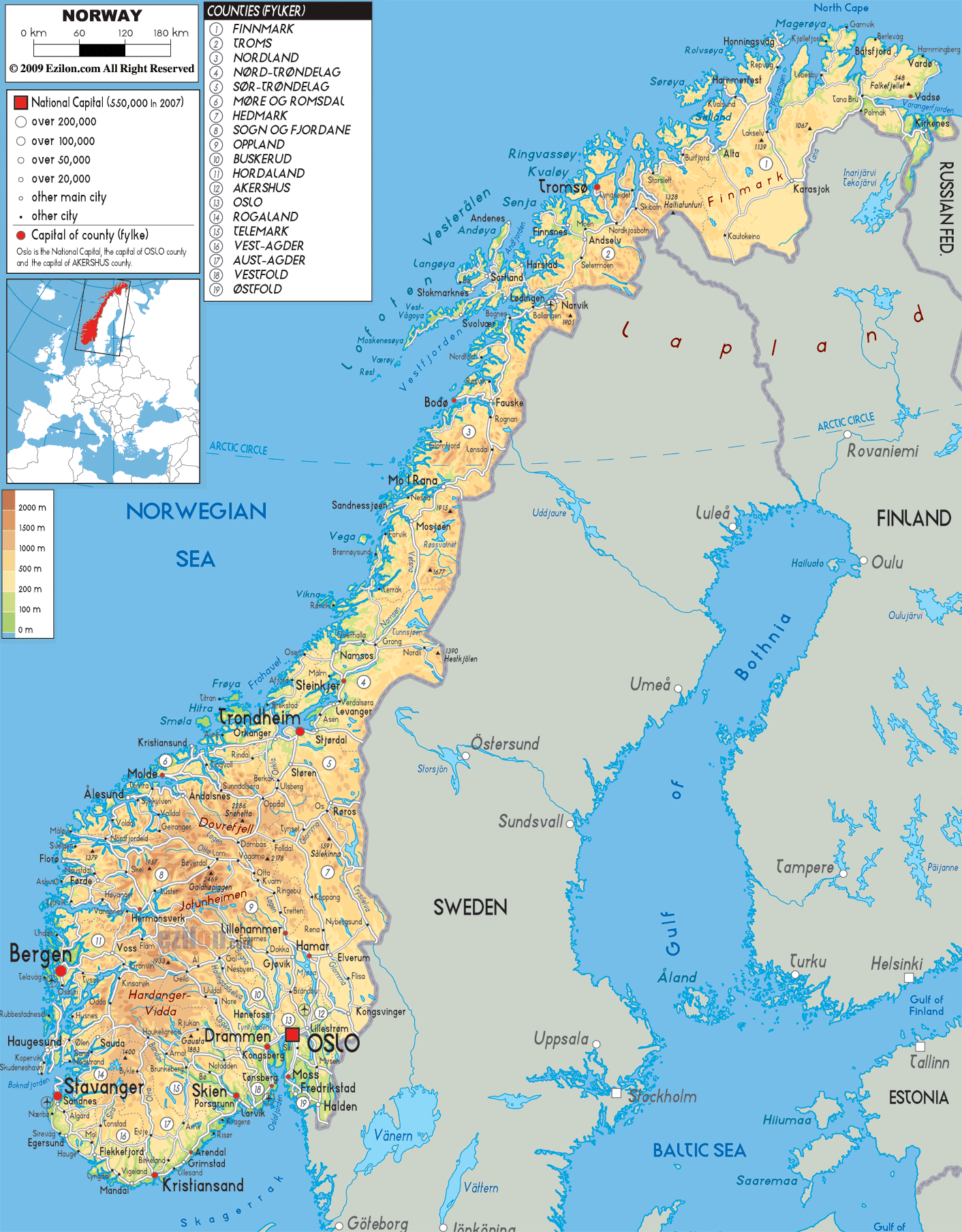
Norway is a northern European country covering an area of 385,207 sq. km on the Scandinavian Peninsula. As observed on the physical map of Norway, the country is highly mountainous and has a heavily indented coastline.
Before the last ice age ended about 10,000 years ago, Norway was covered by a thick ice sheet. When that ice finally retreated (or melted) its movement across the land formed islands, lakes, rivers and mountains. It also etched-out deep valleys that then filled with seawater forming Norway’s fjords.
Norway is a rugged land of elevated plateaus, deep forested valleys and a few remaining ice age glaciers, including Folgefonna, Hardangerjokulen and Jostedalsbreen – the largest glacier on the continental Europe landmass.
Norway is one of Europe’s most mountainous countries and dominated north to south by the many ranges of the Scandinavian Mountains as observed on the map above.
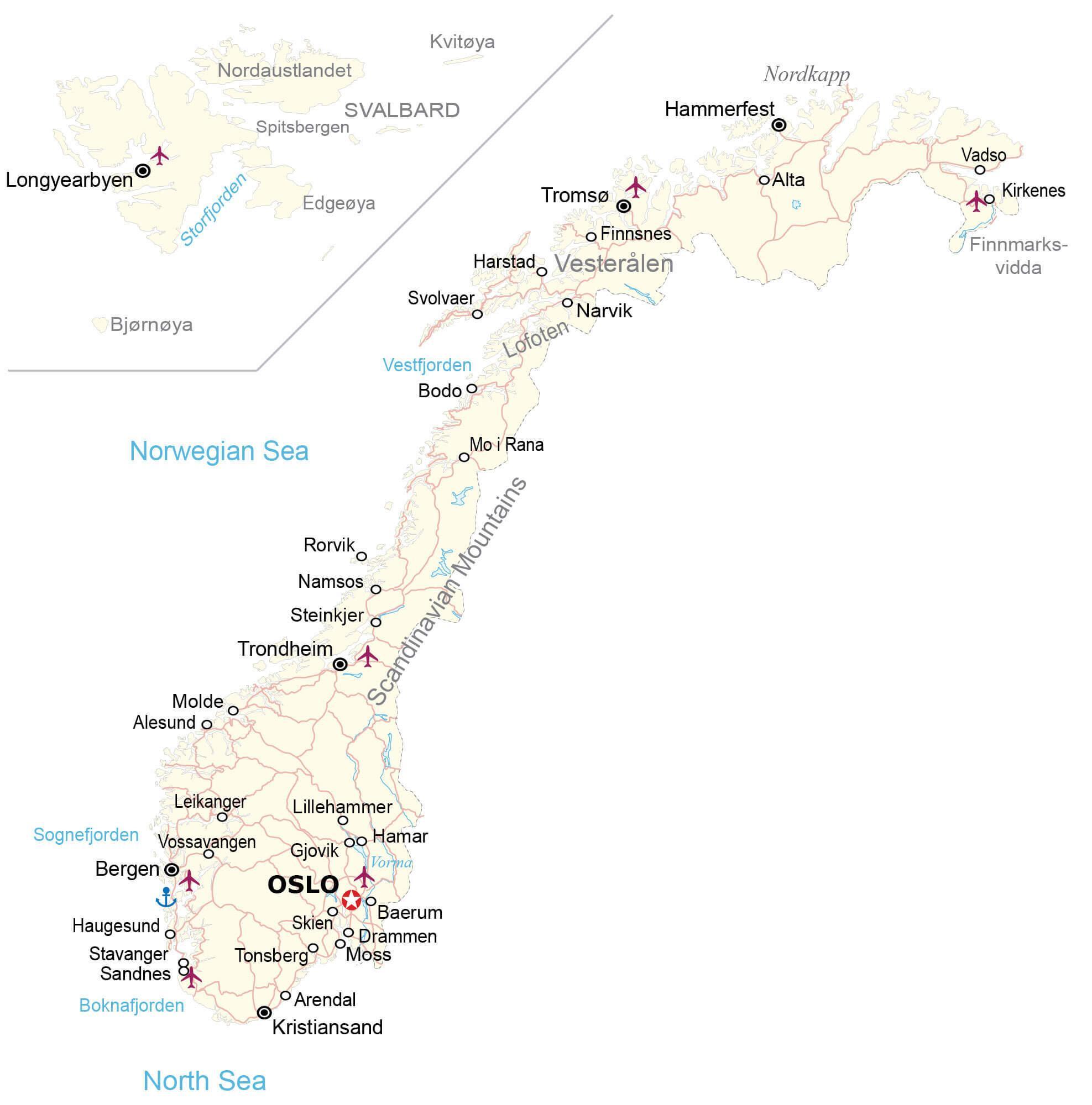
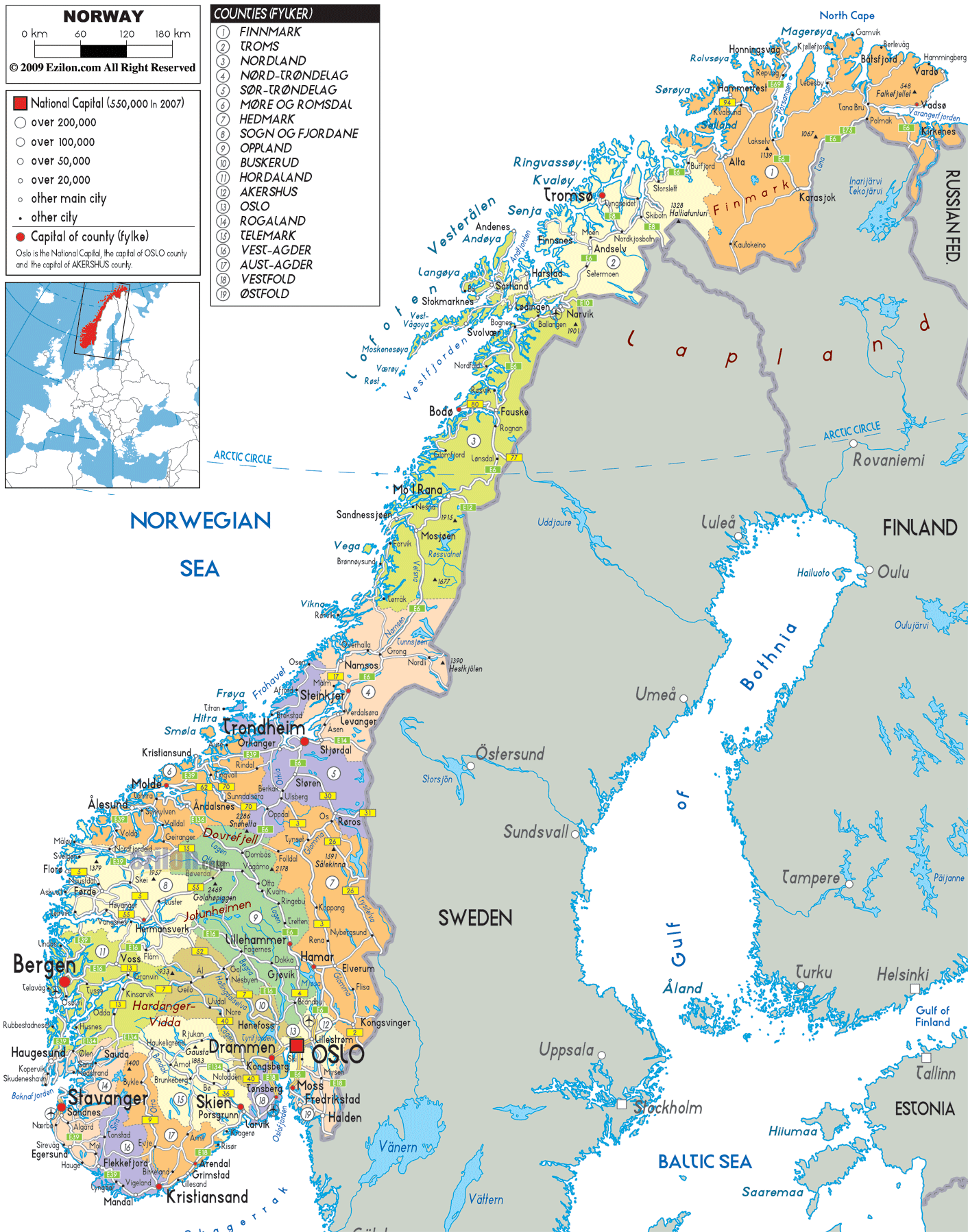
Its toothy-edged western coastline is a jagged expanse of (over 50,000) islands and dozens of long, deeply indented fjords; the most significant of which include Baknafjord, Geirangerfjord, Hardangerfjord, Moldefjord, Sognefjord, Trondheimfjord and Vestfjord.
In the far northeast above the Arctic Circle, frozen arctic tundra dominates the landscape, from Vardo, south and west. This tundra receives little precipitation and has a very short growing season, so it is generally a treeless plain of low shrubs and hearty grasses.
A south-central plateau slopes into the Trondelag, a hilly and mountainous farming area with strips of fertile land on the edges of the Trondheim Fjord. Additional lowlands are found in the southeast and along parts of the southern coastline.
There are reportedly over 150,000 (counted) lakes, most quite small, with the largest being Lake Mjosa.
Significant rivers include the Glama, the country’s longest, and the Dramselva, Lagen (two of them) and the Tana in the far north.
The highest point in Norway (as marked on the map by a yellow triangle) is Galdhøpiggen, standing at 2,469 m (8,100 ft). The lowest point is sea level at the coast.
| Flag: |  |
|---|---|
| Legal Name: | Kingdom of Norway |
| Capital Value: | Oslo |
| Largest City: |
Oslo (1,041,378) |
| Official languages: |
|
| Demonym(s): | Norwegian |
| Government: | Unitary parliamentary constitutional monarchy |
| Legislature: | Storting |
| Total Area: | 323,802 km² |
| Land Area: | 304,282 km² |
| Water Area: | 19,520 km² |
| Population: | 5,347,896 |
| Density: | 14.3/km (37.0/sq mi) (213th) |
| GDP: | $403.34 Billion |
| GDP Per Capita: | $75,419.63 |
| Currency Value: | Norwegian kroner (NOK) |
| Driving side: | right |
| Calling code: | +47 |
| Internet TLD: | .no |
Explore the breathtaking beauty of Norway with this map. From its majestic fjords to its sprawling lakes, the country is brimming with natural wonders. Take a closer look at the country with a topographic map to appreciate its mountains, such as the impressive Galdhopiggen. Delve further with a satellite map to uncover Norway’s lush forests and majestic glaciers.
Online Interactive Political Map
Click on ![]() to view map in "full screen" mode.
to view map in "full screen" mode.
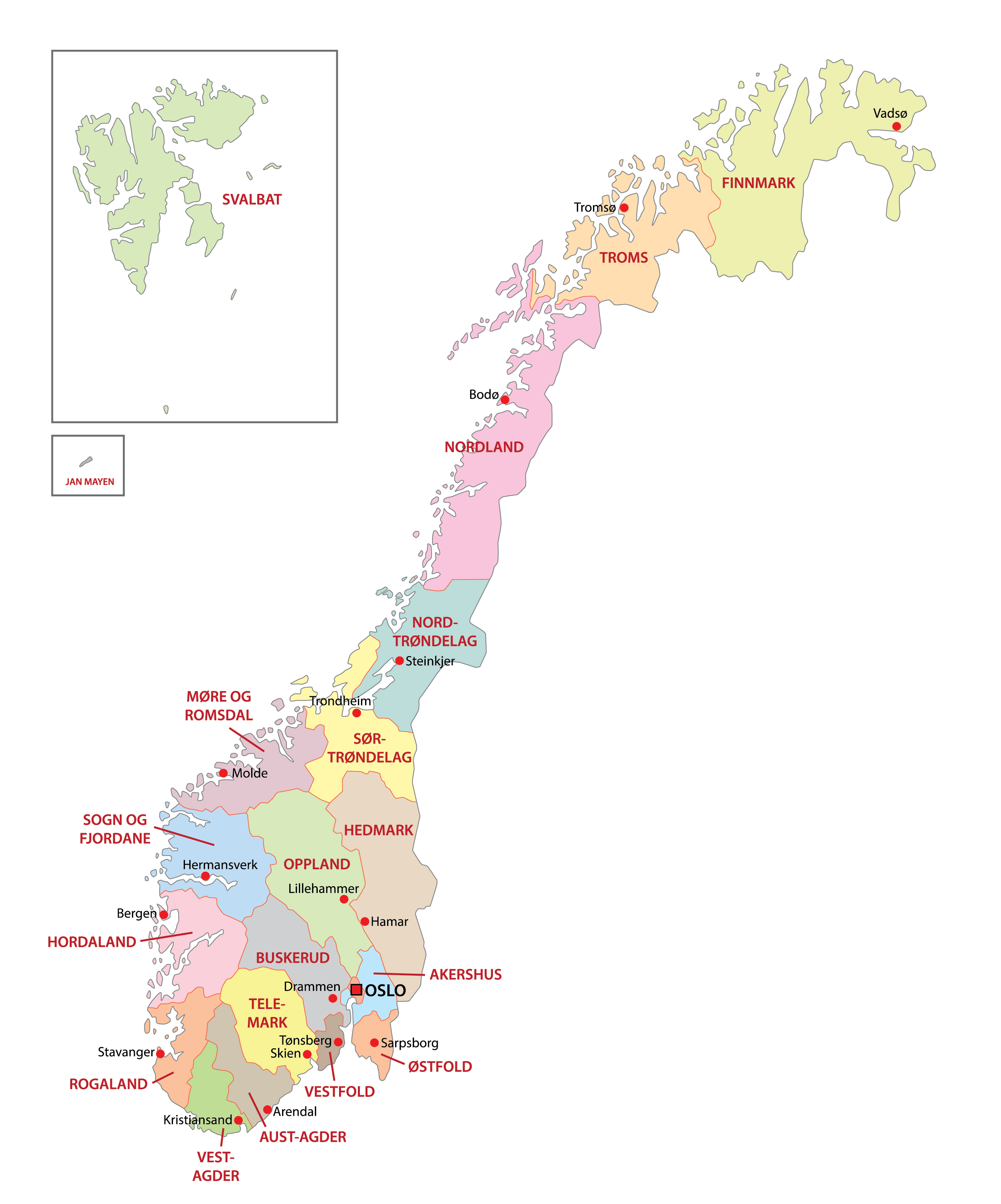
Norway is divided into 11 administrative regions or counties. In alphabetical order, the regions are: Agder, Innlandet, More og Romsdal, Nordland, Oslo, Rogaland, Troms og Finnmark, Trondelag, Vestfold og Telemark, Vestlandet and Viken. These counties are further subdivided into 356 municipalities.
[These new divisions have been reorganised and been implemented by the Norwegian Storting (Parliament), with effect from 1st January, 2020]
Located in the northwest of Oslofjord and surrounded by forested hills is, Oslo – the capital, the largest and the most populous city of Norway. It is the administrative, cultural, industrial and economic center of the country. Oslo is also an important maritime industries and trading center in Europe.
Location Maps
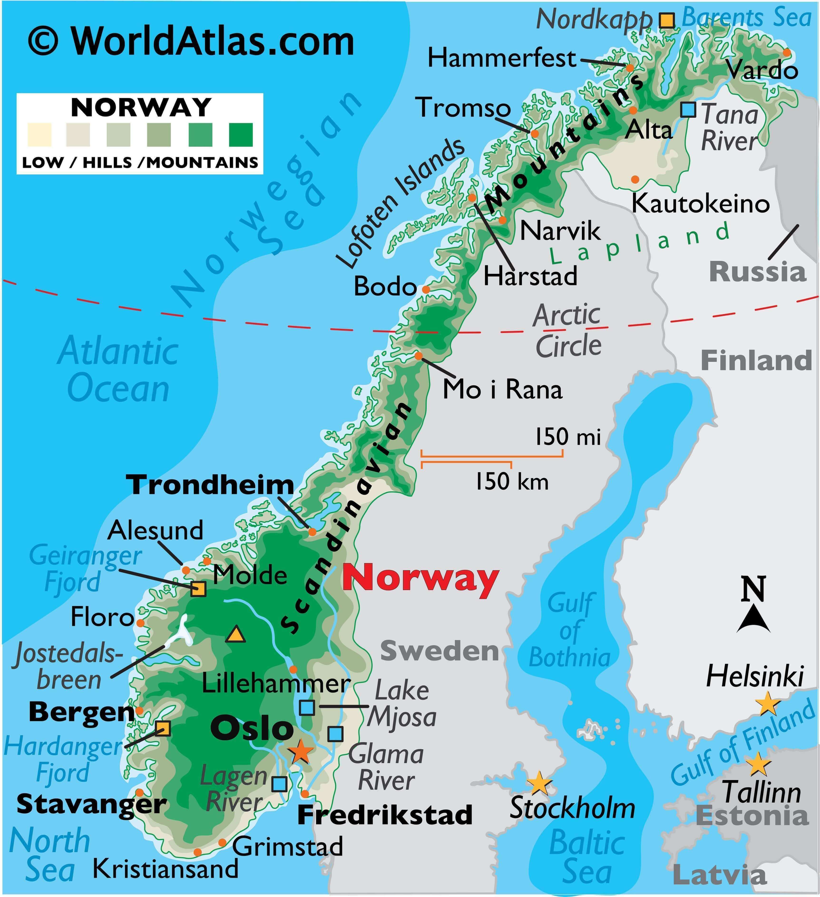
Where is Norway?
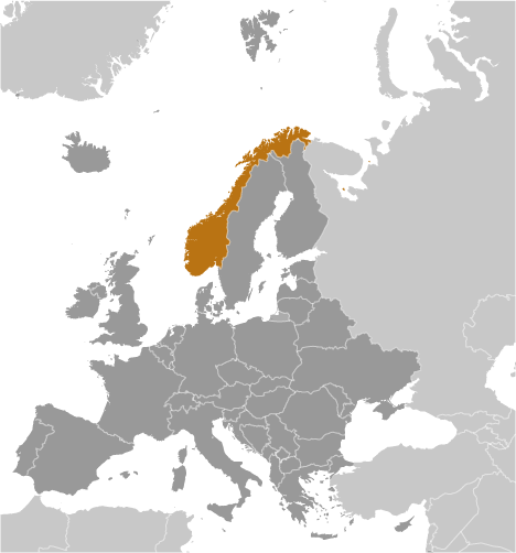
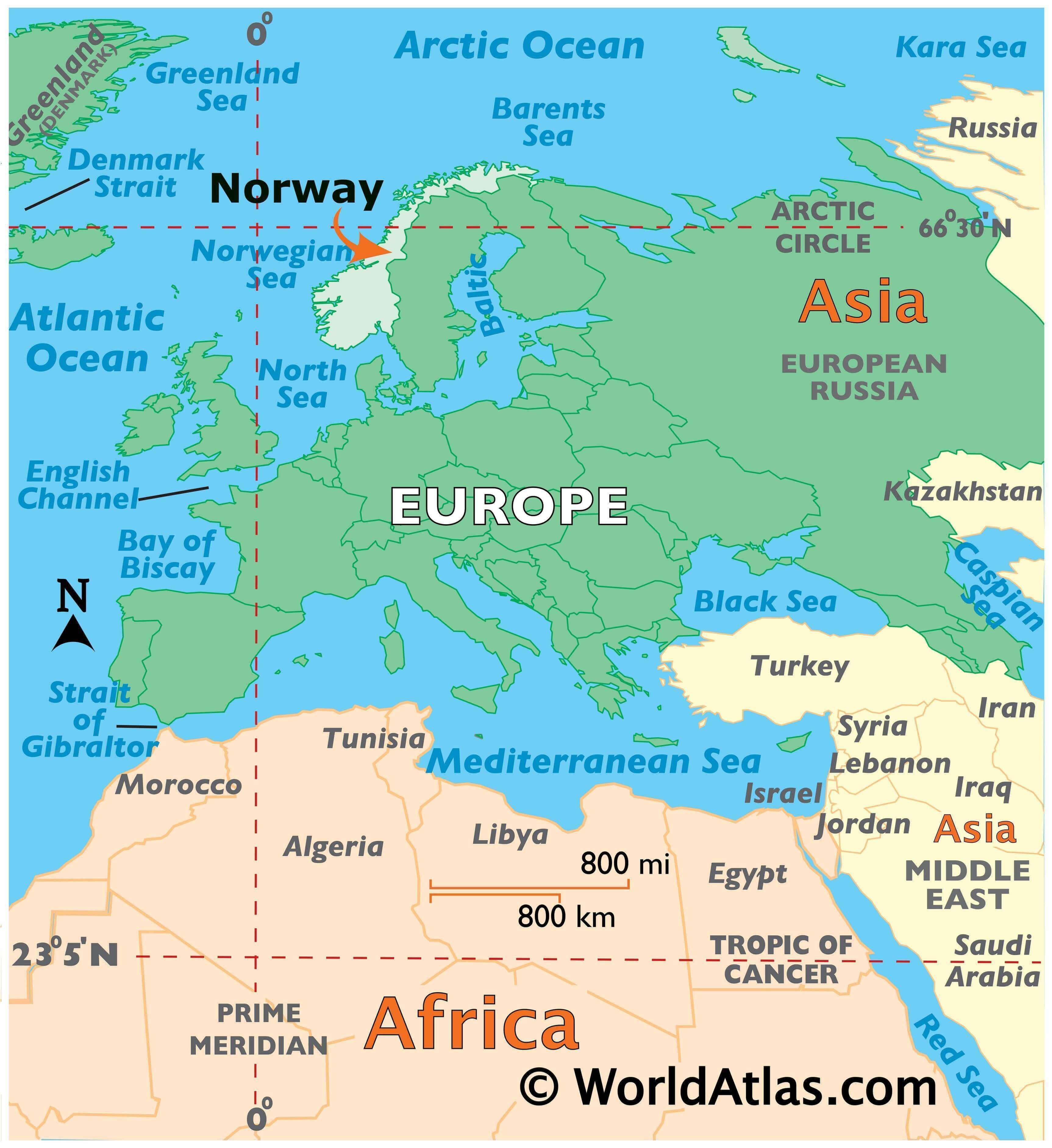
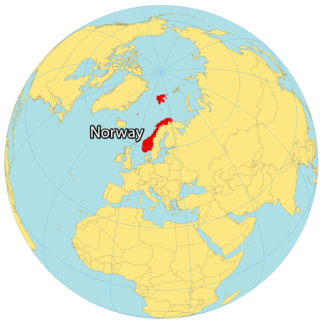
Norway is located in Northern Europe, along the North Sea, the Norwegian Sea, and the North Atlantic Ocean. It forms part of the subregion of Scandinavia with Sweden and Finland. Norway shares a land border with Sweden to the east, and Russia in the far northeast. Norway’s boundaries also include the remote Arctic archipelago of Svalbard. Most of the population resides on the mainland, with Oslo as the capital and largest city – the Nobel Peace Prize is awarded here. Norway is home to many mountains, including the tallest mountain in Northern Europe, Galdhøpiggen. The country boasts a varied landscape, with everything from forested hills to glaciers and snow-capped peaks. In the north, the climate is Arctic, with long, cold winters and short, cool summers. But in the south, the climate is more temperate, with milder winters and warmer summers.
High Definition Political Map of Norway
Physical Map of Norway
Topo Map