Glen Ridge is a borough in Essex County, in the U.S. state of New Jersey. As of the 2020 United States census, the borough’s population was 7,802, an increase of 275 (+3.7%) from the 2010 census count of 7,527, which in turn reflected an increase of 256 (+3.5%) from the 7,271 counted in the 2000 census.
| Name: | Glen Ridge borough |
|---|---|
| LSAD Code: | 21 |
| LSAD Description: | borough (suffix) |
| State: | New Jersey |
| County: | Essex County |
| Incorporated: | February 13, 1895 |
| Elevation: | 197 ft (60 m) |
| Total Area: | 1.28 sq mi (3.31 km²) |
| Land Area: | 1.27 sq mi (3.30 km²) |
| Water Area: | 0.01 sq mi (0.01 km²) 0.39% |
| Total Population: | 7,802 |
| Population Density: | 6,119.2/sq mi (2,362.6/km²) |
| ZIP code: | 07028 |
| Area code: | 973 |
| FIPS code: | 3426610 |
| GNISfeature ID: | 2390559 |
| Website: | www.glenridgenj.org |
Online Interactive Map
Click on ![]() to view map in "full screen" mode.
to view map in "full screen" mode.
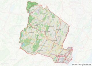
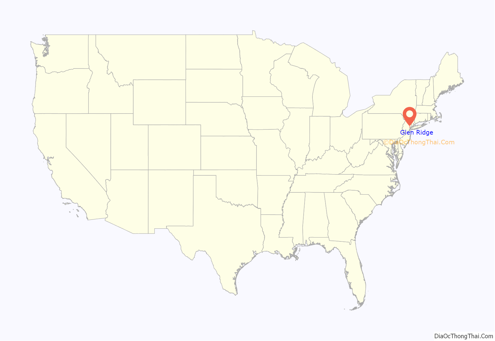
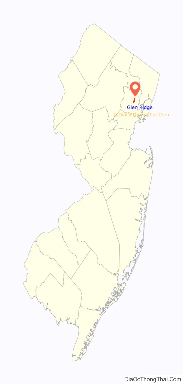
Glen Ridge location map. Where is Glen Ridge borough?
History
In 1666, 64 Connecticut families led by Robert Treat bought land from the Lenni Lenape Native Americans and named it New Ark to reflect a covenant to worship freely without persecution. The territory included the future towns of Bloomfield, Montclair, Belleville and Nutley. When Bloomfield was established in 1812, Glen Ridge was a section “on the hill” composed mostly of farms and woodlands with the exception of a thriving industrial area along Toney’s Brook in the glen. For most of the nineteenth century, three water-powered mills produced lumber, calico, pasteboard boxes and brass fittings. A copper mine and a sandstone quarry were located on the north side of the brook.
In 1856, the Newark and Bloomfield Railroad arrived, with the construction of the Glen Ridge station. In 1872, the New York and Greenwood Lake Railway arrived, with the construction of the station at today’s Benson Street. Glen Ridge began its transition to a suburban residential community. Stately homes slowly replaced orchards and wooded fields.
In 1891, Mountainside Hospital, a local hospital with more than 300 beds now known as HackensackUMC Mountainside, was founded. The Glen Ridge Country Club was founded in 1894, making it one of the state’s oldest clubs.
Residents “on the hill” became unhappy with their representation on the Bloomfield Council. In spite of repeated requests to Bloomfield officials, roads remained unpaved, water and sewer systems were nonexistent, and schools were miles away. Area residents marked out the boundaries of a 1.45-square-mile (3.8 km) area to secede from the adjoining town. At the election held on February 12, 1895, the decision to secede passed by only 23 votes. Robert Rudd was elected the first mayor of Glen Ridge.
On February 13, 1895, Glen Ridge was incorporated as a borough by an act of the New Jersey Legislature from portions of Bloomfield Township, based on the results of a referendum held the previous day.
After becoming a borough, architects suggested buying gas lamps, they became a characteristic of the borough. Circa World War II, gas lamps were discarded, many by the City of New York, later salvaged, repaired, and brought to Glen Ridge. With only 3,000 gaslights remaining in operation in the entire United States, the 2,500 managed by Public Service Enterprise Group, succeeding the Welsbach Company, include 1,400 lamps in South Orange, 667 in Glen Ridge, some in Trenton and dozens of other towns, lighting their streets. The Gaslamp is the Glen Ridge Historical Society’s quarterly newsletter.
In 1924, Glen Ridge became the first municipality in New Jersey to establish a zoning ordinance.
In 1982, the borough’s official name was changed to “Township of Glen Ridge Borough”. Glen Ridge was one of more than a dozen Essex County municipalities to reclassify themselves as townships to take advantage of federal revenue sharing policies that allocated townships a greater share of government aid on a per capita basis. Effective May 1993, the borough’s original name of “Glen Ridge Borough” was restored. The borough’s name comes from the ridge formed by Toney’s Brook.
In 2010, Glen Ridge was ranked as the 38th Best Place to live by New Jersey Monthly magazine.
In 1989, athletes from the high school were involved in the sexual assault of a mentally handicapped student. Three teenagers were found guilty of first-degree aggravated sexual assault; a fourth was convicted of third-degree conspiracy. Author Bernard Lefkowitz wrote about the incident in the 1997 book Our Guys: The Glen Ridge Rape and the Secret Life of the Perfect Suburb. Lefkowitz’s book was adapted into the 1999 TV movie Our Guys: Outrage at Glen Ridge.
Glen Ridge is a frequent location for film, television, and commercial shoots. Notable works include Winter Solstice and Mona Lisa Smile.
In the 1980s, it was discovered that a section of the borough near Carteret Park was built on top of hazardous waste. Waste contaminated with radium from the old U.S. Radium watch dial plant had been used to fill in low-lying areas of Glen Ridge covering 90 acres (36 ha), as well as portions of Montclair and West Orange. It was not until the year 2000 that the area was completely cleaned of any contamination.
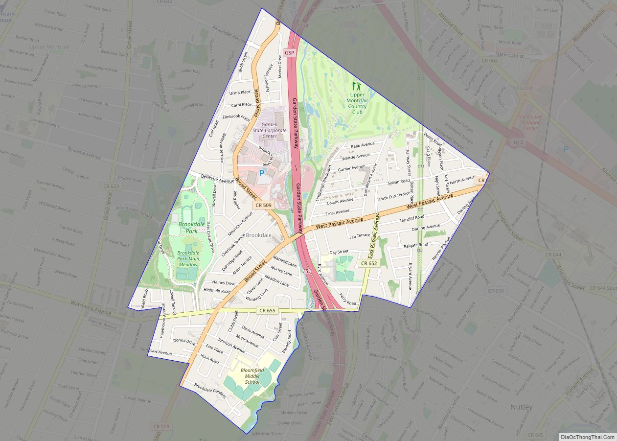
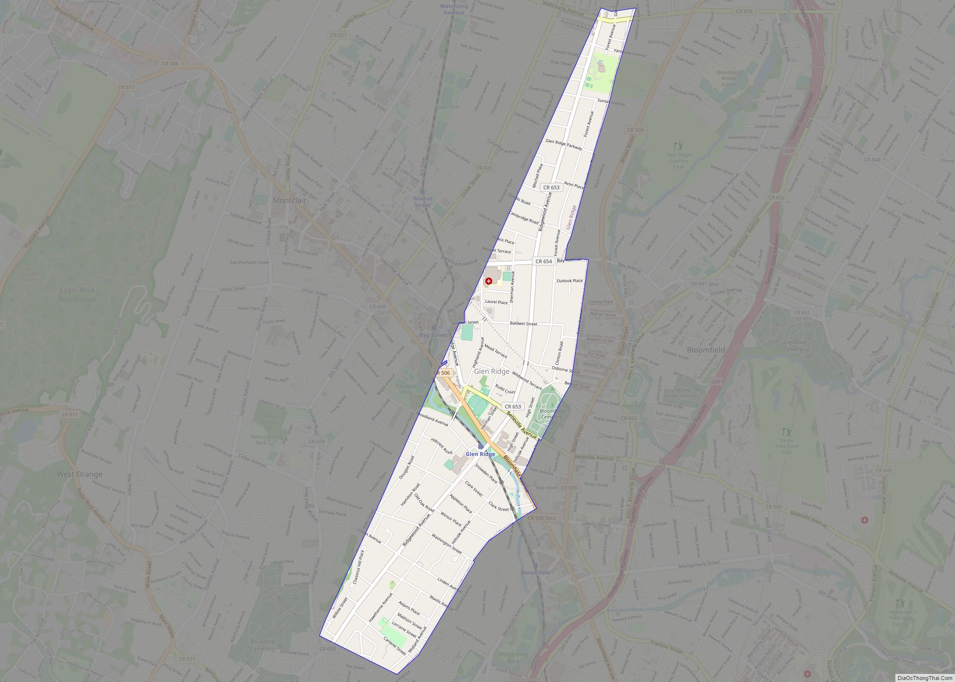
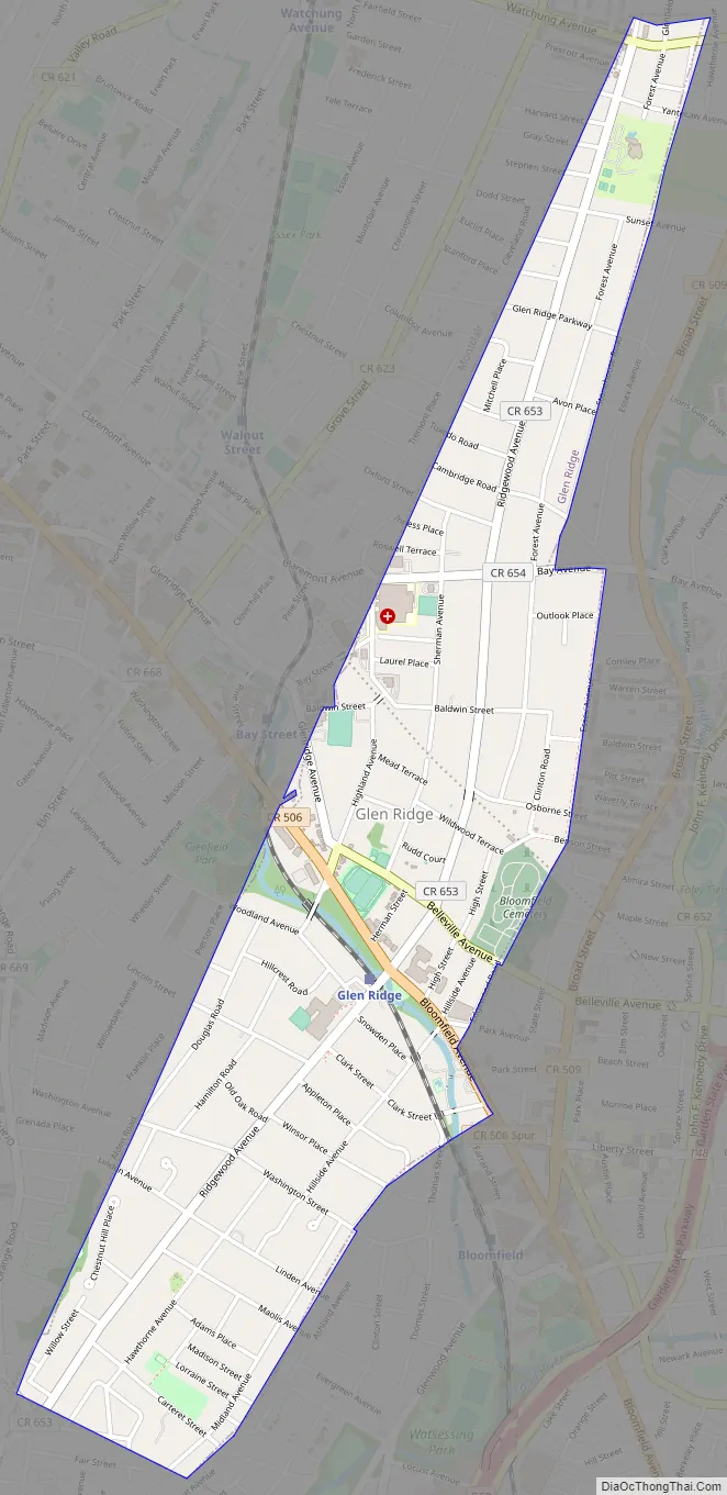
Glen Ridge Road Map
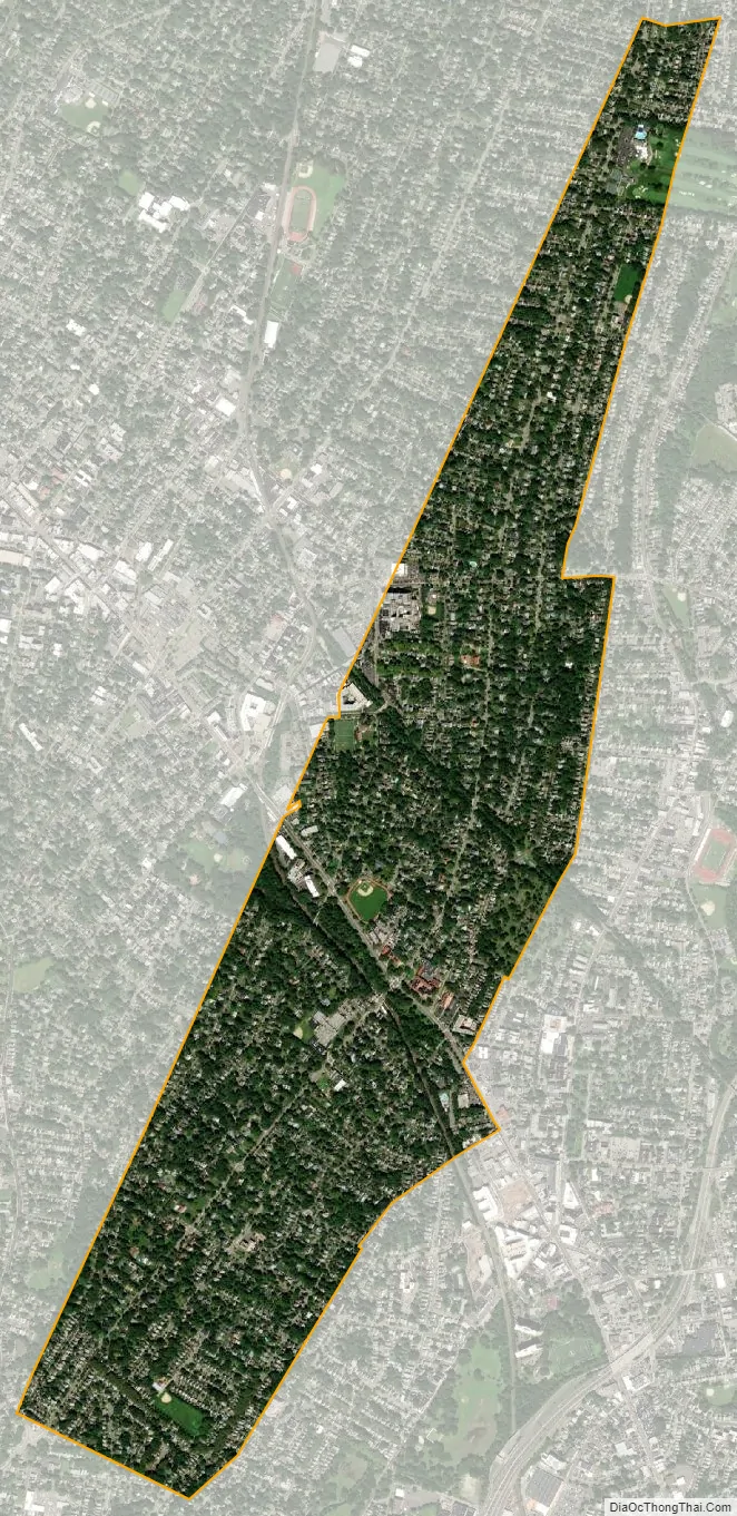
Glen Ridge city Satellite Map
Geography
According to the United States Census Bureau, the borough had a total area of 1.28 square miles (3.31 km), including 1.28 square miles (3.30 km) of land and 0.01 square miles (0.01 km) of water (0.39%). It is bounded by Bloomfield to its east, Montclair to its west, East Orange to its south, and shares a short border with Orange to its southwest. The borough’s US mail ZIP code is 07028.
Glen Ridge is located on a ridge on the east side of the First Mountain of the Watchung Mountains. The town stretches 2 miles (3.2 km) from north to south and a maximum of six blocks wide from east to west, and it is only three or two blocks wide in “the Panhandle” north of Bay Avenue.
Climate
Glen Ridge has a temperate climate, with warm / hot humid summers and cool / cold winters, according to the Köppen climate classification humid subtropical climate. The town gets an average of 49 inches (1,200 mm) of rain per year and 20 inches (510 mm) of snowfall, compared to the US averages of 37 inches (940 mm) and 25 inches (640 mm) inches. Glen Ridge has 124 days of measurable precipitation a year. During the winter, it is highly recommended to wear warm clothing because it can get very cold, while the summers can get extremely hot and humid. The majority of February and a bit of March is when there are the most snowfall. Due to the town’s elevation and the topography of its river banks, it is not prone to significant flooding.
There are typically about 205 sunny days per year in Glen Ridge. The temperature ranges from a high around 86 degrees in July and a low around 21 degrees in January. The comfort index for the town is 47 out of 100, compared to a national average of 44 (with higher numbers being more comfortable).
See also
Map of New Jersey State and its subdivision: Map of other states:- Alabama
- Alaska
- Arizona
- Arkansas
- California
- Colorado
- Connecticut
- Delaware
- District of Columbia
- Florida
- Georgia
- Hawaii
- Idaho
- Illinois
- Indiana
- Iowa
- Kansas
- Kentucky
- Louisiana
- Maine
- Maryland
- Massachusetts
- Michigan
- Minnesota
- Mississippi
- Missouri
- Montana
- Nebraska
- Nevada
- New Hampshire
- New Jersey
- New Mexico
- New York
- North Carolina
- North Dakota
- Ohio
- Oklahoma
- Oregon
- Pennsylvania
- Rhode Island
- South Carolina
- South Dakota
- Tennessee
- Texas
- Utah
- Vermont
- Virginia
- Washington
- West Virginia
- Wisconsin
- Wyoming