Roseland is a borough in western Essex County, New Jersey. As of the 2020 United States census, the borough’s population was 6,299, an increase of 480 (+8.2%) from the 2010 census count of 5,819, which in turn reflected an increase of 521 (+9.8%) from the 5,298 counted in the 2000 census.
In 2015, New Jersey Monthly magazine ranked Roseland as its seventh-best place to live in its “Best Places To Live” in New Jersey rankings. The borough was ranked 14th best place to live in the magazine’s 2008 rankings. In 2017, New Jersey Monthly Ranked Roseland as its 106th best place to live in its 2017 Rankings. New Jersey Monthly magazine ranked Roseland as its 14th best place to live in New Jersey in its 2019 rankings.
| Name: | Roseland borough |
|---|---|
| LSAD Code: | 21 |
| LSAD Description: | borough (suffix) |
| State: | New Jersey |
| County: | Essex County |
| Incorporated: | April 10, 1908 |
| Elevation: | 239 ft (73 m) |
| Total Area: | 3.64 sq mi (9.43 km²) |
| Land Area: | 3.62 sq mi (9.37 km²) |
| Water Area: | 0.02 sq mi (0.06 km²) 0.69% |
| Total Population: | 6,299 |
| Population Density: | 1,741.0/sq mi (672.2/km²) |
| ZIP code: | 07068 |
| Area code: | 973 |
| FIPS code: | 3464590 |
| GNISfeature ID: | 0885378 |
| Website: | www.roselandnj.org |
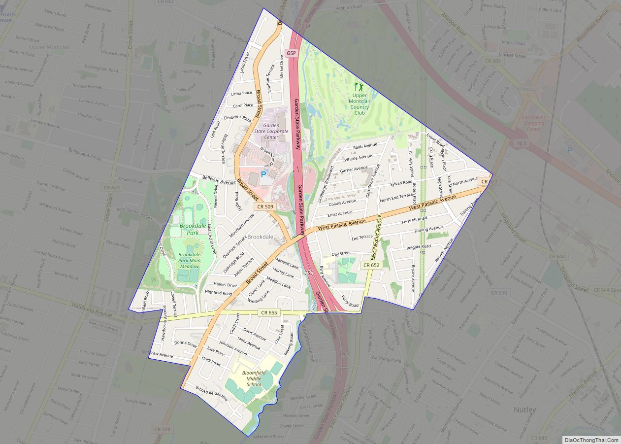
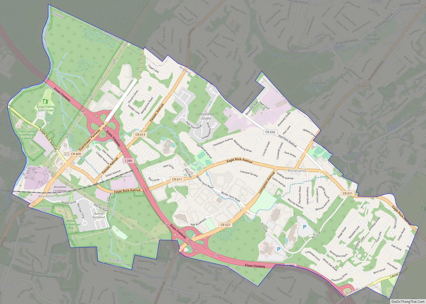
Online Interactive Map
Click on ![]() to view map in "full screen" mode.
to view map in "full screen" mode.
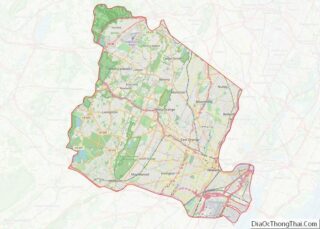
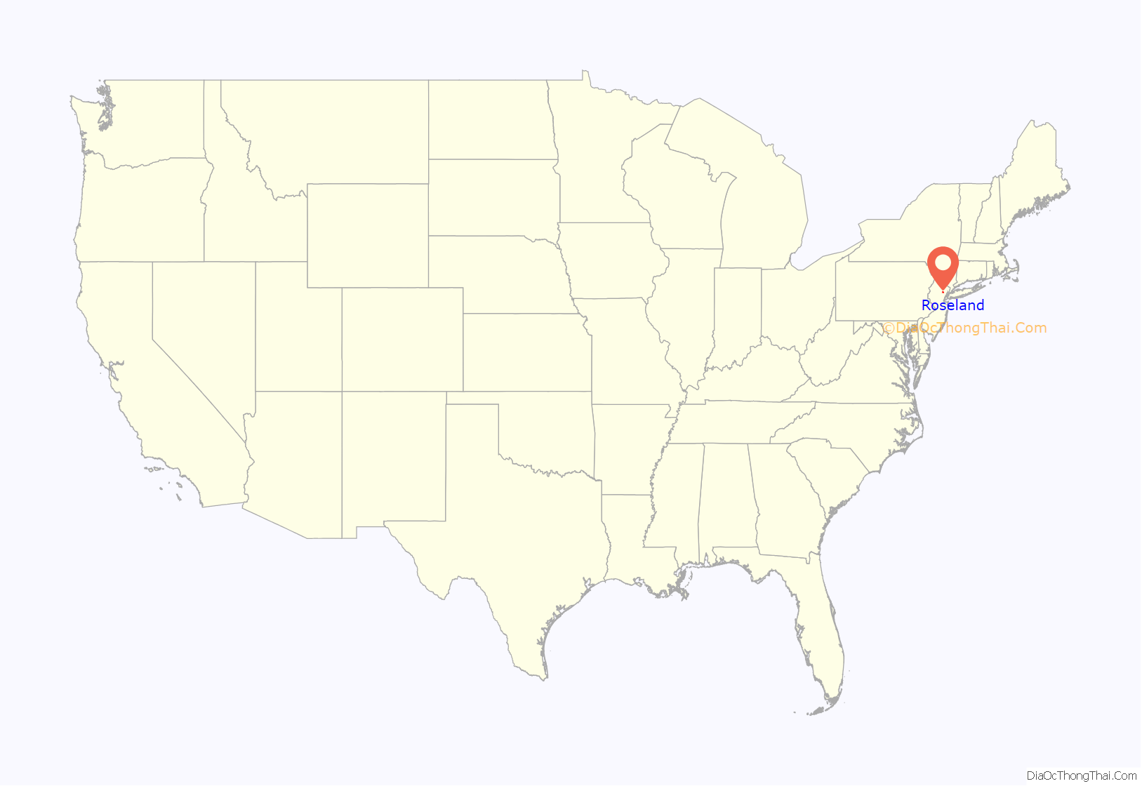
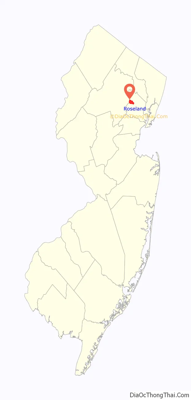
Roseland location map. Where is Roseland borough?
History
Roseland was part of the Horseneck Tract, which was an area that consisted of what are now the municipalities of Caldwell, West Caldwell, North Caldwell, Fairfield, Verona, Cedar Grove, Essex Fells, Roseland, and portions of Livingston and West Orange. In 1702, settlers purchased the 14,000 acres (57 km) Horseneck Tract—so-called because of its irregular shape that suggested a horse’s neck and head—from the Lenni Lenape Native Americans for goods equal to $325. This purchase encompassed much of western Essex County, from the First Mountain to the Passaic River.
Originally named Centerville, the name of the community was changed in 1874 to Roseland to avoid confusion with the several other Centervilles spread across the state, most specifically Centerville, Hunterdon County, New Jersey, which already had a post office under that name. Roseland was chosen over the alternative proposed name of “Roselyn”.
One of the most notable places of interest in the borough was the Becker Farm Railroad, otherwise known as the Centerville & Southwestern Railroad. A miniature railroad operated from 1938 until 1972 on the Becker Farm, which once comprised nearly half of the total area within Roseland and which is now mostly a large business complex. Some vestiges of the railroad still exist.
In 1907, a delegation of residents petitioned Livingston Township officials to construct a school for the growing population in Roseland. The rejection of their request led to the efforts to create an independent municipality, which was established on April 10, 1908.
Roseland was incorporated as a borough by an act of the New Jersey Legislature on April 10, 1908, from portions of Livingston Township.
Roseland Road Map

Roseland city Satellite Map

Geography
According to the United States Census Bureau, the borough had a total area of 3.64 square miles (9.43 km), including 3.62 square miles (9.37 km) of land and 0.03 square miles (0.06 km) of water (0.69%). Roseland is located about 20 miles (30 km) west of New York City and is part of the New York-Northern New Jersey-Long Island, NY-NJ-CT Metropolitan Statistical Area.
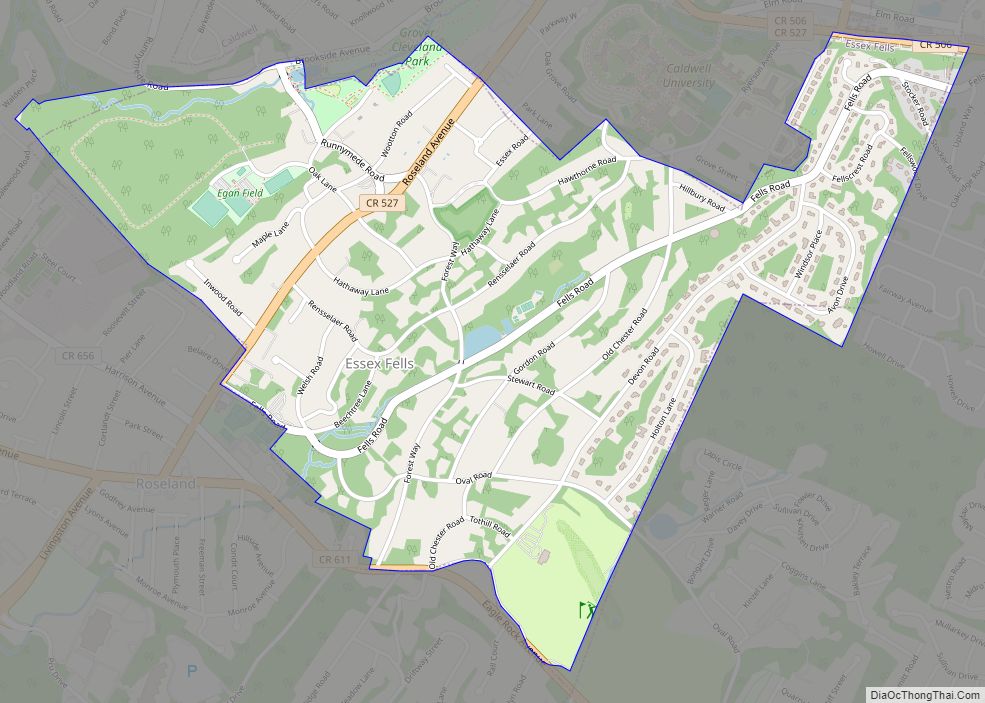
The borough borders the municipalities of Essex Fells, Livingston, West Caldwell and West Orange in Essex County; and East Hanover Township in Morris County.
See also
Map of New Jersey State and its subdivision: Map of other states:- Alabama
- Alaska
- Arizona
- Arkansas
- California
- Colorado
- Connecticut
- Delaware
- District of Columbia
- Florida
- Georgia
- Hawaii
- Idaho
- Illinois
- Indiana
- Iowa
- Kansas
- Kentucky
- Louisiana
- Maine
- Maryland
- Massachusetts
- Michigan
- Minnesota
- Mississippi
- Missouri
- Montana
- Nebraska
- Nevada
- New Hampshire
- New Jersey
- New Mexico
- New York
- North Carolina
- North Dakota
- Ohio
- Oklahoma
- Oregon
- Pennsylvania
- Rhode Island
- South Carolina
- South Dakota
- Tennessee
- Texas
- Utah
- Vermont
- Virginia
- Washington
- West Virginia
- Wisconsin
- Wyoming