Keansburg (/ˈkiːnzbɜːrɡ/ KEENZ-burg) is a borough in Monmouth County, in the U.S. state of New Jersey. As of the 2020 United States census, the borough’s population was 9,755, a decrease of 350 (−3.5%) from the 2010 census count of 10,105, which in turn reflected a decline of 627 (−5.8%) from 10,732 in the 2000 Census.
Keansburg was formed as a borough by an act of the New Jersey Legislature on March 26, 1917, from portions of both Middletown Township and Raritan Township (now Hazlet), based on the results of a referendum held on April 17, 1917.
It is part of the Bayshore Regional Strategic Plan, an effort by nine municipalities in northern Monmouth County to reinvigorate the area’s economy by emphasizing its traditional downtowns, dense residential neighborhoods, maritime history, and the natural beauty of the Raritan Bay coastline.
| Name: | Keansburg borough |
|---|---|
| LSAD Code: | 21 |
| LSAD Description: | borough (suffix) |
| State: | New Jersey |
| County: | Monmouth County |
| Incorporated: | April 17, 1917 |
| Elevation: | 0 ft (0 m) |
| Total Area: | 16.44 sq mi (42.57 km²) |
| Land Area: | 1.07 sq mi (2.78 km²) |
| Water Area: | 15.37 sq mi (39.80 km²) 93.59% |
| Total Population: | 9,755 |
| Population Density: | 9,099.8/sq mi (3,513.5/km²) |
| ZIP code: | 07734 |
| Area code: | 732 exchanges: 471, 495, 787 |
| FIPS code: | 3436480 |
| GNISfeature ID: | 0885265 |
| Website: | www.keansburgnj.gov |
Online Interactive Map
Click on ![]() to view map in "full screen" mode.
to view map in "full screen" mode.
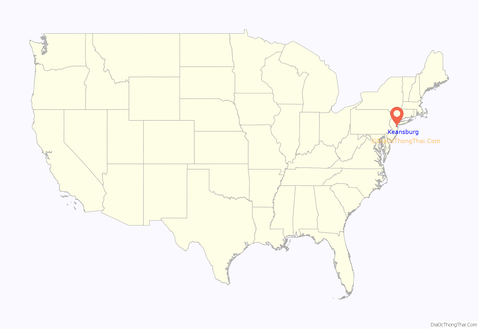
Keansburg location map. Where is Keansburg borough?

History
The land that is now Keansburg was earlier home to Lenni Lenape Native Americans.
On September 3, 1609, the Half Moon, captained by Henry Hudson, is said to have landed on the shores of present-day Keansburg (although some historians argue that the landing and forthcoming explained events took place at the tip of Sandy Hook). Crewmen of the ship were attacked by the Native Americans when they departed the ship, and John Colman was killed, making him what is said to be the first European to be murdered by a Native American. He is believed to have been buried in the area that is today the intersection of Carr Avenue and Beachway in an area known as “Colman’s Point”.
In the time between 1609 and the early 18th century, the land was gradually purchased from the Lenni Lenape, together with other surrounding areas. The area was inhabited by Dutch, English, and Scottish settlers. In the 18th century, farming proved to be successful on Keansburg’s land, with specialties being pears, apples and corn (maize).
In this time, the settlement took on the name of Waackaack (pronounced “Way-kay-ack”), which came from the term “Wakioak” in the Lenape language meaning “Land of Plenty”. The area was also widely known as Tanner’s Landing from the early 18th century until approximately 1820, so named for the pier at the end of what was Tanner’s Landing Road (now Main Street). Tanner’s Landing was a principal port for the area for many years.
The area adopted its second official name of Granville, which derived from the importance of the Phillips Mill, and the grain-producing farms in the region. The name held until the 1880s. During the century, Granville became home to its own church, two lighthouses and small businesses. Roadways were beginning to form from repeated use of horse and buggies. The beach was already a favorite to visitors. Population was about 300 people, who mostly farmed and clammed for a living.
On Sunday, March 22, 1877, at “half past 9 o’clock,” Granville welcomed the newly assigned pastor of the Granville Methodist Episcopal Church, William W. Ramsay. He later stated: “I arrived at the Granville Methodist Episcopal Church in Keansburg as pastor for the ensuing year. I soon learned that the hamlet consisted of about 300 inhabitants, whose occupations were mainly devoted to clamming & farming.” At 19 years of age, Ramsay was slated to serve in the church for just one year. His success at the helm of church led to another year in Granville, after which he decided to make the village his permanent home. Ramsay and his wife, Eliza S. Wood, purchased the land that is 69 Church Street and opened a general store in 1881. In the coming years, Ramsay took greater and greater interest in Granville and eventually arranged a petition to establish a post office. The list of 132 names was passed on to John Kean of Elizabeth, a candidate for Congress. His efforts led to the opening of the post office in 1884, with Mrs. Ramsay serving as its first postmaster. That year, the name Keansburg was adopted in Kean’s honor. A school was built at the cost of $30,000 in 1890 and sat on what is today the corner of Myrtle Avenue and Church Street (now Fallon Manor).
Further development continued with the creation of postcards depicting the village and land purchases, including acquisitions by William A. Gehlhaus and the Keansburg Beach Company. The Keansburg Steamboat Company was founded in 1910 primarily by Gelhaus as a means of providing transportation for New Yorkers who were interested in buying homes in Keansburg. In 1893, Gelhaus purchased a bakery business in Atlantic Highlands which he operated with his brothers until 1905. At that time he entered the real estate business in Keansburg. He was president of the New Point Comfort Beach Company which he formed with Jesse Sculthorp and Howard Roberts. The company owned a large real estate development in Keansburg and in 1906 laid out the Beachway. On June 18, 1909, the New Point Comfort Beach Company bought the steamboat Accomack in Norfolk, Virginia, and started a scheduled run from New York to Keansburg on July 1 that was intended as a way to bring prospective property buyers to Keansburg. Another real estate developer, Keansburg Heights Development Co., bought several thousand tickets. By July 21, more than $1,500 worth of tickets had been sold at $0.35 each. As the town became more populated, the Keansburg Beach Company sold off most of the surrounding land on Beachway Ave., keeping “just the boardwalk and amusement area.”
Tourists from New York City would ferry over and spend the weekend or summer vacation to escape the city heat, until Hurricane Donna wiped out much of the waterfront area in 1960. In 1969, the borough spent $7.9 million on the Bayshore Hurricane Protection Plan, which had been developed with state and federal funding from The New Jersey Bureau of Navigation and the United States Army Corps of Engineers. The redevelopment plan increased the size of the beaches to protect against future storms. A number of fires in the 1980s destroyed several structures on the North side of Beachway Avenue. The Dance Hall Auditorium, Keansburg Bowling Alley and the Casino Theater were destroyed by fire during this time.
The Gelhaus family re-acquired the Keansburg Amusement Park in 1995, following a 20-year absence after Henry Gelhaus had sold the property in 1972. The return of the Gelhaus family as proprietors of the amusement park sparked a resurgence of interest in the town. Upgrades were made to the amusement park grounds and a water park was constructed. Runaway rapids was opened in 1996 on the site of the former Crystal Pool. The Keansburg Waterfront Public Library, founded in 2004, was the result of a concerted effort on the part of townspeople and the borough government to provide a high quality library with resources that address the needs and interests of the community. In 2012, the town added a $3 million desalination plant with Federal Stimulus Funds and a low interest loan from the N.J. Environmental Infrastructure Trust, which greatly improved the quality of the water supply. The town had previously stopped providing well water, as saltwater intrusion into the aquifer had exceeded environmental protection standards. The new facility removes contaminants from the water supply through reverse osmosis.
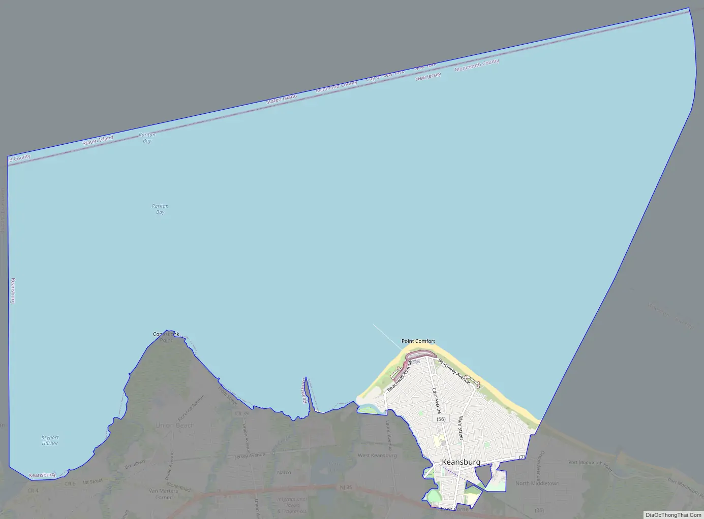
Keansburg Road Map
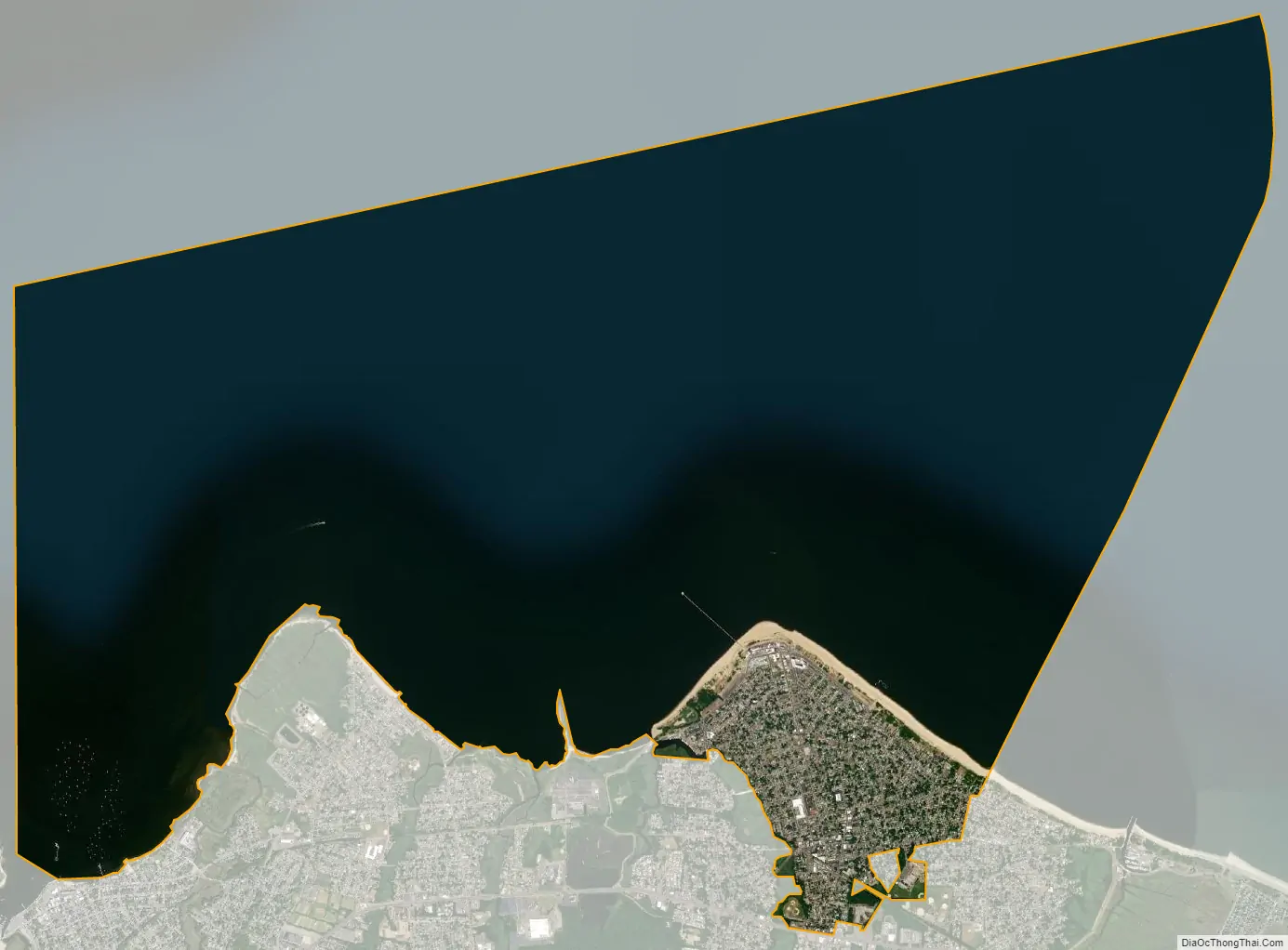
Keansburg city Satellite Map
Geography
According to the United States Census Bureau, the borough had a total area of 16.79 square miles (43.47 km), including 1.07 square miles (2.78 km) of land and 15.71 square miles (40.70 km) of water (93.59%).
Unincorporated communities, localities and place names located partially or completely within the borough include Beacon Beach, Point Comfort and Tiltons Corner.
The borough has land borders with the Monmouth County municipalities of Hazlet Township, Middletown Township and Union Beach; and has maritime borders with Aberdeen Township and Keyport, and the New York City borough of Staten Island across Raritan Bay. A small piece of Middletown Township measuring 13 acres (5.3 ha) is an exclave completely surrounded by Keansburg.
See also
Map of New Jersey State and its subdivision: Map of other states:- Alabama
- Alaska
- Arizona
- Arkansas
- California
- Colorado
- Connecticut
- Delaware
- District of Columbia
- Florida
- Georgia
- Hawaii
- Idaho
- Illinois
- Indiana
- Iowa
- Kansas
- Kentucky
- Louisiana
- Maine
- Maryland
- Massachusetts
- Michigan
- Minnesota
- Mississippi
- Missouri
- Montana
- Nebraska
- Nevada
- New Hampshire
- New Jersey
- New Mexico
- New York
- North Carolina
- North Dakota
- Ohio
- Oklahoma
- Oregon
- Pennsylvania
- Rhode Island
- South Carolina
- South Dakota
- Tennessee
- Texas
- Utah
- Vermont
- Virginia
- Washington
- West Virginia
- Wisconsin
- Wyoming


