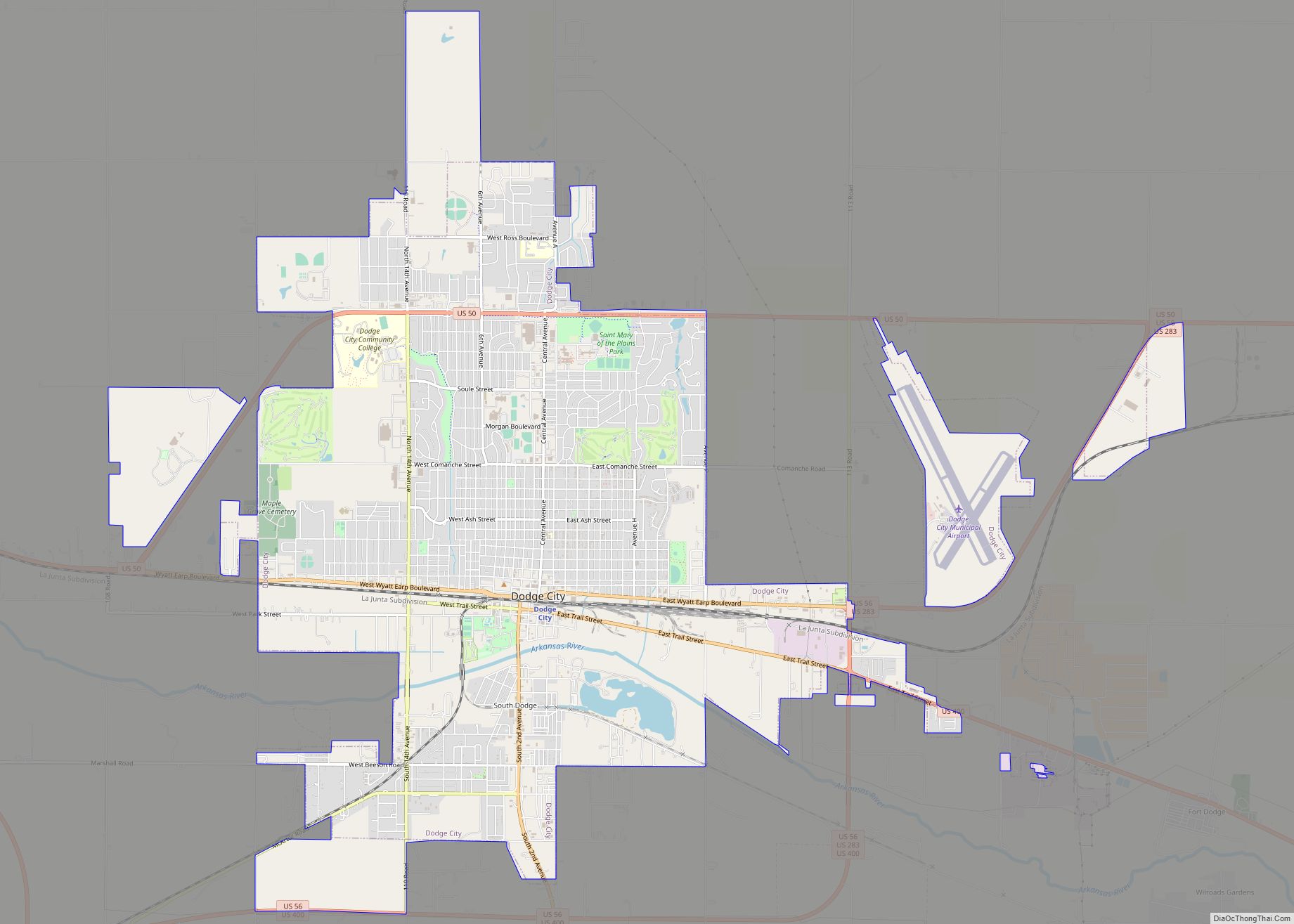
Dodge City is the county seat of Ford County, Kansas, United States, named after nearby Fort Dodge. As of the 2020 census, the population of the city was 27,788. The city is known in American culture for its history as a wild frontier town of the Old West.
| Name: | Dodge City city |
|---|---|
| LSAD Code: | 25 |
| LSAD Description: | city (suffix) |
| State: | Kansas |
| County: | Ford County |
| Founded: | 1872 |
| Incorporated: | 1875 |
| Elevation: | 2,494 ft (760 m) |
| Total Area: | 14.77 sq mi (38.24 km²) |
| Land Area: | 14.66 sq mi (37.97 km²) |
| Water Area: | 0.10 sq mi (0.27 km²) |
| Total Population: | 27,788 |
| Population Density: | 1,900/sq mi (730/km²) |
| ZIP code: | 67801, 67843 |
| Area code: | 620 |
| FIPS code: | 2018250 |
| Website: | dodgecity.org |
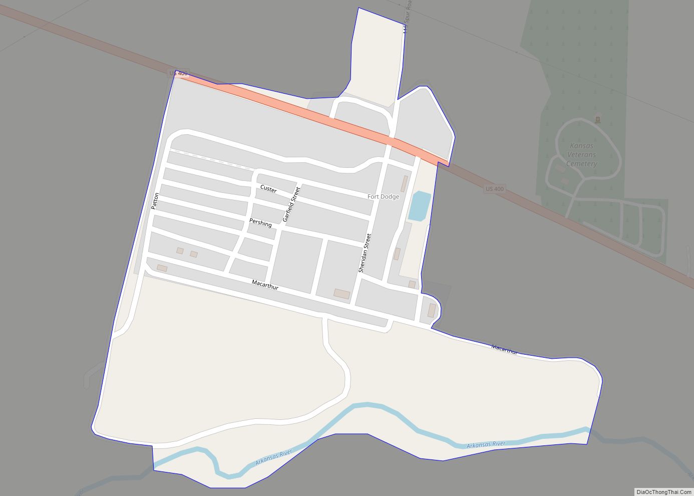
Online Interactive Map
Click on ![]() to view map in "full screen" mode.
to view map in "full screen" mode.
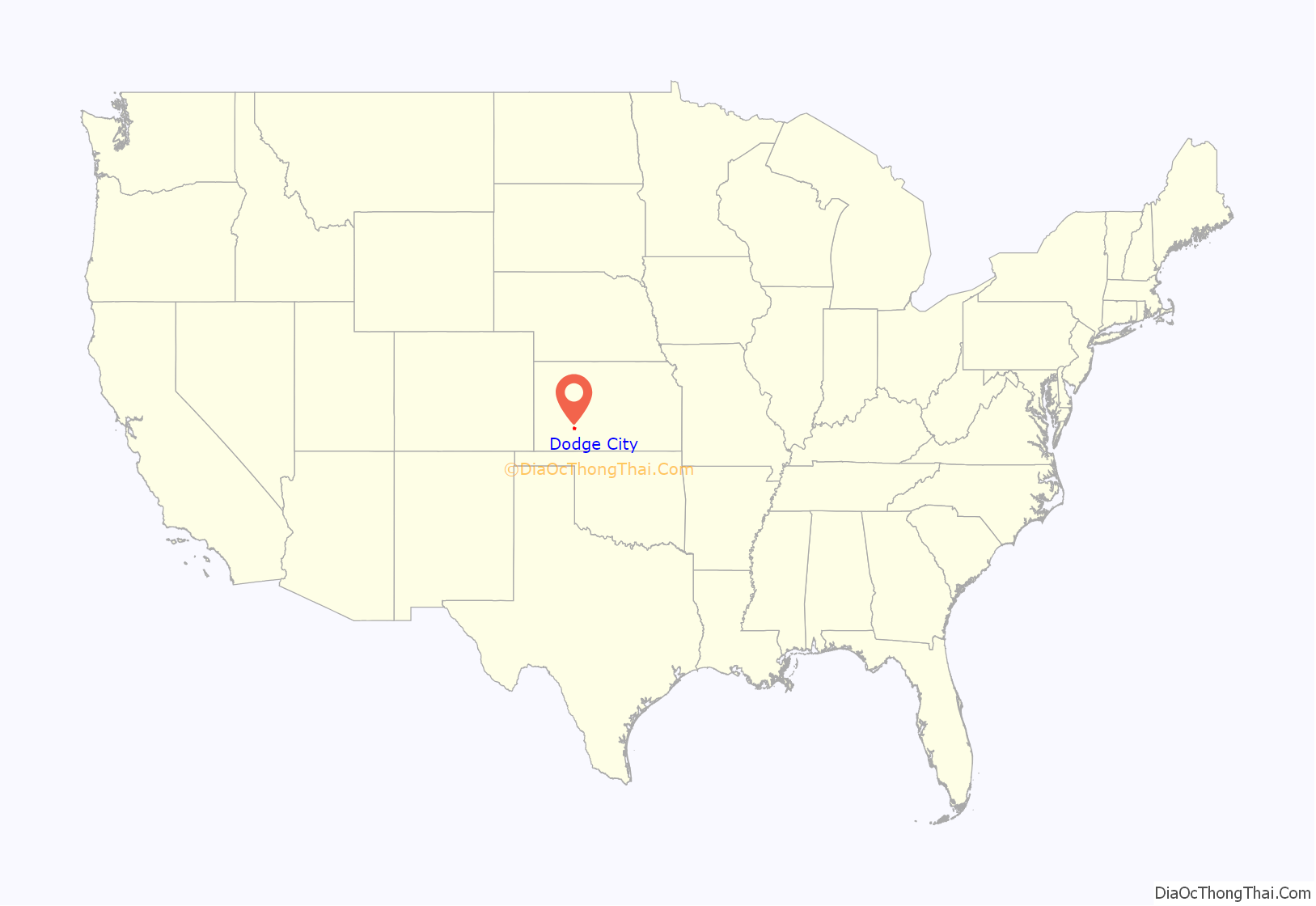
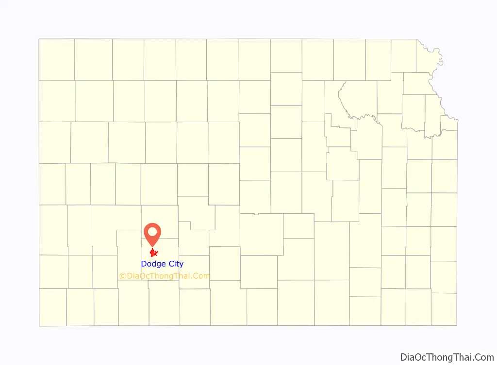
Dodge City location map. Where is Dodge City city?
History
The first settlement in the area that became Dodge City was Fort Mann, built by civilians in 1847. At that time, the territory was part of Mexico, and the fort was built to provide protection for travelers on the Santa Fe Trail. Fort Mann collapsed in 1848 after an attack by Natives. In 1850, the U.S. Army arrived to provide protection in the region and constructed Fort Atkinson on the old Fort Mann site. The army abandoned Fort Atkinson in 1853. Military forces on the Santa Fe Trail were re-established farther north and east at Fort Larned in 1859, but the area remained vacant around what would become Dodge City until the end of the Civil War. In April 1865, the American Frontier Wars in the West began heating up, and the army constructed Fort Dodge to assist Fort Larned in providing protection on the Santa Fe Trail. Fort Dodge remained in operation until 1882.
The town of Dodge City can trace its origins to 1871, when rancher Henry J. Sitler built a sod house west of Fort Dodge to oversee his cattle operations in the region, conveniently located near the Santa Fe Trail and Arkansas River, and Sitler’s house quickly became a stopping point for travelers. Others saw the commercial potential of the region with the Santa Fe Railroad rapidly approaching from the east. In 1872, Dodge City was staked out on the 100th meridian and the legal western boundary of the Fort Dodge reservation. The town site was platted and George M. Hoover established the first bar in a tent to serve thirsty soldiers from Fort Dodge. The railroad arrived in September to find a town ready and waiting for business. The early settlers in Dodge City traded in buffalo bones and hides and provided a civilian community for Fort Dodge. With the arrival of the railroad, Dodge City soon became involved in the cattle trade.
The idea of driving Texas Longhorn cattle from Texas to railheads in Kansas originated in the late 1850s, but was cut short by the Civil War. In 1866, the first Texas cattle started arriving in Baxter Springs in southeastern Kansas by way of the Shawnee Trail. Texas Longhorn cattle carried a tick that spread Texas cattle fever, among other breeds of cattle. Alarmed Kansas farmers persuaded the Kansas State Legislature to establish a quarantine line in central Kansas. The quarantine prohibited Texas Longhorns from the heavily settled, eastern portion of the state.
With the cattle trade forced west, Texas Longhorns began moving north along the Chisholm Trail. In 1867, the main cowtown was Abilene, Kansas. Profits were high, and other towns quickly joined in the cattle boom: Newton in 1871, Ellsworth in 1872, and Wichita in 1872. In 1876, however, the Kansas State Legislature responded to pressure from farmers settling in central Kansas and once again shifted the quarantine line westward, which essentially eliminated Abilene and the other cowtowns from the cattle trade. With no place else to go, Dodge City suddenly became the “queen of the cow towns.”
A new route known as the Great Western Cattle Trail or Western Trail branched off from the Chisholm Trail to lead cattle into Dodge City. Dodge City became a boomtown, with thousands of cattle passing annually through its stockyards. The peak years of the cattle trade in Dodge City were from 1883 to 1884, and during that time the town grew tremendously. In 1880, Dodge City got a new competitor for the cattle trade from the border town of Caldwell. For a few years, the competition between the towns was fierce, but enough cattle were available for both towns to prosper.
Dodge City became known as a true frontier settlement of the Old West. Dodge City had more gunfighters working at one time or another than any other town in the West, many of whom participated in the Dodge City War of 1883. It had saloons, gambling halls, and brothels, including the Long Branch Saloon and China Doll brothel. For a time in 1884, Dodge City had a bullfighting ring where Mexican bullfighters would put on a show with specially chosen Longhorn bulls.
As more agricultural settlers moved into western Kansas, pressure increased on the Kansas State Legislature to do something about splenic fever, known today as anthrax. Consequently, in 1885, the quarantine line was extended across the state and the Western Trail was all but shut down. By 1886, the cowboys, saloon keepers, gamblers, and brothel owners moved west to greener pastures, and Dodge City became a sleepy little town much like other communities in western Kansas.
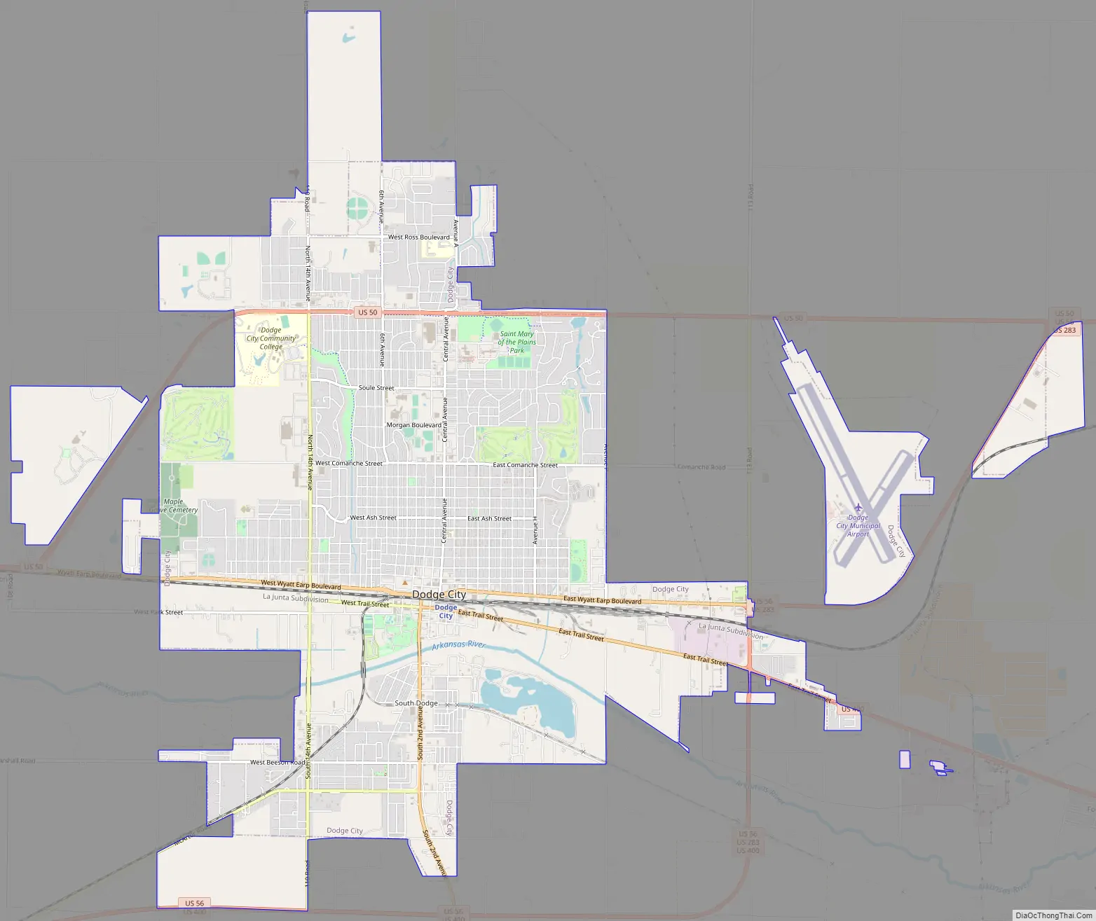
Dodge City Road Map
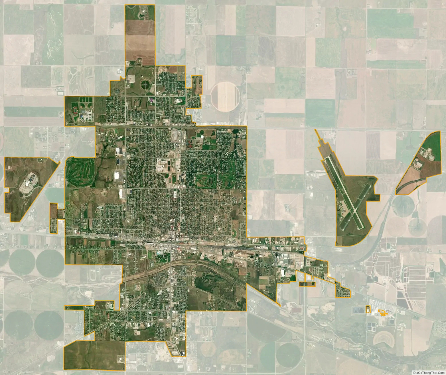
Dodge City city Satellite Map
Geography
Dodge City is located at 37°45′35″N 100°1′6″W / 37.75972°N 100.01833°W / 37.75972; -100.01833 (37.759671, −100.018212) at an elevation of 2,493 ft (760 m). It lies on the Arkansas River in the High Plains region of the Great Plains. The city sits above one of the world’s largest underground water systems, the Ogallala Aquifer, and is 25 miles (40 km) from the eastern edge of the Hugoton Natural Gas Area. Located at the intersection of U. S. Routes 50, 56 and 283 in southwestern Kansas, Dodge City is 151 mi (243 km) west of Wichita, 199 mi (320 km) northeast of Amarillo, and 301 mi (484 km) southeast of Denver.
According to the United States Census Bureau, the city has a total area of 14.55 square miles (37.68 km), of which 14.44 square miles (37.40 km) is land and 0.11 square miles (0.28 km) is water.
Climate
Dodge City lies at the intersection of North America’s semi-arid (Köppen BSk) and humid subtropical climate (Köppen Cfa) zones, with hot summers, highly variable winters, both warm and very cold periods, and low to moderate humidity and precipitation throughout the year; it is part of USDA Hardiness zone 6b. Areas to the west are drier and more strongly semi-arid. Severe weather, including tornadoes, is common in the area, especially in the spring months. Dodge City is often cited as the windiest city in the United States with an average speed of 13.9 mph (22.4 km/h), which results in occasional blizzards in the winter, even when snowfall does not accumulate much. On average, January is the coldest month, July is the hottest month, and June is the wettest month.
The normal annual mean temperature in Dodge City is 55.4 °F (13.0 °C), while the normal monthly daily average temperature ranges from 32.2 °F (0.1 °C) in January to 79.6 °F (26.4 °C) in July. The high temperature reaches or exceeds 90 °F (32 °C) an average of 67 days a year and reaches or exceeds 100 °F (38 °C) an average of 13 days a year; the last year that failed to reach 100 °F was 1958. The minimum temperature falls to or below 0 °F (−18 °C) an average of 3.0 days a year. The highest officially recorded temperature was 111 °F (44 °C) on June 27, 2012, while the lowest temperature officially recorded was −26 °F (−32 °C) on February 12, 1899. The record cold daily maximum is −13 °F (−25 °C) on January 13, 1875, and conversely, the record warm daily minimum is 81 °F (27 °C) last set July 12, 1978.
Dodge City receives an annual average of 21.6 inches (550 mm) in precipitation, with the largest share being received from May through August; annual precipitation has historically ranged from 9.97 in (253 mm) in 1956 to 34.29 in (871 mm) in 1944. There are, on average, 77 days of measurable precipitation each year. Snowfall averages 21.1 inches (54 cm) per season, although snowfall has historically ranged from 0.2 in (0.51 cm) in 1903–04 to 61.3 in (156 cm) in 1992–93. Measurable snowfall occurs an average of 14 days a year with at least an inch of snow being received on six of those days. Snow depth of at least an inch occurs an average of 19 days a year. The average window for overnight freezes is October 17 through April 21, allowing a growing season of 178 days.
See also
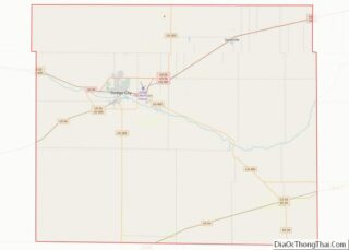
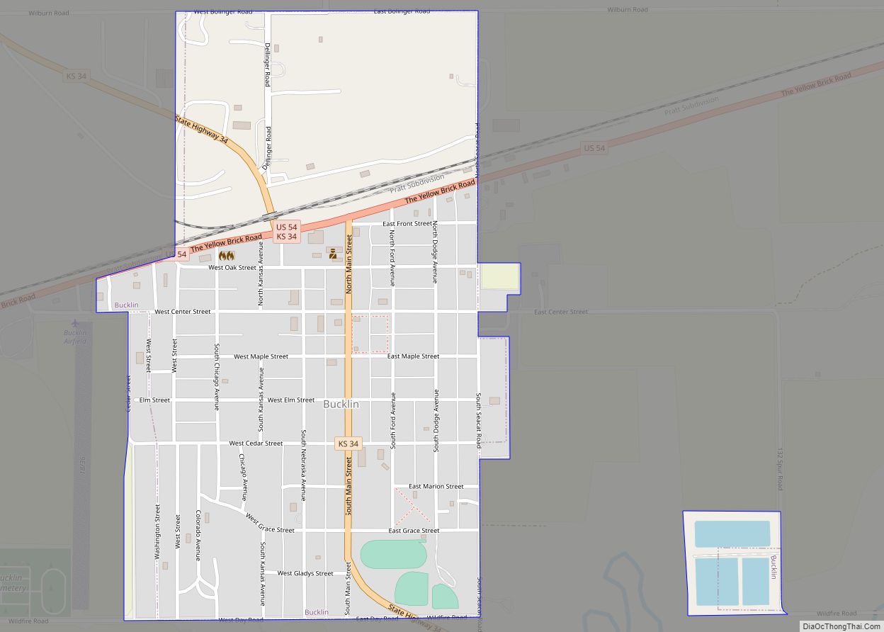
Map of Kansas State and its subdivision:- Allen
- Anderson
- Atchison
- Barber
- Barton
- Bourbon
- Brown
- Butler
- Chase
- Chautauqua
- Cherokee
- Cheyenne
- Clark
- Clay
- Cloud
- Coffey
- Comanche
- Cowley
- Crawford
- Decatur
- Dickinson
- Doniphan
- Douglas
- Edwards
- Elk
- Ellis
- Ellsworth
- Finney
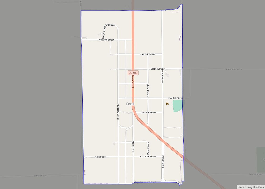
- Ford
- Franklin
- Geary
- Gove
- Graham
- Grant
- Gray
- Greeley
- Greenwood
- Hamilton
- Harper
- Harvey
- Haskell
- Hodgeman
- Jackson
- Jefferson
- Jewell
- Johnson
- Kearny
- Kingman
- Kiowa
- Labette
- Lane
- Leavenworth
- Lincoln
- Linn
- Logan
- Lyon
- Marion
- Marshall
- McPherson
- Meade
- Miami
- Mitchell
- Montgomery
- Morris
- Morton
- Nemaha
- Neosho
- Ness
- Norton
- Osage
- Osborne
- Ottawa
- Pawnee
- Phillips
- Pottawatomie
- Pratt
- Rawlins
- Reno
- Republic
- Rice
- Riley
- Rooks
- Rush
- Russell
- Saline
- Scott
- Sedgwick
- Seward
- Shawnee
- Sheridan
- Sherman
- Smith
- Stafford
- Stanton
- Stevens
- Sumner
- Thomas
- Trego
- Wabaunsee
- Wallace
- Washington
- Wichita
- Wilson
- Woodson
- Wyandotte
- Alabama
- Alaska
- Arizona
- Arkansas
- California
- Colorado
- Connecticut
- Delaware
- District of Columbia
- Florida
- Georgia
- Hawaii
- Idaho
- Illinois
- Indiana
- Iowa
- Kansas
- Kentucky
- Louisiana
- Maine
- Maryland
- Massachusetts
- Michigan
- Minnesota
- Mississippi
- Missouri
- Montana
- Nebraska
- Nevada
- New Hampshire
- New Jersey
- New Mexico
- New York
- North Carolina
- North Dakota
- Ohio
- Oklahoma
- Oregon
- Pennsylvania
- Rhode Island
- South Carolina
- South Dakota
- Tennessee
- Texas
- Utah
- Vermont
- Virginia
- Washington
- West Virginia
- Wisconsin
- Wyoming