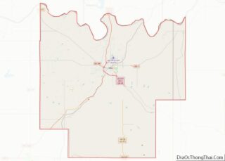
Ada is a city in and the county seat of Pontotoc County, Oklahoma, United States. The population was 16,481 at the 2020 United States Census. The city was named for Ada Reed, the daughter of an early settler, and was incorporated in 1901. Ada is home to East Central University, and is the headquarters of the Chickasaw Nation. Ada is an Oklahoma Main Street City, an Oklahoma Certified City, and a Tree City USA member.
| Name: | Ada city |
|---|---|
| LSAD Code: | 25 |
| LSAD Description: | city (suffix) |
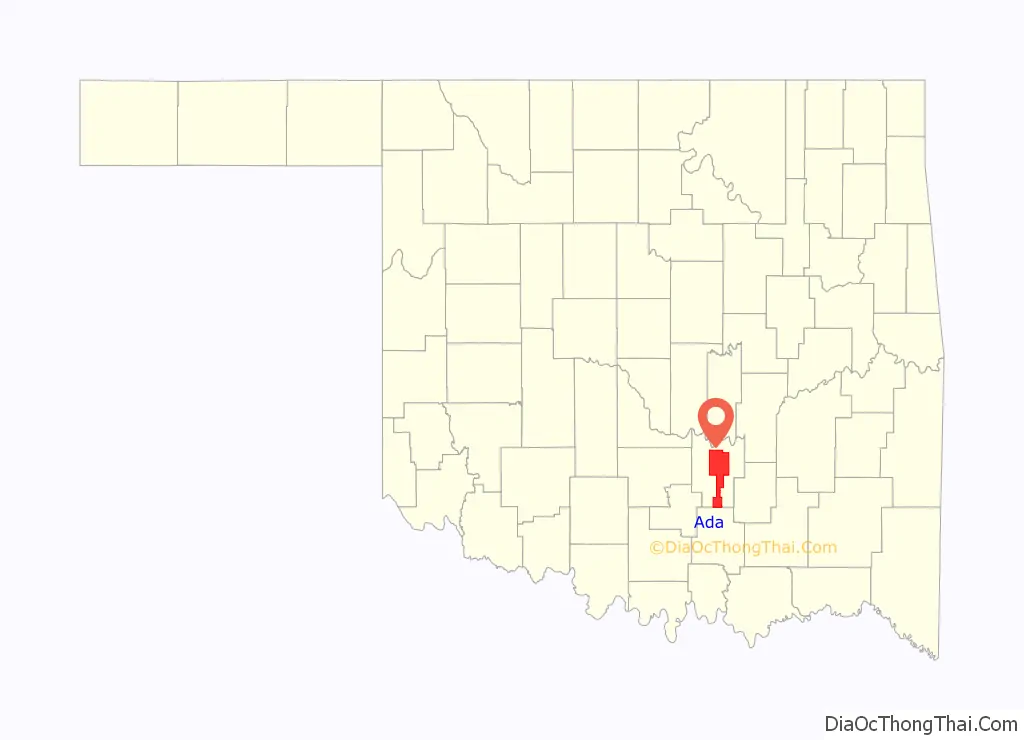
| State: | Oklahoma |
| County: | Pontotoc County |
| Elevation: | 1,010 ft (308 m) |
| Total Area: | 20.20 sq mi (52.32 km²) |
| Land Area: | 20.14 sq mi (52.17 km²) |
| Water Area: | 0.06 sq mi (0.15 km²) 0% |
| Total Population: | 16,481 |
| Population Density: | 818.20/sq mi (315.90/km²) |
| ZIP code: | 74820-74821 |
| Area code: | 580 |
| FIPS code: | 4000200 |
| GNISfeature ID: | 1089523 |
| Website: | adaok.com |
Online Interactive Map
Click on ![]() to view map in "full screen" mode.
to view map in "full screen" mode.
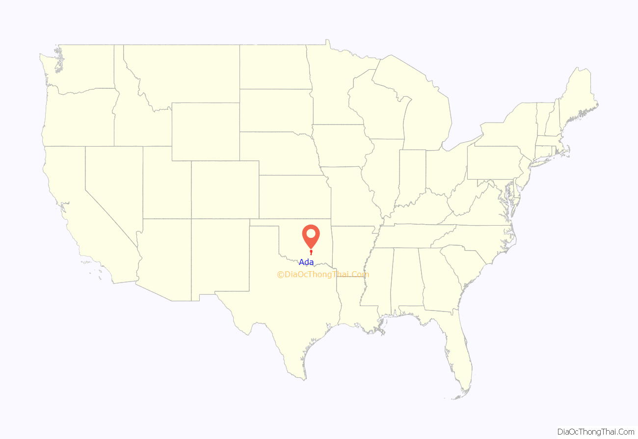
Ada location map. Where is Ada city?
History
In the late 1880s, the Daggs family (by way of Texas) became the first white family to settle what is now known as Ada, which was formerly known as Daggs Prairie. In April 1889, Jeff Reed (a Texan and relative of the Daggs family) was appointed to carry the mail from Stonewall to Center (which was later combined with Pickett), two small communities in then Indian Territory. With his family and his stock, he sought a place for a home on a prairie midway between the two points, where he constructed a log house and started Reed’s Store. Other settlers soon built homes nearby. In 1891, a post office was established and named after Reed’s oldest daughter, Ada. Ada incorporated as a city in 1901 and grew rapidly with the arrival of the St. Louis and San Francisco Railway line. Within a decade the Santa Fe Railroad and the Oklahoma Central Railway also served the town.
Ada was originally a sundown town, where African Americans were not allowed to live. In the 1900s, the town was opened up to African Americans so that black witnesses could stay while testifying in district court. Despite a violent episode in 1904, the town remained open to African Americans to provide labor for a local cotton compress.
In 1909, the women of Ada organized an effort to build a normal school in their city. It resulted in the founding of East Central College (now East Central University).
On April 19, 1909, an organized mob hanged four men, among whom was American outlaw Deacon Jim Miller, who was set to be tried for the murder of a former U.S. marshal and member of the local freemason lodge. The town had a population of about 5,000 at the time, and 38 murders a year at the time of the lynching. The Daily Ardmoreite reported that the four lynched men were “one of the bloodiest band of murderers in the state of Oklahoma and an organization of professional assassins, that for a record of blood crimes, probably has no equal in the annals of criminal history in the entire southwest”.
The first manufacturing company in Ada, the Portland Cement Company, installed the first cement clinker in Oklahoma in 1910. American Glass Casket Company began manufacturing glass caskets in 1916, but the business failed. Hazel Atlas Glass bought the plant in 1928 and produced glass products until 1991.
National Register of Historic Places
The following sites in Ada are listed on the National Register of Historic Places listings in Pontotoc County, Oklahoma:
- Ada Public Library
- Bebee Field Round House
- East Central State Normal School
- F.W. Meaders House
- Mijo Camp Industrial District
- Pontotoc County Courthouse
- Sugg Clinic
- Wintersmith Park Historic District
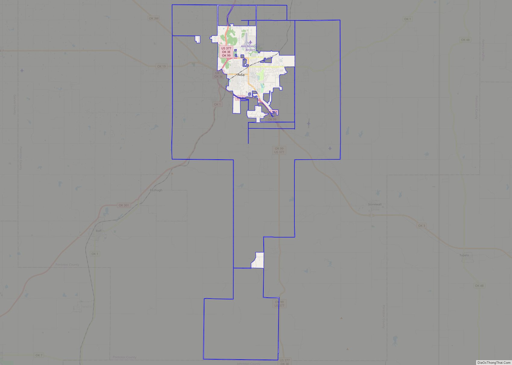
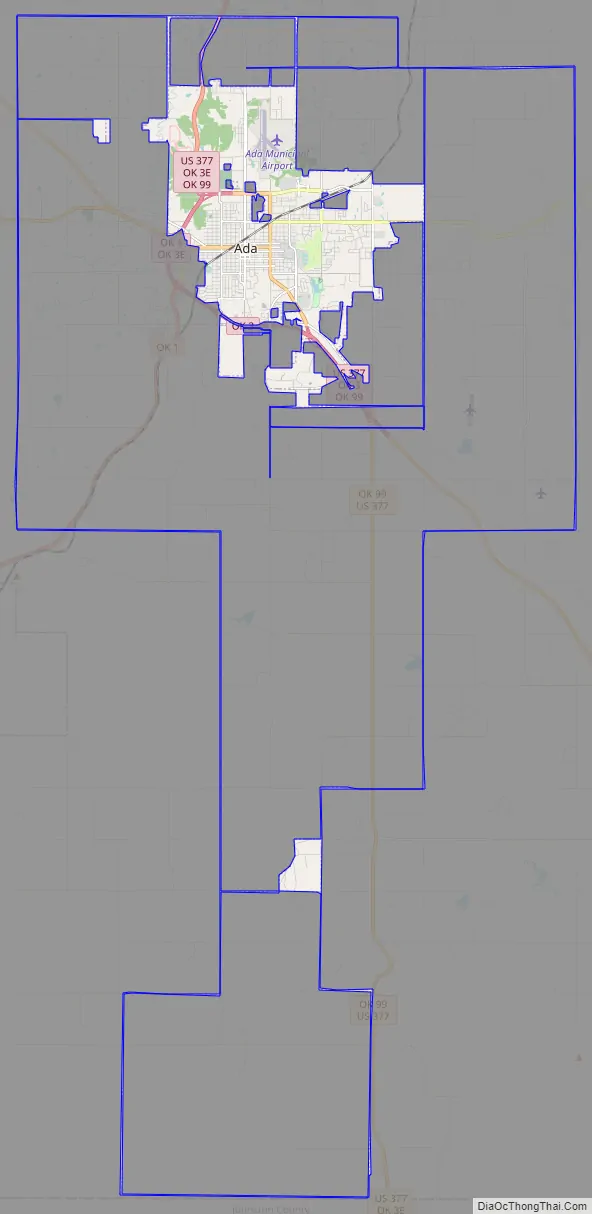
Ada Road Map
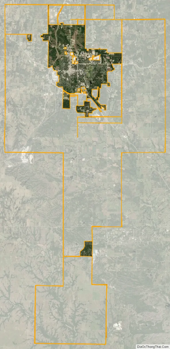
Ada city Satellite Map
Geography
Ada is located in the rolling hills of southeastern Oklahoma. Ada is 88 miles (142 km) from Oklahoma City, 122 mi (196 km) from Tulsa, and 133 mi (214 km) from Dallas, Texas.
According to the United States Census Bureau, the city has a total area of 15.8 square miles (40.9 km), of which 15.7 square miles (40.7 km) is land and 0.1 square miles (0.3 km) (0.44%) is water.
Climate
See also
Map of Oklahoma State and its subdivision:- Adair
- Alfalfa
- Atoka
- Beaver
- Beckham
- Blaine
- Bryan
- Caddo
- Canadian
- Carter
- Cherokee
- Choctaw
- Cimarron
- Cleveland
- Coal
- Comanche
- Cotton
- Craig
- Creek
- Custer
- Delaware
- Dewey
- Ellis
- Garfield
- Garvin
- Grady
- Grant
- Greer
- Harmon
- Harper
- Haskell
- Hughes
- Jackson
- Jefferson
- Johnston
- Kay
- Kingfisher
- Kiowa
- Latimer
- Le Flore
- Lincoln
- Logan
- Love
- Major
- Marshall
- Mayes
- McClain
- McCurtain
- McIntosh
- Murray
- Muskogee
- Noble
- Nowata
- Okfuskee
- Oklahoma
- Okmulgee
- Osage
- Ottawa
- Pawnee
- Payne
- Pittsburg
- Pontotoc
- Pottawatomie
- Pushmataha
- Roger Mills
- Rogers
- Seminole
- Sequoyah
- Stephens
- Texas
- Tillman
- Tulsa
- Wagoner
- Washington
- Washita
- Woods
- Woodward
- Alabama
- Alaska
- Arizona
- Arkansas
- California
- Colorado
- Connecticut
- Delaware
- District of Columbia
- Florida
- Georgia
- Hawaii
- Idaho
- Illinois
- Indiana
- Iowa
- Kansas
- Kentucky
- Louisiana
- Maine
- Maryland
- Massachusetts
- Michigan
- Minnesota
- Mississippi
- Missouri
- Montana
- Nebraska
- Nevada
- New Hampshire
- New Jersey
- New Mexico
- New York
- North Carolina
- North Dakota
- Ohio
- Oklahoma
- Oregon
- Pennsylvania
- Rhode Island
- South Carolina
- South Dakota
- Tennessee
- Texas
- Utah
- Vermont
- Virginia
- Washington
- West Virginia
- Wisconsin
- Wyoming