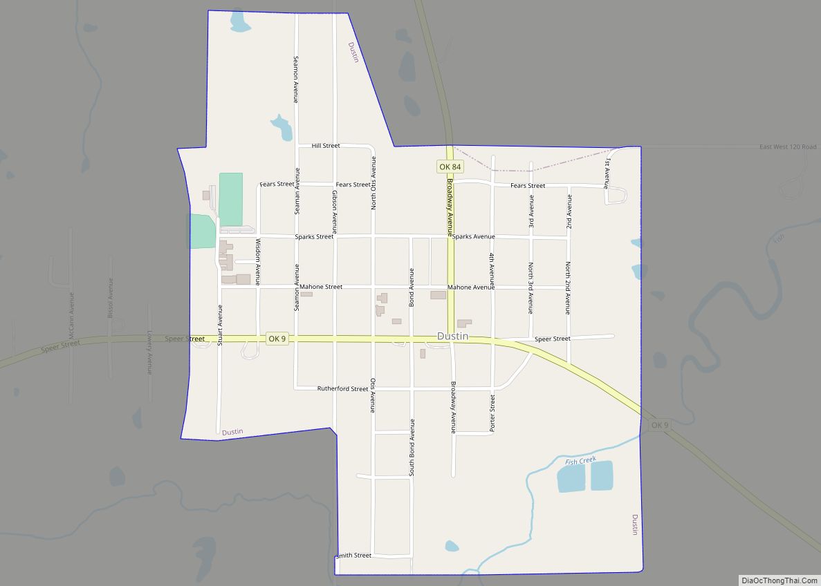
Dustin is a town in Hughes County, Oklahoma, United States. The population was 395 at the 2010 census, down from 452 in 2000.
| Name: | Dustin town |
|---|---|
| LSAD Code: | 43 |
| LSAD Description: | town (suffix) |
| State: | Oklahoma |
| County: | Hughes County |
| Elevation: | 715 ft (218 m) |
| Total Area: | 0.70 sq mi (1.81 km²) |
| Land Area: | 0.65 sq mi (1.67 km²) |
| Water Area: | 0.05 sq mi (0.14 km²) |
| Total Population: | 327 |
| Population Density: | 505.41/sq mi (195.25/km²) |
| ZIP code: | 74839 |
| Area code: | 539/918 |
| FIPS code: | 4022200 |
| GNISfeature ID: | 1092315 |
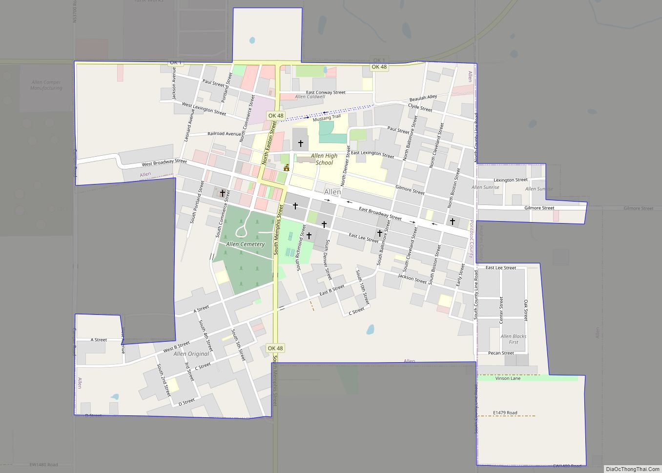
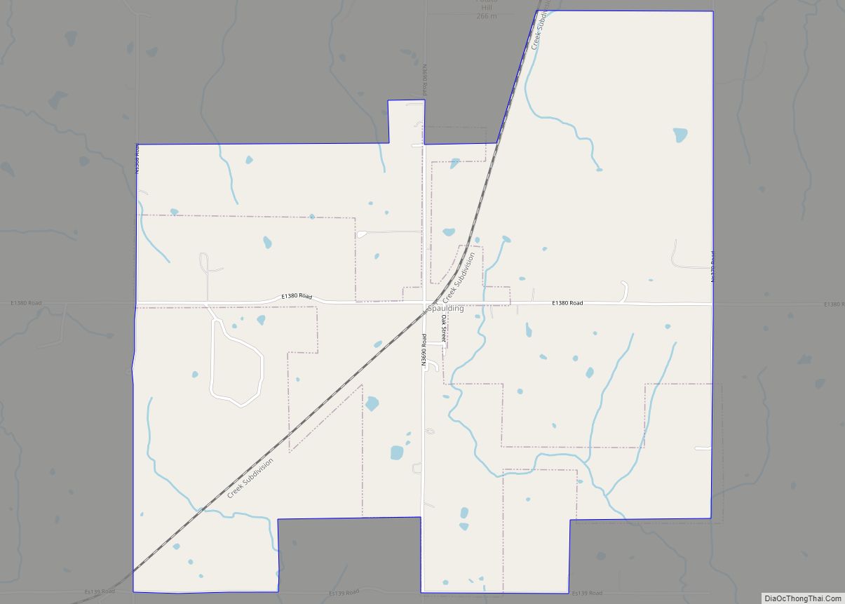
Online Interactive Map
Click on ![]() to view map in "full screen" mode.
to view map in "full screen" mode.
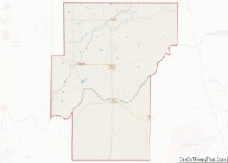
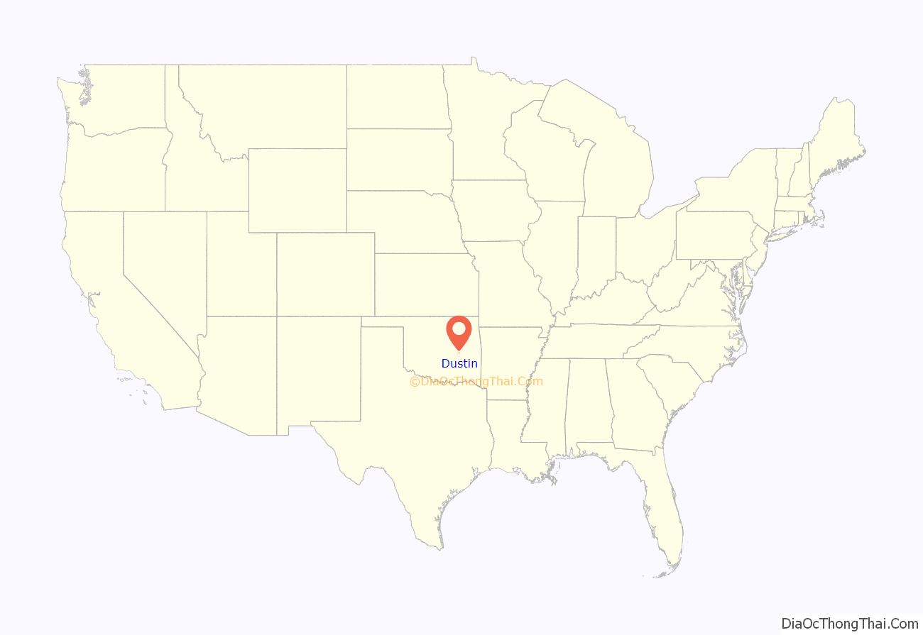
Dustin location map. Where is Dustin town?

History
Dustin, Oklahoma was called Watsonville when the community first formed in the late 19th century. When the post office opened there on April 18, 1898, it was officially named as “Watsonville”. The original site was 4 miles (6.4 km) south of the North Canadian River in the area then known as the Creek Nation in Indian Territory.
The post office site was moved 2 miles (3.2 km) north of the present site and its name was changed to “Spokogee” on June 27, 1902, though the same person, Marion J. Butler, remained as postmaster. After the Fort Smith and Western Railroad built its Fort Smith–Guthrie line through the area in 1903, the town and post office were both officially changed to “Dustin” on May 9, 1904.
The Missouri, Oklahoma and Gulf Railway (MO&G), built a north–south line through Dustin in 1905.
Dustin became a trading and commercial center for the surrounding agricultural area. Early businesses included two banks, two drug stores, three doctors, and two hardware stores. Although a school was among the first buildings constructed, it burned down before the school year began. It was soon replaced and two male teachers were hired. The MO&G maintained a railroad round house for working on its locomotives. Before the end of the first decade, Dustin had added four barbershops, a third barbershop, a third drug store, a fourth doctor, a third bank, a livery stable, two hotels, two cotton gins, an ice plant/bottling plant, and a wagon factory. Several newspapers, including the Dustin Dispatch, the Dustin News, and the Dustonian, informed the citizens in the early decades of the twentieth century.
Dustin built its first water supply system in 1912. In the 1930s, the community built Lake Dustin, a community-owned spring-fed 3,200,000 US gallons (12,000 m) reservoir. In 2012, Dustin began constructing a new municipal water supply system in 2003. The 1910 census reported that Dustin had a population of 579, which increased to an all-time high of 713 in 1920.
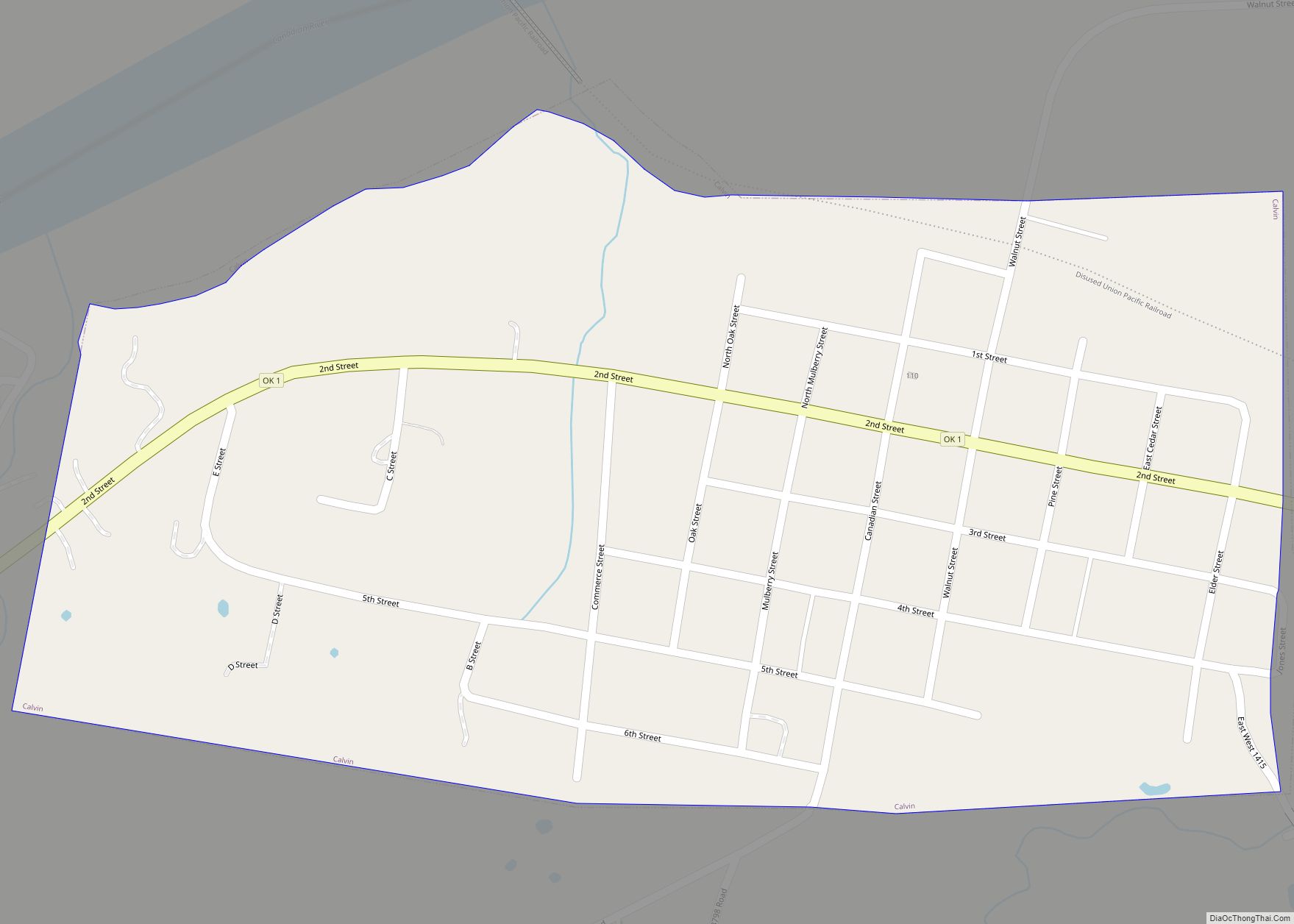
Dustin Road Map
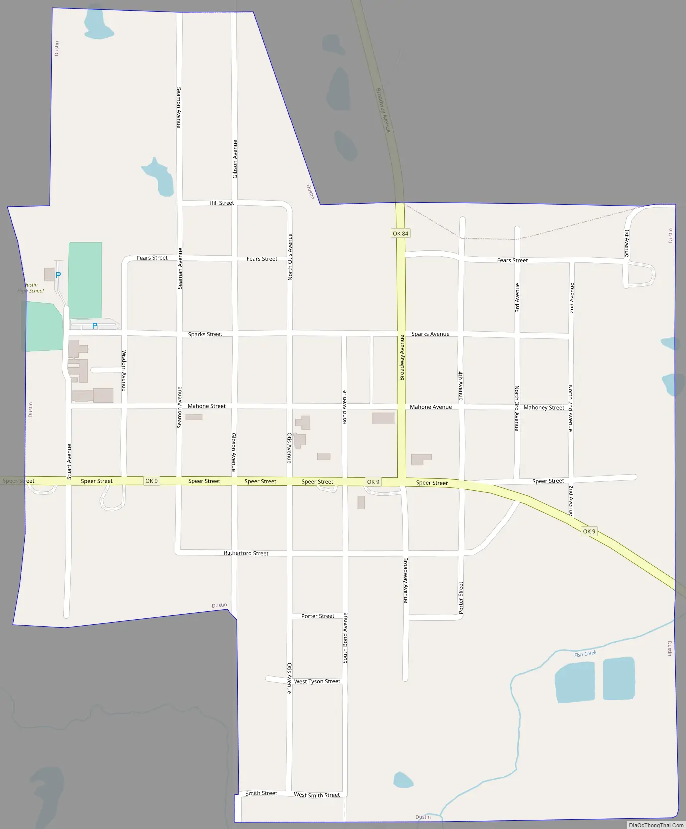
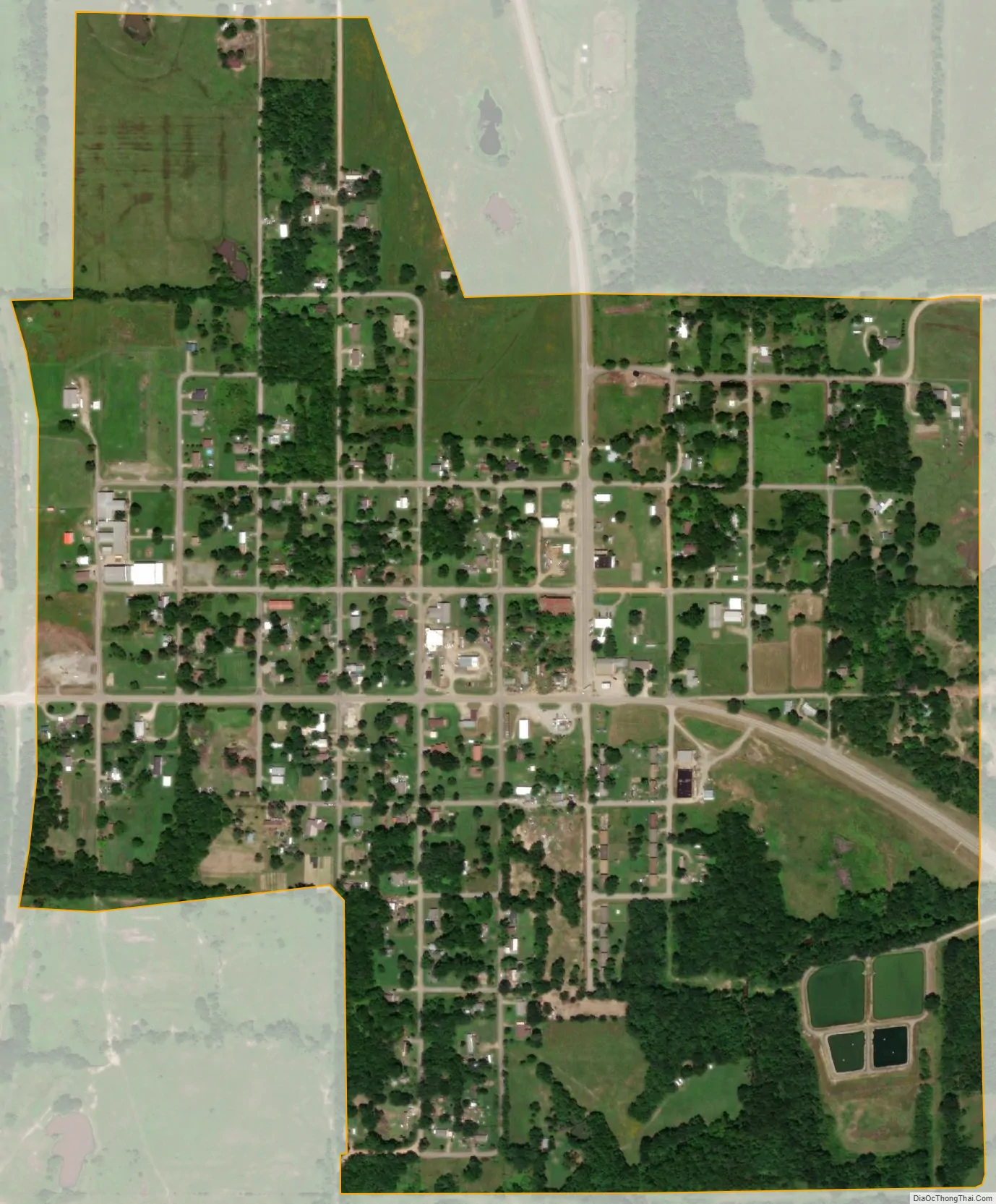
Dustin city Satellite Map
Geography
Dustin is located in northeastern Hughes County at 35°16′21″N 96°1′58″W / 35.27250°N 96.03278°W / 35.27250; -96.03278 (35.272609, -96.032855). Oklahoma State Highway 9 passes through the center of town, leading east 6 miles (10 km) to the Indian Nation Turnpike and west 13 miles (21 km) to Wetumka. Oklahoma State Highway 84 departs OK-9 in the center of Dustin, leading north and west 10 miles (16 km) to Weleetka.
According to the United States Census Bureau, Dustin has a total area of 0.60 square miles (1.55 km), of which 0.01 square miles (0.02 km), or 1.12%, are water. Fish Creek flows through the southeast corner of the town, running northeast to the North Canadian River.
See also
Map of Oklahoma State and its subdivision:- Adair
- Alfalfa
- Atoka
- Beaver
- Beckham
- Blaine
- Bryan
- Caddo
- Canadian
- Carter
- Cherokee
- Choctaw
- Cimarron
- Cleveland
- Coal
- Comanche
- Cotton
- Craig
- Creek
- Custer
- Delaware
- Dewey
- Ellis
- Garfield
- Garvin
- Grady
- Grant
- Greer
- Harmon
- Harper
- Haskell
- Hughes
- Jackson
- Jefferson
- Johnston
- Kay
- Kingfisher
- Kiowa
- Latimer
- Le Flore
- Lincoln
- Logan
- Love
- Major
- Marshall
- Mayes
- McClain
- McCurtain
- McIntosh
- Murray
- Muskogee
- Noble
- Nowata
- Okfuskee
- Oklahoma
- Okmulgee
- Osage
- Ottawa
- Pawnee
- Payne
- Pittsburg
- Pontotoc
- Pottawatomie
- Pushmataha
- Roger Mills
- Rogers
- Seminole
- Sequoyah
- Stephens
- Texas
- Tillman
- Tulsa
- Wagoner
- Washington
- Washita
- Woods
- Woodward
- Alabama
- Alaska
- Arizona
- Arkansas
- California
- Colorado
- Connecticut
- Delaware
- District of Columbia
- Florida
- Georgia
- Hawaii
- Idaho
- Illinois
- Indiana
- Iowa
- Kansas
- Kentucky
- Louisiana
- Maine
- Maryland
- Massachusetts
- Michigan
- Minnesota
- Mississippi
- Missouri
- Montana
- Nebraska
- Nevada
- New Hampshire
- New Jersey
- New Mexico
- New York
- North Carolina
- North Dakota
- Ohio
- Oklahoma
- Oregon
- Pennsylvania
- Rhode Island
- South Carolina
- South Dakota
- Tennessee
- Texas
- Utah
- Vermont
- Virginia
- Washington
- West Virginia
- Wisconsin
- Wyoming