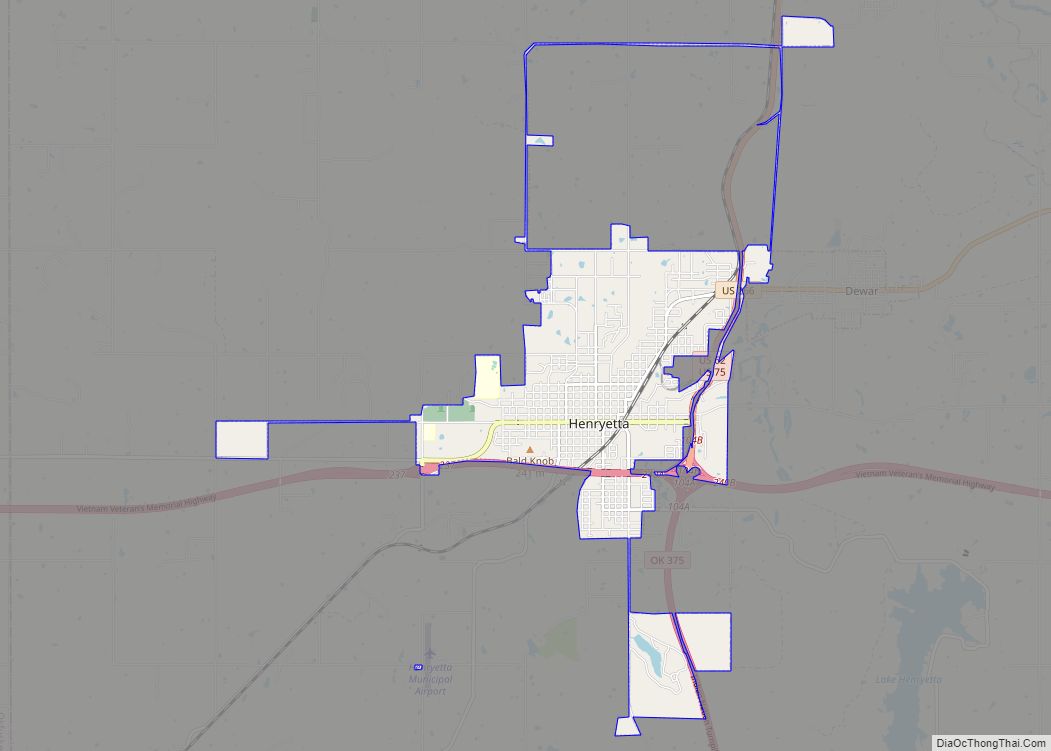
Henryetta is a city in Okmulgee County, Oklahoma, United States. The population was 5,927 at the 2010 census, down 2.8 percent from the figure of 6,096 recorded in 2000.
| Name: | Henryetta city |
|---|---|
| LSAD Code: | 25 |
| LSAD Description: | city (suffix) |
| State: | Oklahoma |
| County: | Okmulgee County |
| Elevation: | 682 ft (208 m) |
| Total Area: | 6.89 sq mi (17.83 km²) |
| Land Area: | 6.85 sq mi (17.74 km²) |
| Water Area: | 0.04 sq mi (0.10 km²) |
| Total Population: | 5,640 |
| Population Density: | 823.60/sq mi (318.01/km²) |
| ZIP code: | 74437 |
| Area code: | 539/918 |
| FIPS code: | 4033750 |
| GNISfeature ID: | 1093675 |
Online Interactive Map
Click on ![]() to view map in "full screen" mode.
to view map in "full screen" mode.
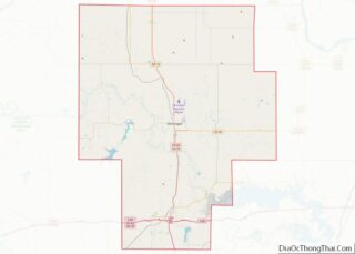
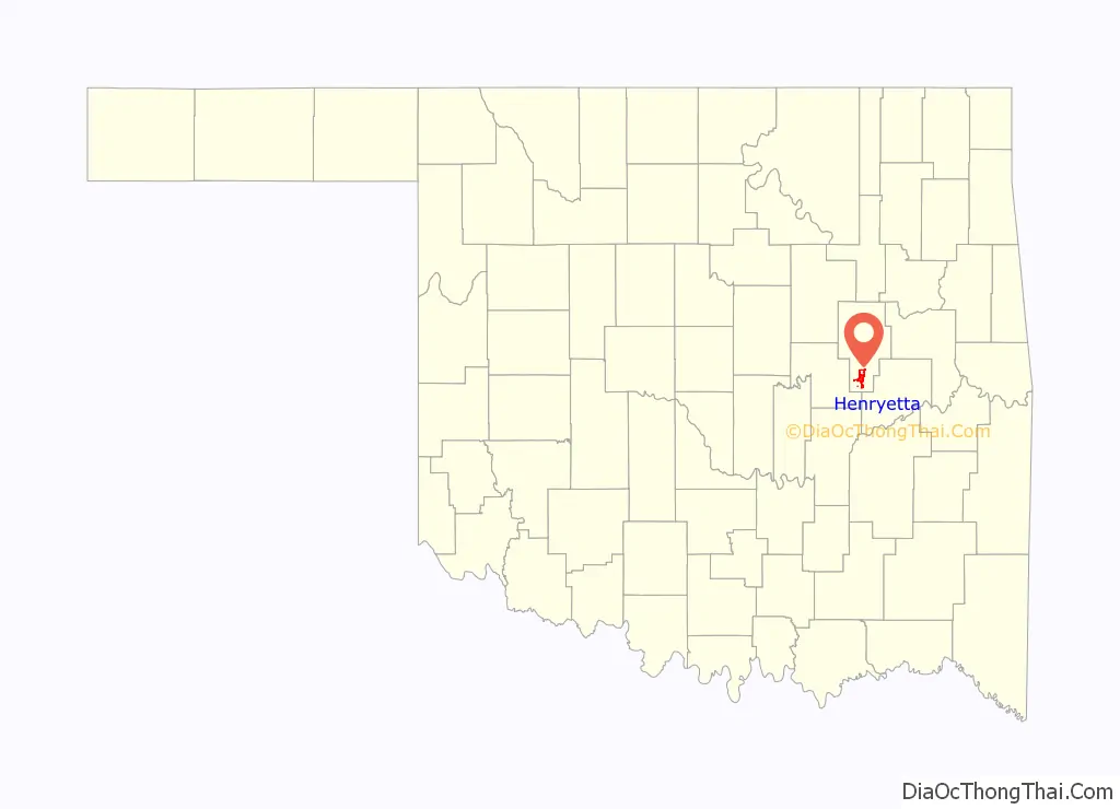
Henryetta location map. Where is Henryetta city?

History
Hugh Henry established a ranch on Creek Nation land in 1885. He soon found a deposit of coal, which he began using to fuel the forge at his ranch. Discovery of more coal deposits in the large Henryetta Coal Formation attracted several railroads to develop these mines. A settlement named Furrs grew up around the mines. The name changed to Henryetta when a post office opened on August 28, 1900.
At statehood in 1907, Henryetta had 1,051 residents. The economy was based on agriculture, coal, natural gas and oil. In 1909, the area had 14 coal mines, producing 65,000 tons per month. By 1910, the population had grown to 1,671. The town added a broom factory, several brick factories and a bottling plant during the 1920s. By the time of the 36th annual report of the Department of Mines and Minerals in 1943, combined yearly production by Acme Coal Company, Atlas Coal Company, Ben Hurr Coal Company, Starr Coal Company, and Wardin-Pullen Coal Company– all of Henryetta– was over 600,000 tons.
Henryetta’s manufacturing base continued to expand. Pittsburgh Plate Glass (PPG) built a plate glass window plant in Henryetta in 1929–30, employing 900 people and claiming to be the largest west of the Mississippi River. The factory closed in 1974, but was purchased and refitted for making glass containers, and continues in operation by Anchor Glass Container.
Eagle-Picher placed a massive zinc smelting facility in the Spelter City area of town, which continued through the 1960’s. The company also employed more than 700 people at its plant that extracted the rare metal germanium. The plant has since closed and become a Superfund cleanup site.
Besides Anchor Glass, current employers include the international oilfield-services company Shawcor; Henryetta Pallet, a regional wood pallet manufacturer; and, G&H Decoy, a waterfowl decoy manufacturer since 1934.
Henryetta Road Map
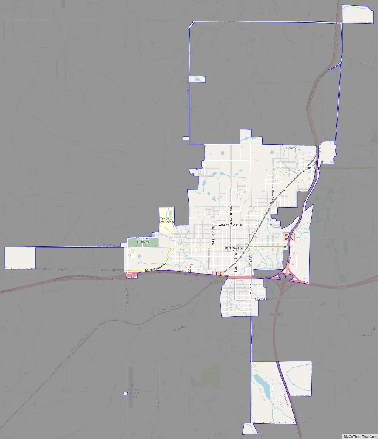
Henryetta city Satellite Map

Geography
Henryetta is located at 35°26′33″N 95°59′6″W / 35.44250°N 95.98500°W / 35.44250; -95.98500 (35.442379, -95.985000).
According to the United States Census Bureau, the city has a total area of 6.1 square miles (16 km), of which 6.0 square miles (16 km) is land and 0.04 square miles (0.10 km) (0.66%) is water.
See also
Map of Oklahoma State and its subdivision:- Adair
- Alfalfa
- Atoka
- Beaver
- Beckham
- Blaine
- Bryan
- Caddo
- Canadian
- Carter
- Cherokee
- Choctaw
- Cimarron
- Cleveland
- Coal
- Comanche
- Cotton
- Craig
- Creek
- Custer
- Delaware
- Dewey
- Ellis
- Garfield
- Garvin
- Grady
- Grant
- Greer
- Harmon
- Harper
- Haskell
- Hughes
- Jackson
- Jefferson
- Johnston
- Kay
- Kingfisher
- Kiowa
- Latimer
- Le Flore
- Lincoln
- Logan
- Love
- Major
- Marshall
- Mayes
- McClain
- McCurtain
- McIntosh
- Murray
- Muskogee
- Noble
- Nowata
- Okfuskee
- Oklahoma
- Okmulgee
- Osage
- Ottawa
- Pawnee
- Payne
- Pittsburg
- Pontotoc
- Pottawatomie
- Pushmataha
- Roger Mills
- Rogers
- Seminole
- Sequoyah
- Stephens
- Texas
- Tillman
- Tulsa
- Wagoner
- Washington
- Washita
- Woods
- Woodward
- Alabama
- Alaska
- Arizona
- Arkansas
- California
- Colorado
- Connecticut
- Delaware
- District of Columbia
- Florida
- Georgia
- Hawaii
- Idaho
- Illinois
- Indiana
- Iowa
- Kansas
- Kentucky
- Louisiana
- Maine
- Maryland
- Massachusetts
- Michigan
- Minnesota
- Mississippi
- Missouri
- Montana
- Nebraska
- Nevada
- New Hampshire
- New Jersey
- New Mexico
- New York
- North Carolina
- North Dakota
- Ohio
- Oklahoma
- Oregon
- Pennsylvania
- Rhode Island
- South Carolina
- South Dakota
- Tennessee
- Texas
- Utah
- Vermont
- Virginia
- Washington
- West Virginia
- Wisconsin
- Wyoming