Horntown is a town in Hughes County, Oklahoma, United States. The population was 97 at the 2010 census, up from the figure of 61 recorded in 2000.
| Name: | Horntown town |
|---|---|
| LSAD Code: | 43 |
| LSAD Description: | town (suffix) |
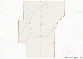
| State: | Oklahoma |
| County: | Hughes County |
| Elevation: | 843 ft (257 m) |
| Total Area: | 4.01 sq mi (10.38 km²) |
| Land Area: | 3.95 sq mi (10.24 km²) |
| Water Area: | 0.05 sq mi (0.14 km²) |
| Total Population: | 92 |
| Population Density: | 23.27/sq mi (8.98/km²) |
| FIPS code: | 4036090 |
| GNISfeature ID: | 1093929 |
Online Interactive Map
Click on ![]() to view map in "full screen" mode.
to view map in "full screen" mode.
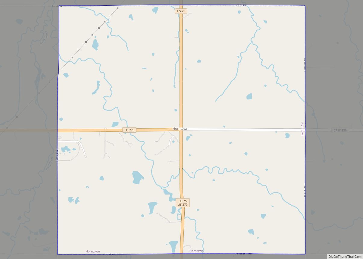
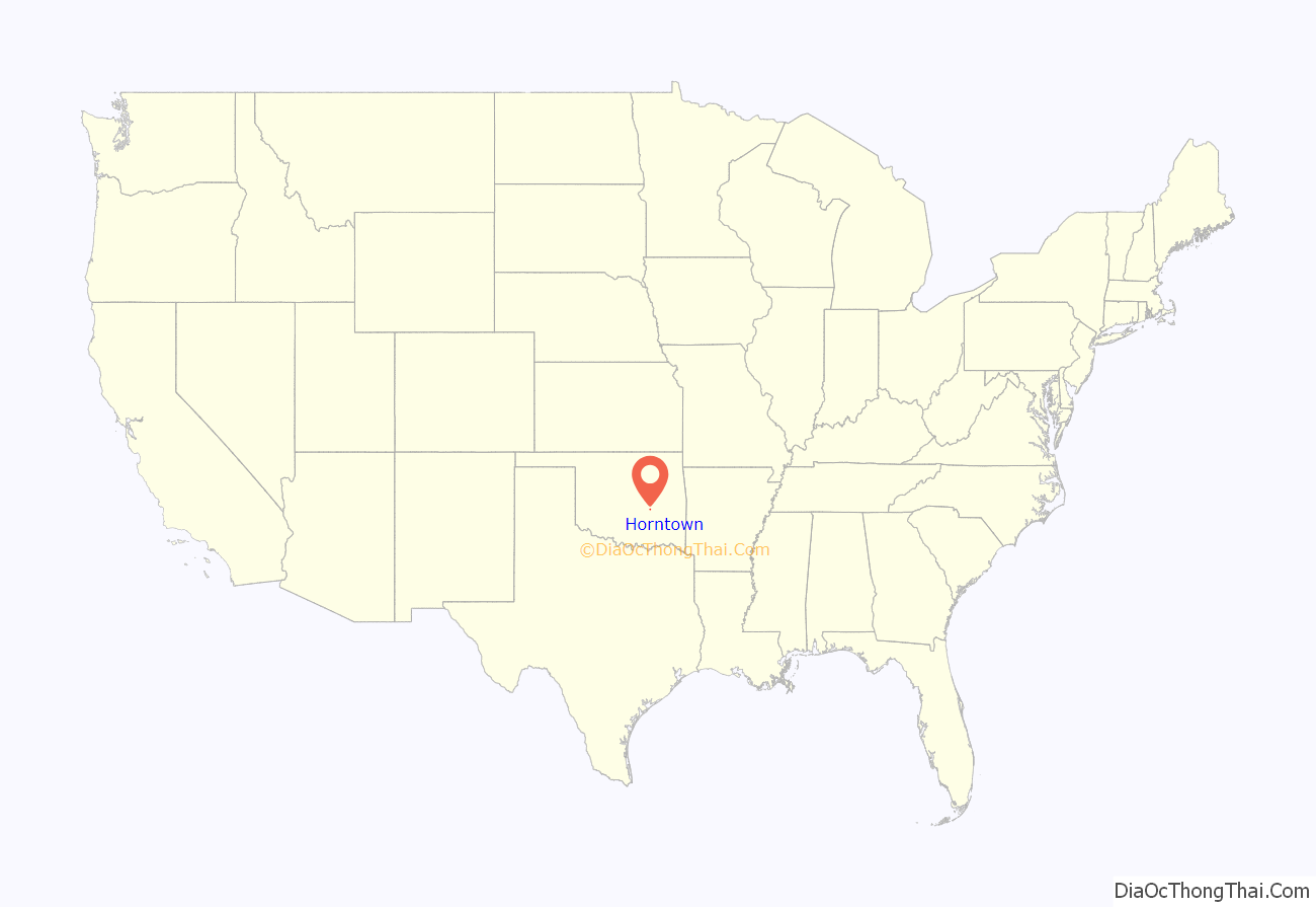
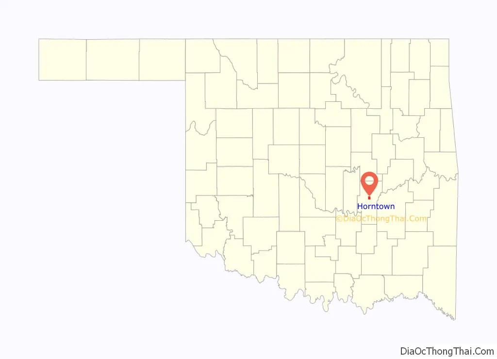
Horntown location map. Where is Horntown town?
History
Horntown is the center of a dispersed rural community in Jacobs Township of Hughes County that formed in the 1920s. The earliest inhabitants, according to the Encyclopedia of Oklahoma History and Culture, were T. C. Horn and Charley Hawthorn, who operated retail stores, garages, and gasoline stations and a restaurant at the crossroads of two section-line roads that are now U.S. Highways 75 and 270.
When Horntown incorporated on August 2, 1995, it comprised 4.021 square miles. Also in that year, the population of the immediate area served by Horntown’s businesses included approximately 200 residents. Subsequently, the U.S. Census of 2000 counted 61 residents inside the town limits. The census of 2010 recorded an official population increase to 97. At that time, a convenience store–restaurant, a gasoline station, and a tire store operated. The Horntown fire department, law enforcement, and emergency services maintained a small complex of buildings, and the Banner Baptist Church served residents.
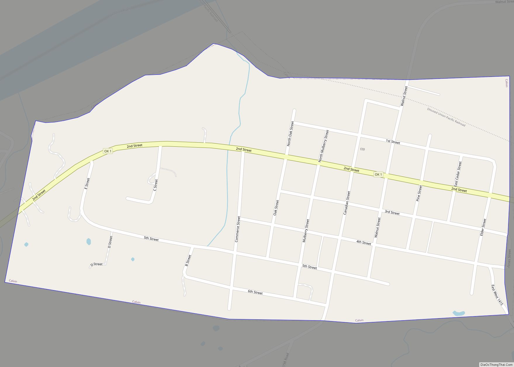
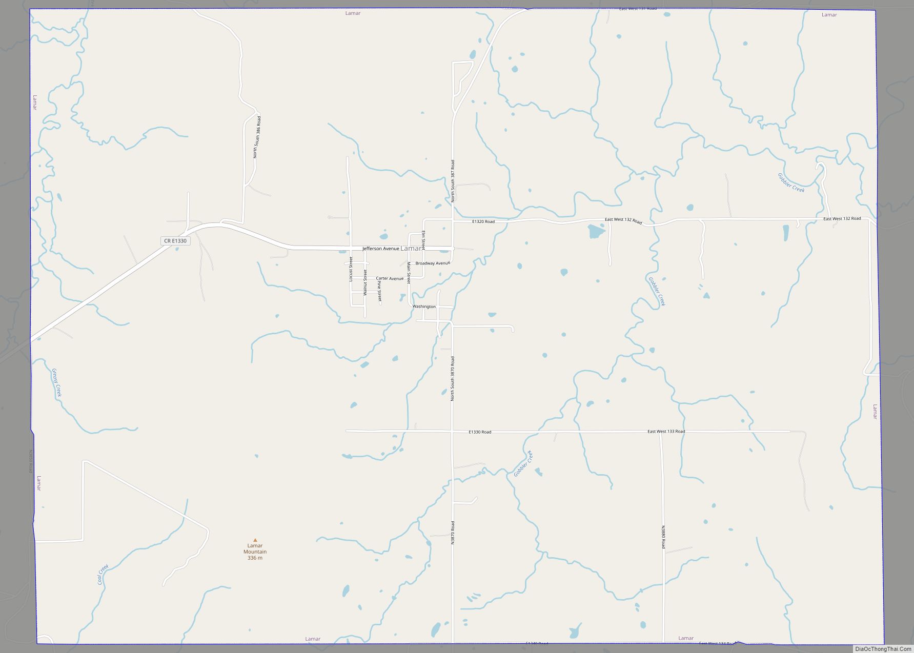
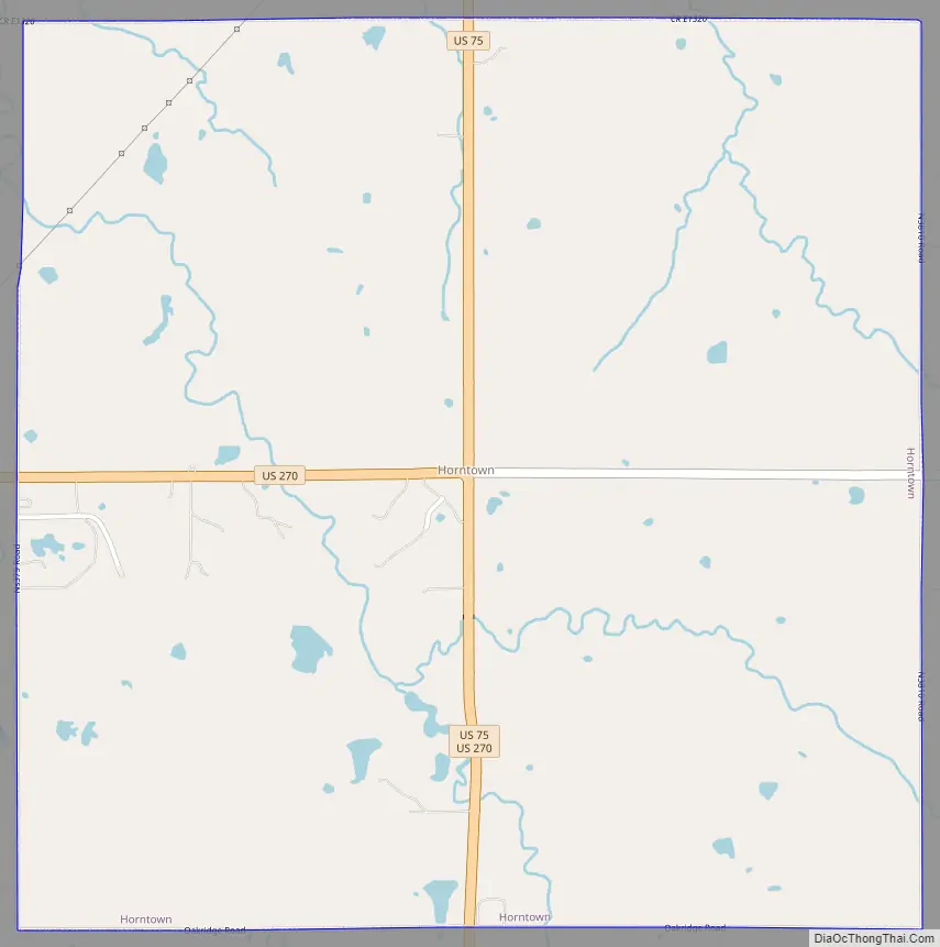
Horntown Road Map
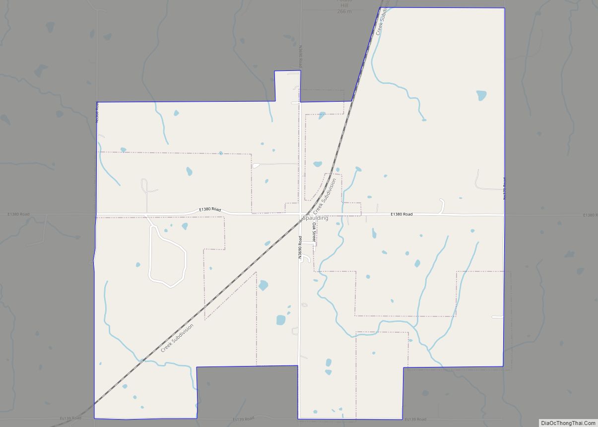
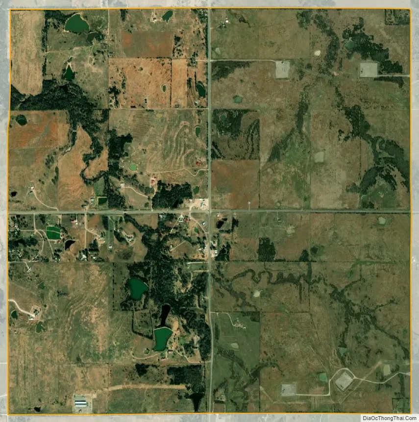
Horntown city Satellite Map
Geography
Horntown is located in central Hughes County at 35°5′2″N 96°14′59″W / 35.08389°N 96.24972°W / 35.08389; -96.24972 (35.084025, -96.249711). The lightly populated town is centered on the intersection of U.S. Routes 75 and 270. US 75 leads north 10 miles (16 km) to Wetumka, while US 270 leads west 8 miles (13 km) to Holdenville, the Hughes county seat. The two highways join in Horntown and lead south 8 miles (13 km) to Calvin.
According to the United States Census Bureau, Horntown has a total area of 4.0 square miles (10.4 km), of which 0.04 square miles (0.1 km), or 1.33%, are water. The town drains north via Grief Creek and Graves Creek to Wewoka Creek, a tributary of the North Canadian River.
See also
Map of Oklahoma State and its subdivision:- Adair
- Alfalfa
- Atoka
- Beaver
- Beckham
- Blaine
- Bryan
- Caddo
- Canadian
- Carter
- Cherokee
- Choctaw
- Cimarron
- Cleveland
- Coal
- Comanche
- Cotton
- Craig
- Creek
- Custer
- Delaware
- Dewey
- Ellis
- Garfield
- Garvin
- Grady
- Grant
- Greer
- Harmon
- Harper
- Haskell
- Hughes
- Jackson
- Jefferson
- Johnston
- Kay
- Kingfisher
- Kiowa
- Latimer
- Le Flore
- Lincoln
- Logan
- Love
- Major
- Marshall
- Mayes
- McClain
- McCurtain
- McIntosh
- Murray
- Muskogee
- Noble
- Nowata
- Okfuskee
- Oklahoma
- Okmulgee
- Osage
- Ottawa
- Pawnee
- Payne
- Pittsburg
- Pontotoc
- Pottawatomie
- Pushmataha
- Roger Mills
- Rogers
- Seminole
- Sequoyah
- Stephens
- Texas
- Tillman
- Tulsa
- Wagoner
- Washington
- Washita
- Woods
- Woodward
- Alabama
- Alaska
- Arizona
- Arkansas
- California
- Colorado
- Connecticut
- Delaware
- District of Columbia
- Florida
- Georgia
- Hawaii
- Idaho
- Illinois
- Indiana
- Iowa
- Kansas
- Kentucky
- Louisiana
- Maine
- Maryland
- Massachusetts
- Michigan
- Minnesota
- Mississippi
- Missouri
- Montana
- Nebraska
- Nevada
- New Hampshire
- New Jersey
- New Mexico
- New York
- North Carolina
- North Dakota
- Ohio
- Oklahoma
- Oregon
- Pennsylvania
- Rhode Island
- South Carolina
- South Dakota
- Tennessee
- Texas
- Utah
- Vermont
- Virginia
- Washington
- West Virginia
- Wisconsin
- Wyoming