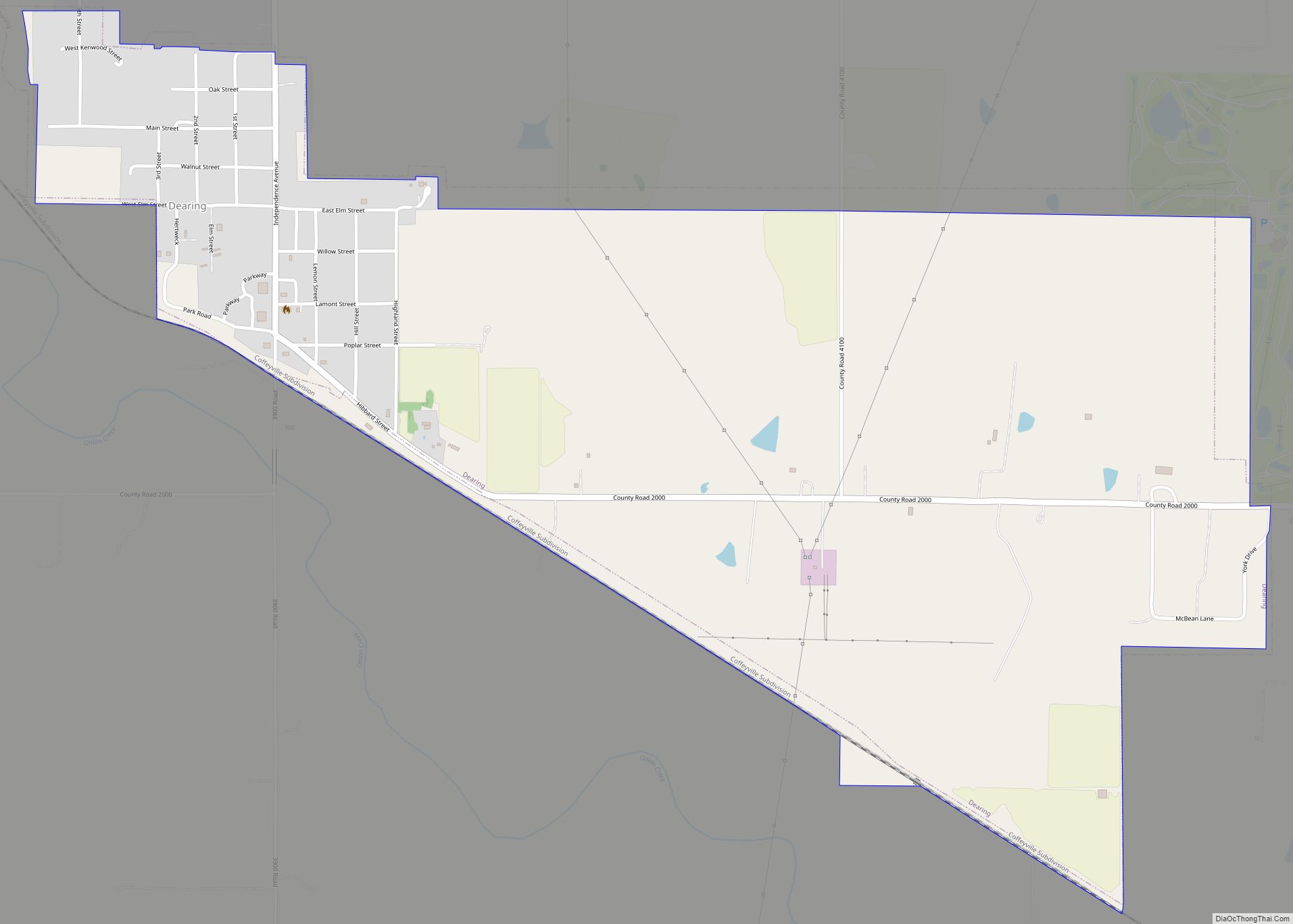
Coffeyville is a city in southeastern Montgomery County, Kansas, United States, located along the Verdigris River in the state’s southeastern region. As of the 2020 census, the population of the city was 8,826. Coffeyville is the most populous city of Montgomery County, and the home to Coffeyville Community College. The town of South Coffeyville, Oklahoma is approximately 1 mile south of the city.
| Name: | Coffeyville city |
|---|---|
| LSAD Code: | 25 |
| LSAD Description: | city (suffix) |
| State: | Kansas |
| County: | Montgomery County |
| Founded: | 1869 |
| Incorporated: | 1873 |
| Elevation: | 735 ft (224 m) |
| Total Area: | 9.47 sq mi (24.52 km²) |
| Land Area: | 9.47 sq mi (24.52 km²) |
| Water Area: | 0.00 sq mi (0.00 km²) |
| Total Population: | 8,826 |
| Population Density: | 930/sq mi (360/km²) |
| ZIP code: | 67337 |
| Area code: | 620 |
| FIPS code: | 2014600 |
| Website: | coffeyville.com |
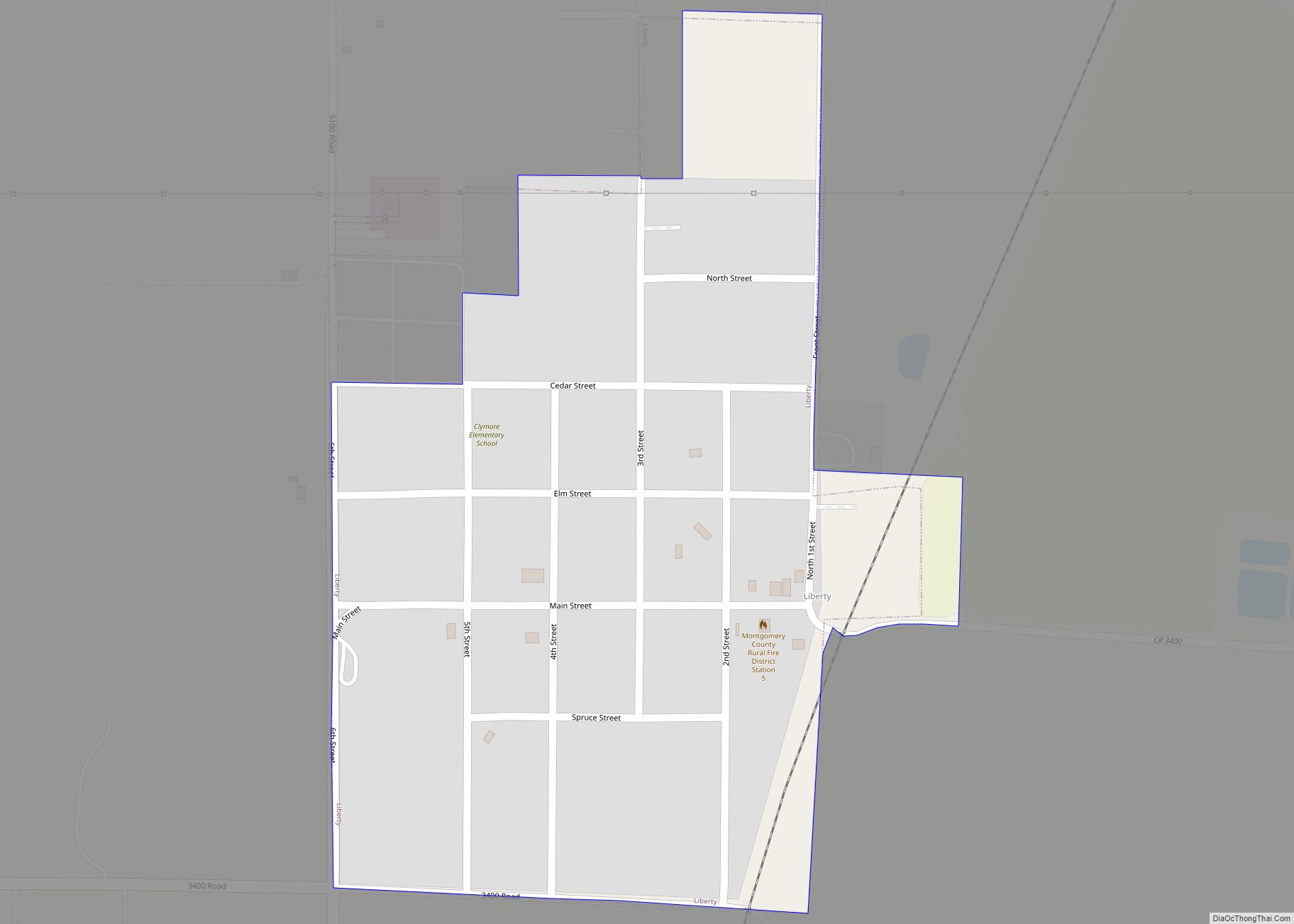
Online Interactive Map
Click on ![]() to view map in "full screen" mode.
to view map in "full screen" mode.
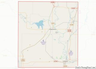
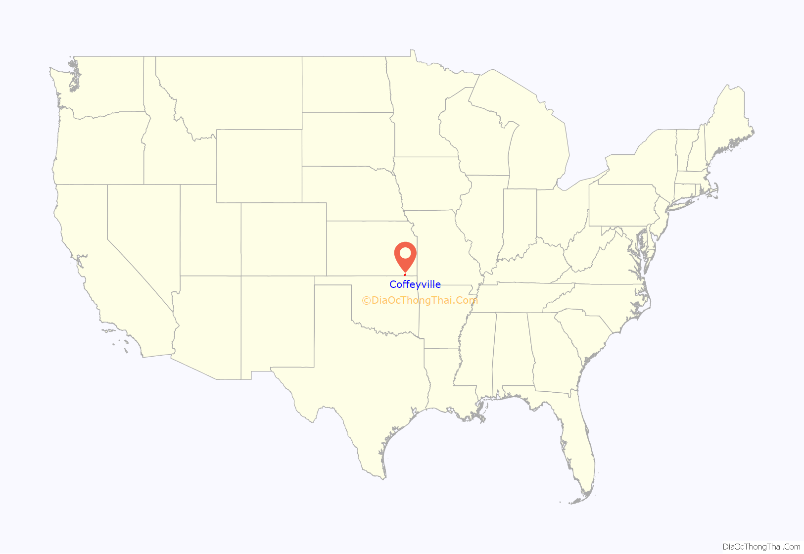
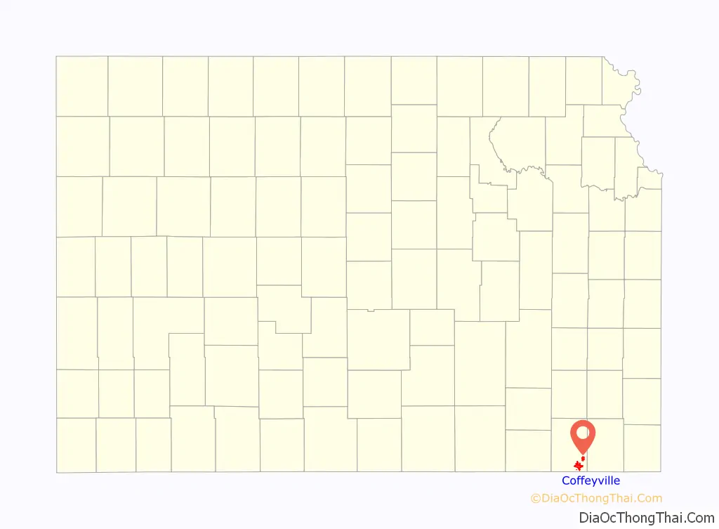
Coffeyville location map. Where is Coffeyville city?
History
This settlement was founded in 1869 as an Indian trading post by Col. James A. Coffey, serving the population across the border in what was then the Indian Territory. The town was stimulated in 1871 by being made a stop on the Leavenworth, Lawrence & Galveston Railroad, which connected it to other markets and developments. With the arrival of the railroad, a young surveyor, Napoleon B. Blanton, was dispatched to lay out the town. The naming of the town was left to the toss of a coin between Col. Coffey and U.S. Army Captain Blanton. Coffey won the toss and the town was officially named Coffeyville.
The city was incorporated in 1872, but the charter was voided as illegal, and the city was re-incorporated in March 1873.
As a frontier settlement, Coffeyville had its share of violence. On October 5, 1892, four of the Dalton Gang were killed in a shootout during an attempted bank robbery; Emmett Dalton survived with 23 gunshot wounds and later pleaded guilty to second-degree murder, although he later asserted that he never fired a shot during the robbery. He served 14 years before being pardoned. The gang had been trying to rob the First National and Condon banks, located across the street from each other. Law enforcement personnel and civilians recognized them under their disguises of fake beards and attacked the gang members as they fled one of the banks. Three civilians and a local marshal, Charles T. Connelly, died defending the town. The town holds an annual celebration each October to commemorate the Dalton Raid.
After the discovery of its resources of plentiful natural gas and abundant clay, Coffeyville enjoyed rapid growth from 1890 to 1910, as its population expanded sixfold. Many of the Coffeyville buildings now appearing in the National Register of Historic Places (NRHP) were built during this time period. They include the Old Condon National Bank (now the Perkins Building, c. 1890, added 1/12/1973), the Brown Mansion (c. 1904-1907, added 12/12/1976), the new larger Bethel African Methodist Episcopal Church (c. 1907, added 7/28/1995) and the Charles M. Ball House (c. 1906-1908, added 2/7/2011).
From the turn of the 20th century to the 1930s, Coffeyville was one of the largest glass and brick manufacturing centers in the nation. During this same period, the development of oil production attracted the founding of several oil field equipment manufacturers, and more workers and residents.
In March 1927, a racially charged riot occurred after three African American men were arrested on a false accusation of raping two teenage girls. A white mob stormed the jail, but were unable to locate the three men. The mob then attacked African Americans on the streets. Kansas National Guardsmen arrived and restored order.
Early Sunday School
In 1930 residents who were members of the Church of Jesus Christ of Latter-day Saints (LDS) organized a Sunday School; it was one of only 11 places in Kansas to have such a facility then.
Coffeyville Multiscope
Coffeyville industrialist Douglas Brown founded Coffeyville Multiscope, which produced components of the Norden bombsight. This played a determining role in the perfection of precision daylight bombing during World War II as a result of the bombsight’s advanced accuracy and drift correction capability.
2007 flood
On July 1, 2007, Coffeyville suffered a major flood when the Verdigris River crested at 10 feet above flood stage and flooded approximately a third of the city. The flood topped the local refinery (Coffeyville Resources LLC) levees by 4 feet, allowing oil to pollute the water. Approximately 1700 barrels (71,000 gallons) of crude oil mingled with the already contaminated flood waters. The EPA worked to prevent the oil and flood water mix from continuing downriver, where it could damage the water in Oologah Lake near Oologah, Oklahoma. Many residential water supplies are drawn from that lake. A minimal amount of oil reached Oologah Lake, and it did not pose a threat to the water supplies of other cities along the Verdigris River or from the lake. A number of animals were found dead or injured in flood areas, covered with oil.
By July 2, areas east of Patterson Street were off limits, and a curfew was enacted in other areas of the city. On July 3, the city lost its supply of potable water, but the water service was restored and the order to boil water rescinded on July 7. The Federal Emergency Management Agency (FEMA) and the Red Cross came to aid residents, and Kansas Governor Kathleen Sebelius and President George W. Bush declared the city a federal disaster area. Most displaced residents found shelter with family and friends, but many were sheltered in two area churches and a senior citizens’ apartment complex. Some pets were rescued to a temporary animal shelter built for them at LeClere Park.
The flooded area on the city’s east side was reopened on July 11 for residents and business owners to begin assessing damage and to retrieve salvageable items.
In order to focus on the post-flood recovery and clean-up, the city and state cancelled the 2007 Inter-State Fair & Rodeo. The ongoing flood recovery included a wholesale environmental remediation of the flood-affected eastern portion of the city, which continued through late 2008 to early 2009. Many of the flood-damaged homes were purchased by Coffeyville Resources LLC as a part of its effort to compensate the homeowners affected by the oil spill.
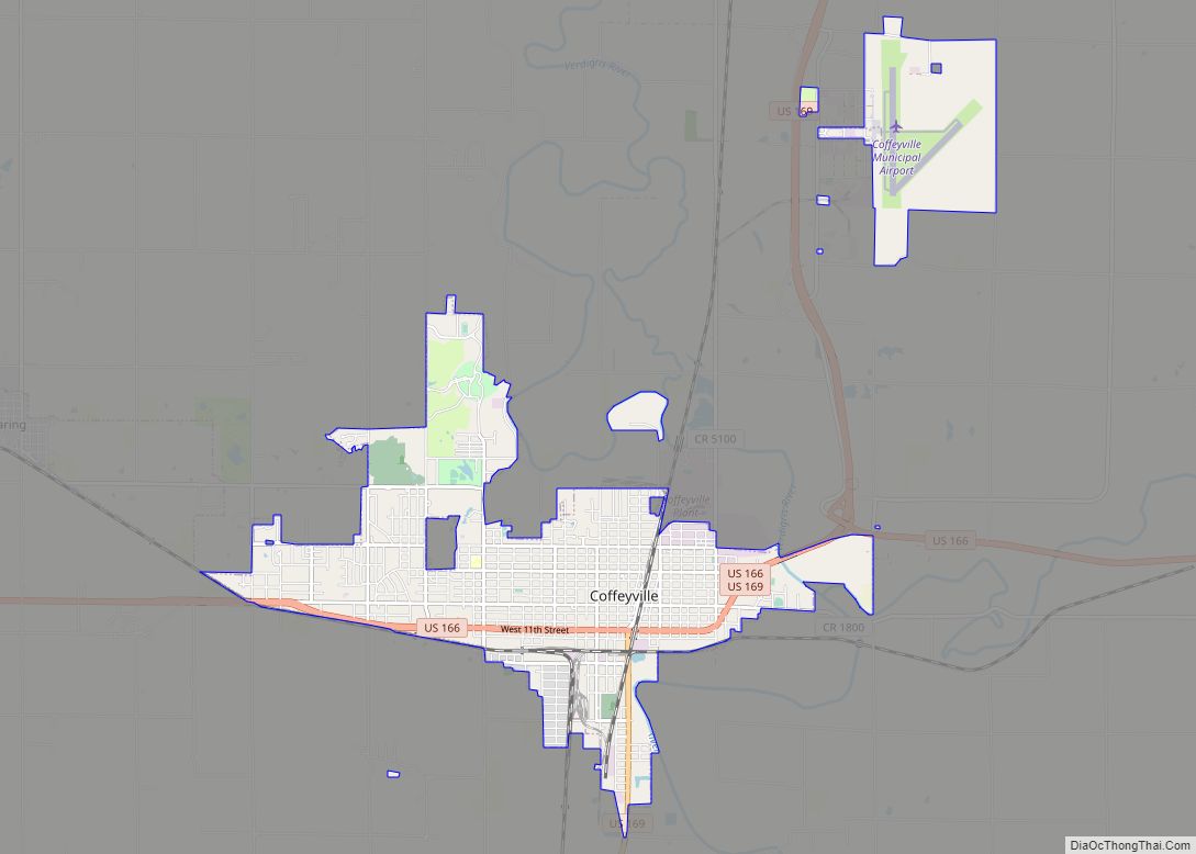
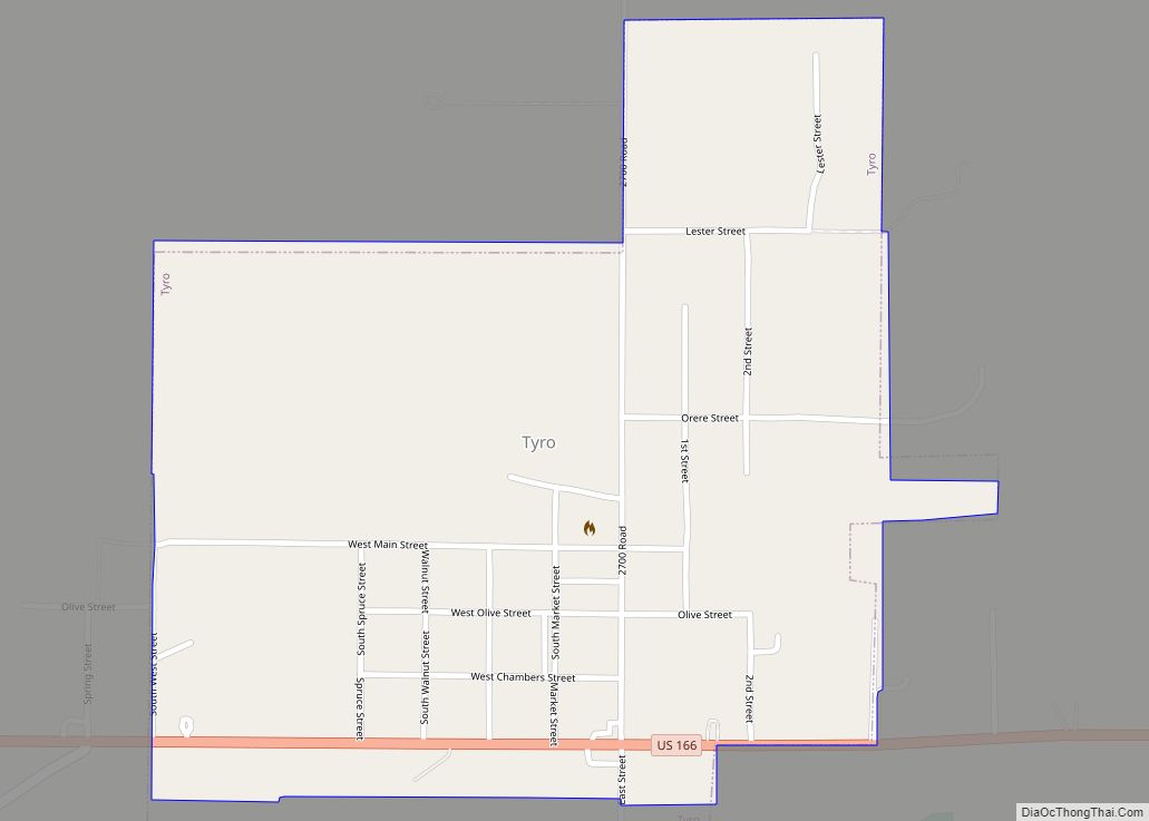
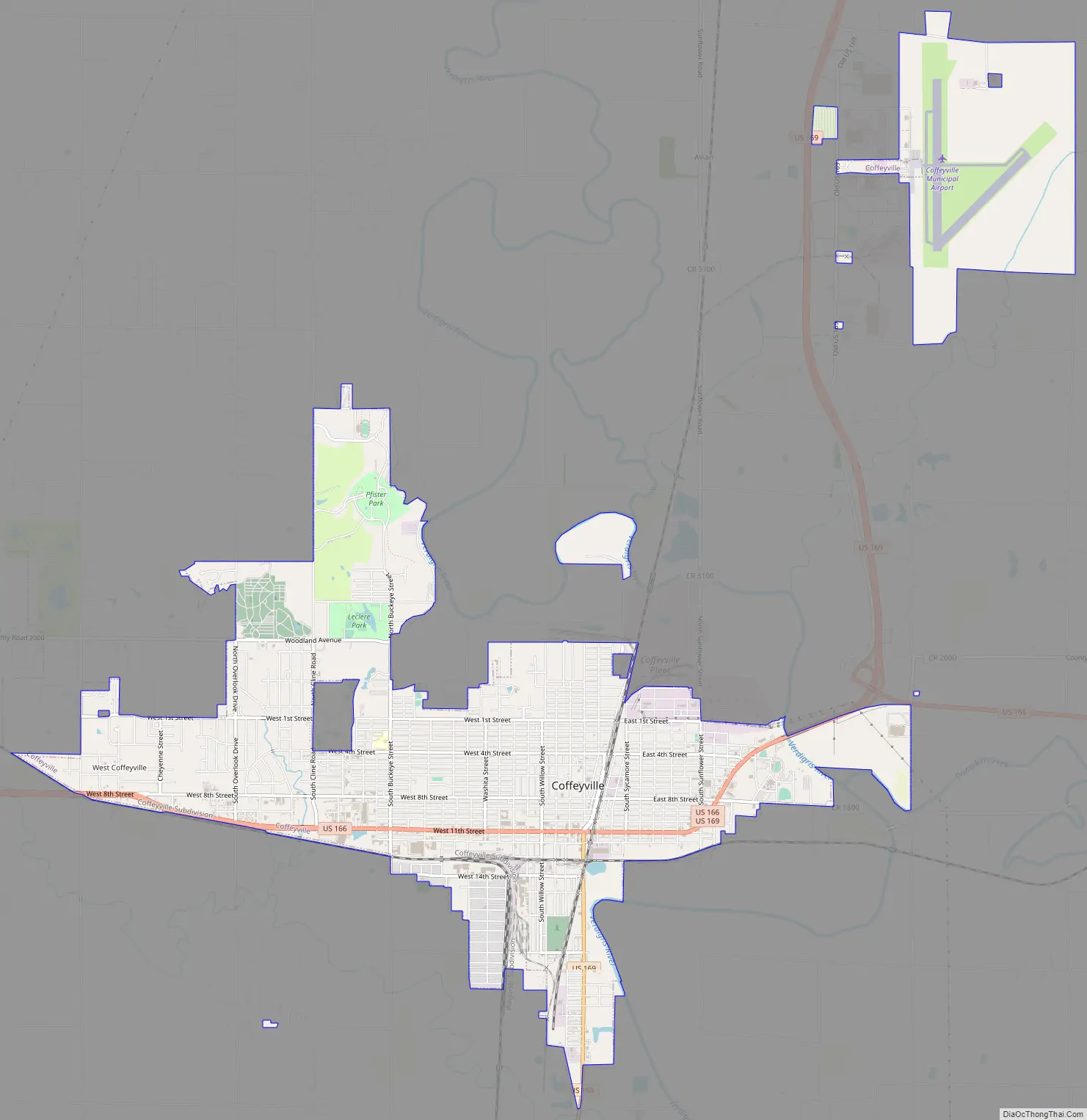
Coffeyville Road Map
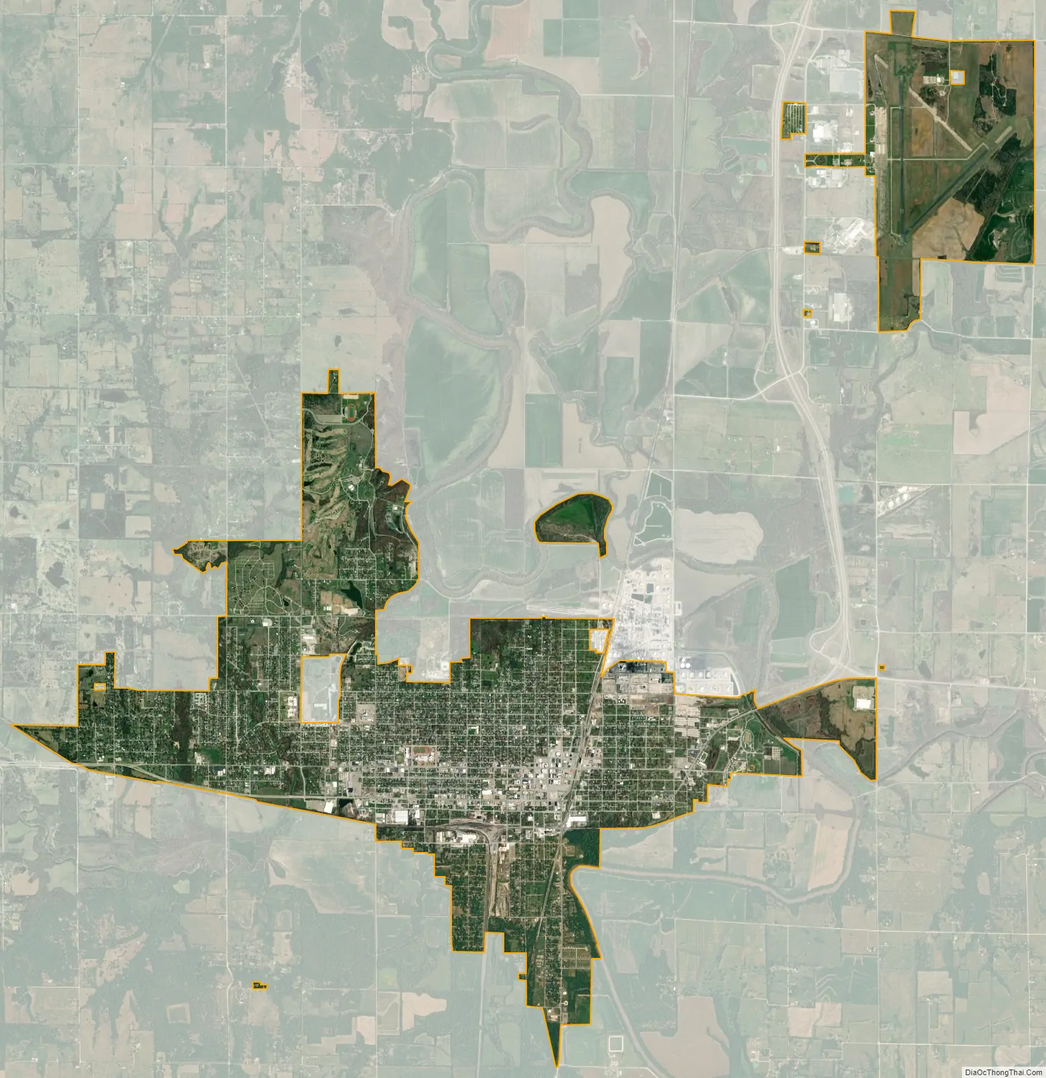
Coffeyville city Satellite Map
Geography
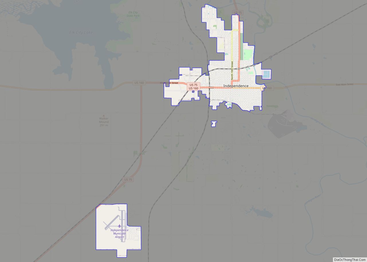
Coffeyville is in the southeast corner of Kansas, about 75 miles (121 km) north of Tulsa, Oklahoma, and 60 miles (97 km) west of Joplin, Missouri. The city is situated about one-half mile north of the Oklahoma state line at 37°2′16″N 95°37′35″W / 37.03778°N 95.62639°W / 37.03778; -95.62639 (37.037708, -95.626438), along the west bank of the Verdigris River. The city is the location of the lowest point in the state of Kansas at 679 feet (207 m) above sea level. Coffeyville Municipal Airport is a few miles northeast of the city along US-169. Though Coffeyville is the largest city in Montgomery County, the county seat is Independence, 16 miles (26 km) northwest of the city.
Coffeyville, specifically a spot just north of Coffeyville Country Club, is the default center starting point of Google Maps, being the accidental center point of the default starting map being displayed, which shows the 48 contiguous United States. (Lawrence, Kansas also claims to be the Google center as it has been the default mid point of the interactive 3D map Google Earth). Other locations that are considered to be the geographic center of the contiguous United States are also in Kansas.
According to the United States Census Bureau, the city has a total area of 7.43 square miles (19.24 km), all land.
Climate
According to the Köppen Climate Classification system, Coffeyville has a humid subtropical climate, abbreviated “Cfa” on climate maps. The hottest temperature recorded in Coffeyville was 113 °F (45.0 °C) on August 4, 2012, while the coldest temperature recorded was −22 °F (−30.0 °C) on February 10, 2011.
See also
Map of Kansas State and its subdivision:- Allen
- Anderson
- Atchison
- Barber
- Barton
- Bourbon
- Brown
- Butler
- Chase
- Chautauqua
- Cherokee
- Cheyenne
- Clark
- Clay
- Cloud
- Coffey
- Comanche
- Cowley
- Crawford
- Decatur
- Dickinson
- Doniphan
- Douglas
- Edwards
- Elk
- Ellis
- Ellsworth
- Finney
- Ford
- Franklin
- Geary
- Gove
- Graham
- Grant
- Gray
- Greeley
- Greenwood
- Hamilton
- Harper
- Harvey
- Haskell
- Hodgeman
- Jackson
- Jefferson
- Jewell
- Johnson
- Kearny
- Kingman
- Kiowa
- Labette
- Lane
- Leavenworth
- Lincoln
- Linn
- Logan
- Lyon
- Marion
- Marshall
- McPherson
- Meade
- Miami
- Mitchell
- Montgomery
- Morris
- Morton
- Nemaha
- Neosho
- Ness
- Norton
- Osage
- Osborne
- Ottawa
- Pawnee
- Phillips
- Pottawatomie
- Pratt
- Rawlins
- Reno
- Republic
- Rice
- Riley
- Rooks
- Rush
- Russell
- Saline
- Scott
- Sedgwick
- Seward
- Shawnee
- Sheridan
- Sherman
- Smith
- Stafford
- Stanton
- Stevens
- Sumner
- Thomas
- Trego
- Wabaunsee
- Wallace
- Washington
- Wichita
- Wilson
- Woodson
- Wyandotte
- Alabama
- Alaska
- Arizona
- Arkansas
- California
- Colorado
- Connecticut
- Delaware
- District of Columbia
- Florida
- Georgia
- Hawaii
- Idaho
- Illinois
- Indiana
- Iowa
- Kansas
- Kentucky
- Louisiana
- Maine
- Maryland
- Massachusetts
- Michigan
- Minnesota
- Mississippi
- Missouri
- Montana
- Nebraska
- Nevada
- New Hampshire
- New Jersey
- New Mexico
- New York
- North Carolina
- North Dakota
- Ohio
- Oklahoma
- Oregon
- Pennsylvania
- Rhode Island
- South Carolina
- South Dakota
- Tennessee
- Texas
- Utah
- Vermont
- Virginia
- Washington
- West Virginia
- Wisconsin
- Wyoming