Lindsay is a city in Garvin County, Oklahoma, United States. The population was 2,840 at the 2010 census. It once promoted itself as “The Broomcorn Capital of the World” but no longer uses that slogan, as broomcorn is no longer raised in the area.
| Name: | Lindsay city |
|---|---|
| LSAD Code: | 25 |
| LSAD Description: | city (suffix) |
| State: | Oklahoma |
| County: | Garvin County |
| Elevation: | 974 ft (297 m) |
| Total Area: | 2.32 sq mi (6.01 km²) |
| Land Area: | 2.32 sq mi (6.00 km²) |
| Water Area: | 0.01 sq mi (0.02 km²) |
| Total Population: | 2,864 |
| Population Density: | 1,236.61/sq mi (477.46/km²) |
| ZIP code: | 73052 |
| Area code: | 405 |
| FIPS code: | 4043150 |
| GNISfeature ID: | 1094691 |
| Website: | www.cityoflindsay.com |
Online Interactive Map
Click on ![]() to view map in "full screen" mode.
to view map in "full screen" mode.
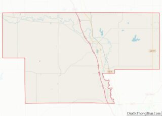
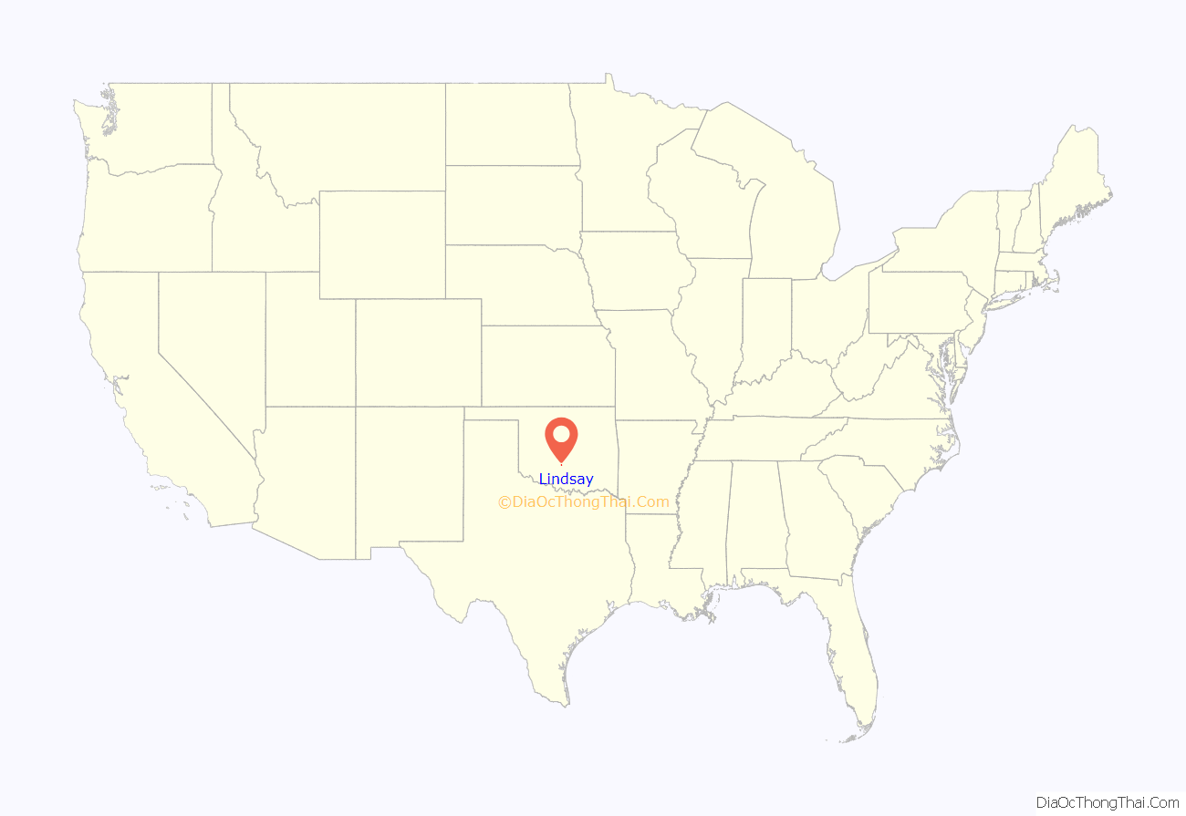
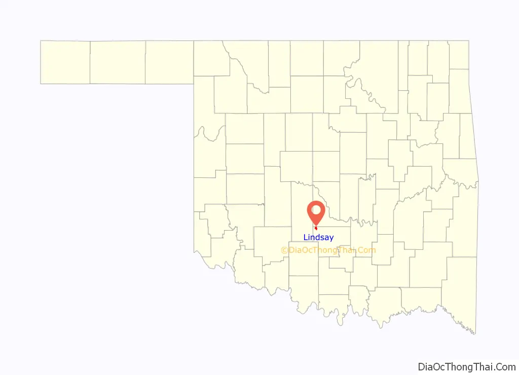
Lindsay location map. Where is Lindsay city?
History
Lindsay was founded in January 1902, when the Kiowa, Chickasha and Fort Smith Railway (an affiliate of the Atchison, Topeka and Santa Fe) and the Chicago, Rock Island and Pacific railroad companies were linking their lines halfway between Chickasha and Pauls Valley, a project completed in 1903. The AT&SF trains from Pauls Valley turned around at Lindsay, and the Rock Island trains from Chickasha did the same.
Lindsay was named after Lewis Lindsay, a local area farmer who donated 440 acres (180 ha) of land for the townsite. At the time of its founding, Lindsay was located in Pickens County, Chickasaw Nation.
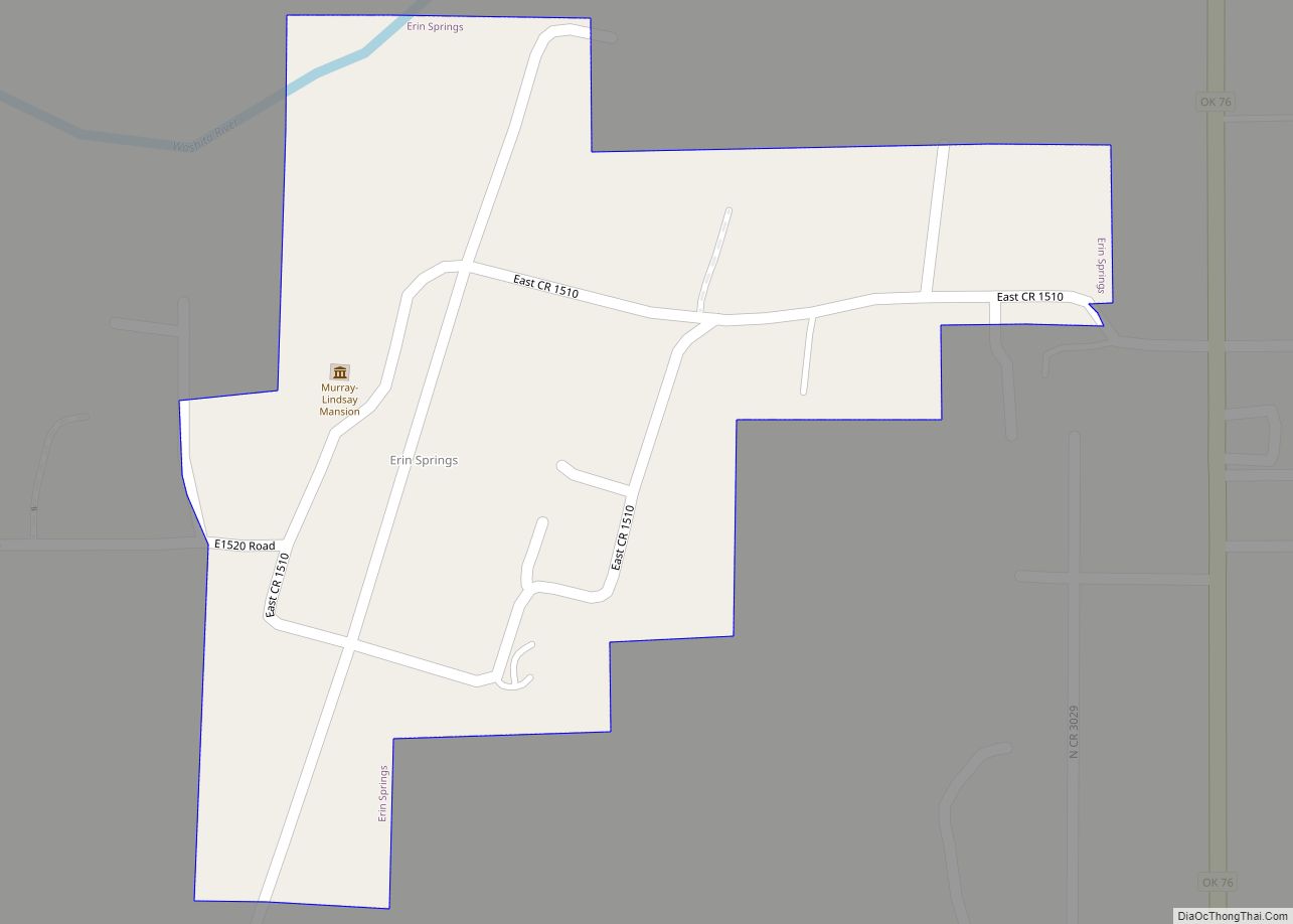
The Lindsay-Murray Mansion
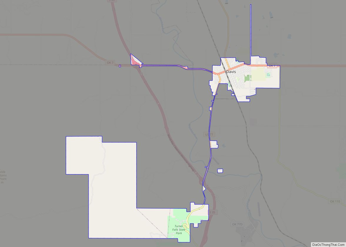
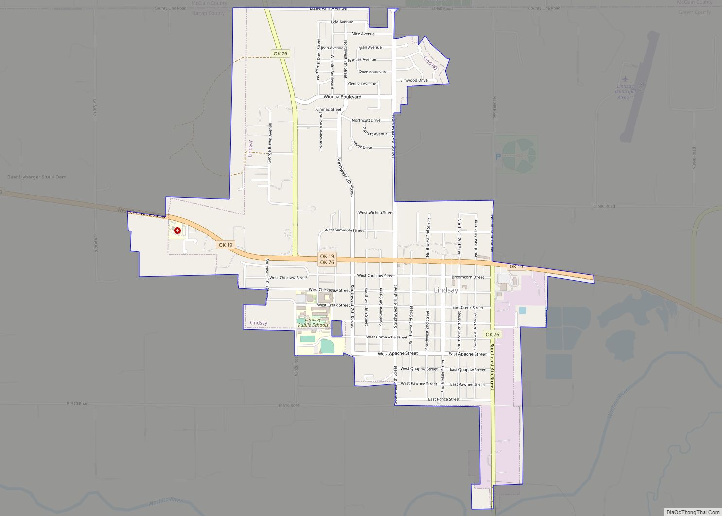
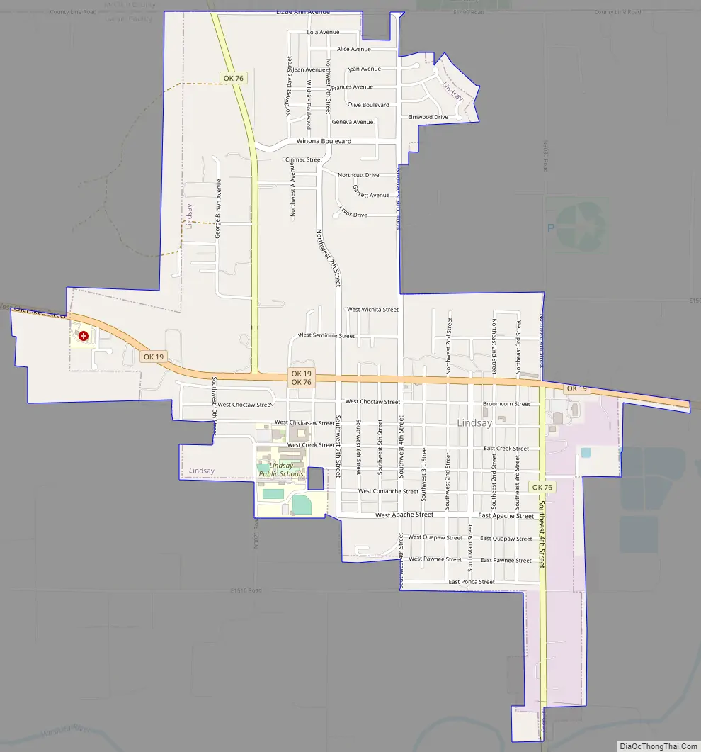
Lindsay Road Map
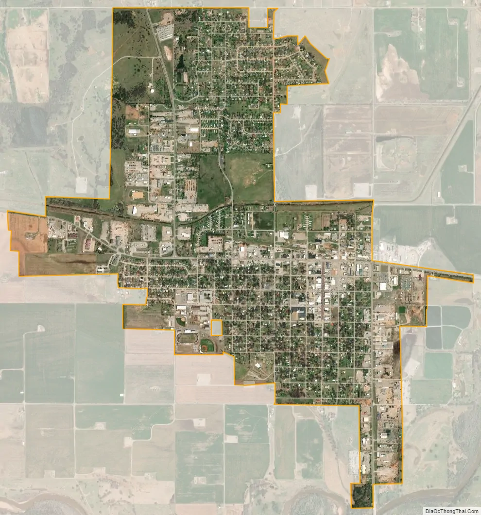
Lindsay city Satellite Map
Geography
Lindsay is located in northwestern Garvin County at 34°50′14″N 97°36′27″W / 34.83722°N 97.60750°W / 34.83722; -97.60750 (34.837280, -97.607537). The town’s northern border follows the McClain County line.
Lindsay is in the Washita River valley. Oklahoma State Highway 19 passes through the center of town as Cherokee Street, leading east (downriver) 11 miles (18 km) to Maysville and northwest (generally upstream) 28 miles (45 km) to Chickasha. Oklahoma State Highway 76 leads north from Lindsay 23 miles (37 km) to Blanchard and south 46 miles (74 km) Healdton.
According to the United States Census Bureau, Lindsay has a total area of 2.3 square miles (6.0 km), of which 0.01 square miles (0.02 km), or 0.25%, is water.
Climate
See also
Map of Oklahoma State and its subdivision:- Adair
- Alfalfa
- Atoka
- Beaver
- Beckham
- Blaine
- Bryan
- Caddo
- Canadian
- Carter
- Cherokee
- Choctaw
- Cimarron
- Cleveland
- Coal
- Comanche
- Cotton
- Craig
- Creek
- Custer
- Delaware
- Dewey
- Ellis
- Garfield
- Garvin
- Grady
- Grant
- Greer
- Harmon
- Harper
- Haskell
- Hughes
- Jackson
- Jefferson
- Johnston
- Kay
- Kingfisher
- Kiowa
- Latimer
- Le Flore
- Lincoln
- Logan
- Love
- Major
- Marshall
- Mayes
- McClain
- McCurtain
- McIntosh
- Murray
- Muskogee
- Noble
- Nowata
- Okfuskee
- Oklahoma
- Okmulgee
- Osage
- Ottawa
- Pawnee
- Payne
- Pittsburg
- Pontotoc
- Pottawatomie
- Pushmataha
- Roger Mills
- Rogers
- Seminole
- Sequoyah
- Stephens
- Texas
- Tillman
- Tulsa
- Wagoner
- Washington
- Washita
- Woods
- Woodward
- Alabama
- Alaska
- Arizona
- Arkansas
- California
- Colorado
- Connecticut
- Delaware
- District of Columbia
- Florida
- Georgia
- Hawaii
- Idaho
- Illinois
- Indiana
- Iowa
- Kansas
- Kentucky
- Louisiana
- Maine
- Maryland
- Massachusetts
- Michigan
- Minnesota
- Mississippi
- Missouri
- Montana
- Nebraska
- Nevada
- New Hampshire
- New Jersey
- New Mexico
- New York
- North Carolina
- North Dakota
- Ohio
- Oklahoma
- Oregon
- Pennsylvania
- Rhode Island
- South Carolina
- South Dakota
- Tennessee
- Texas
- Utah
- Vermont
- Virginia
- Washington
- West Virginia
- Wisconsin
- Wyoming