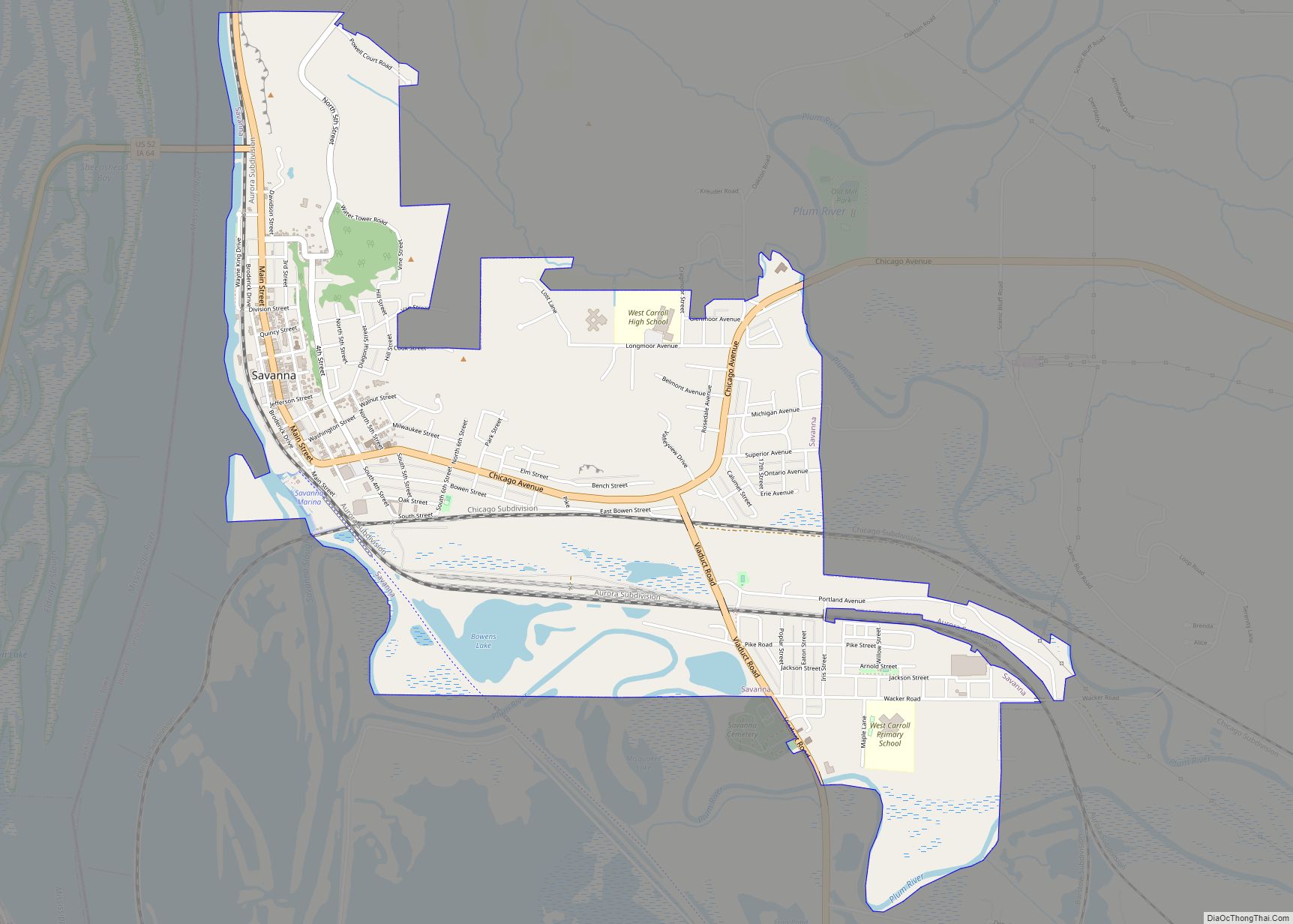
Savanna is a city in Carroll County, Illinois, United States. The population was 2,783 at the 2020 census, down from 2,945 at the 2010 census. Savanna is located along the Mississippi River at the mouth of the Plum River. Going from north to south, the second automobile bridge between Iowa and Illinois is located just north of Savanna, and is part of U.S. Route 52. The bridge leads to Sabula, Iowa, which is across the river from Savanna. Savanna is also served by two major railroads, the Burlington Northern and Santa Fe Railway (BNSF) Railway Company and the Canadian Pacific Railway (CP). These rail lines were formerly operated by the Burlington Route and the Milwaukee Road respectively. Savanna also has a small airport, the Tri-Township Airport (KSFY).
Savanna is protected by the Savanna Police, Fire Department and Ambulance Service. All three organizations maintain stations on Chicago Avenue. The three organizations were located in the same building (a throwback to when the fire department was responsible for the ambulance) but the original building only houses the fire department and one of the backup centers for Carroll County 911 dispatch. Savanna formerly had its own hospital, but this has since been converted to an assisted living facility, Pinnacle Place. All ambulance patients are transported to Mercy Medical Center in Clinton, Iowa or other Illinois hospitals. The Savanna Ambulance is one of two in the county to have paramedic certified members (a distinction shared with the Mount Carroll Volunteer Ambulance.)
| Name: | Savanna city |
|---|---|
| LSAD Code: | 25 |
| LSAD Description: | city (suffix) |
| State: | Illinois |
| County: | Carroll County |
| Elevation: | 600 ft (200 m) |
| Total Area: | 2.71 sq mi (7.02 km²) |
| Land Area: | 2.62 sq mi (6.78 km²) |
| Water Area: | 0.09 sq mi (0.24 km²) |
| Total Population: | 2,783 |
| Population Density: | 1,063.84/sq mi (410.68/km²) |
| Area code: | 815 |
| FIPS code: | 1767821 |
| Website: | https://www.savanna-il.us/ |
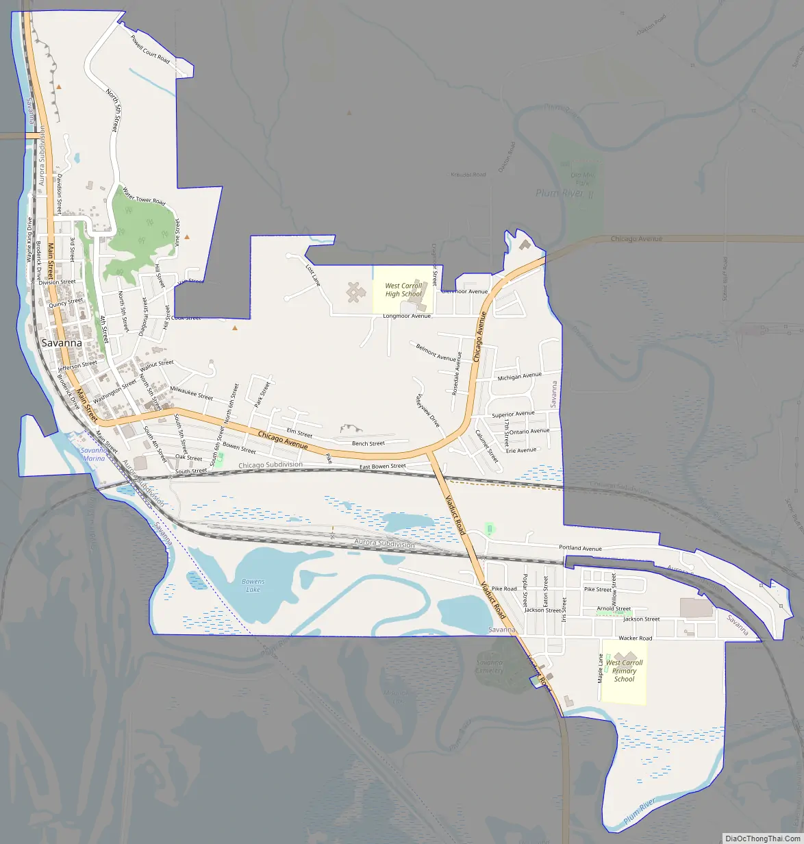
Online Interactive Map
Click on ![]() to view map in "full screen" mode.
to view map in "full screen" mode.
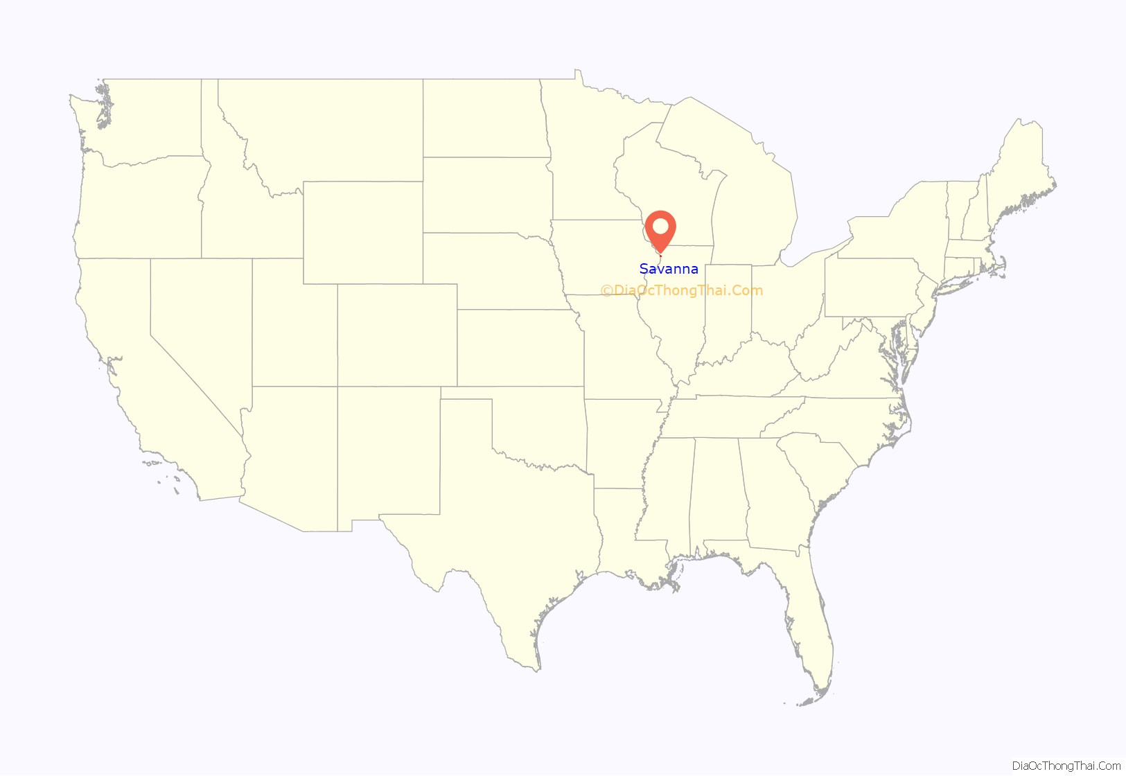
Savanna location map. Where is Savanna city?
History
The region was once part of the vast hunting grounds of different native American tribes, including the Sauk. Following the Treaty of St. Louis (1804) and a number of additional treaties, land in Illinois along the Eastern bank of the Mississippi River was opened to settlement by farmers. Towns such as Savanna grew their commerce by using the river for efficient transport. Savanna’s earliest settlers experienced some repercussions during the Black Hawk War in 1832.
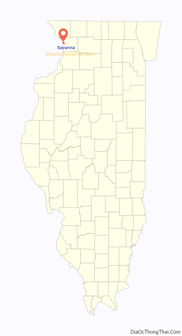
Savanna Road Map
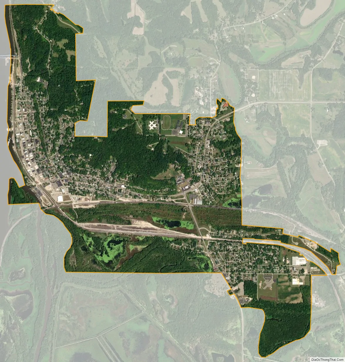
Savanna city Satellite Map
Geography
Savanna is located at 42°5′24″N 90°8′24″W / 42.09000°N 90.14000°W / 42.09000; -90.14000 (42.090069, -90.140050).
According to the 2021 census gazetteer files, Savanna has a total area of 2.71 square miles (7.02 km), of which 2.62 square miles (6.79 km) (or 96.53%) is land and 0.09 square miles (0.23 km) (or 3.47%) is water.
See also
Map of Illinois State and its subdivision:- Adams
- Alexander
- Bond
- Boone
- Brown
- Bureau
- Calhoun
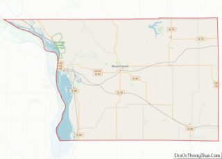
- Carroll
- Cass
- Champaign
- Christian
- Clark
- Clay
- Clinton
- Coles
- Cook
- Crawford
- Cumberland
- De Kalb
- De Witt
- Douglas
- Dupage
- Edgar
- Edwards
- Effingham
- Fayette
- Ford
- Franklin
- Fulton
- Gallatin
- Greene
- Grundy
- Hamilton
- Hancock
- Hardin
- Henderson
- Henry
- Iroquois
- Jackson
- Jasper
- Jefferson
- Jersey
- Jo Daviess
- Johnson
- Kane
- Kankakee
- Kendall
- Knox
- La Salle
- Lake
- Lake Michigan
- Lawrence
- Lee
- Livingston
- Logan
- Macon
- Macoupin
- Madison
- Marion
- Marshall
- Mason
- Massac
- McDonough
- McHenry
- McLean
- Menard
- Mercer
- Monroe
- Montgomery
- Morgan
- Moultrie
- Ogle
- Peoria
- Perry
- Piatt
- Pike
- Pope
- Pulaski
- Putnam
- Randolph
- Richland
- Rock Island
- Saint Clair
- Saline
- Sangamon
- Schuyler
- Scott
- Shelby
- Stark
- Stephenson
- Tazewell
- Union
- Vermilion
- Wabash
- Warren
- Washington
- Wayne
- White
- Whiteside
- Will
- Williamson
- Winnebago
- Woodford
- Alabama
- Alaska
- Arizona
- Arkansas
- California
- Colorado
- Connecticut
- Delaware
- District of Columbia
- Florida
- Georgia
- Hawaii
- Idaho
- Illinois
- Indiana
- Iowa
- Kansas
- Kentucky
- Louisiana
- Maine
- Maryland
- Massachusetts
- Michigan
- Minnesota
- Mississippi
- Missouri
- Montana
- Nebraska
- Nevada
- New Hampshire
- New Jersey
- New Mexico
- New York
- North Carolina
- North Dakota
- Ohio
- Oklahoma
- Oregon
- Pennsylvania
- Rhode Island
- South Carolina
- South Dakota
- Tennessee
- Texas
- Utah
- Vermont
- Virginia
- Washington
- West Virginia
- Wisconsin
- Wyoming