Morris is a city in Okmulgee County, Oklahoma, United States. The population was 1,494 at the 2010 census, an increase of 14.3% from the figure of 1,294 recorded in 2000.
| Name: | Morris city |
|---|---|
| LSAD Code: | 25 |
| LSAD Description: | city (suffix) |
| State: | Oklahoma |
| County: | Okmulgee County |
| Elevation: | 722 ft (220 m) |
| Total Area: | 1.27 sq mi (3.30 km²) |
| Land Area: | 1.22 sq mi (3.16 km²) |
| Water Area: | 0.05 sq mi (0.14 km²) |
| Total Population: | 1,299 |
| Population Density: | 1,064.75/sq mi (411.08/km²) |
| ZIP code: | 74445 |
| Area code: | 539/918 |
| FIPS code: | 4049400 |
| GNISfeature ID: | 1095519 |
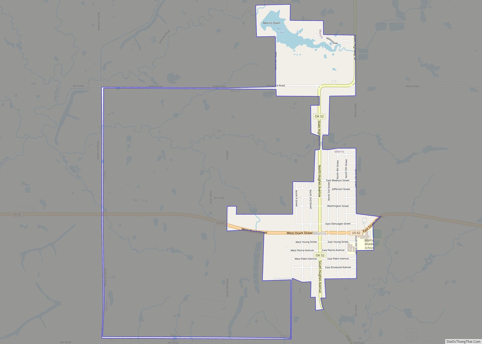
Online Interactive Map
Click on ![]() to view map in "full screen" mode.
to view map in "full screen" mode.
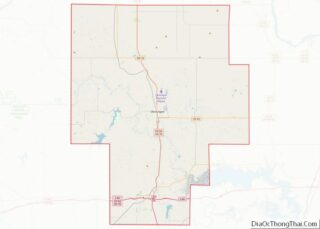
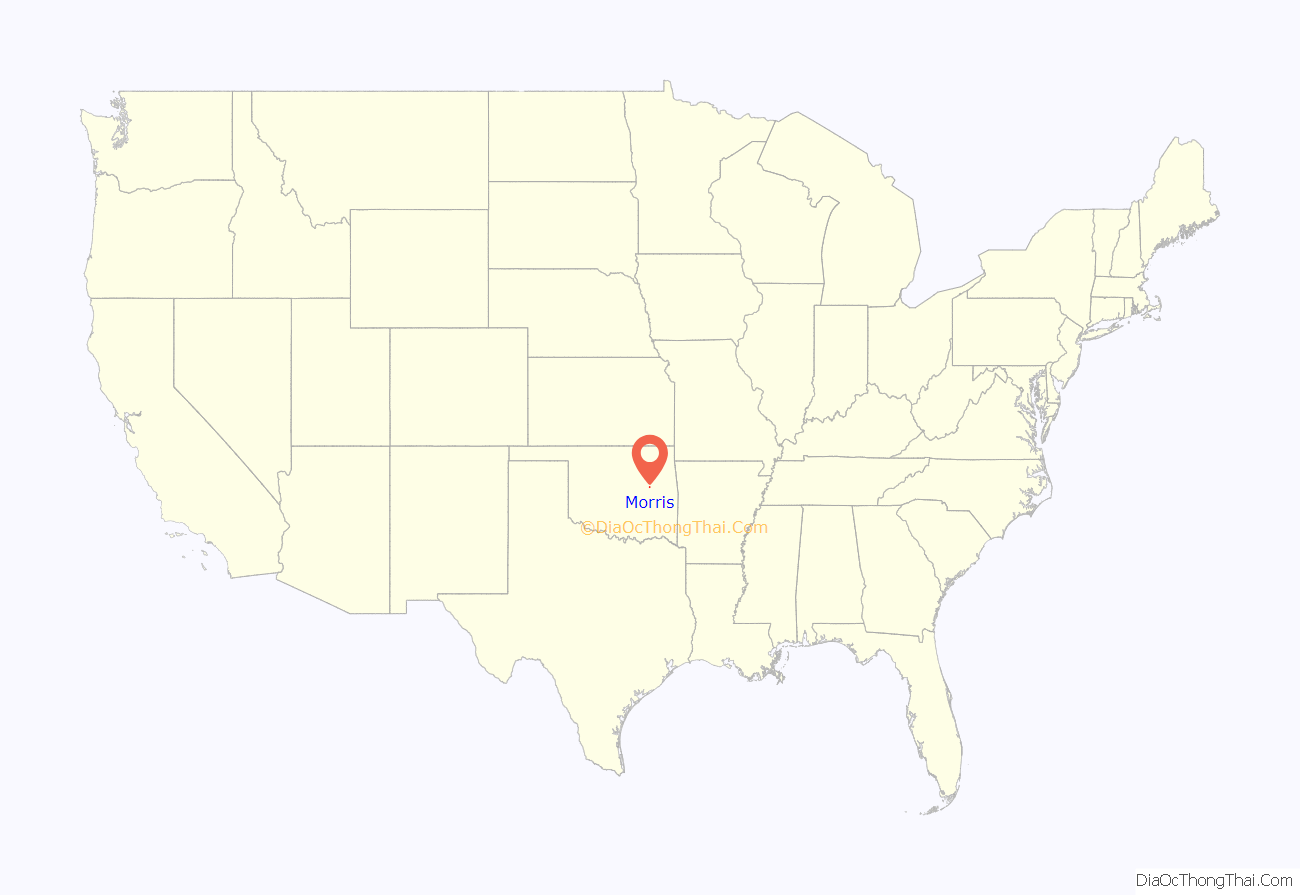
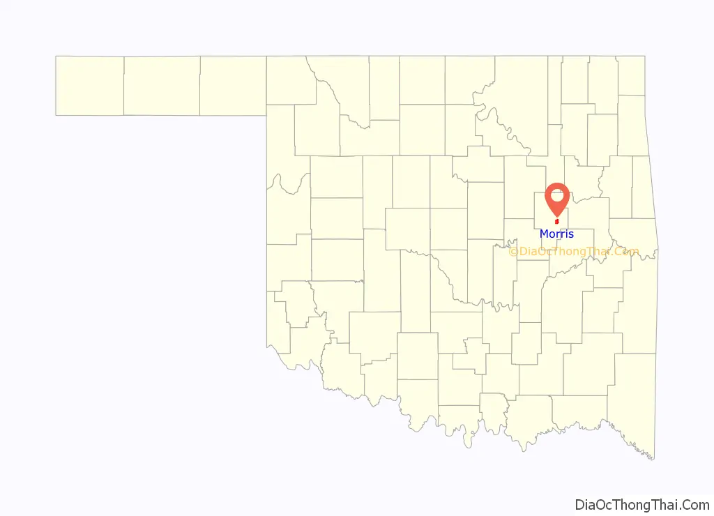
Morris location map. Where is Morris city?
History
The community began as a cattle stop on the Ozark and Cherokee Central Railway (later the St. Louis and San Francisco Railway, commonly known as the “Frisco”), which ran between Muskogee and Okmulgee. The post office was established here on January 4, 1904.
The townsite was platted in 1904 by L. R. Kershaw, who was an attorney and an immigration agent for the Frisco. He named the town after H. E. Morris, a Frisco executive. Many of the street names in Morris are named after towns that were familiar to Kershaw from his home state of Illinois. Kershaw was also the founder of two of the earliest banks in Morris, Indian Territory: The Farmer’s State Bank of Morris in 1905 and the First National Bank of Morris in 1907. Morris’s later history includes bank robberies, the most talked about being those by Charles Arthur “Pretty Boy” Floyd, who was popular in the Morris area.
The Morris News, a newspaper founded in 1910, has continued publication into the 20th century.
The large early growth in Morris’s history came from mineral extraction. Coal lay close to the surface in the area around Morris, and an oil boom developed around the Morris Pool. In more recent times, ranching and farming in the area have aided the town’s economy.
A tornado struck Morris on April 26, 1984. It killed nine people and destroyed the entire business section, as well as about one half of the housing.
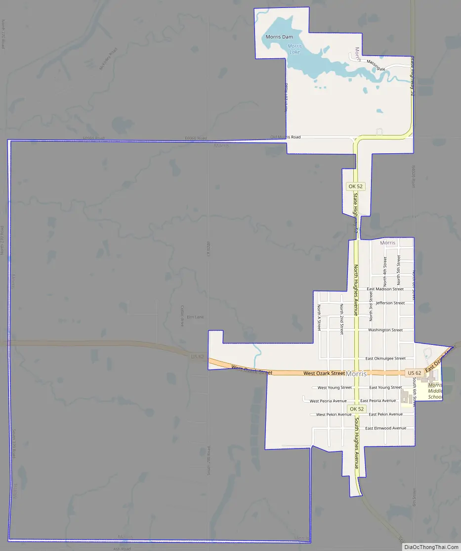
Morris Road Map
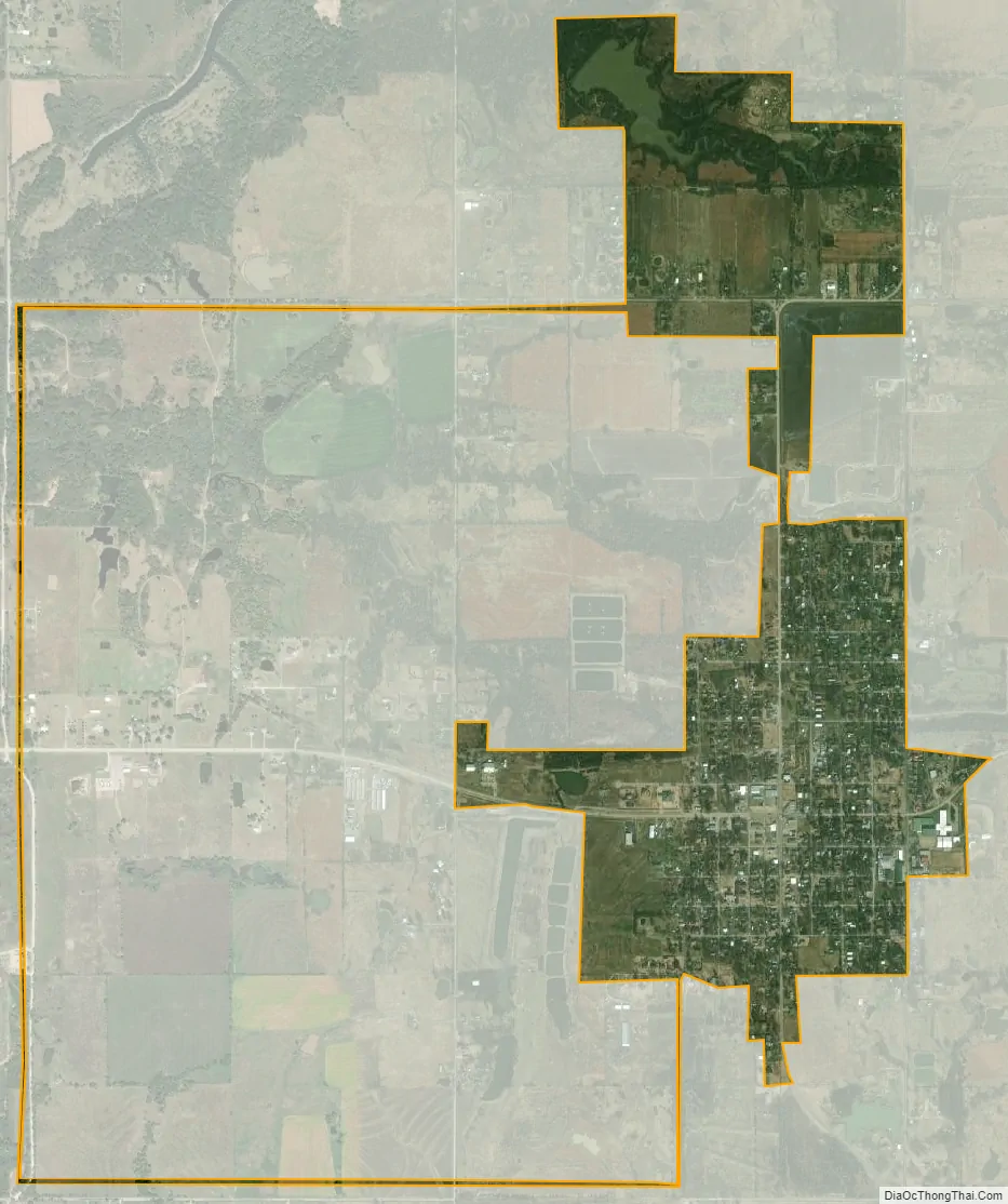
Morris city Satellite Map
Geography
Morris is located at 35°36′36″N 95°51′40″W / 35.61000°N 95.86111°W / 35.61000; -95.86111 (35.610041, -95.861038). It is 8 miles (13 km) east of Okmulgee, at the intersection of U S. Highway 62 and State Highway 52.
According to the United States Census Bureau, the city has a total area of 1.2 square miles (3.1 km), of which 1.1 square miles (2.8 km) is land and 0.1 square miles (0.26 km) (5.17%) is water.
See also
Map of Oklahoma State and its subdivision:- Adair
- Alfalfa
- Atoka
- Beaver
- Beckham
- Blaine
- Bryan
- Caddo
- Canadian
- Carter
- Cherokee
- Choctaw
- Cimarron
- Cleveland
- Coal
- Comanche
- Cotton
- Craig
- Creek
- Custer
- Delaware
- Dewey
- Ellis
- Garfield
- Garvin
- Grady
- Grant
- Greer
- Harmon
- Harper
- Haskell
- Hughes
- Jackson
- Jefferson
- Johnston
- Kay
- Kingfisher
- Kiowa
- Latimer
- Le Flore
- Lincoln
- Logan
- Love
- Major
- Marshall
- Mayes
- McClain
- McCurtain
- McIntosh
- Murray
- Muskogee
- Noble
- Nowata
- Okfuskee
- Oklahoma
- Okmulgee
- Osage
- Ottawa
- Pawnee
- Payne
- Pittsburg
- Pontotoc
- Pottawatomie
- Pushmataha
- Roger Mills
- Rogers
- Seminole
- Sequoyah
- Stephens
- Texas
- Tillman
- Tulsa
- Wagoner
- Washington
- Washita
- Woods
- Woodward
- Alabama
- Alaska
- Arizona
- Arkansas
- California
- Colorado
- Connecticut
- Delaware
- District of Columbia
- Florida
- Georgia
- Hawaii
- Idaho
- Illinois
- Indiana
- Iowa
- Kansas
- Kentucky
- Louisiana
- Maine
- Maryland
- Massachusetts
- Michigan
- Minnesota
- Mississippi
- Missouri
- Montana
- Nebraska
- Nevada
- New Hampshire
- New Jersey
- New Mexico
- New York
- North Carolina
- North Dakota
- Ohio
- Oklahoma
- Oregon
- Pennsylvania
- Rhode Island
- South Carolina
- South Dakota
- Tennessee
- Texas
- Utah
- Vermont
- Virginia
- Washington
- West Virginia
- Wisconsin
- Wyoming