Texanna is a census-designated place (CDP) in McIntosh County, Oklahoma, United States. The population was 2,083 at the 2000 census.
Established in District 12 of the old Indian Territory, its post office existed from June 27, 1888 until July 16, 1940. Texanna’s population in the 1905 Territorial Census was 200. It is said to have been named for a settlement of Texas Cherokees. Residents of Texanna now have a Eufaula and Checotah postal address.
| Name: | Texanna CDP |
|---|---|
| LSAD Code: | 57 |
| LSAD Description: | CDP (suffix) |
| State: | Oklahoma |
| County: | McIntosh County |
| Elevation: | 600 ft (183 m) |
| Total Area: | 39.95 sq mi (103.48 km²) |
| Land Area: | 39.70 sq mi (102.82 km²) |
| Water Area: | 0.26 sq mi (0.66 km²) |
| Total Population: | 2,293 |
| Population Density: | 57.76/sq mi (22.30/km²) |
| ZIP code: | 74426 |
| Area code: | 539/918 |
| FIPS code: | 4072950 |
| GNISfeature ID: | 1100882 |
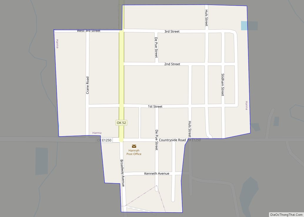
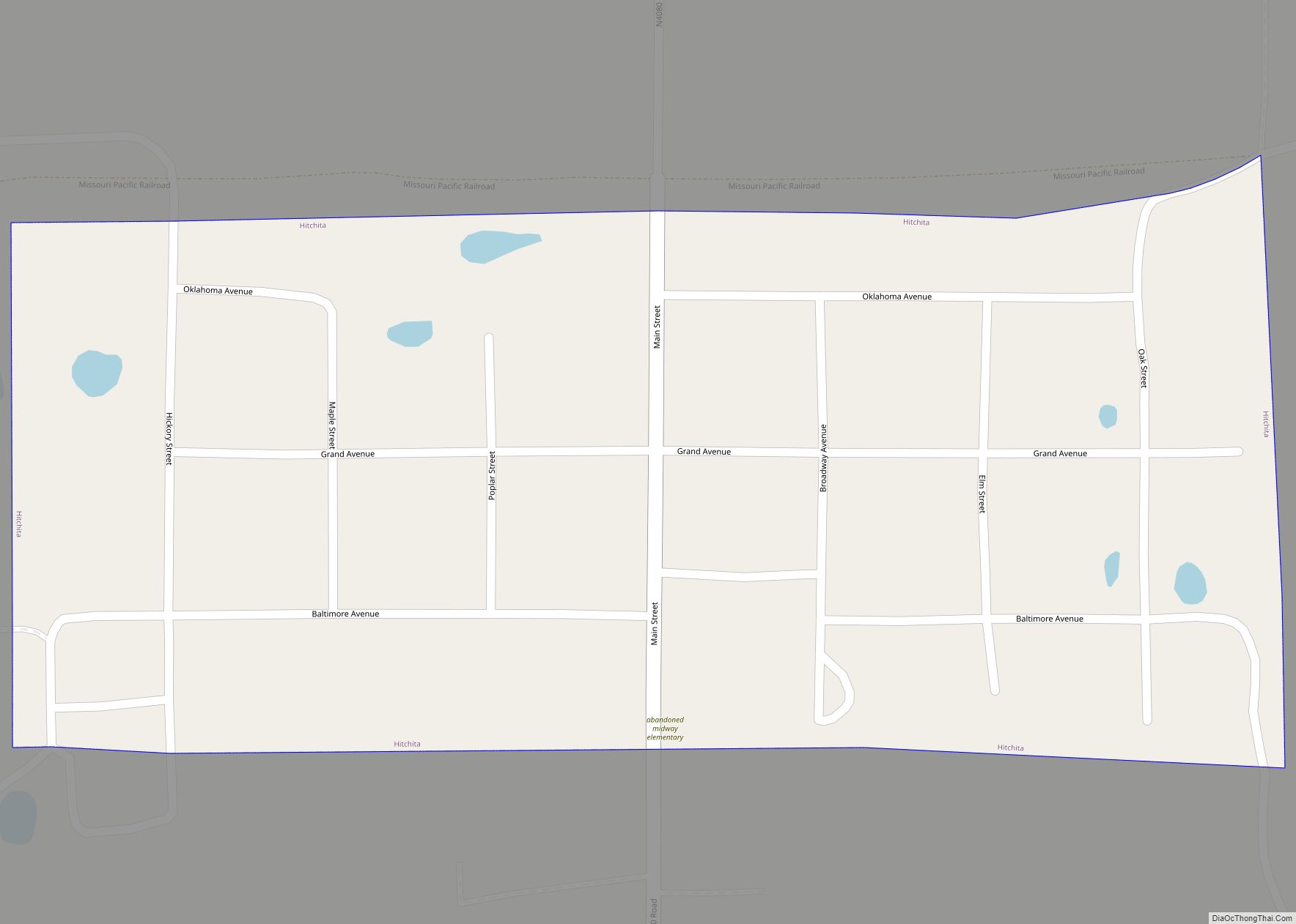
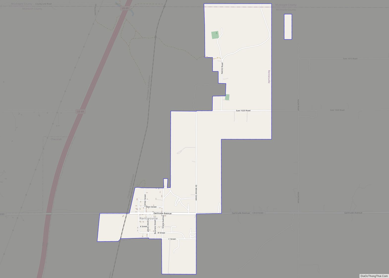
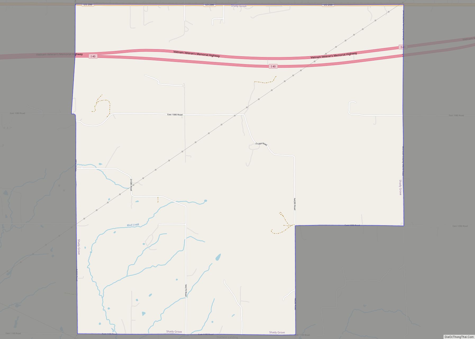
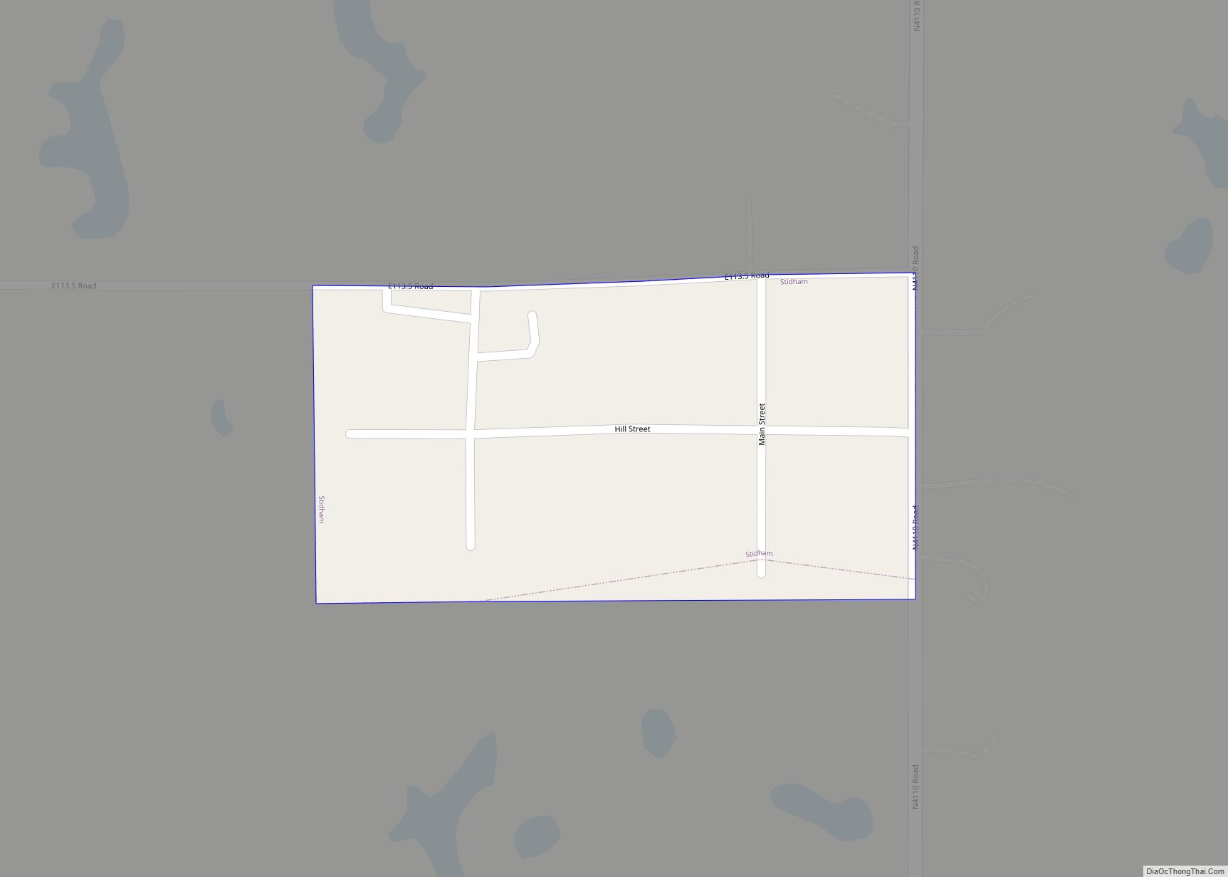
Online Interactive Map
Click on ![]() to view map in "full screen" mode.
to view map in "full screen" mode.
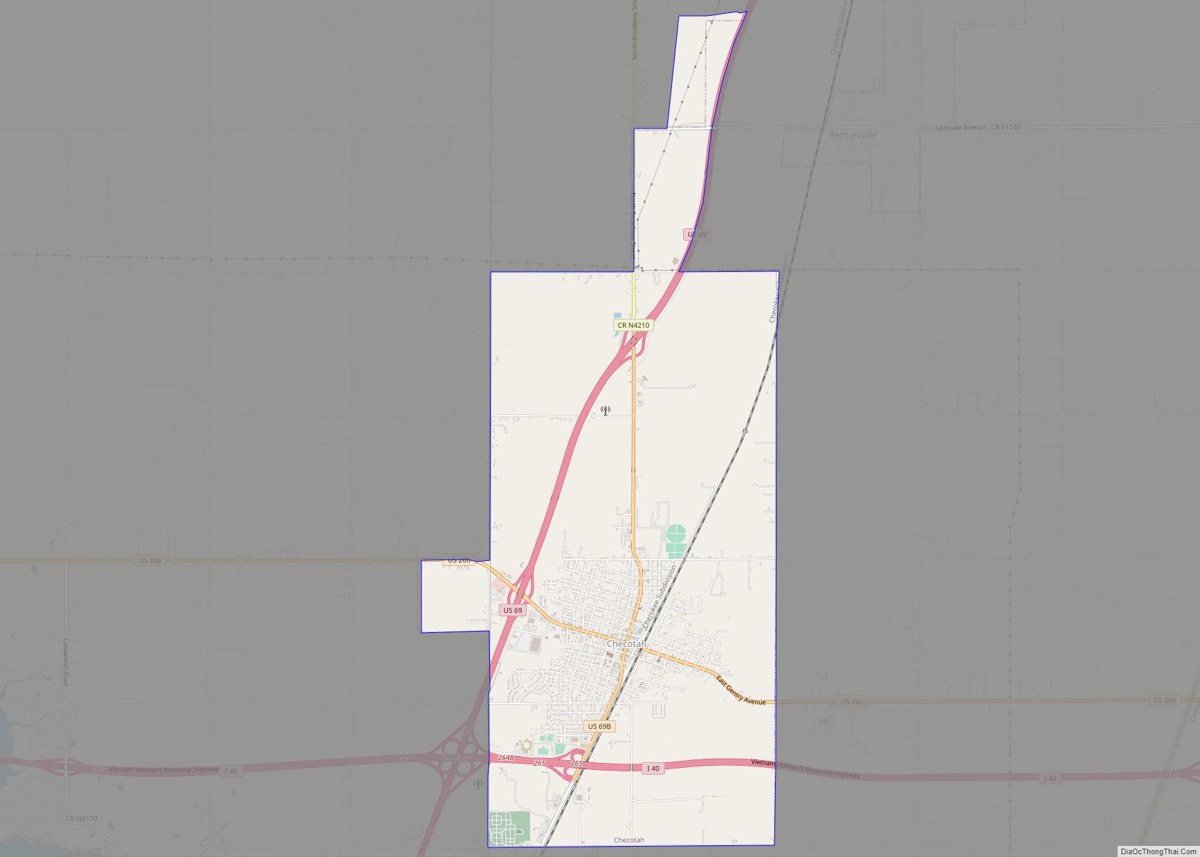
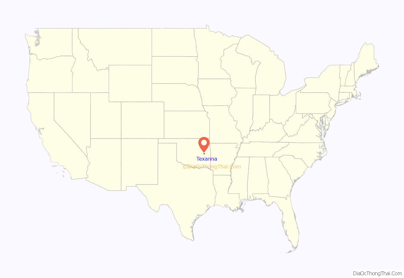
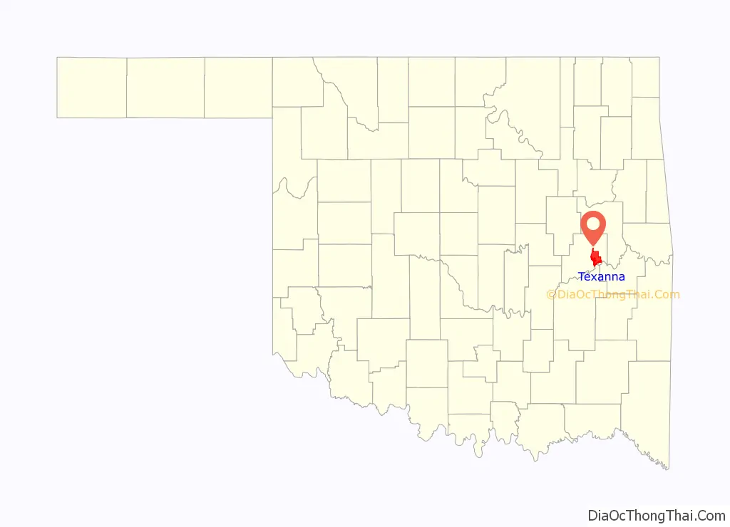
Texanna location map. Where is Texanna CDP?
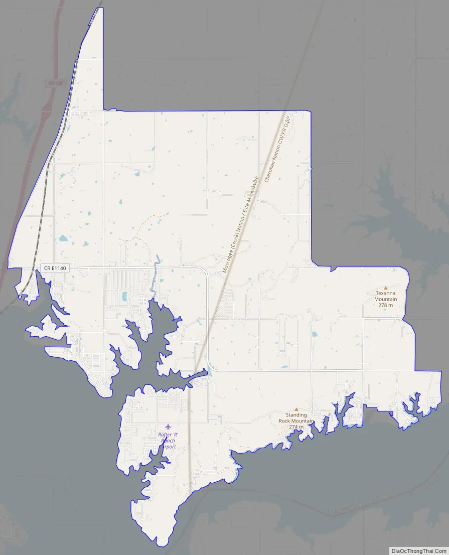
Texanna Road Map
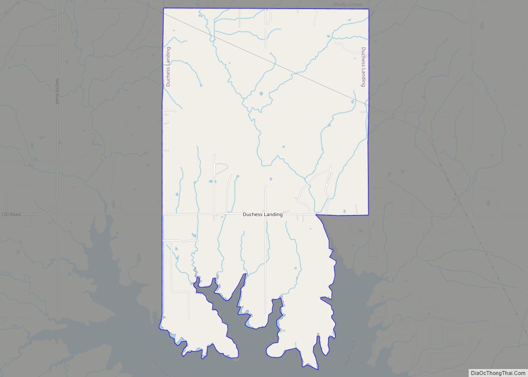
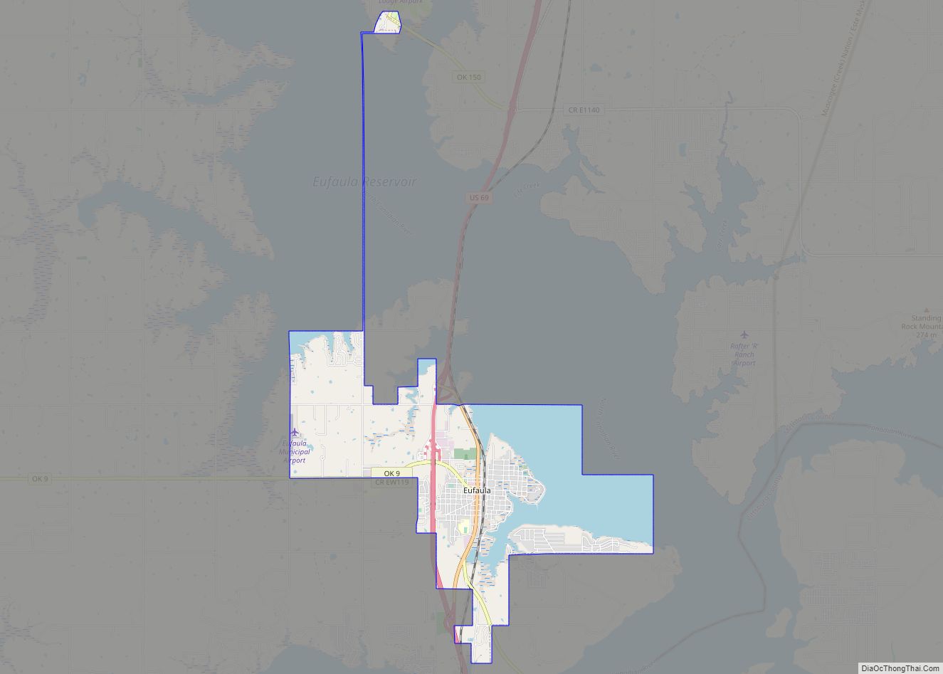
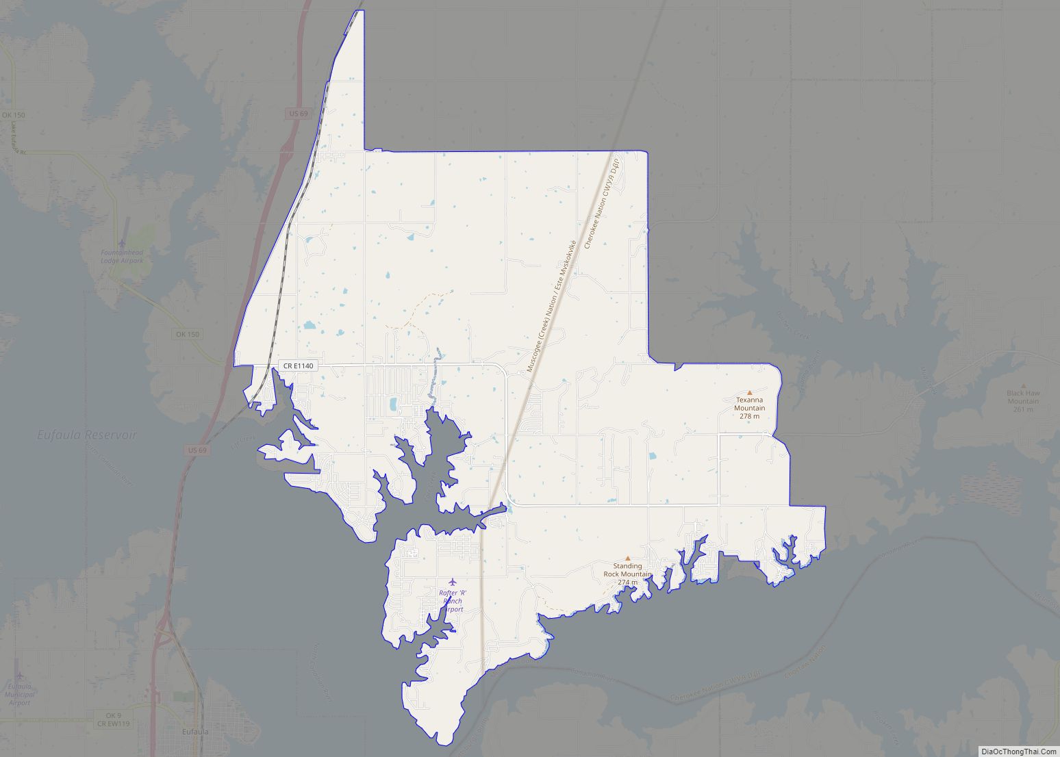
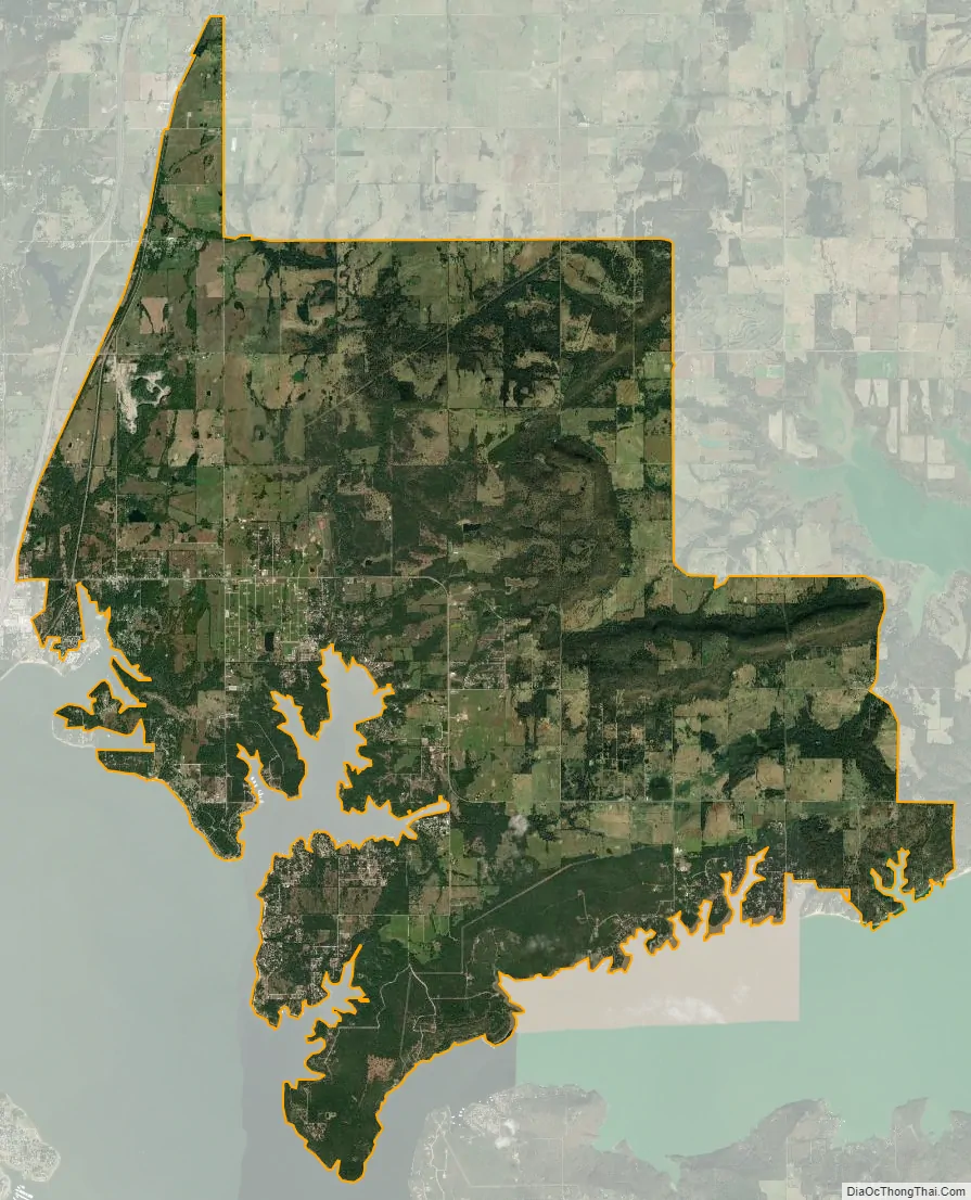
Texanna city Satellite Map
Geography
Texanna is located at 35°21′3″N 95°31′57″W / 35.35083°N 95.53250°W / 35.35083; -95.53250 (35.350928, -95.532556).
Texanna lies roughly east-southeast of Henryetta, being south of Interstate 40, east of U.S. Route 69, and on Lake Eufaula.
According to the United States Census Bureau, the CDP has a total area of 40.0 square miles (104 km), of which 39.9 square miles (103 km) is land and 0.1 square miles (0.26 km) (0.25%) is water.
See also
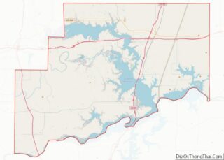
Map of Oklahoma State and its subdivision:- Adair
- Alfalfa
- Atoka
- Beaver
- Beckham
- Blaine
- Bryan
- Caddo
- Canadian
- Carter
- Cherokee
- Choctaw
- Cimarron
- Cleveland
- Coal
- Comanche
- Cotton
- Craig
- Creek
- Custer
- Delaware
- Dewey
- Ellis
- Garfield
- Garvin
- Grady
- Grant
- Greer
- Harmon
- Harper
- Haskell
- Hughes
- Jackson
- Jefferson
- Johnston
- Kay
- Kingfisher
- Kiowa
- Latimer
- Le Flore
- Lincoln
- Logan
- Love
- Major
- Marshall
- Mayes
- McClain
- McCurtain
- McIntosh
- Murray
- Muskogee
- Noble
- Nowata
- Okfuskee
- Oklahoma
- Okmulgee
- Osage
- Ottawa
- Pawnee
- Payne
- Pittsburg
- Pontotoc
- Pottawatomie
- Pushmataha
- Roger Mills
- Rogers
- Seminole
- Sequoyah
- Stephens
- Texas
- Tillman
- Tulsa
- Wagoner
- Washington
- Washita
- Woods
- Woodward
- Alabama
- Alaska
- Arizona
- Arkansas
- California
- Colorado
- Connecticut
- Delaware
- District of Columbia
- Florida
- Georgia
- Hawaii
- Idaho
- Illinois
- Indiana
- Iowa
- Kansas
- Kentucky
- Louisiana
- Maine
- Maryland
- Massachusetts
- Michigan
- Minnesota
- Mississippi
- Missouri
- Montana
- Nebraska
- Nevada
- New Hampshire
- New Jersey
- New Mexico
- New York
- North Carolina
- North Dakota
- Ohio
- Oklahoma
- Oregon
- Pennsylvania
- Rhode Island
- South Carolina
- South Dakota
- Tennessee
- Texas
- Utah
- Vermont
- Virginia
- Washington
- West Virginia
- Wisconsin
- Wyoming