Wister is a town in Le Flore County, Oklahoma, United States. It is part of the Fort Smith metropolitan area. The population was 1,102 at the 2010 census. Wister is named for Gutman G. Wister, an official with the Choctaw, Oklahoma and Gulf Railroad.
| Name: | Wister town |
|---|---|
| LSAD Code: | 43 |
| LSAD Description: | town (suffix) |
| State: | Oklahoma |
| County: | Le Flore County |
| Elevation: | 486 ft (148 m) |
| Total Area: | 1.90 sq mi (4.92 km²) |
| Land Area: | 1.89 sq mi (4.89 km²) |
| Water Area: | 0.01 sq mi (0.03 km²) |
| Total Population: | 1,031 |
| Population Density: | 545.79/sq mi (210.79/km²) |
| ZIP code: | 74966 |
| Area code: | 539/918 |
| FIPS code: | 4081750 |
| GNISfeature ID: | 1099932 |
Online Interactive Map
Click on ![]() to view map in "full screen" mode.
to view map in "full screen" mode.
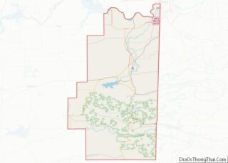
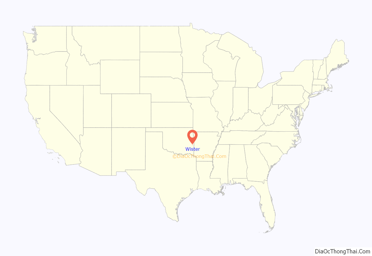
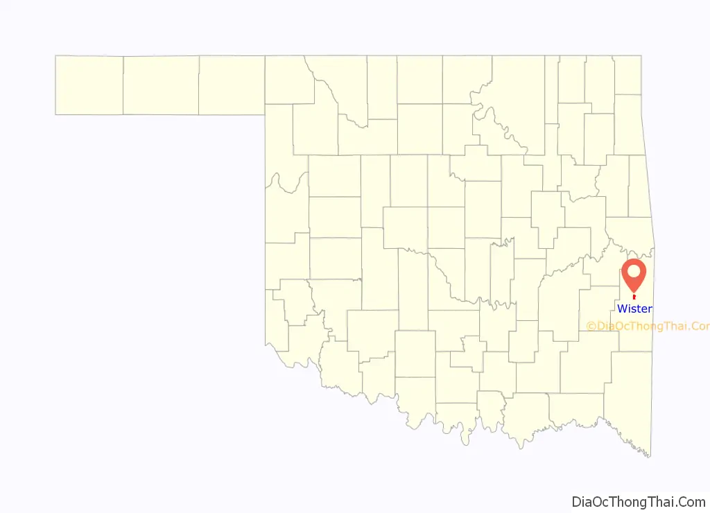
Wister location map. Where is Wister town?
History
A post office was established at Wister, Indian Territory, on June 30, 1890. The community was named for an official of the Choctaw, Oklahoma and Gulf Railroad, one of the two railroads that intersected in the town.
At the time of its founding, Wister was located in Sugar Loaf County, a part of the Moshulatubbee District of the Choctaw Nation.
Until it became known as Wister, the settlement had been known as Wister Junction, due to its location at the crossing of two railroad routes. The Choctaw, Oklahoma and Gulf Railroad was an east-west route linking Wister Junction with McAlester and passing through lucrative coal mining towns along the way. Its eastern terminus was at the St. Louis and San Francisco Railroad, a north-south route connecting Fort Smith, Arkansas with Paris, Texas. After receiving its post office, the town could no longer be known as Wister Junction, as federal post office regulations forbade new post offices from carrying descriptive names such as “Junction,” “Mountain,” or “Corner.”
Wister Road Map
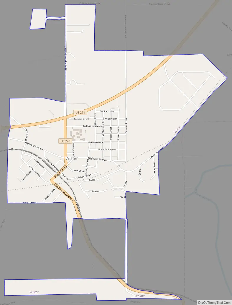
Wister city Satellite Map

Geography
Wister is located 55 miles (89 km) east of McAlester and 20 miles (32 km) west of the Oklahoma-Arkansas border.
According to the United States Census Bureau, the town has a total area of 1.5 square miles (3.9 km), of which 1.4 square miles (3.6 km) is land and 0.04 square miles (0.10 km) (2.04%) is water.
Wister is located on Lake Wister. Crappie, bass and catfish are the most frequently sought fish species in the lake. Along with fishing, Wister Lake also offers a wide variety of tourist activities such as camping, waterskiing, and swimming.
See also
Map of Oklahoma State and its subdivision:- Adair
- Alfalfa
- Atoka
- Beaver
- Beckham
- Blaine
- Bryan
- Caddo
- Canadian
- Carter
- Cherokee
- Choctaw
- Cimarron
- Cleveland
- Coal
- Comanche
- Cotton
- Craig
- Creek
- Custer
- Delaware
- Dewey
- Ellis
- Garfield
- Garvin
- Grady
- Grant
- Greer
- Harmon
- Harper
- Haskell
- Hughes
- Jackson
- Jefferson
- Johnston
- Kay
- Kingfisher
- Kiowa
- Latimer
- Le Flore
- Lincoln
- Logan
- Love
- Major
- Marshall
- Mayes
- McClain
- McCurtain
- McIntosh
- Murray
- Muskogee
- Noble
- Nowata
- Okfuskee
- Oklahoma
- Okmulgee
- Osage
- Ottawa
- Pawnee
- Payne
- Pittsburg
- Pontotoc
- Pottawatomie
- Pushmataha
- Roger Mills
- Rogers
- Seminole
- Sequoyah
- Stephens
- Texas
- Tillman
- Tulsa
- Wagoner
- Washington
- Washita
- Woods
- Woodward
- Alabama
- Alaska
- Arizona
- Arkansas
- California
- Colorado
- Connecticut
- Delaware
- District of Columbia
- Florida
- Georgia
- Hawaii
- Idaho
- Illinois
- Indiana
- Iowa
- Kansas
- Kentucky
- Louisiana
- Maine
- Maryland
- Massachusetts
- Michigan
- Minnesota
- Mississippi
- Missouri
- Montana
- Nebraska
- Nevada
- New Hampshire
- New Jersey
- New Mexico
- New York
- North Carolina
- North Dakota
- Ohio
- Oklahoma
- Oregon
- Pennsylvania
- Rhode Island
- South Carolina
- South Dakota
- Tennessee
- Texas
- Utah
- Vermont
- Virginia
- Washington
- West Virginia
- Wisconsin
- Wyoming