Marion is a city in and the county seat of Marion County, South Carolina, United States. It is named for Francis Marion, a brigadier general from South Carolina in the American Revolutionary War. The population was 6,939 at the 2010 census.
| Name: | Marion city |
|---|---|
| LSAD Code: | 25 |
| LSAD Description: | city (suffix) |
| State: | South Carolina |
| County: | Marion County |
| Elevation: | 72 ft (22 m) |
| Total Area: | 4.48 sq mi (11.59 km²) |
| Land Area: | 4.48 sq mi (11.59 km²) |
| Water Area: | 0.00 sq mi (0.00 km²) |
| Total Population: | 6,448 |
| Population Density: | 1,440.25/sq mi (556.11/km²) |
| ZIP code: | 29571 |
| Area code: | 843, 854 |
| FIPS code: | 4544575 |
| GNISfeature ID: | 1246533 |
| Website: | www.marionsc.gov |
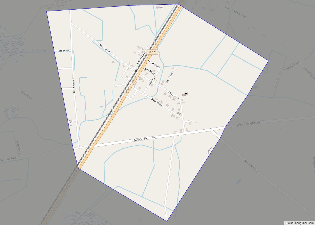
Online Interactive Map
Click on ![]() to view map in "full screen" mode.
to view map in "full screen" mode.
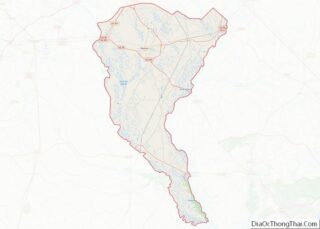
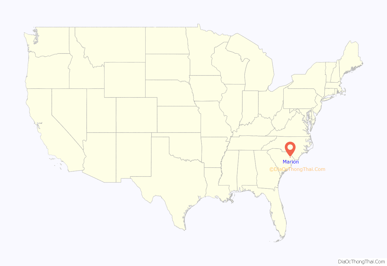
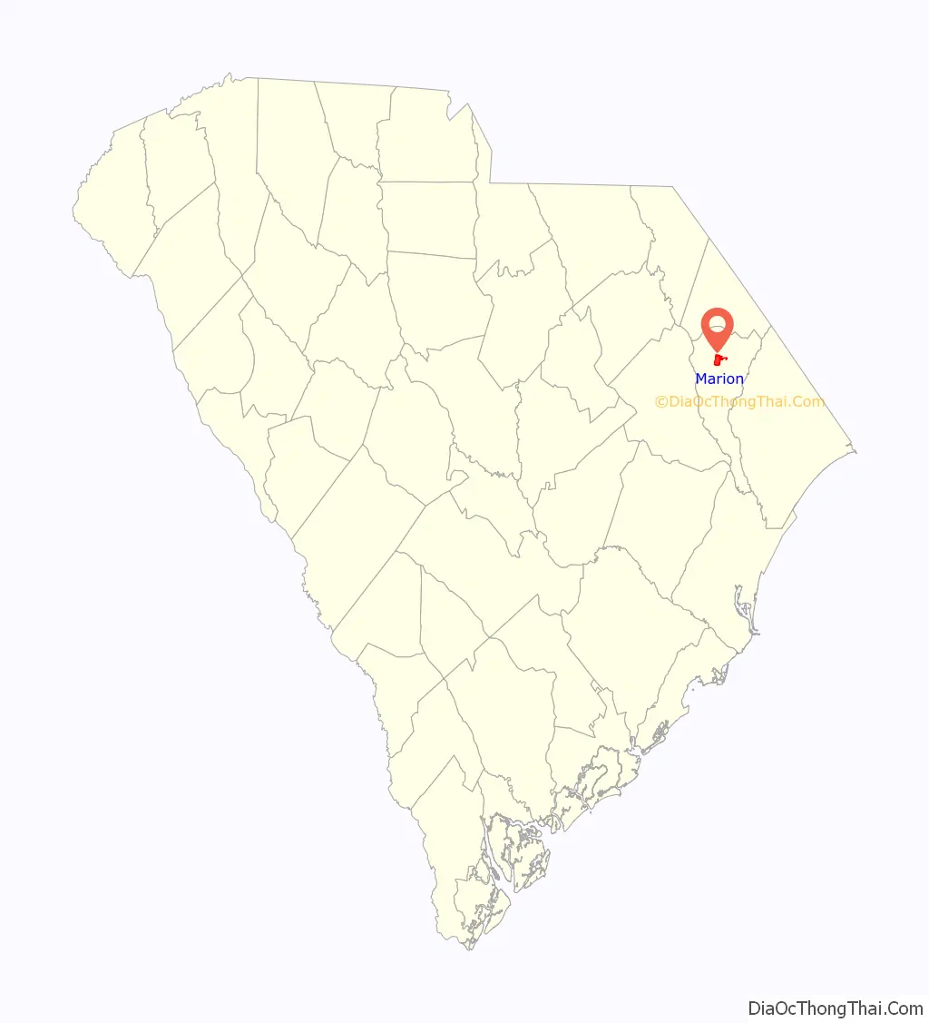
Marion location map. Where is Marion city?
History
The Marion High School, Marion County Court House, Marion County Library, Marion County Museum and Marion Historic District are listed on the National Register of Historic Places.
Some sixty years after the first permanent settlement in South Carolina, a group of English settlers sent out by the Lords Proprietor landed in Georgetown and moved up the Pee Dee River to the junction of the Little Pee Dee River about halfway between Georgetown and the present town of Marion. Among these families were Brittons, Davis, Flaglers, Giles, Graves and Tyler. At about the same time, and maybe on the same ship from England, came Captain John Godbold, a retired English sea captain. He moved farther up the Big Pee Dee and settled on Catfish Creek. The creek is southwest of and very near to the present city limits of Marion.
During its early colonial years the area was part of Craven County. When Craven was divided, this segment of land was placed in Georgetown District and was known as Gilesboro after Col. Hugh Giles, American Revolutionary war hero who fought under Francis Marion. In 1785, another division was made and the name “Liberty” was used for a short time to designate this area.
On December 17, 1847, when by an act of the South Carolina Legislature a charter was issued to the town, its official name was given as “Marion”. The name honors General Francis Marion, a hero of the Revolutionary War.
Court House
A commission was appointed by the South Carolina Legislature to locate the site for a court house. Court was scheduled for the first Monday in March 1800. The court house was not complete, so it was held in a log building on Colonel Hugh Giles’ plantation about two miles below Marion. The section was called Gilesboro or Gilesboro Court House for some time after. The Commissioners appointed to select the site for the Court House were offered land by several land owners in the vicinity, including Giles, but they chose and accepted four acres from Thomas Godbold, a grandson of Captain John Godbold. The present Court House was erected in 1854 and is the third Court House on or near the same site.
During the Revolutionary War, the people of Marion County were divided in their loyalties. There were ardent Patriots under Col. Hugh Giles, Capt. John Dozier, Capt. Stephen Godbold and others. Maj. Micajah Ganey and Capt. Jessee Barfield led the Loyalists. Before the end of the war, most of the Loyalists had pledged allegiance to the colonists due to the activities of General Francis Marion in the area. The Revolutionary battles in the county were Port’s Ferry, Blue Savannah and Bowling Green.
During the American Civil War, Marion County was spared damage from Sherman’s troops due to the Big Pee Dee River being at flood stage. The troops were unable to cross the river. The county fully participated in the reconstruction and in 1876 there were Red Shirt organizations in every township.
Marion mascot is Swamp foxes.
Railroad
Marion County had several periods of growth. With the building and completion of the Wilmington to Manchester Railroad in 1854, business and transportation improved. Gen. W.W. Harllee was the first president of the railroad; the town of Florence, to the west of Marion, was named for his daughter. The second president was Col. William S. Mullins for whom the town of Mullins was named. Col. William S. Mullins- birth- 1824 Fayetteville, Cumberland County, North Carolina. DEATH 1878 (aged 53–54) Mullins, Marion County, South Carolina, USA BURIAL Mullins Cemetery Mullins, Marion County, South Carolina, USA
Separation
In 1888, a part of the west side of the county was separated to form Florence County and in 1910 the upper part of the county was separated to form Dillon County.
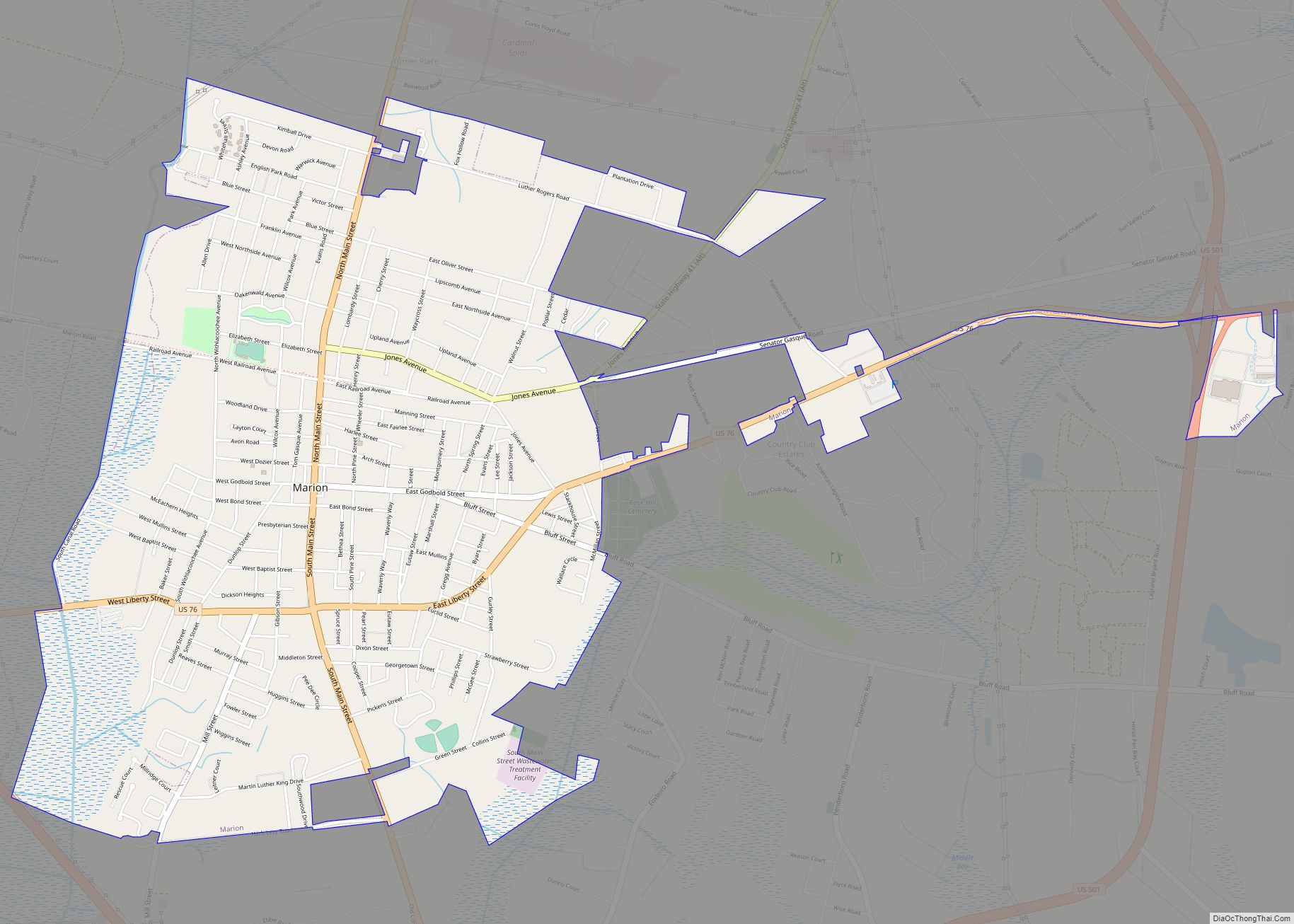
Marion Road Map
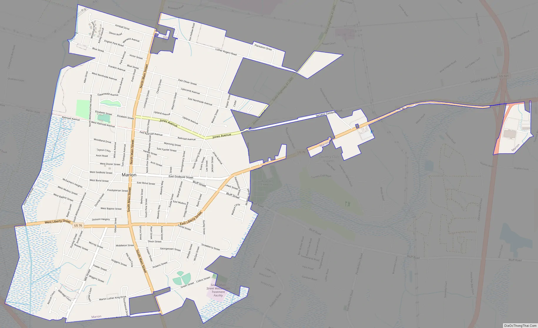
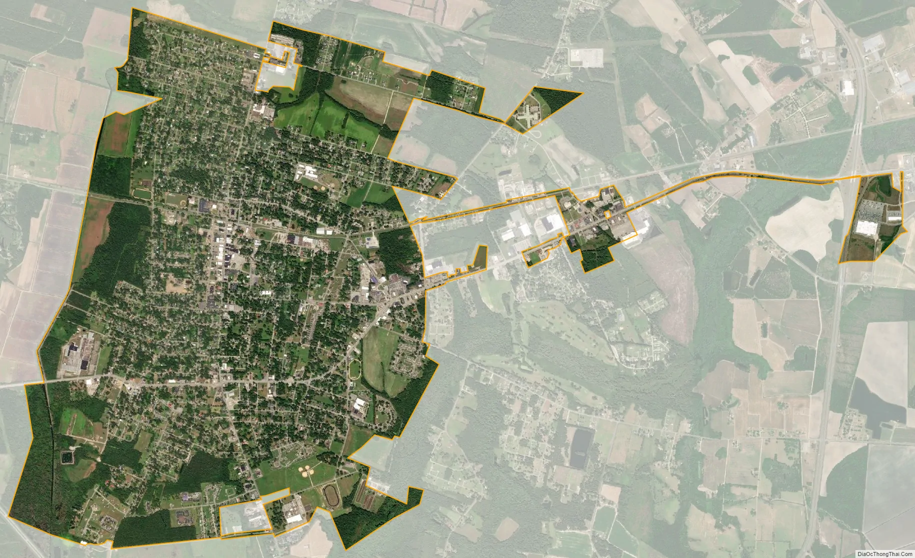
Marion city Satellite Map
Geography
Marion is located at 34°10′48″N 79°23′50″W / 34.18000°N 79.39722°W / 34.18000; -79.39722 (34.180088, -79.397098).
According to the United States Census Bureau, the city has a total area of 4.3 square miles (11 km), all of it land.
See also
Map of South Carolina State and its subdivision:- Abbeville
- Aiken
- Allendale
- Anderson
- Bamberg
- Barnwell
- Beaufort
- Berkeley
- Calhoun
- Charleston
- Cherokee
- Chester
- Chesterfield
- Clarendon
- Colleton
- Darlington
- Dillon
- Dorchester
- Edgefield
- Fairfield
- Florence
- Georgetown
- Greenville
- Greenwood
- Hampton
- Horry
- Jasper
- Kershaw
- Lancaster
- Laurens
- Lee
- Lexington
- Marion
- Marlboro
- McCormick
- Newberry
- Oconee
- Orangeburg
- Pickens
- Richland
- Saluda
- Spartanburg
- Sumter
- Union
- Williamsburg
- York
- Alabama
- Alaska
- Arizona
- Arkansas
- California
- Colorado
- Connecticut
- Delaware
- District of Columbia
- Florida
- Georgia
- Hawaii
- Idaho
- Illinois
- Indiana
- Iowa
- Kansas
- Kentucky
- Louisiana
- Maine
- Maryland
- Massachusetts
- Michigan
- Minnesota
- Mississippi
- Missouri
- Montana
- Nebraska
- Nevada
- New Hampshire
- New Jersey
- New Mexico
- New York
- North Carolina
- North Dakota
- Ohio
- Oklahoma
- Oregon
- Pennsylvania
- Rhode Island
- South Carolina
- South Dakota
- Tennessee
- Texas
- Utah
- Vermont
- Virginia
- Washington
- West Virginia
- Wisconsin
- Wyoming