American Fork is a city in north-central Utah County, Utah, United States, at the foot of Mount Timpanogos in the Wasatch Range, north from Utah Lake. This city is thirty-two miles southeast of Salt Lake City. It is part of the Provo–Orem Metropolitan Statistical Area. The population was 33,337 in 2020. The city has grown rapidly since the 1970s.
| Name: | American Fork city |
|---|---|
| LSAD Code: | 25 |
| LSAD Description: | city (suffix) |
| State: | Utah |
| County: | Utah County |
| Incorporated: | June 4, 1853 |
| Elevation: | 4,606 ft (1,404 m) |
| Total Area: | 11.16 sq mi (28.90 km²) |
| Land Area: | 11.15 sq mi (28.87 km²) |
| Water Area: | 0.01 sq mi (0.02 km²) |
| Total Population: | 33,337 |
| Population Density: | 2,987.19/sq mi (1,154.73/km²) |
| ZIP code: | 84003 |
| FIPS code: | 4901310 |
| GNISfeature ID: | 1438194 |
| Website: | www.americanfork.gov |
Online Interactive Map
Click on ![]() to view map in "full screen" mode.
to view map in "full screen" mode.
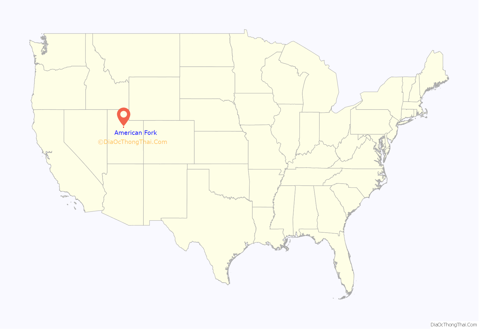
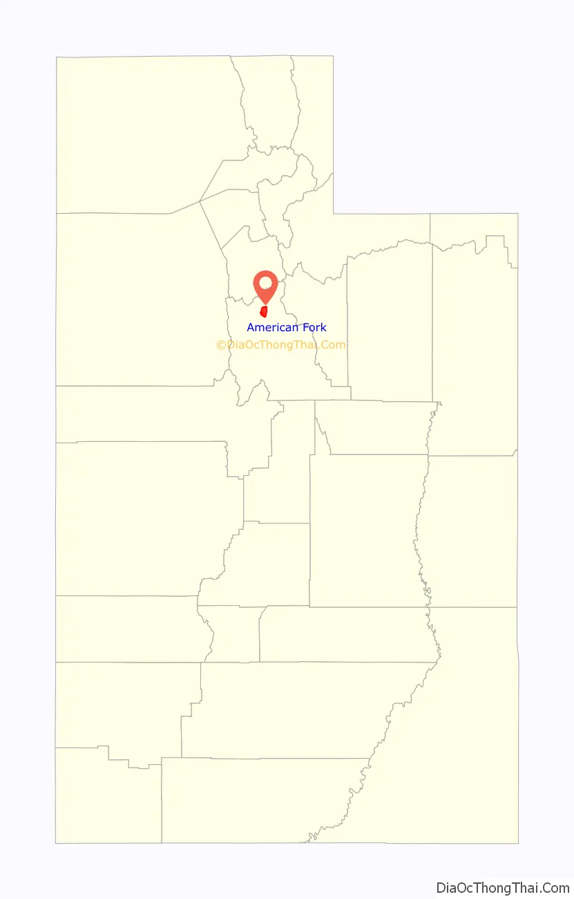
American Fork location map. Where is American Fork city?
History
The area around Utah Lake was used as a seasonal hunting and fishing ground by the Ute Indians. American Fork was settled in 1850 by Mormon pioneers and incorporated as Lake City in 1852. The first settlers were Arza Adams, followed by Stephen Chipman (grandfather of Stephen L. Chipman, a prominent citizen around the start of the 20th Century), Ira Eldredge, John Eldredge and their families.
The first settlers of American Fork lived in scattered conditions along the American Fork river. By the 1850s, the tension between the settlers and Native Americans was increasing. In 1853, Daniel H. Wells, the head of the Nauvoo Legion (the Utah Territorial Militia at the time), instructed settlers to move into specific forts. At a meeting on July 23, 1853, at the schoolhouse in American Fork, Lorenzo Snow and Parley P. Pratt convinced the settlers to follow Wells’ directions and all move together into a central fort. A fort was built of 37 acres (150,000 m) to which the settlers located. Only parts of the wall were built to eight feet high, and none were built to the original plan of twelve feet high.
Settlers changed the name from Lake City to American Fork in 1860. It was renamed after the American Fork, which runs through the city, to avoid confusion with Salt Lake City. Most residents were farmers and merchants during its early history. By the 1860s, American Fork had established a public school, making it the first community in the territory of Utah to offer public education to its citizens. In the 1870s, American Fork served as a rail access point for mining activities in American Fork Canyon. American Fork had “a literal social feud” with the town of Lehi due to the Utah Sugar Company choosing Lehi as the factory building site in 1890 instead of American Fork. There were several mercantile businesses in American Fork, such as the American Fork Co-operative Association and Chipman Mercantile. For several decades in the 1900s, raising chickens (and eggs) was an important industry in the city. In 1892, Joseph Forbes organized the schools in American Fork, and the Forbes school is named after him.
During World War II, the town population expanded when the Columbia Steel plant was built. An annual summer celebration in the city is still called “Steel Days” in honor of the economic importance of the mill, which closed in November 2001. The steel mill was located approximately six miles (10 km) southeast of town, on land on the east shore of Utah Lake.
American Fork built a city hospital in 1937. A new facility was built in 1950 and sold to Intermountain Healthcare in 1977, replacing that hospital with a new facility in 1980.
The 1992 film The Sandlot was mostly filmed on the Wasatch Front. The carnival scene was filmed in American Fork on State Street by Robinson Park.
Several scenes from the 1984 movie Footloose were also filmed in American Fork, including the opening scene inside the church, the front porch scene with Kevin Bacon and his family, and the gas station scene in which Bacon refuels his Volkswagen.
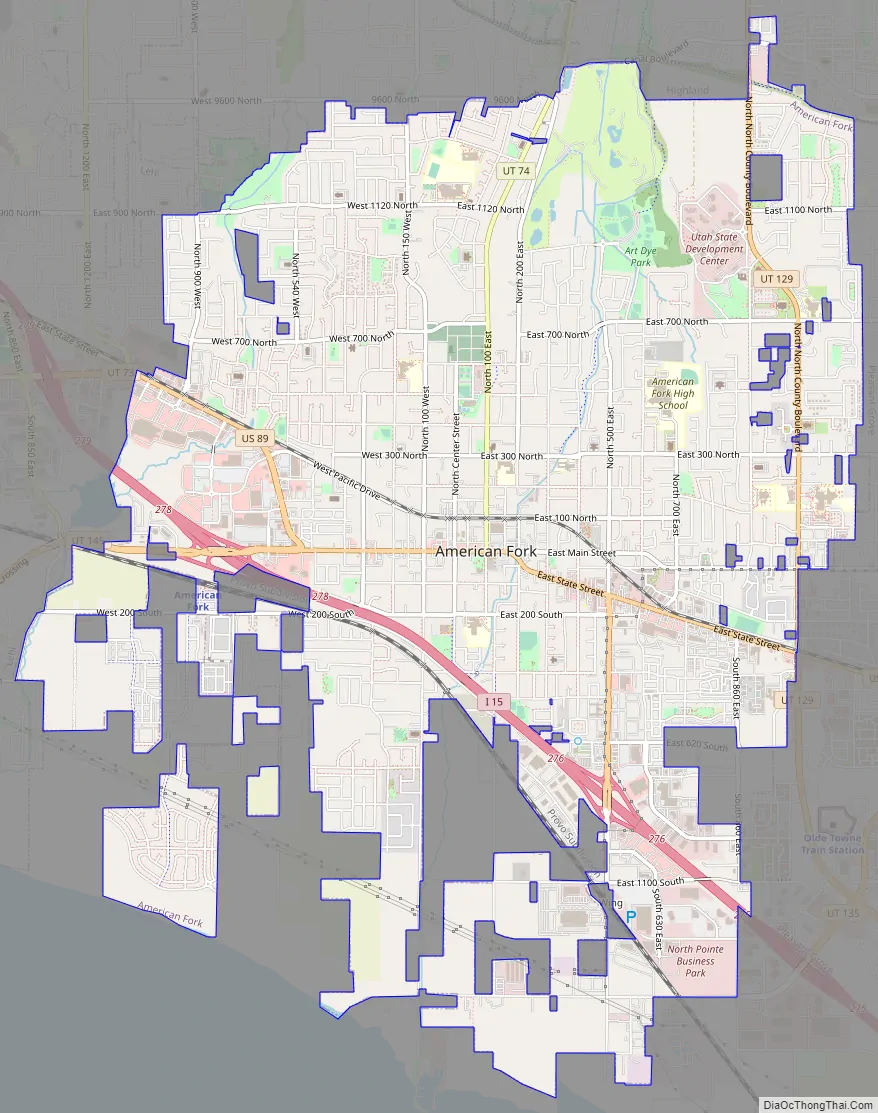
American Fork Road Map
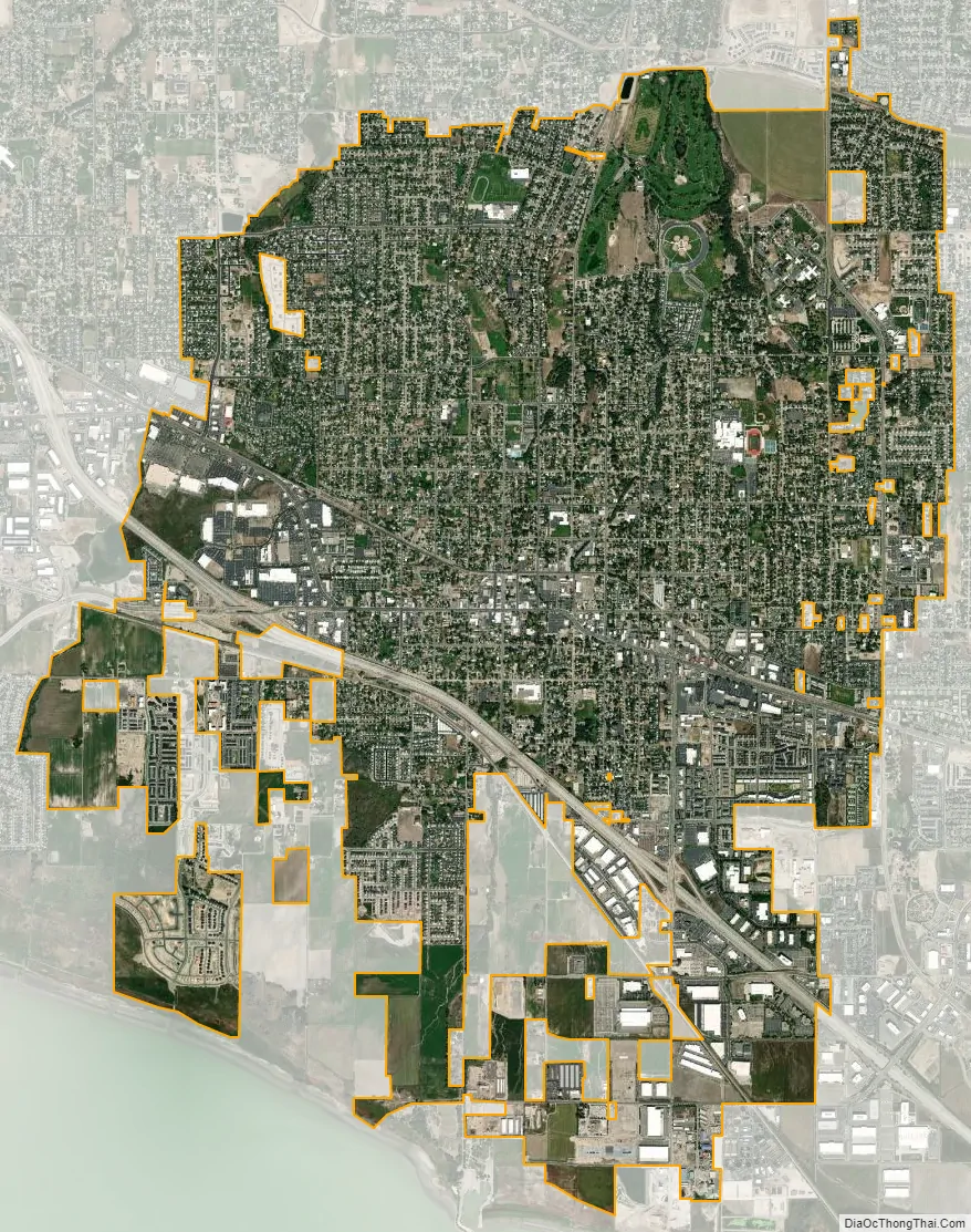
American Fork city Satellite Map
Geography
Elevations throughout the city range from 4,566 feet (1,392 m) to 4,619 feet (1,408 m) above sea level.
According to the United States Census Bureau, the city has a total area of 9.2 square miles (23.9 km), all land.
See also
Map of Utah State and its subdivision: Map of other states:- Alabama
- Alaska
- Arizona
- Arkansas
- California
- Colorado
- Connecticut
- Delaware
- District of Columbia
- Florida
- Georgia
- Hawaii
- Idaho
- Illinois
- Indiana
- Iowa
- Kansas
- Kentucky
- Louisiana
- Maine
- Maryland
- Massachusetts
- Michigan
- Minnesota
- Mississippi
- Missouri
- Montana
- Nebraska
- Nevada
- New Hampshire
- New Jersey
- New Mexico
- New York
- North Carolina
- North Dakota
- Ohio
- Oklahoma
- Oregon
- Pennsylvania
- Rhode Island
- South Carolina
- South Dakota
- Tennessee
- Texas
- Utah
- Vermont
- Virginia
- Washington
- West Virginia
- Wisconsin
- Wyoming


