Clawson is a town in Emery County, Utah, United States. The population was 163 at the 2020 census. The community was named after Rudger Clawson, a Mormon leader.
| Name: | Clawson town |
|---|---|
| LSAD Code: | 43 |
| LSAD Description: | town (suffix) |
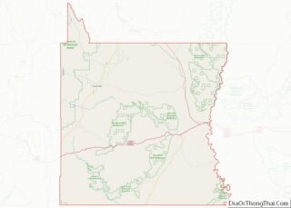
| State: | Utah |
| County: | Emery County |
| Incorporated: | 1981 |
| Elevation: | 5,942 ft (1,811 m) |
| Total Area: | 1.01 sq mi (2.62 km²) |
| Land Area: | 1.01 sq mi (2.62 km²) |
| Water Area: | 0.00 sq mi (0.00 km²) |
| Total Population: | 163 |
| Population Density: | 161.39/sq mi (62.21/km²) |
| ZIP code: | 84516 |
| Area code: | 435 |
| FIPS code: | 4913300 |
| GNISfeature ID: | 1426675 |
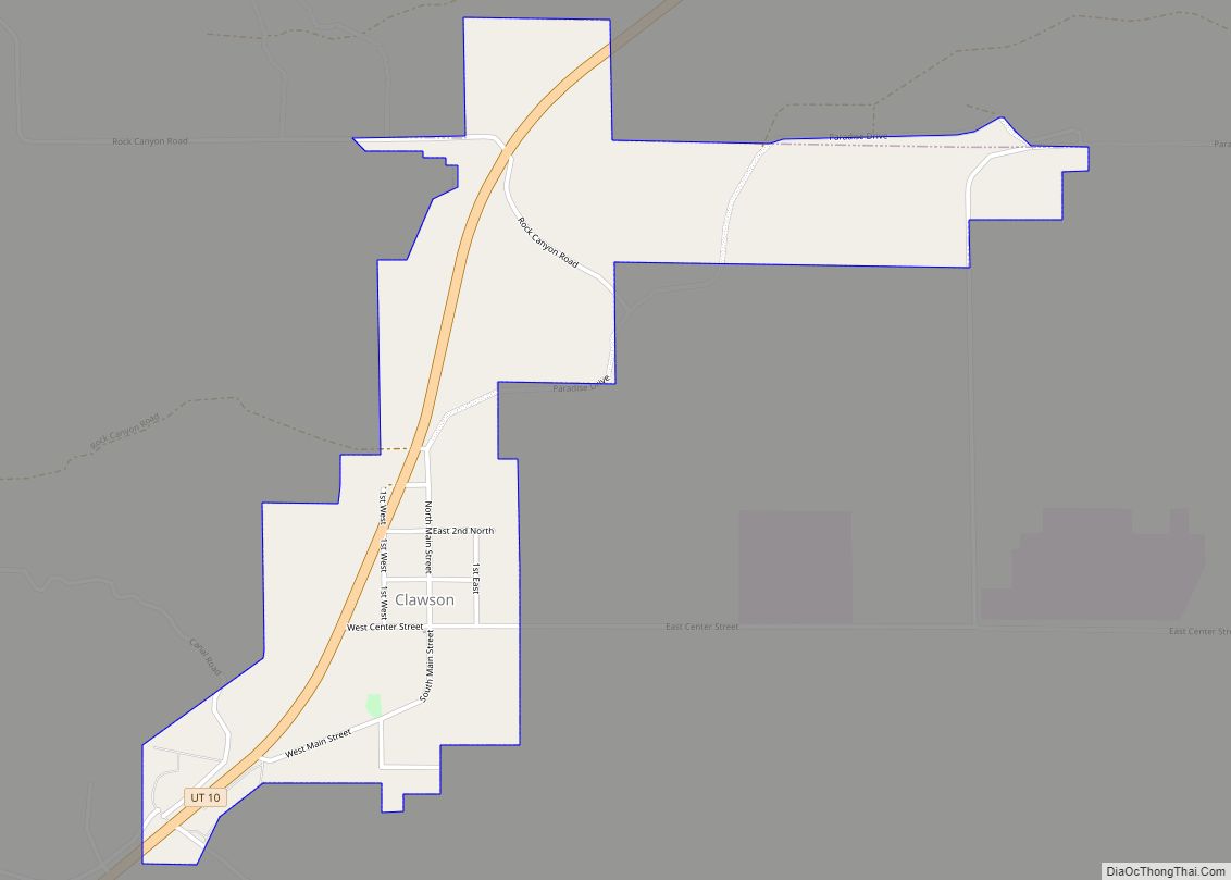
Online Interactive Map
Click on ![]() to view map in "full screen" mode.
to view map in "full screen" mode.
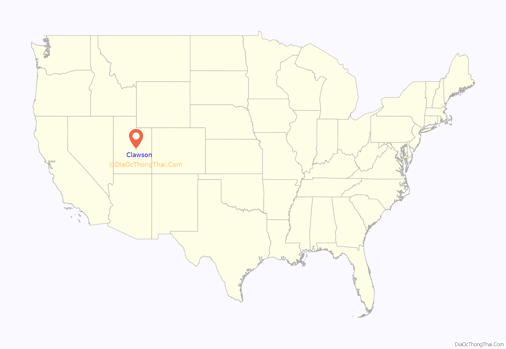
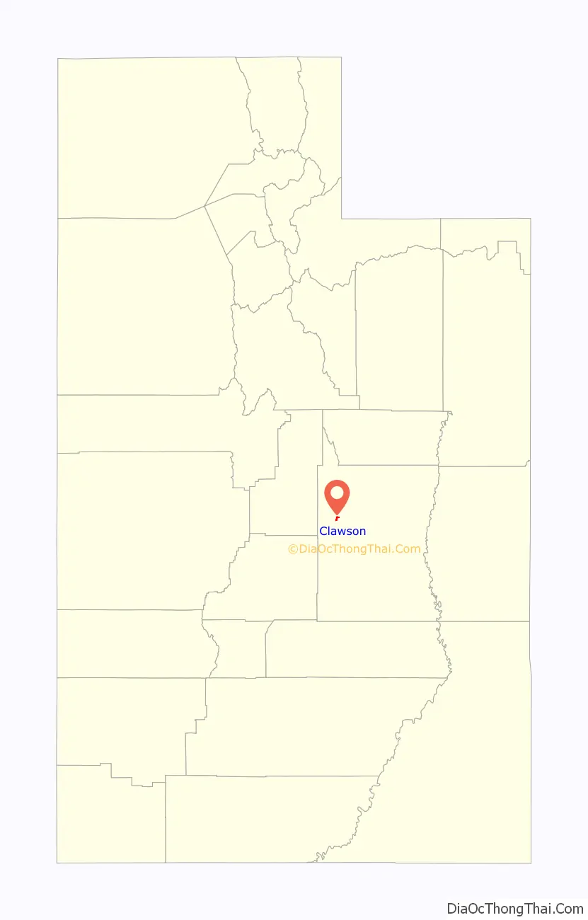
Clawson location map. Where is Clawson town?
History
A canal to carry water from Ferron Creek was completed in 1896. Before being settled, the area was known as North Flat. In 1897, the first settlers arrived, calling the community “Kingsville” after Guy King, who was one of the original settlers. The first school was opened in 1898 in the home of Guy King, with Florence Barney as the teacher. She rode 14 miles (23 km) on horseback each day to the school.
In 1902, the President of the Emery Stake, Reuben C. Miller, sent the bishopric of Ferron to select a permanent spot for the town of Kingsville. There were two candidate locations: the homesteads and the Westingkow farm 2 miles (3 km) west of that. The bishop decided it should be near the Westingkow farm because the lay of the land suggested that the old location could become swampy. Although the settlers initially disagreed, they consented, purchased the Westingkow farm, and moved their log cabins two miles to the west.
On October 25, 1904, LDS Church Apostle Rudger Clawson of the Quorum of the Twelve Apostles came and organized a ward. The town’s name was changed from Kingston to Clawson in his honor.
After decades of existing as an unincorporated community, Clawson was incorporated as a town in 1981.
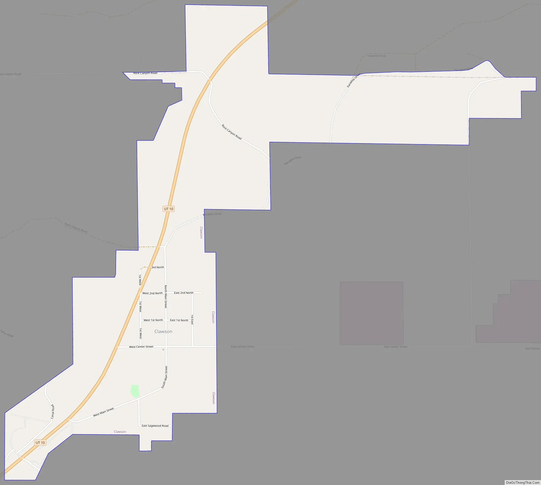
Clawson Road Map
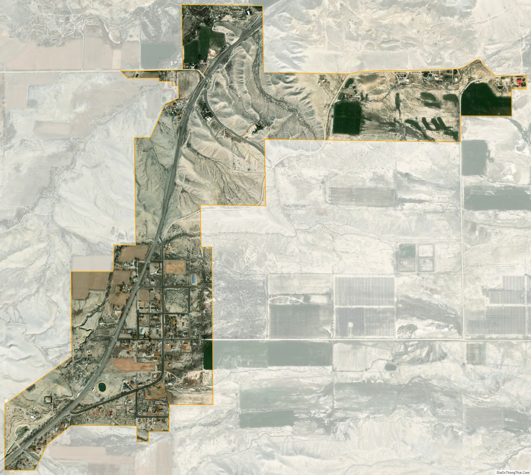
Clawson city Satellite Map
Geography
Clawson is located in northwestern Emery County along Utah State Route 10. It is 7 miles (11 km) southwest of Castle Dale, the county seat, and 3.5 miles (5.6 km) northeast of Ferron.
According to the United States Census Bureau, the town of Clawson has a total area of 0.69 square miles (1.8 km), all land.
Climate
Large seasonal temperature differences typify this climatic region, with warm to hot (and often humid) summers and cold (sometimes severely cold) winters. According to the Köppen Climate Classification system, Clawson has a humid continental climate, abbreviated “Dfb” on climate maps.
See also
Map of Utah State and its subdivision: Map of other states:- Alabama
- Alaska
- Arizona
- Arkansas
- California
- Colorado
- Connecticut
- Delaware
- District of Columbia
- Florida
- Georgia
- Hawaii
- Idaho
- Illinois
- Indiana
- Iowa
- Kansas
- Kentucky
- Louisiana
- Maine
- Maryland
- Massachusetts
- Michigan
- Minnesota
- Mississippi
- Missouri
- Montana
- Nebraska
- Nevada
- New Hampshire
- New Jersey
- New Mexico
- New York
- North Carolina
- North Dakota
- Ohio
- Oklahoma
- Oregon
- Pennsylvania
- Rhode Island
- South Carolina
- South Dakota
- Tennessee
- Texas
- Utah
- Vermont
- Virginia
- Washington
- West Virginia
- Wisconsin
- Wyoming