Green River is a city in Emery County, Utah. The population was 847 at the 2020 census.
| Name: | Green River city |
|---|---|
| LSAD Code: | 25 |
| LSAD Description: | city (suffix) |
| State: | Utah |
| County: | Emery County |
| Incorporated: | 1906 |
| Elevation: | 4,078 ft (1,243 m) |
| Total Area: | 27.26 sq mi (70.61 km²) |
| Land Area: | 27.14 sq mi (70.29 km²) |
| Water Area: | 0.12 sq mi (0.32 km²) |
| Total Population: | 847 |
| Population Density: | 34.45/sq mi (13.30/km²) |
| ZIP code: | 84525 |
| Area code: | 435 |
| FIPS code: | 4931670 |
| GNISfeature ID: | 1428398 |
| Website: | greenriverutah.com |
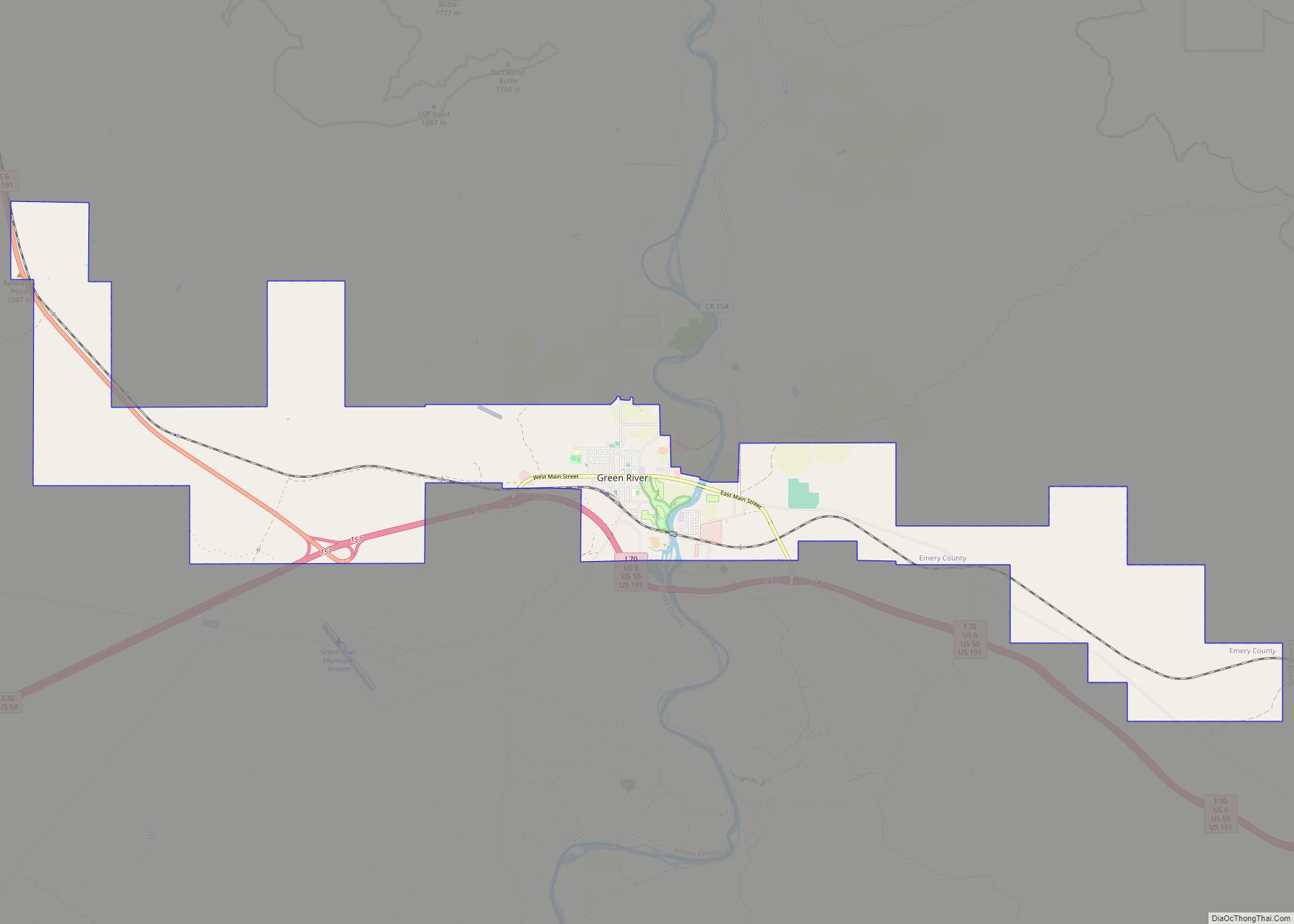
Online Interactive Map
Click on ![]() to view map in "full screen" mode.
to view map in "full screen" mode.
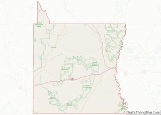
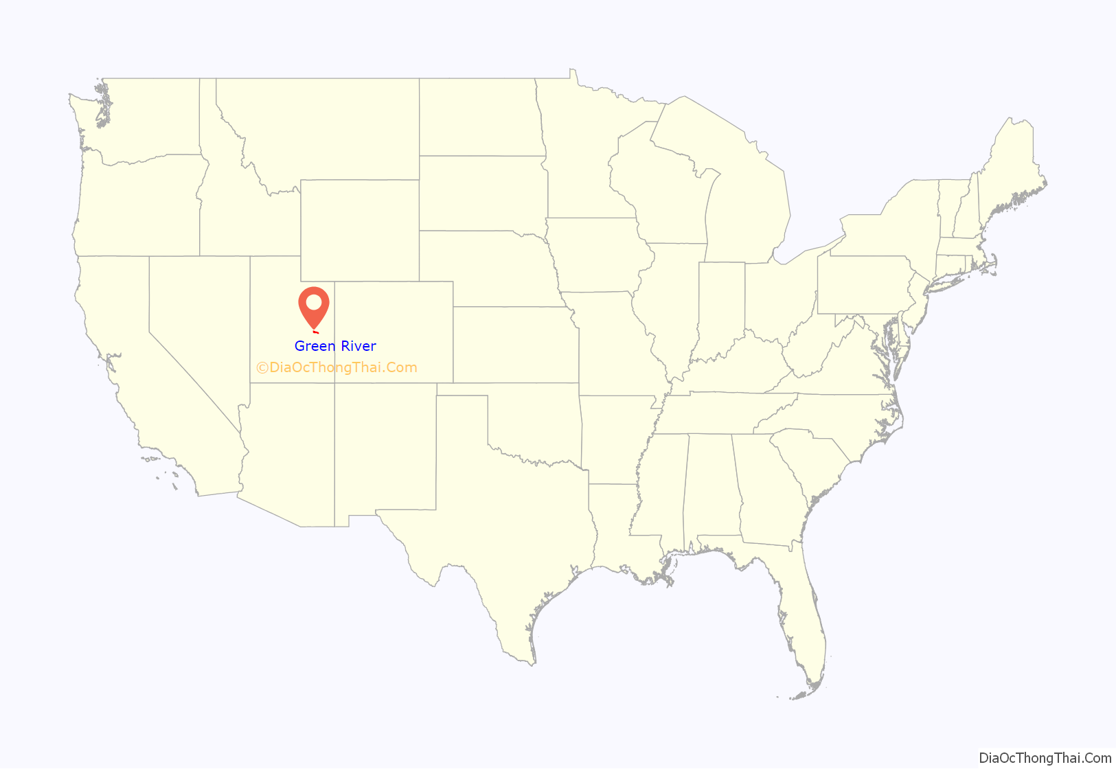
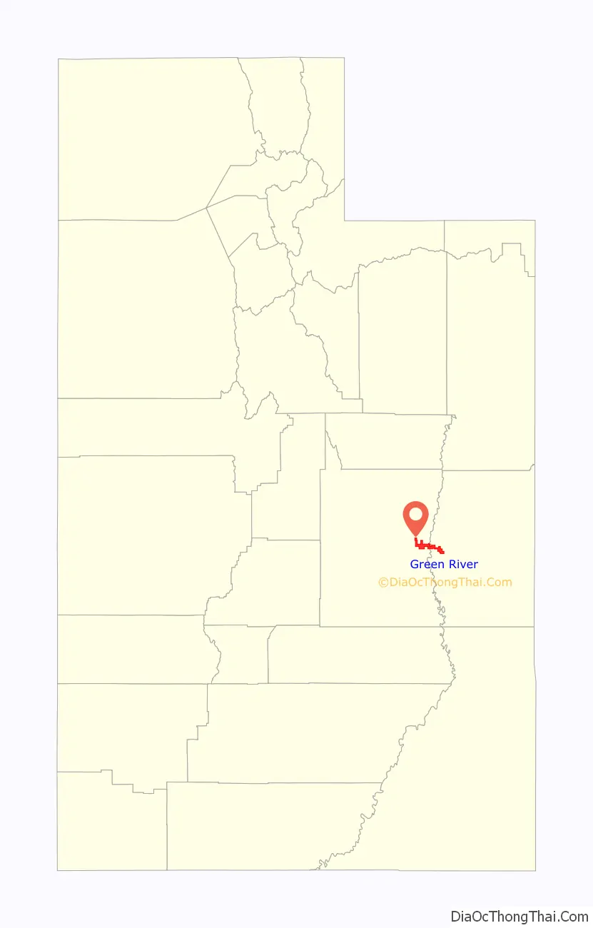
Green River location map. Where is Green River city?
History
The city of Green River is located in ancestral Ute lands, in the home locale of the Seuvarits/Sheberetch band of Ute people. The Old Spanish Trail trade route passed across the Green River in the area of modern Green River from 1829 into the 1850s.
John Wesley Powell embarked on the first of two voyages down the Green River in May 1869 and floated the river to its confluence with the Colorado and beyond. Powell left a detailed account of the river and the surrounding landscape and prepared the first thorough maps of the river basin. Powell left his mark in other ways as well. He and his men named most of the canyons, geographic features, and rapids along the Green River during his two voyages in 1869 and 1871. Powell also paved the way for later generations of explorers and scientists interested in the unique geology of the basin of the Green River.
The settlement of the Green River started as a river crossing for the U.S. mail. In 1876, Mr. Blake set up a ferry and way station on the east side of the river. It became a stopover for travelers with a ferry transporting people, supplies, and animals across the river.
In 1883 the line commonly known as the Utah Division of the Denver and Rio Grande Western Railroad was built, and a train station was opened. The west side of the river became known as “Greenriver” (later changed to “Green River”), and the east side of the river became known as “Elgin”, and is still referred to by that name today. With the railroad coming, the town quickly went from a small farm hamlet to a boom town, with workers coming to build the bridge and the roadbed for the railroad. After the railroad’s completion, the Green River became a fueling and watering stop for the railroad, with switching yards and engine sheds. A hotel called the Palmer House was built and became the scheduled meal stop for trains from both directions for many years. Green River enjoyed the railroad boom until 1892 when the railroad transferred most of its operations to Helper. The population of the town declined significantly.
Throughout the 1940s, 1950s, and 1960s, the mining of uranium played a significant role in the economy of Green River. Several trucking companies hauled ore from mines in the Four-Corners Mining District west of Green River, the San Rafael Swell, the Henry Mountains, and the area that is now Lake Powell.
The U.S. Air Force built the Green River Launch Complex outside Green River in 1964. It was an annex of the U.S. Army’s White Sands Missile Range. From 1964 to 1973, the Air Force launched 141 Athena missiles from the Green River complex, near the Crystal Geyser, as part of research to improve nuclear missiles.
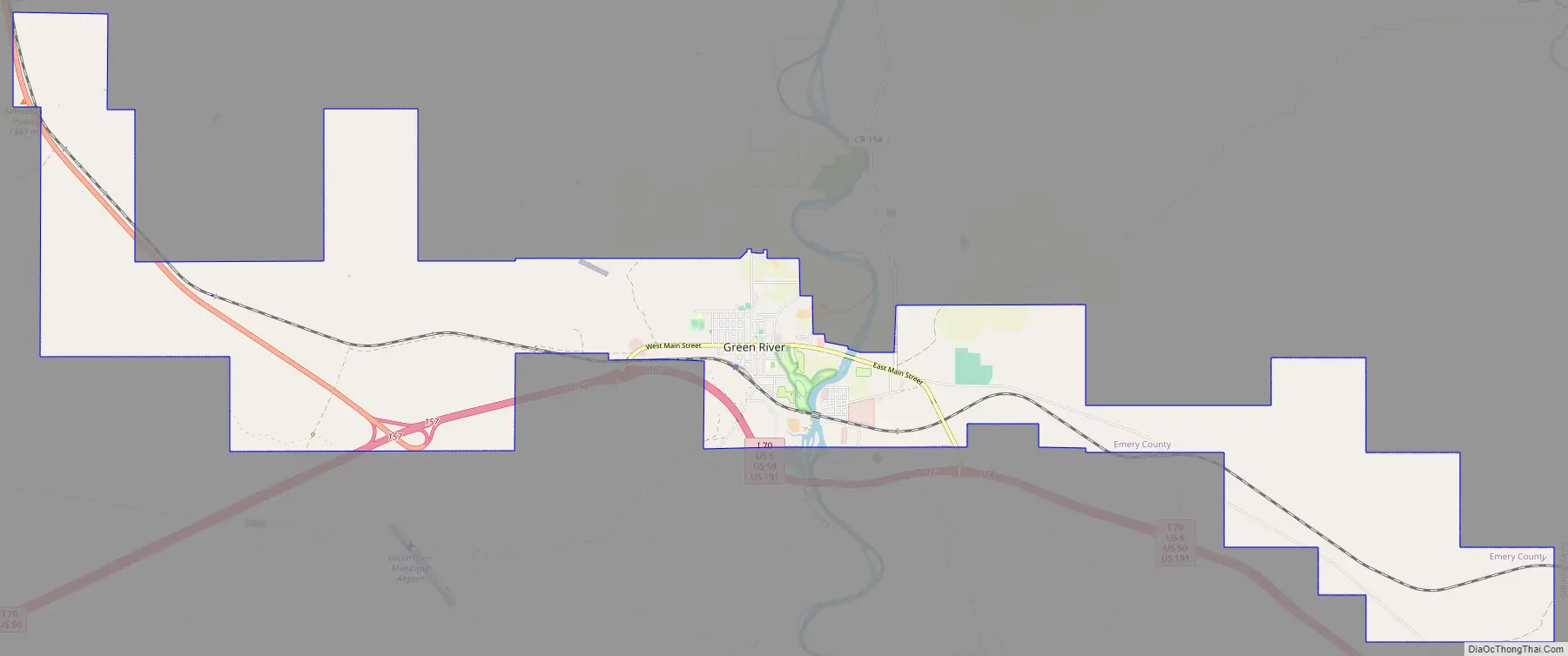
Green River Road Map
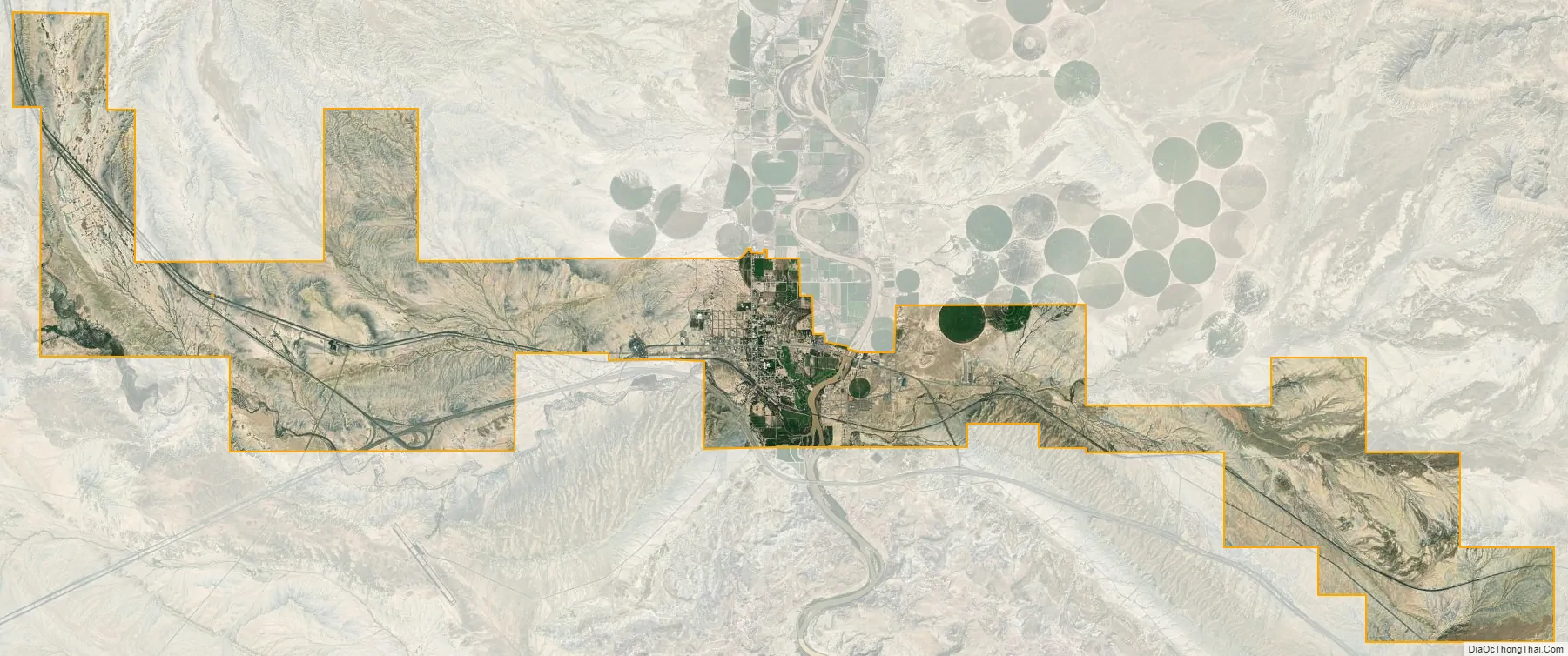
Green River city Satellite Map
Geography
The city is located on the banks of the Green River, a major tributary of the Colorado River. The San Rafael Swell region is located west of the city, while Canyonlands National Park lies to the south. Today located exclusively in Emery County, the city was split between Emery and Grand counties until January 6, 2003, when Emery County’s boundaries were expanded to follow the city limits.
According to the United States Census Bureau, the city of Green River has a land area of 27.14 square miles (70,287,692 m), and a water area 0.12 square miles (319,726 m).
Interstate 70 passes just south of the city, with access from Exits 160 and 164. Grand Junction, Colorado 102 miles (164 km) and Denver 343 miles (552 km) lie to the east. Cove Fort, I-70’s western terminus, is 162 miles (261 km) to the west with Las Vegas 406 miles (653 km) via Interstate 15 from Cove Fort. Price lies 64 miles (103 km) to the northwest on US Routes 6 and 191 as well as Salt Lake City 168 miles (270 km) via Interstate 15 from Spanish Fork.
Climate
Green River has a moderate desert climate (Köppen BWk).
See also
Map of Utah State and its subdivision: Map of other states:- Alabama
- Alaska
- Arizona
- Arkansas
- California
- Colorado
- Connecticut
- Delaware
- District of Columbia
- Florida
- Georgia
- Hawaii
- Idaho
- Illinois
- Indiana
- Iowa
- Kansas
- Kentucky
- Louisiana
- Maine
- Maryland
- Massachusetts
- Michigan
- Minnesota
- Mississippi
- Missouri
- Montana
- Nebraska
- Nevada
- New Hampshire
- New Jersey
- New Mexico
- New York
- North Carolina
- North Dakota
- Ohio
- Oklahoma
- Oregon
- Pennsylvania
- Rhode Island
- South Carolina
- South Dakota
- Tennessee
- Texas
- Utah
- Vermont
- Virginia
- Washington
- West Virginia
- Wisconsin
- Wyoming