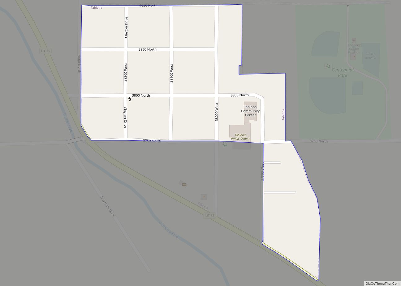
Tabiona (/tæbiˈoʊnə/ TAB-ee-OH-nə) is a town in Duchesne County, Utah, United States. It is eighty-six miles southeast of the Salt Lake City metropolitan area. The population was 171 at the 2010 United States Census.
| Name: | Tabiona town |
|---|---|
| LSAD Code: | 43 |
| LSAD Description: | town (suffix) |
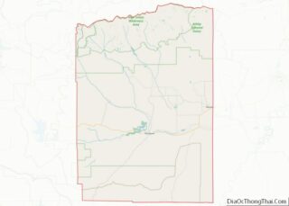
| State: | Utah |
| County: | Duchesne County |
| Incorporated: | 1935 |
| Elevation: | 6,516 ft (1,986 m) |
| Total Area: | 0.10 sq mi (0.27 km²) |
| Land Area: | 0.10 sq mi (0.27 km²) |
| Water Area: | 0.00 sq mi (0.00 km²) |
| Total Population: | 171 |
| Population Density: | 1,558.82/sq mi (599.73/km²) |
| ZIP code: | 84072 |
| Area code: | 435 |
| FIPS code: | 4974920 |
| GNISfeature ID: | 1433156 |
Online Interactive Map
Click on ![]() to view map in "full screen" mode.
to view map in "full screen" mode.
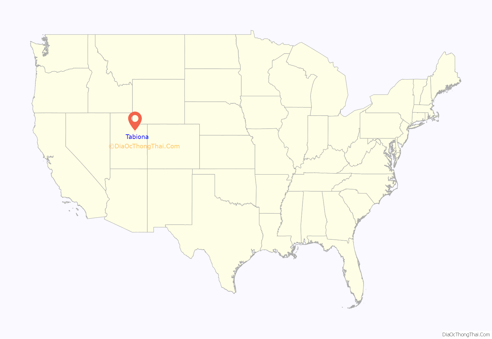
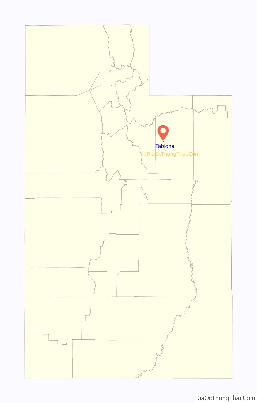
Tabiona location map. Where is Tabiona town?
History
Tabiona was named for a Shoshone chief, Chief Tabby-To-Kwanah.
http://www.blackhawkproductions.com/facts.htm
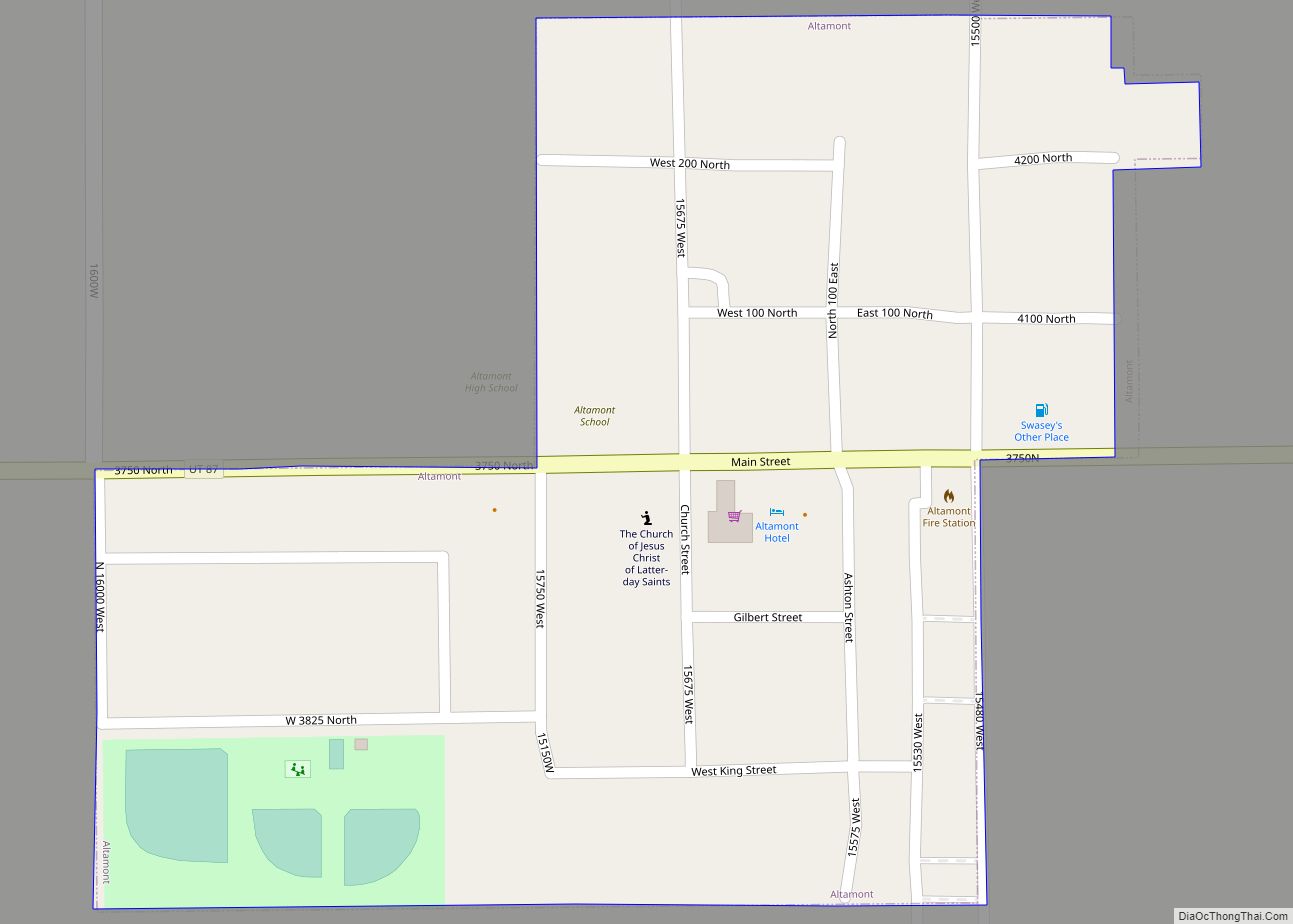
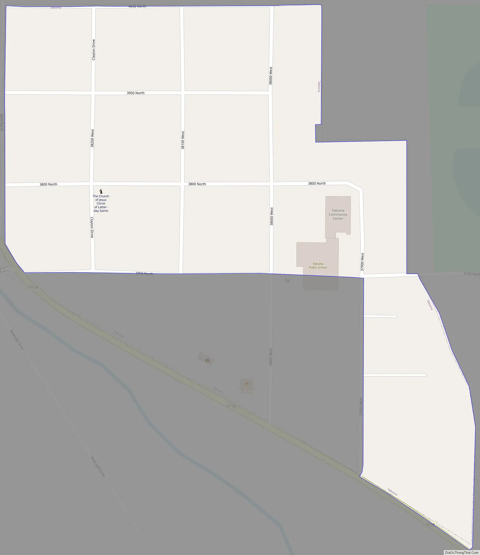
Tabiona Road Map
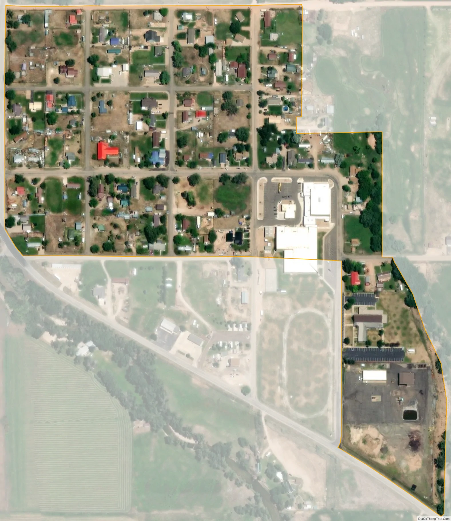
Tabiona city Satellite Map
Geography
According to the United States Census Bureau, the town has a total area of 0.1 square miles (0.26 km), all land.
See also
Map of Utah State and its subdivision: Map of other states:- Alabama
- Alaska
- Arizona
- Arkansas
- California
- Colorado
- Connecticut
- Delaware
- District of Columbia
- Florida
- Georgia
- Hawaii
- Idaho
- Illinois
- Indiana
- Iowa
- Kansas
- Kentucky
- Louisiana
- Maine
- Maryland
- Massachusetts
- Michigan
- Minnesota
- Mississippi
- Missouri
- Montana
- Nebraska
- Nevada
- New Hampshire
- New Jersey
- New Mexico
- New York
- North Carolina
- North Dakota
- Ohio
- Oklahoma
- Oregon
- Pennsylvania
- Rhode Island
- South Carolina
- South Dakota
- Tennessee
- Texas
- Utah
- Vermont
- Virginia
- Washington
- West Virginia
- Wisconsin
- Wyoming