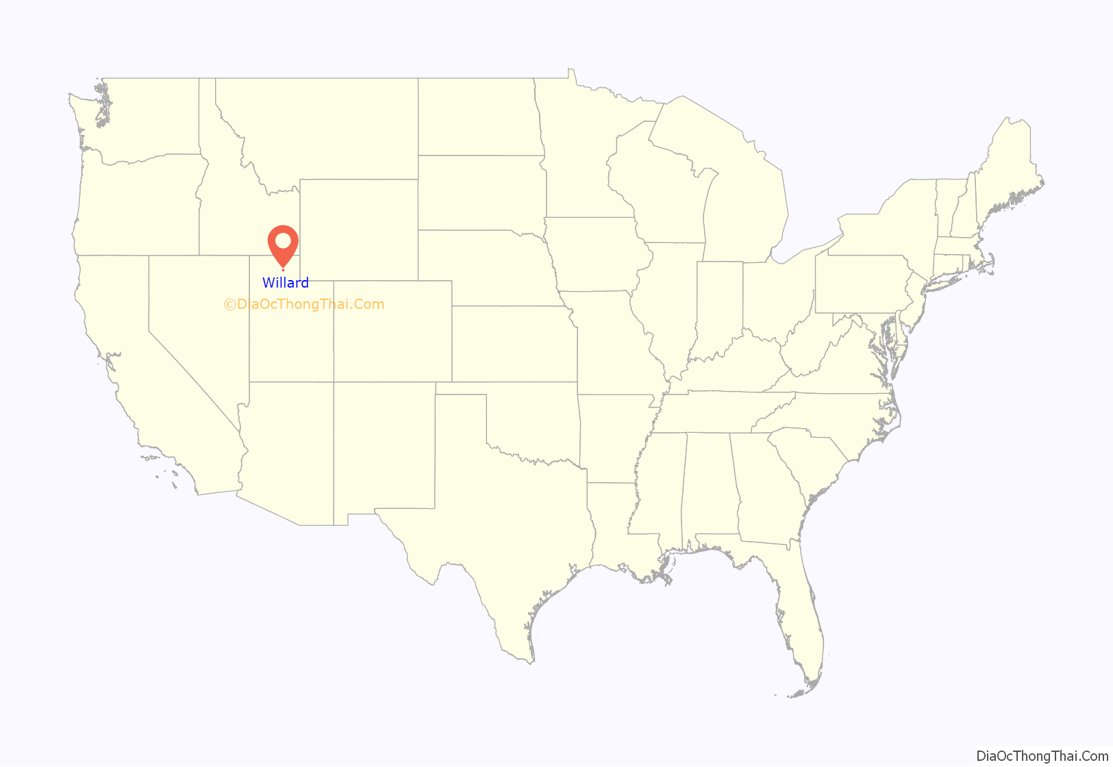
Willard (Shoshoni: Sogo-timp-bow ya) is a city in Box Elder County, Utah, United States. The population was 1,772 at the 2010 census.
| Name: | Willard city |
|---|---|
| LSAD Code: | 25 |
| LSAD Description: | city (suffix) |
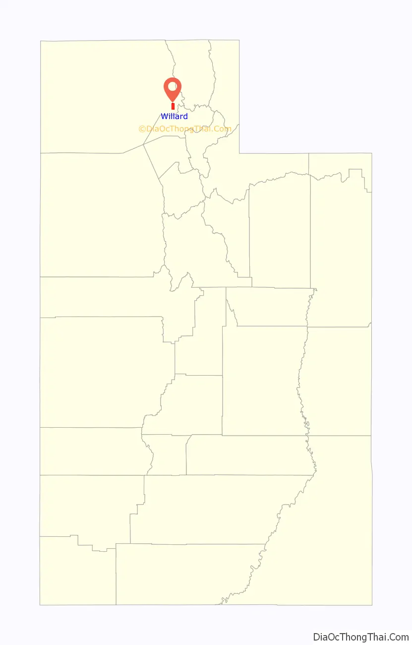
| State: | Utah |
| County: | Box Elder County |
| Incorporated: | 1870 |
| Elevation: | 4,350 ft (1,326 m) |
| Total Area: | 7.08 sq mi (18.35 km²) |
| Land Area: | 5.62 sq mi (14.55 km²) |
| Water Area: | 1.47 sq mi (3.80 km²) |
| Total Population: | 1,772 |
| Population Density: | 348.58/sq mi (134.58/km²) |
| ZIP code: | 84340 |
| Area code: | 435 |
| FIPS code: | 4984710 |
| GNISfeature ID: | 1447372 |
| Website: | www.willardcity.com |
Online Interactive Map
Click on ![]() to view map in "full screen" mode.
to view map in "full screen" mode.
Willard location map. Where is Willard city?
History
In 1851, several companies of Mormon settlers were sent north from Salt Lake City to a northern bay of the Great Salt Lake called Bear River Bay. In 1957 the US Corps of Engineers built a fresh water lake which is now called Willard Bay. A company of nineteen located on North Willow Creek, 7 miles (11 km) south of the site where Brigham City would be established. Two years later, the infant community relocated two miles further south, and a fort wall was built due to the possibility of attacks by the Shohone and their allies. Willard’s first settlers were mostly of Welsh, English, Scottish and Dutch descent. Most were farmers, but some were merchants, carpenters, blacksmiths and school teachers. Historically, the economy of Willard centered on agriculture, with fruit crops being the major product. Gravel excavation and worked stone have also been a significant source of income.
Henry G. Sherwood surveyed North Willow Creek in 1851. The community was renamed Willard in honor of Willard Richards (1804-1854, a recently deceased Apostle of the LDS Church and counselor to Brigham Young, in 1859. Willard received its charter as a city in 1870.
Gifted stonemason Shadrack Jones took advantage of local rock cliffs and the alluvial fan exposed as ancient Lake Bonneville receded. Between 1862 and 1883, he mined the local stone and built single-family homes. Over thirty still stand and many are listed on the National Register of Historic Places as contributing buildings in the Willard Historic District. Other early structures included a brick yard, the first grist mill in Box Elder County, and a number of molasses mills.
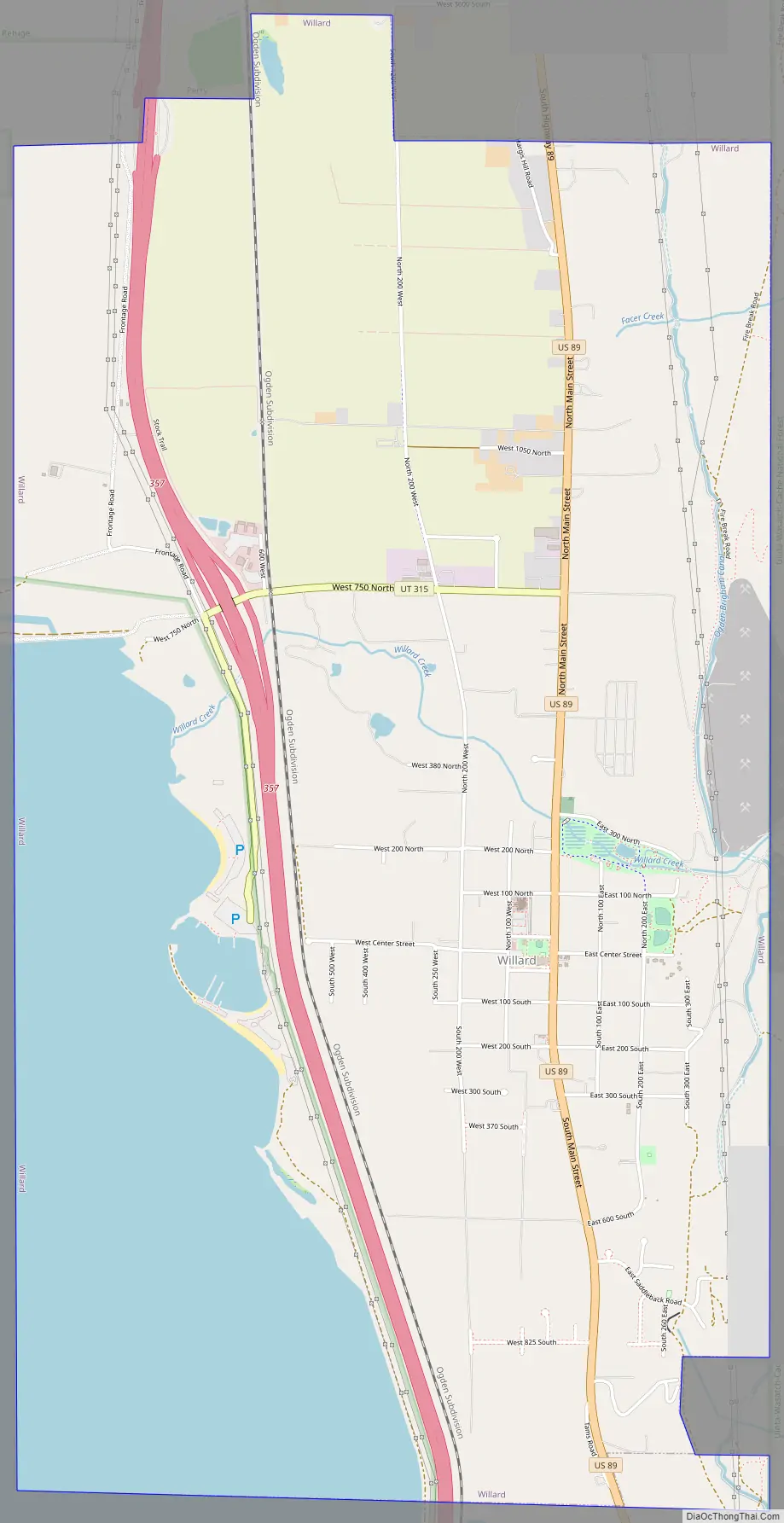
Willard Road Map
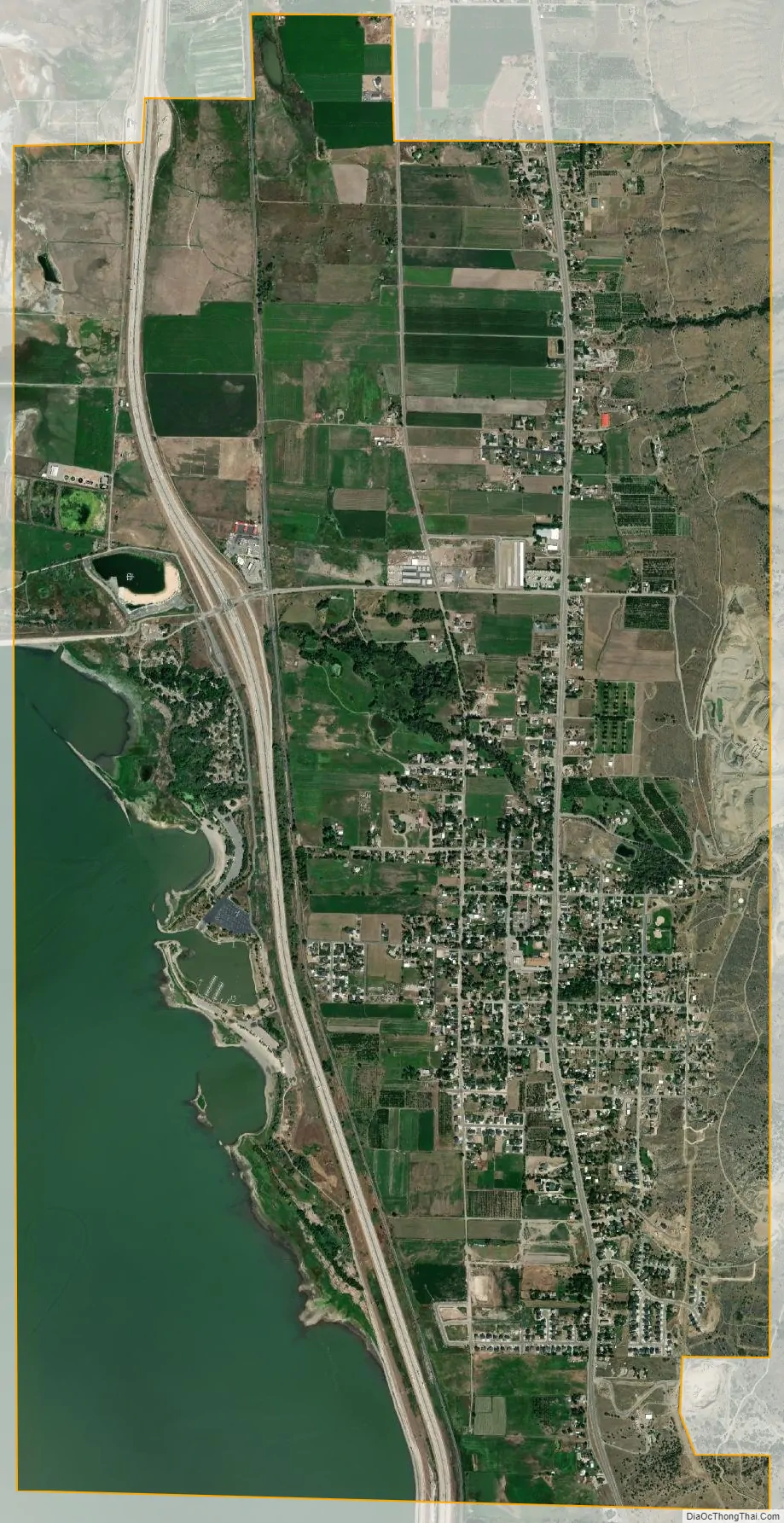
Willard city Satellite Map
Geography
Willard is located in southeastern Box Elder County and is bordered by the city of Perry to the north and the unincorporated community of South Willard to the south. The east edge of the city is bordered by Cache National Forest in the Wasatch Range, and the west side extends into Willard Bay, a freshwater reservoir built out of the Great Salt Lake. Willard Bay State Park is located within the city limits along the shore of Willard Bay.
Interstate highways 15 and 84 pass through the western side of the city, with access from Exit 357. U.S. Route 89 is the city’s Main Street.
According to the United States Census Bureau, the city has a total area of 7.2 square miles (18.6 km), of which 5.7 square miles (14.7 km) is land and 1.5 square miles (3.9 km), or 21.16%, is water.
See also
Map of Utah State and its subdivision: Map of other states:- Alabama
- Alaska
- Arizona
- Arkansas
- California
- Colorado
- Connecticut
- Delaware
- District of Columbia
- Florida
- Georgia
- Hawaii
- Idaho
- Illinois
- Indiana
- Iowa
- Kansas
- Kentucky
- Louisiana
- Maine
- Maryland
- Massachusetts
- Michigan
- Minnesota
- Mississippi
- Missouri
- Montana
- Nebraska
- Nevada
- New Hampshire
- New Jersey
- New Mexico
- New York
- North Carolina
- North Dakota
- Ohio
- Oklahoma
- Oregon
- Pennsylvania
- Rhode Island
- South Carolina
- South Dakota
- Tennessee
- Texas
- Utah
- Vermont
- Virginia
- Washington
- West Virginia
- Wisconsin
- Wyoming