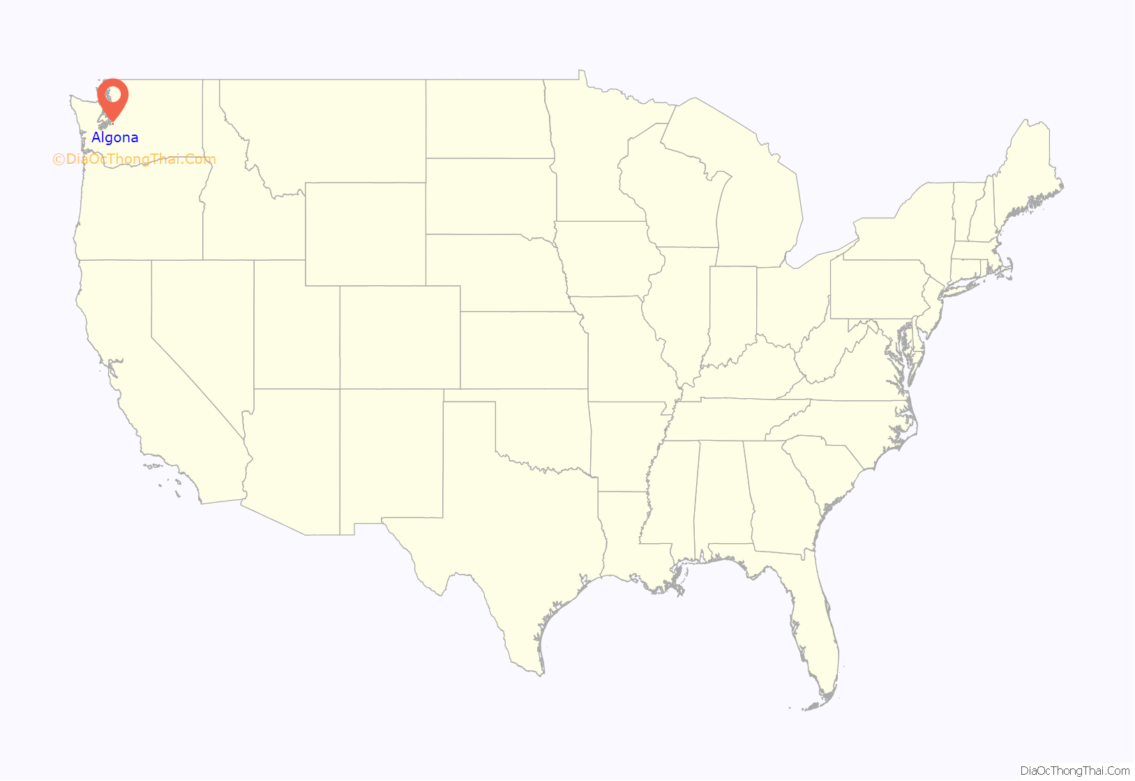
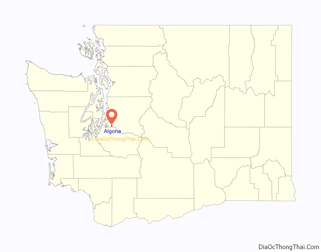
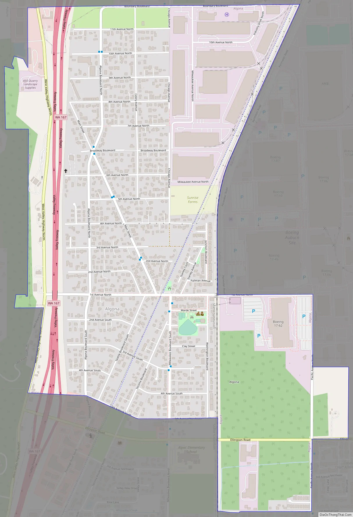
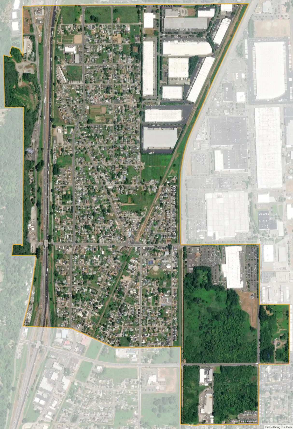
Algona (/ælˈɡoʊnə/) is a city in King County, Washington, United States, and the Seattle metropolitan area, surrounded by the suburbs of Auburn to the north and east, Pacific to the south, and unincorporated King County to the west. The population was 3,290 as of the 2020 census.
Due to Algona’s adjacency to the city of Pacific, the two communities are sometimes referred to collectively as Algona-Pacific or Algona/Pacific.
| Name: | Algona city |
|---|---|
| LSAD Code: | 25 |
| LSAD Description: | city (suffix) |
| State: | Washington |
| County: | King County |
| Founded: | 1955 |
| Elevation: | 82 ft (25 m) |
| Total Area: | 1.29 sq mi (3.35 km²) |
| Land Area: | 1.29 sq mi (3.35 km²) |
| Water Area: | 0.00 sq mi (0.00 km²) |
| Total Population: | 3,290 |
| Population Density: | 2,482.97/sq mi (958.83/km²) |
| ZIP code: | 98001 |
| Area code: | 253 |
| FIPS code: | 5301290 |
| GNISfeature ID: | 1511959 |
| Website: | algonawa.gov |
Online Interactive Map
Click on ![]() to view map in "full screen" mode.
to view map in "full screen" mode.
Algona location map. Where is Algona city?
History
The community was originally called “Algoma”. (A recording error by postal officials accounts for the error in spelling, which was never corrected.)
Algona was officially incorporated on August 22, 1955.
Algona Road Map
Algona city Satellite Map
Geography
According to the United States Census Bureau, the city has a total area of 1.29 square miles (3.34 km), all of it land.
See also
Map of Washington State and its subdivision:- Adams
- Asotin
- Benton
- Chelan
- Clallam
- Clark
- Columbia
- Cowlitz
- Douglas
- Ferry
- Franklin
- Garfield
- Grant
- Grays Harbor
- Island
- Jefferson
- King
- Kitsap
- Kittitas
- Klickitat
- Lewis
- Lincoln
- Mason
- Okanogan
- Pacific
- Pend Oreille
- Pierce
- San Juan
- Skagit
- Skamania
- Snohomish
- Spokane
- Stevens
- Thurston
- Wahkiakum
- Walla Walla
- Whatcom
- Whitman
- Yakima
- Alabama
- Alaska
- Arizona
- Arkansas
- California
- Colorado
- Connecticut
- Delaware
- District of Columbia
- Florida
- Georgia
- Hawaii
- Idaho
- Illinois
- Indiana
- Iowa
- Kansas
- Kentucky
- Louisiana
- Maine
- Maryland
- Massachusetts
- Michigan
- Minnesota
- Mississippi
- Missouri
- Montana
- Nebraska
- Nevada
- New Hampshire
- New Jersey
- New Mexico
- New York
- North Carolina
- North Dakota
- Ohio
- Oklahoma
- Oregon
- Pennsylvania
- Rhode Island
- South Carolina
- South Dakota
- Tennessee
- Texas
- Utah
- Vermont
- Virginia
- Washington
- West Virginia
- Wisconsin
- Wyoming


