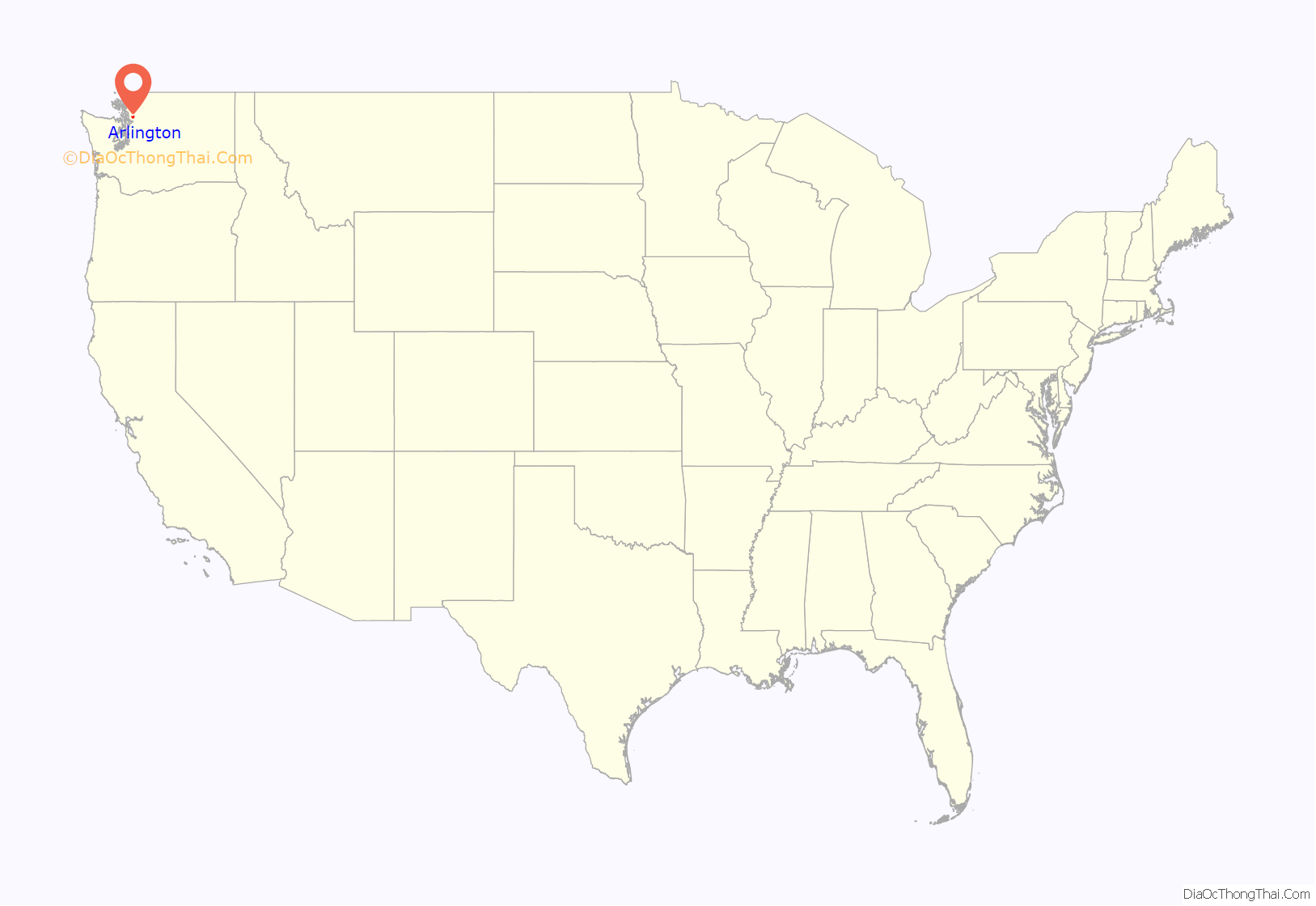
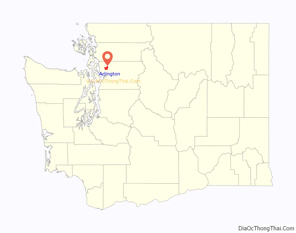
Arlington is a city in northern Snohomish County, Washington, United States, part of the Seattle metropolitan area. The city lies on the Stillaguamish River in the western foothills of the Cascade Range, adjacent to the city of Marysville. It is approximately 10 miles (16 km) north of Everett, the county seat, and 40 miles (64 km) north of Seattle, the state’s largest city. As of the 2020 U.S. census, Arlington had a population of 19,868; its estimated population is 20,075 as of 2021.
Arlington was established in the 1880s by settlers and the area was platted as two towns, Arlington and Haller City. Haller City was absorbed by the larger Arlington, which was incorporated as a city in 1903. During the Great Depression of the 1930s, the Arlington area was the site of major projects undertaken for employment under the direction of federal relief agencies, including construction of a municipal airport that would serve as a naval air station during World War II. Arlington began suburbanizing in the 1980s, growing by more than 450 percent by 2000 and annexing the unincorporated area of Smokey Point to the southwest.
The economy of the Arlington area historically relied on timber and agriculture. In the early 21st century, it has transitioned to a service economy, with some aviation industry jobs near the municipal airport. The city is governed by a mayor–council government, electing a mayor and seven city councilmembers. The municipal government maintains the city’s parks system and water and wastewater utilities. Other services, including public utilities, public transportation, and schools, are contracted to regional or county-level agencies and companies.
| Name: | Arlington city |
|---|---|
| LSAD Code: | 25 |
| LSAD Description: | city (suffix) |
| State: | Washington |
| County: | Snohomish County |
| Incorporated: | May 20, 1903 |
| Elevation: | 115 ft (35 m) |
| Total Area: | 9.81 sq mi (25.4 km²) |
| Land Area: | 9.80 sq mi (25.4 km²) |
| Water Area: | 0.01 sq mi (0.03 km²) |
| Total Population: | 19,868 |
| Population Density: | 2,024.45/sq mi (781.64/km²) |
| ZIP code: | 98223 |
| Area code: | 360 |
| FIPS code: | 5302585 |
| GNISfeature ID: | 1515947 |
| Website: | www.arlingtonwa.gov |
Online Interactive Map
Click on ![]() to view map in "full screen" mode.
to view map in "full screen" mode.
Arlington location map. Where is Arlington city?
History
Pre-contact and settlement
Prior to American settlement in the 19th century, the Puget Sound region was inhabited by indigenous Coast Salish peoples. The Stillaguamish people had a permanent village at the confluence of the two forks of the Stillaguamish River where they followed fish runs. This village, called Skabalco or Skabalko (Lushootseed: sq̓ʷuʔalqʷuʔ) meaning “confluence”), had two winter houses, with 200-300 people living there at the time. The early settlement of Haller City (now Haller Park) was later developed just downriver of this site. The area slightly south of the river is called stiqayuʔ, meaning “wolf”; Arlington was later developed there. The modern-day neighborhood of Kent Prairie (Lushootseed: xʷbaqʷab) was once a prairie where members of the tribe would gather wild crops. They also had a major village at Chuck-Kol-Che upriver near modern-day Trafton
American exploration of the area began in 1851, when prospector Samuel Hancock was led by Indian guides on a canoe up the Stillaguamish River. The area was opened to logging after the signing of the Treaty of Point Elliott in 1855 between the United States government and the Stillaguamish tribe, who were relocated to trust lands and the Tulalip Indian Reservation.
The U.S. Army built a military road connecting Fort Steilacoom to Fort Bellingham, crossing the Stillaguamish River near the confluence. In the 1880s, wagon roads were constructed to this area from the towns of Marysville to the south and Silvana to the west, bringing entrepreneurs to the logging camps, informally named “The Forks”. The area’s first store was opened in 1888 by Nels K. Tvete and Nils C. Johnson, and was followed by a hotel with lodging and meals for loggers.
Two settlements were established on the south side of the confluence in anticipation of the Seattle, Lake Shore and Eastern Railway building a track through the area. G. Morris Haller, son of Colonel Granville O. Haller, founded a settlement on the banks of the Stillaguamish River in 1883, naming it “Haller City”.
The Seattle, Lake Shore & Eastern Railroad chose to build its depot on higher ground to the south of Haller City, leading contractors Earl & McLeod to establish a new town at the depot on March 15, 1890. The new town was named “Arlington” after Lord Henry Arlington, member of the cabinet of King Charles II of England. Arlington and Haller City were platted within a month of each other in 1890, quickly developing a rivalry that would continue for several years.
Arlington and Haller City grew rapidly in their first years, reaching a combined population of 500 by 1893, relying on agriculture, dairy farming and the manufacturing of wood shingles as their main sources of income. Both towns established their own schools, post offices, saloons, general stores, churches, social clubs, and hotels. The two towns were separated by a 40-acre (16 ha) tract claimed by two settlers in 1891, preventing either town from fully absorbing the other. During the late 1890s, the claim dispute was settled and merchants began moving to the larger, more prosperous Arlington, signalling the end for Haller City. Today, Haller City is memorialized in the name of a park in downtown Arlington, as well as a middle school operated by the Arlington School District.
Incorporation and early 20th century
Arlington was incorporated as a fourth-class city on May 20, 1903, including the remnants of Haller City (located north of modern-day Division Street). The incorporation came after a referendum on May 5, in which 134 of 173 voters approved the city’s incorporation. The new city elected shingle mill owner John M. Smith as its first mayor. In the years following incorporation, Arlington gained a local bank, a cooperative creamery, a city park, a library, electricity, and telephone service.
During the early 20th century, Arlington’s largest employers remained its shingle mills and saw mills. Other industries, including dairy processing, mechanical shops, stores, and factories, became prominent after World War I, during a period of growth for the city. The Great Depression of the 1930s forced all but one of the mills to close, causing unemployment to rise in Arlington and neighboring cities. The federal government established a Civilian Conservation Corps (CCC) camp near Darrington to create temporary jobs; the young men built structures and conducted firefighting in the Mount Baker National Forest. The Works Progress Administration and Civil Works Administration funded the construction of the city’s sidewalks, a high school, and a municipal airport that opened in 1934.
The entry of the United States into World War II brought the U.S. Navy to Arlington, resulting in the conversion of the municipal airport into a naval air station in 1943. The Navy constructed new runways and hangars and, beginning in 1946, the municipal government was allowed to operate civilian and commercial services. Ownership of the airport was formally transferred from the federal government back to the city of Arlington in 1959.
On October 19, 1959, a Boeing 707-227 crashed on the banks of the Stillaguamish River’s North Fork during a test flight, killing four of eight occupants. The plane, being flown by Boeing test pilots instructing personnel from Braniff International Airways, lost three engines and suffered a fire in the fourth after a dutch roll had been executed beyond maximum bank restrictions. The plane made an emergency landing in the riverbed while unsuccessfully trying to reach a nearby open field.
Suburbanization and present day
The completion of Interstate 5 and State Route 9 in the late 1960s brought increased residential development in Arlington, forming a bedroom community for commuters who worked in Everett and Seattle. Despite the influx of commuting residents, Arlington retained its small-town image while unsuccessfully attempting to lure new industries and a state college. Suburban housing developments began construction in the 1980s and 1990s, driving a 450 percent increase in Arlington’s population to 15,000 by 2007. In 1999, Arlington annexed the community of Smokey Point, located along Interstate 5 to the southwest of the city, after a lengthy court battle with Marysville, which instead was permitted to annex Lakewood to the west. The city began developing a large business park around the municipal airport in the 1990s, bringing the city’s number of jobs to a total of 11,000 by 2003.
The city of Arlington celebrated its centennial in 2003 with a parade, a festival honoring the city’s history, sporting events, and musical and theatrical performances. The centennial celebrations culminated in the dedication of the $44 million Arlington High School campus, attended by an all-class reunion of the old school. In 2007, the city of Arlington renovated six blocks of downtown’s Olympic Avenue at a cost of $4.4 million, widening sidewalks, improving street foliage, and adding new street lights. The project was credited with helping revitalize the city’s downtown, turning Olympic Avenue into a gathering place for residents and a venue for festivals.
On March 22, 2014, a large landslide near Oso dammed the North Fork of the Stillaguamish River, with mud and debris covering an area of one square mile (2.6 km). A total of 43 people were killed and nearly 50 structures destroyed. The landslide closed State Route 530 to Darrington, cutting the town off, leaving Arlington as the center of the coordinated emergency response to the disaster. Arlington was recognized for its role in aiding victims of the disaster and hosted U.S. President Barack Obama during his visit to the site in April.
The city has continued to grow in the late 2010s, with new apartment buildings constructed in Smokey Point, including those designed as retirement communities. The Cascade Industrial Center, located on 4,000 acres (1,600 ha) between Arlington and Marysville, was designated by the Puget Sound Regional Council in 2019 and is planned to house manufacturing and other industrial uses.
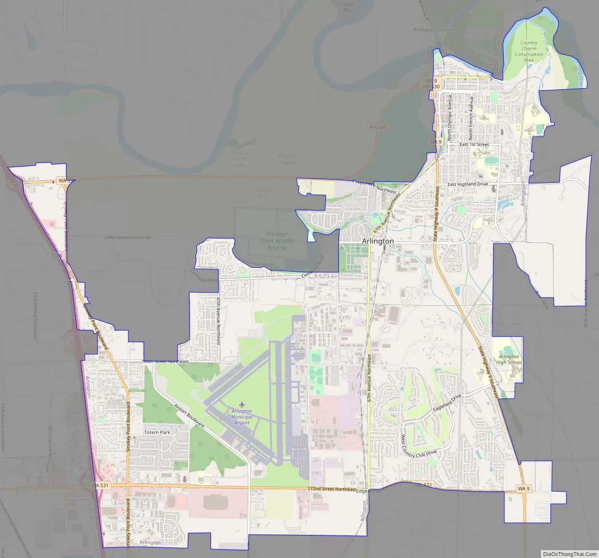
Arlington Road Map
Arlington city Satellite Map
Geography
According to the United States Census Bureau, the city of Arlington has a total area of 9.26 square miles (23.98 km), of which 9.25 square miles (23.96 km) is land and 0.01 square miles (0.03 km) is water. The city is in the northwestern part of Snohomish County in Western Washington, and is considered part of the Seattle metropolitan area. It is approximately 41 miles (66 km) north of Seattle and 10 miles (16 km) north of Everett. Arlington’s city limits are generally defined to the south by Marysville at State Route 531 (172nd Street NE) and roughly 165th Street NE, to the west by Interstate 5, to the north by the Stillaguamish River valley, and to the east by the Cascade Range foothills. The city’s urban growth boundary includes 10.3 square miles (27 km) within and outside of city limits.
The city lies on a glacial terrace formed during the Pleistocene epoch by the recession of the Cordilleran Ice Sheet. Arlington covers a series of hills that sit at an elevation of 100 to 200 feet (30 to 61 m) above sea level. Downtown Arlington is situated on a bluff above the confluence of the Stillaguamish River and its North and South Forks. Most of Arlington sits in the watersheds of the Stillaguamish River, Portage Creek, and Quilceda Creek. From various points in Arlington, the Olympic Mountains, Mount Pilchuck, and Mount Rainier are visible on the horizon.
The Stillaguamish River valley and floodplain, including Arlington, lies in a lahar hazard zone 60 miles (97 km) downstream from Glacier Peak, an active stratovolcano in the eastern part of the county. During an eruption 13,000 years ago, several eruption-generated lahars deposited more than 7 feet (2 m) of sediment on modern-day Arlington.
Subareas and neighborhoods
The city of Arlington publishes a decennial comprehensive plan, which divides the urban growth area into ten planning subareas, each containing neighborhoods and subdivisions.
- Old Town consists of downtown Arlington and surrounding residential neighborhoods built during the early 20th century. The northern reaches of Old Town include commercial areas developed during the post-war period that are distinct from older buildings along Olympic Avenue.
- Arlington Bluff is a residential area between the Stillaguamish River floodplain and the Arlington Municipal Airport industrial center.
- Kent Prairie, a residential area south of Old Town, was developed in the early post-war period. The subarea also includes retail stores centered around the intersection of State Route 9 and 204th Street NE. The area was once home to a Stillaguamish village, as well as Arlington’s first schoolhouse, built in 1884.
- The designated Manufacturing Industrial Center is an industrial district southwest of Old Town, surrounding the Arlington Municipal Airport and the city’s only active railroad.
- Hilltop consists of Arlington’s largest planned residential subdivisions, including Gleneagle, Crown Ridge, and the Magnolias. It is south of Kent Prairie on a large terrace on the west side of State Route 9. Gleneagle is Arlington’s largest single development, with over 1,000 homes and a private golf course.
- The Brekhus/Beach subarea, also known as Burn Hill, is a residential area southeast of Old Town and is centered along Burn Road.
The West Arlington Subarea, designated in 2011, combines several neighborhoods annexed by Arlington in the 1990s and 2000s, including Smokey Point and Island Crossing.
- Smokey Point, annexed by Arlington in 1999, is a major commercial and residential area at the junction of Interstate 5 and State Route 531, southwest of Arlington. Portions of Smokey Point extend south and west into the city of Marysville, which annexed the area in the 2000s.
- Island Crossing, at the junction of Interstate 5 and State Route 530, is a rural community with a cluster of retail stores. It was annexed by Arlington in 2008, and has been re-designated for commercial development.
- The proposed King-Thompson subarea is northwest of Smokey Point and lies outside of Arlington’s city limits and urban growth boundary. It has been identified as a potential area for extensive residential development. The municipal government applied to annex the area into the city’s urban growth area in 2013, but withdrew the application in 2016.
Climate
Arlington has a general climate similar to most of the Puget Sound lowlands, with dry summers and mild, rainy winters moderated by a marine influence from the Pacific Ocean. The majority of the region’s precipitation arrives during the winter and early spring, and Arlington averages 181 days of precipitation per year. Arlington’s location in the foothills of the Cascade Range brings additional precipitation compared to nearby communities, with 46 inches (1,200 mm) annually compared to 33 inches (840 mm) in Everett. Arlington rarely receives significant snowfall, with an average of 7 inches (18 cm) per year since 1922.
July is Arlington’s warmest month, with average high temperatures of 73.6 °F (23.1 °C), while January is the coolest, at an average high of 44.5 °F (6.9 °C). The highest recorded temperature, 103 °F (39 °C), occurred on June 28, 2021, amid a regional heat wave, and the lowest, 7 °F (−14 °C), occurred on January 1, 1979. According to the Köppen climate classification system, Arlington has a warm-summer Mediterranean climate (Csb).
See also
Map of Washington State and its subdivision:- Adams
- Asotin
- Benton
- Chelan
- Clallam
- Clark
- Columbia
- Cowlitz
- Douglas
- Ferry
- Franklin
- Garfield
- Grant
- Grays Harbor
- Island
- Jefferson
- King
- Kitsap
- Kittitas
- Klickitat
- Lewis
- Lincoln
- Mason
- Okanogan
- Pacific
- Pend Oreille
- Pierce
- San Juan
- Skagit
- Skamania
- Snohomish
- Spokane
- Stevens
- Thurston
- Wahkiakum
- Walla Walla
- Whatcom
- Whitman
- Yakima
- Alabama
- Alaska
- Arizona
- Arkansas
- California
- Colorado
- Connecticut
- Delaware
- District of Columbia
- Florida
- Georgia
- Hawaii
- Idaho
- Illinois
- Indiana
- Iowa
- Kansas
- Kentucky
- Louisiana
- Maine
- Maryland
- Massachusetts
- Michigan
- Minnesota
- Mississippi
- Missouri
- Montana
- Nebraska
- Nevada
- New Hampshire
- New Jersey
- New Mexico
- New York
- North Carolina
- North Dakota
- Ohio
- Oklahoma
- Oregon
- Pennsylvania
- Rhode Island
- South Carolina
- South Dakota
- Tennessee
- Texas
- Utah
- Vermont
- Virginia
- Washington
- West Virginia
- Wisconsin
- Wyoming


