Auburn is a city in King County, Washington, United States (with a small portion crossing into neighboring Pierce County). The population was 87,256 at the 2020 Census. Auburn is a suburb in the Seattle metropolitan area, and is currently ranked as the 14th largest city in the state of Washington.
Auburn is bordered by the cities of Federal Way, Pacific, and Algona to the west, Sumner to the south, Kent to the north, and unincorporated King County to the east. The Muckleshoot Indian Reservation lies to the south and southeast.
| Name: | Auburn city |
|---|---|
| LSAD Code: | 25 |
| LSAD Description: | city (suffix) |
| State: | Washington |
| County: | King County, Pierce County |
| Founded: | June 13, 1891 |
| Elevation: | 82.62 ft (25 m) |
| Total Area: | 29.87 sq mi (77.35 km²) |
| Land Area: | 29.58 sq mi (76.60 km²) |
| Water Area: | 0.29 sq mi (0.75 km²) |
| Total Population: | 87,256 |
| Population Density: | 2,754.30/sq mi (1,063.45/km²) |
| ZIP code: | 98001, 98002, 98092, 98071 |
| Area code: | 253 |
| FIPS code: | 5303180 |
| GNISfeature ID: | 1511974 |
| Website: | auburnwa.gov |
Online Interactive Map
Click on ![]() to view map in "full screen" mode.
to view map in "full screen" mode.
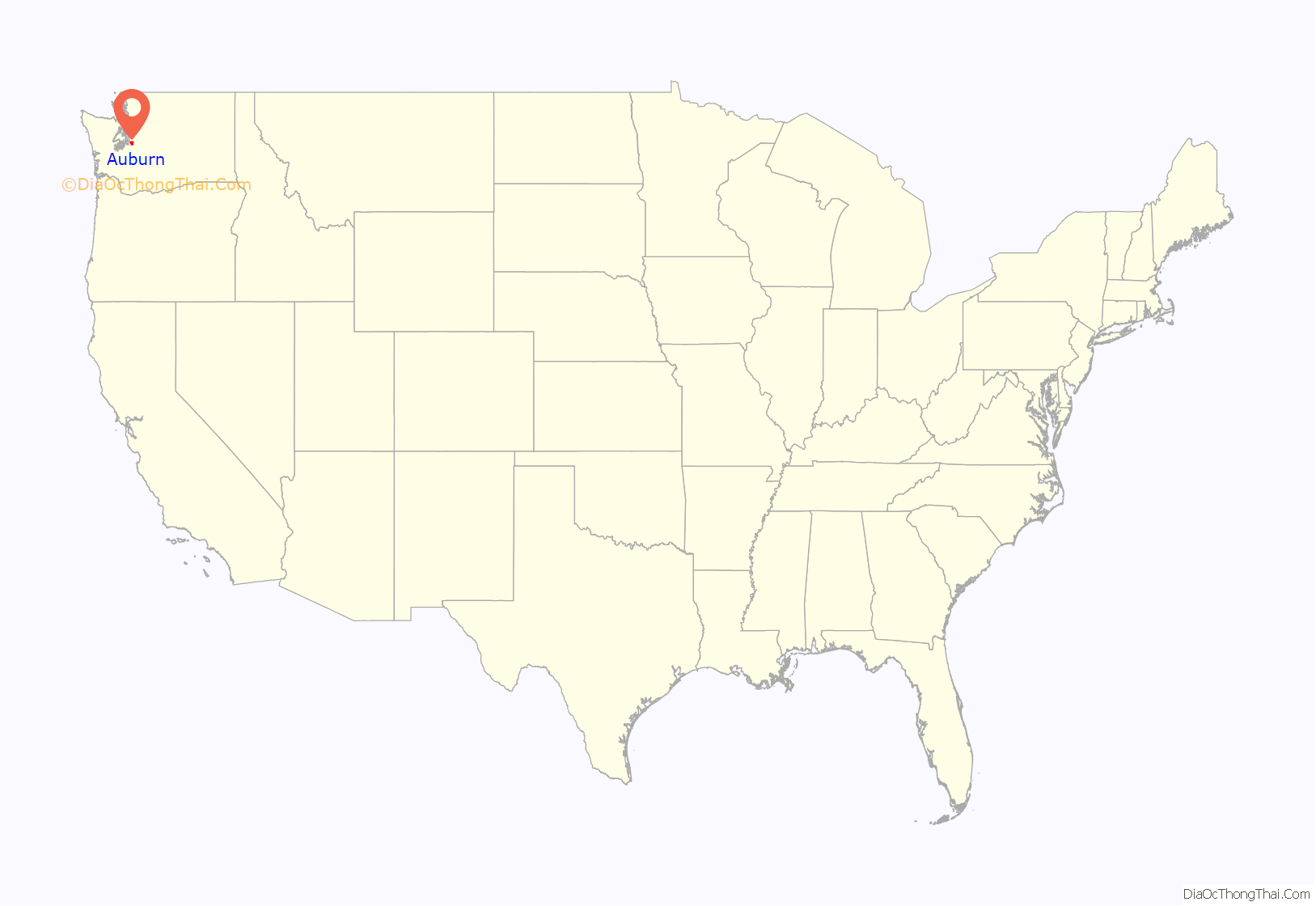
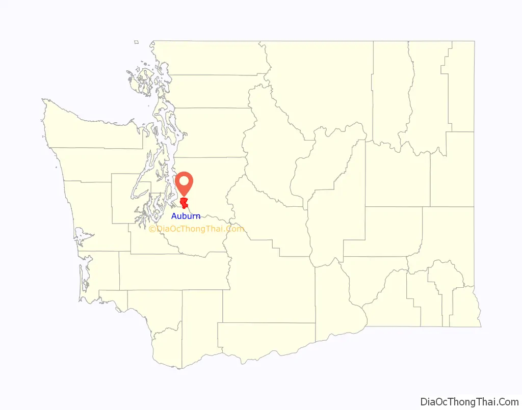
Auburn location map. Where is Auburn city?
History
Before the first non-indigenous settlers arrived in the Green River Valley in the 1850s, the area was home to the Muckleshoot people, who were temporarily driven out by Indian wars later that decade. Several settler families arrived in the 1860s, including Levi Ballard, who set up a homestead between the Green and White rivers. Ballard filed for a plat to establish a town in February 1886, naming it Slaughter for an officer slain during the Indian wars in 1855.
Slaughter was incorporated on June 13, 1891, but its name was changed two years later to Auburn on February 21, 1893, by an action of the state legislature. Newer residents had disliked the name and its connection to the word “slaughter”, especially after the town’s hotel was named the Slaughter House. The name Auburn was chosen in honor of Auburn, New York, for the area’s shared reliance on hops farming.
The White and Green Rivers have been a major part of the history and culture of Auburn since the area was settled with multiple locations in the city being named after either of the two rivers. Frequent flooding from the rivers caused numerous problems for the people living in the community with one outcome being the creation of Mountain View Cemetery over on one of the hills overlooking the valley. It was not until the completion of the Mud Mountain Dam and the Howard A. Hanson Dam, along the White River and Green River respectively, that the flooding would cease and allow the city to grow without the aforementioned hurdle impeding the growth.
In 1917 the city, in response to the growing of the Japanese community, donated some of the land in Pioneer Cemetery to the White River Buddhist Church. A little over ten years later, Rev. Giryo Takemura, minister of the church at the time, and his future son-in-law, Chiyokichi Natsuhara, raised money to replace the old wooden sticks and columns that had been in use as gravestones at the Cemetery with more durable concrete markers. The interwar period saw several Japanese-American baseball teams from the area compete in the courier league with the White River All-Stars enjoying particularly large success winning four of the July 4th tournaments. In 1930 a Japanese bath house was constructed outside of Neely Mansion by the then current tenants.
The onset of the Second World War saw the Japanese-American community of Auburn become seen with largely unwarranted distrust by many of the white residents of Auburn. This, combined with a larger countrywide Japanese focused xenophobia, led to the city’s Japanese-American population being relocated to internment camps. After the war, of about 300 Japanese families living in Auburn only around twenty five returned.
In 2008, Auburn annexed the West Hill and Lea Hill neighborhoods of unincorporated King County, adding 15,000 residents and expanding its land area by 26 percent.
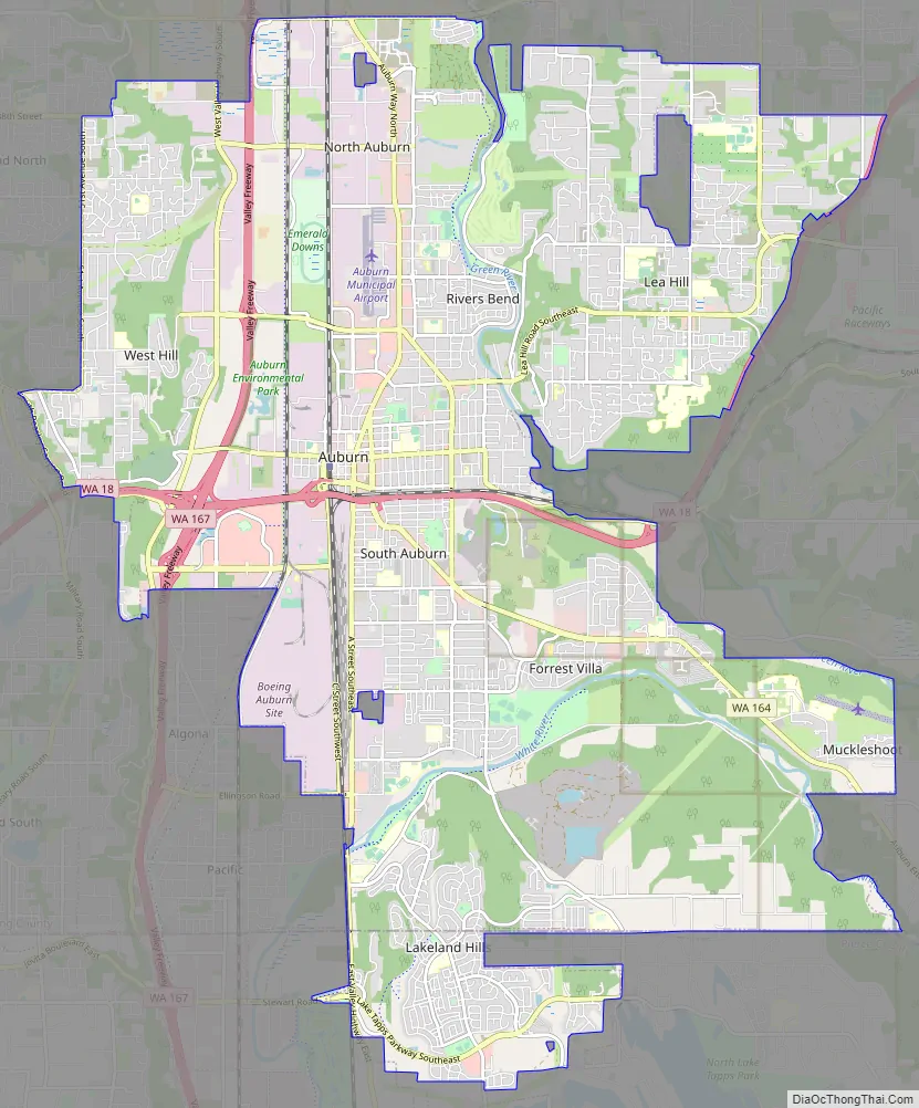
Auburn Road Map
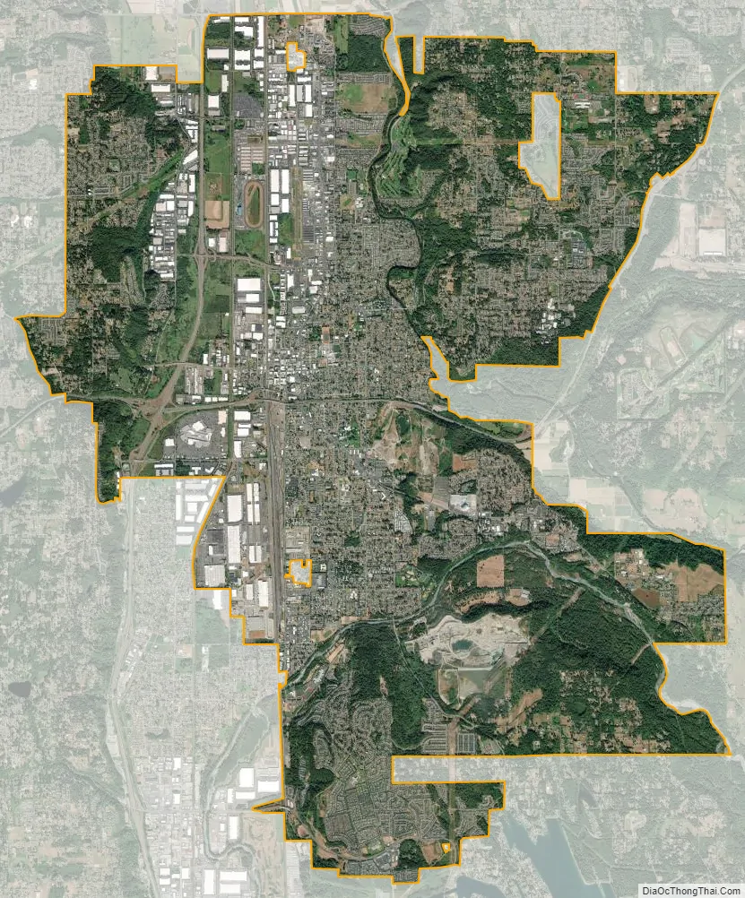
Auburn city Satellite Map
Geography
According to the United States Census Bureau, the city has a total area of 29.89 square miles (77.41 km), of which 29.62 square miles (76.72 km) is land and 0.27 square miles (0.70 km) is water.
Two rivers, the White River and, to a greater extent, the Green River flow through Auburn.
Historically, the Stuck River ran through the settlement of Stuck, which is now a small pocket of unincorporated King County within southern Auburn. In 1906, the flow of the White River was diverted into the Stuck’s channel near today’s Game Farm Park. References to the Stuck River still appear in some property legal descriptions and place names, e.g. Stuck River Drive, within Auburn, but today it is essentially indistinguishable from the southern White River.
Neighborhoods
- Downtown—Historic buildings with a traditional main street and also many Craftsman-style houses from the 1920s.
- North Auburn—A mix of commercial and single-family housing separated by Auburn Way North.
- River’s Bend—A small residential neighborhood nestled along the Green River, located at the bottom of Lea Hill in North Auburn.
- Christopher/Thomas—An area in North Auburn roughly bordered by the Valley Drive Inn and 227th Street. Both are former farming towns annexed into the city in the 1960s.
- Lea Hill—A mainly residential neighborhood east of the valley, annexed into the city in 2007. Green River College is located here.
- Hazelwood—The area on Lea Hill between Green River Community College, and Auburn Mountainview High School. Once a town in the late nineteenth century.
- West Valley—A commercial and industrial area on the west side of SR 167, located on the bottom of West Hill.
- West Hill—Located on the West Hill, bordered by the city of Federal Way to the west.
- South Auburn—A general area located south of downtown, once a low-income area but becoming a commercial zone.
- Terminal Park—An area of middle class housing near the end of the rail yard named for the railroad workers who lived there.
- Forest Villa—Mainly residential area located in the Game Farm Park area.
- Lakeland Hills—A master-planned community sprawling on a large hillside at the southern end of the city on both sides of King and Pierce counties.
- Hidden Valley—A planned development located East of Lakeland Hills overlooking North Lake Tapps.
Climate
See also
Map of Washington State and its subdivision:- Adams
- Asotin
- Benton
- Chelan
- Clallam
- Clark
- Columbia
- Cowlitz
- Douglas
- Ferry
- Franklin
- Garfield
- Grant
- Grays Harbor
- Island
- Jefferson
- King
- Kitsap
- Kittitas
- Klickitat
- Lewis
- Lincoln
- Mason
- Okanogan
- Pacific
- Pend Oreille
- Pierce
- San Juan
- Skagit
- Skamania
- Snohomish
- Spokane
- Stevens
- Thurston
- Wahkiakum
- Walla Walla
- Whatcom
- Whitman
- Yakima
- Alabama
- Alaska
- Arizona
- Arkansas
- California
- Colorado
- Connecticut
- Delaware
- District of Columbia
- Florida
- Georgia
- Hawaii
- Idaho
- Illinois
- Indiana
- Iowa
- Kansas
- Kentucky
- Louisiana
- Maine
- Maryland
- Massachusetts
- Michigan
- Minnesota
- Mississippi
- Missouri
- Montana
- Nebraska
- Nevada
- New Hampshire
- New Jersey
- New Mexico
- New York
- North Carolina
- North Dakota
- Ohio
- Oklahoma
- Oregon
- Pennsylvania
- Rhode Island
- South Carolina
- South Dakota
- Tennessee
- Texas
- Utah
- Vermont
- Virginia
- Washington
- West Virginia
- Wisconsin
- Wyoming


