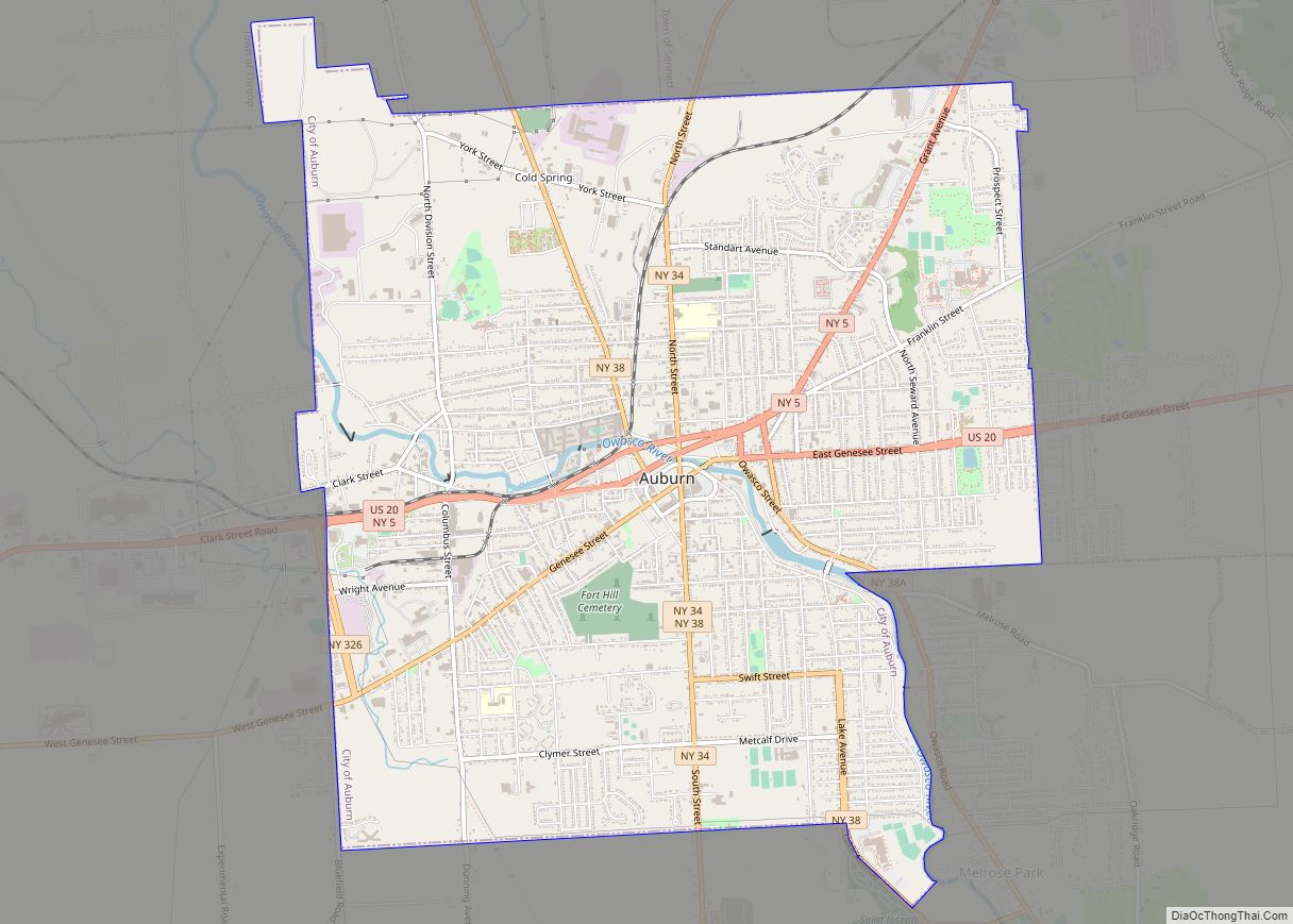
Auburn is a city in Cayuga County, New York, United States. Located at the north end of Owasco Lake, one of the Finger Lakes in Central New York, the city had a population of 26,866 at the 2020 census. It is the largest city of Cayuga County, the county seat, and the site of the maximum-security Auburn Correctional Facility, as well as the William H. Seward House Museum and the house of abolitionist Harriet Tubman.
| Name: | Auburn city |
|---|---|
| LSAD Code: | 25 |
| LSAD Description: | city (suffix) |
| State: | New York |
| County: | Cayuga County |
| Incorporated: | 1815 (village) 1848 (city) |
| Elevation: | 686 ft (209 m) |
| Total Area: | 8.41 sq mi (21.78 km²) |
| Land Area: | 8.34 sq mi (21.59 km²) |
| Water Area: | 0.08 sq mi (0.20 km²) |
| Total Population: | 26,866 |
| Population Density: | 3,223.28/sq mi (1,244.46/km²) |
| ZIP code: | 13021 |
| Area code: | 315 |
| FIPS code: | 3603078 |
| GNISfeature ID: | 0942692 |
| Website: | www.auburnny.gov |
Online Interactive Map
Click on ![]() to view map in "full screen" mode.
to view map in "full screen" mode.
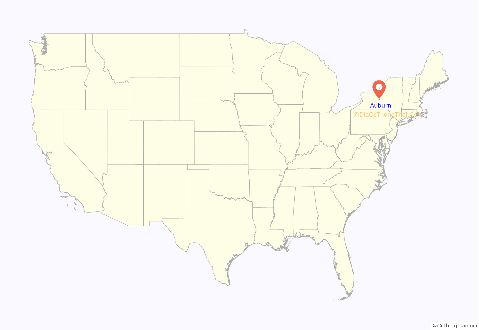
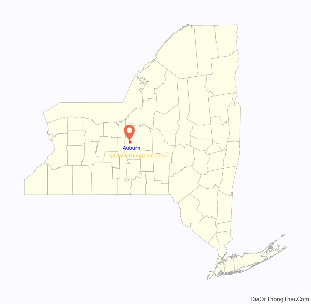
Auburn location map. Where is Auburn city?
History
The region around Auburn had been Haudenosaunee territory for centuries before European contact and historical records.
Auburn was founded in 1793, during the post-Revolutionary period of settlement of western New York. The founder, John L. Hardenbergh, was a veteran of the Sullivan-Clinton campaign against the Iroquois during the American Revolution. Hardenbergh settled in the vicinity of the Owasco River with his infant daughter and two African-American indentured servants, Harry and Kate Freeman. After his death in 1806, Hardenbergh was buried in Auburn’s North Street Cemetery, and was re-interred in 1852 in Fort Hill Cemetery – the first burial in the city’s newly opened burial ground. The community grew up around Hardenbergh’s gristmill and sawmill.
Originally known as Hardenbergh’s Corners in the town of Aurelius, the settlement was renamed Auburn in 1805 when it became the county seat. It became an incorporated village in 1815, and was chartered as a city in 1848. It was only a few miles from the Erie Canal, which opened in 1825 and allowed local factories to inexpensively ship goods north or south. In 1871, the Southern Central Railroad, financed by the Lehigh Valley Railroad, completed a line primarily to carry anthracite coal from Athens, Pennsylvania through Auburn to wharves on Lake Ontario at Fair Haven.
From 1818 to 1939, Auburn was home to Auburn Theological Seminary, one of the preeminent theological seminaries in the United States. In 1939, facing financial difficulties as a result of the Great Depression, the seminary moved to the campus of Union Theological Seminary in New York City. The only building from the Auburn Theological Seminary that stands today is Willard Memorial Chapel and the adjacent Welch Memorial Hall on Nelson Street, designed by Andrew Jackson Warner of Rochester, with stained-glass windows and interior decoration by Louis Comfort Tiffany. It is the only complete and unaltered Tiffany chapel interior known to exist.
In 1816, Auburn Prison (now the Auburn Correctional Facility) was founded as a model for the contemporary ideas about treating prisoners, known now as the Auburn system. Visitors were charged a fee for viewing the facility and its inmates. On August 6, 1890, the first execution by the electric chair was carried out at Auburn Prison. In 1901 Leon Czolgosz, assassin of President William McKinley, was executed there. Although the ideas of the Auburn System have been abandoned, the prison continues to serve as a maximum security facility, and is one of the most secure prisons in the continental United States.
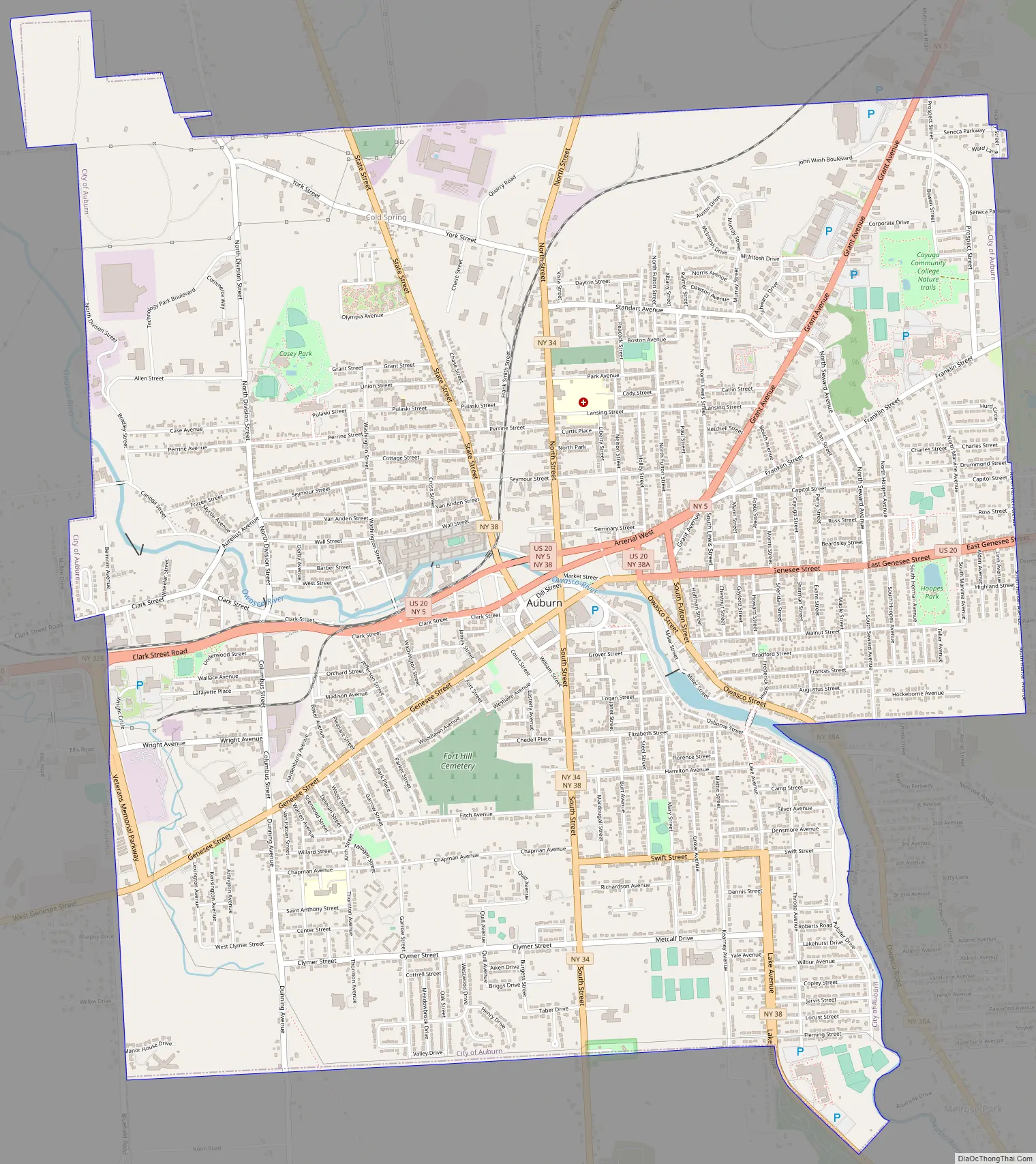
Auburn Road Map
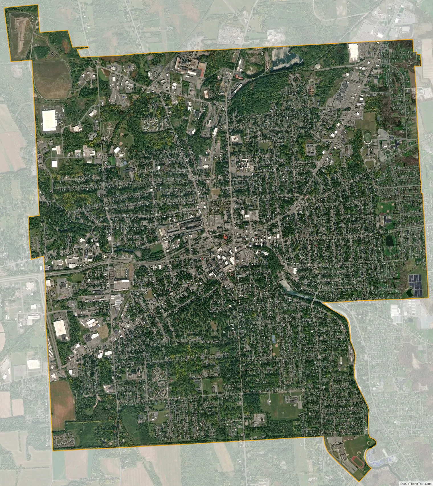
Auburn city Satellite Map
Geography
Auburn is located at 42.9317° N, 76.5661° W at the north end of Owasco Lake, one of the Finger Lakes, which is drained by the Owasco Outlet – also known as the Owasco River – which runs north through the city on its way to the Seneca River. A dam, owned and operated by the city, controls the outflow of the lake, which is used for drinking water and recreation. The city is required to keep a sufficient amount of water in the river to deal with the effluent from its waste disposal treatment facility.
According to the United States Census Bureau, the city has a total area of 8.4 square miles (21.8 km), of which 8.3 square miles (21.6 km) is land and 0.08 square miles (0.2 km), or 0.89%, is water.
US 20 is an important east-west highway passing through the city, and New York State Route 34 and New York State Route 38 are north-south highways that intersect US-20 in Auburn. Seneca Falls is 15 miles (24 km) west on US 20, and Syracuse is 26 miles (42 km) to the northeast via New York State Route 5.
See also
Map of New York State and its subdivision:- Albany
- Allegany
- Bronx
- Broome
- Cattaraugus
- Cayuga
- Chautauqua
- Chemung
- Chenango
- Clinton
- Columbia
- Cortland
- Delaware
- Dutchess
- Erie
- Essex
- Franklin
- Fulton
- Genesee
- Greene
- Hamilton
- Herkimer
- Jefferson
- Kings
- Lake Ontario
- Lewis
- Livingston
- Madison
- Monroe
- Montgomery
- Nassau
- New York
- Niagara
- Oneida
- Onondaga
- Ontario
- Orange
- Orleans
- Oswego
- Otsego
- Putnam
- Queens
- Rensselaer
- Richmond
- Rockland
- Saint Lawrence
- Saratoga
- Schenectady
- Schoharie
- Schuyler
- Seneca
- Steuben
- Suffolk
- Sullivan
- Tioga
- Tompkins
- Ulster
- Warren
- Washington
- Wayne
- Westchester
- Wyoming
- Yates
- Alabama
- Alaska
- Arizona
- Arkansas
- California
- Colorado
- Connecticut
- Delaware
- District of Columbia
- Florida
- Georgia
- Hawaii
- Idaho
- Illinois
- Indiana
- Iowa
- Kansas
- Kentucky
- Louisiana
- Maine
- Maryland
- Massachusetts
- Michigan
- Minnesota
- Mississippi
- Missouri
- Montana
- Nebraska
- Nevada
- New Hampshire
- New Jersey
- New Mexico
- New York
- North Carolina
- North Dakota
- Ohio
- Oklahoma
- Oregon
- Pennsylvania
- Rhode Island
- South Carolina
- South Dakota
- Tennessee
- Texas
- Utah
- Vermont
- Virginia
- Washington
- West Virginia
- Wisconsin
- Wyoming