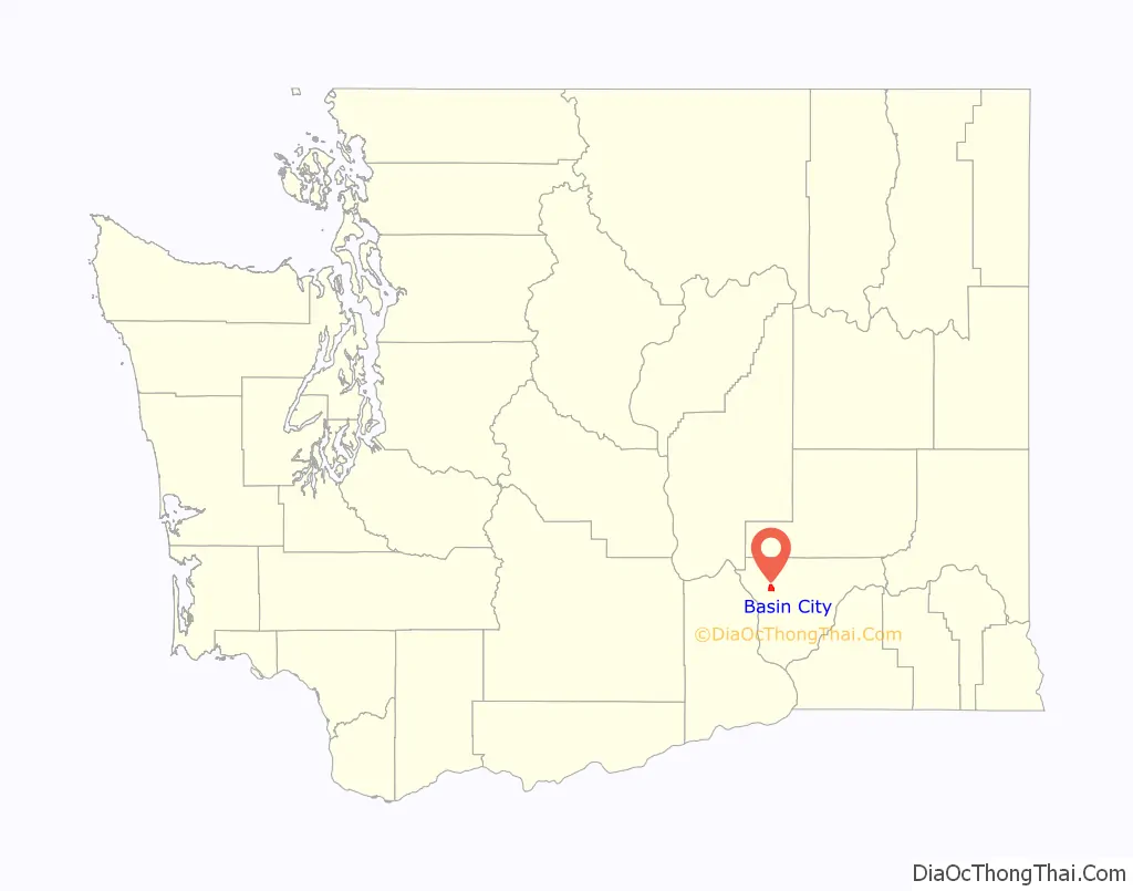
Basin City (/ˈbeɪsən ˈsɪtiː/) is an unincorporated community and census-designated place (CDP) in Franklin County, Washington, United States. The population was 1,092 at the 2010 census, up from 968 at the 2000 census.
| Name: | Basin City CDP |
|---|---|
| LSAD Code: | 57 |
| LSAD Description: | CDP (suffix) |
| State: | Washington |
| County: | Franklin County |
| Elevation: | 702 ft (214 m) |
| Total Area: | 3.2 sq mi (8.3 km²) |
| Land Area: | 3.2 sq mi (8.3 km²) |
| Water Area: | 0.0 sq mi (0.0 km²) |
| Total Population: | 1,092 |
| Population Density: | 342/sq mi (132.2/km²) |
| ZIP code: | 99343 |
| Area code: | 509 |
| FIPS code: | 5304405 |
| GNISfeature ID: | 1511987 |
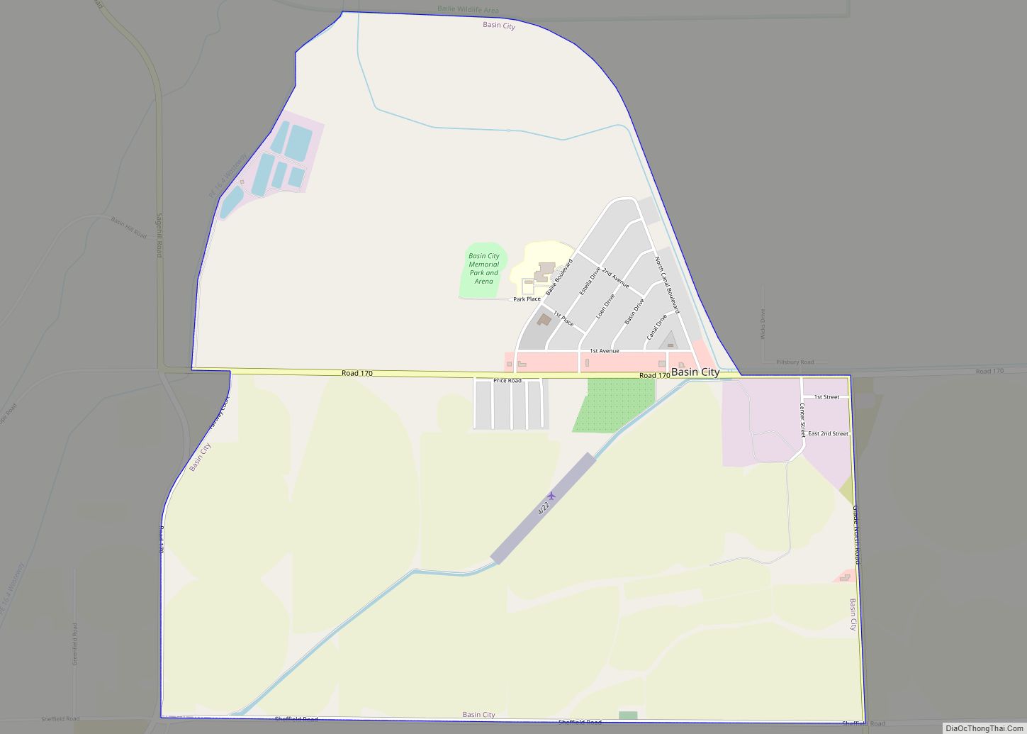
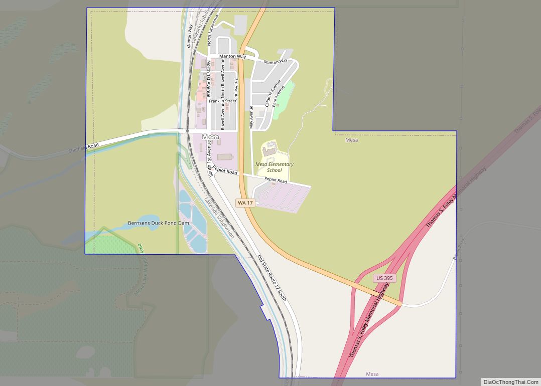
Online Interactive Map
Click on ![]() to view map in "full screen" mode.
to view map in "full screen" mode.
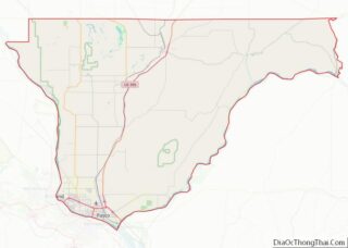
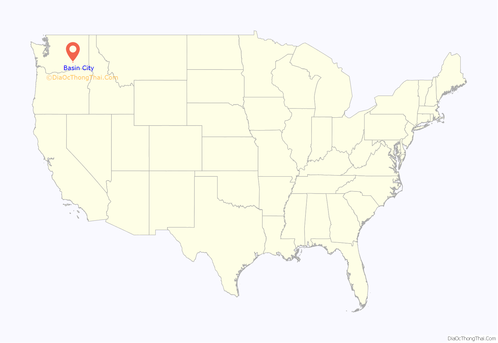
Basin City location map. Where is Basin City CDP?
History
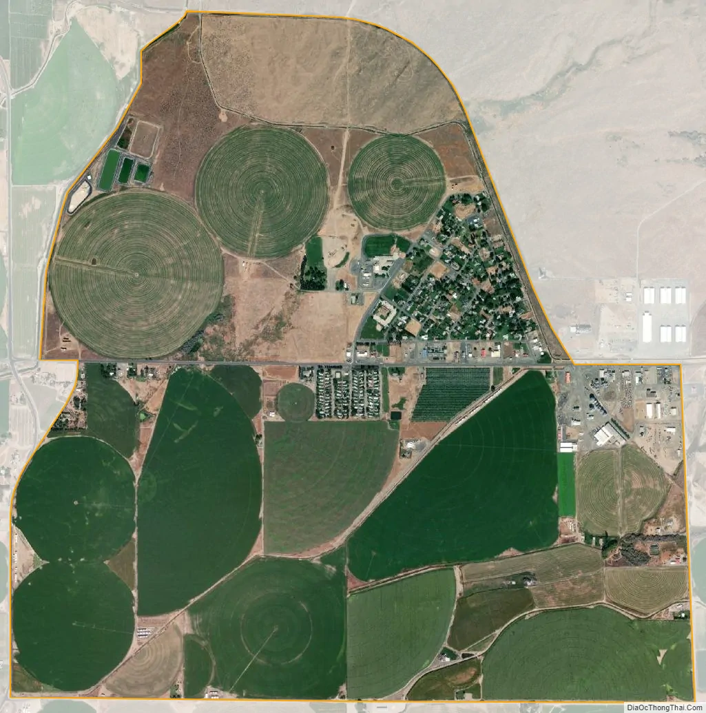
The town of Basin City was laid out in the 1950s on land owned by dry-land farmer Loen Bailie. The town was established to support the local agricultural community which was being opened to irrigation through the Columbia Basin Project. The new settlers to the area consisted primarily of young farmers from Idaho and southwestern Oregon and World War II veterans, who received preferential status on the purchase of federal lands that were sold as part of the project. Early crops included sugar beets, alfalfa, corn, asparagus, wheat and barley. Later, potatoes, beans, carrots, and onions also became important, while sugar beet production stopped due to closure of a local sugar beet plant. A large number of orchards were planted, and the area is now a major supplier of the famous Washington apples. Cherries and other fruits are also produced locally.
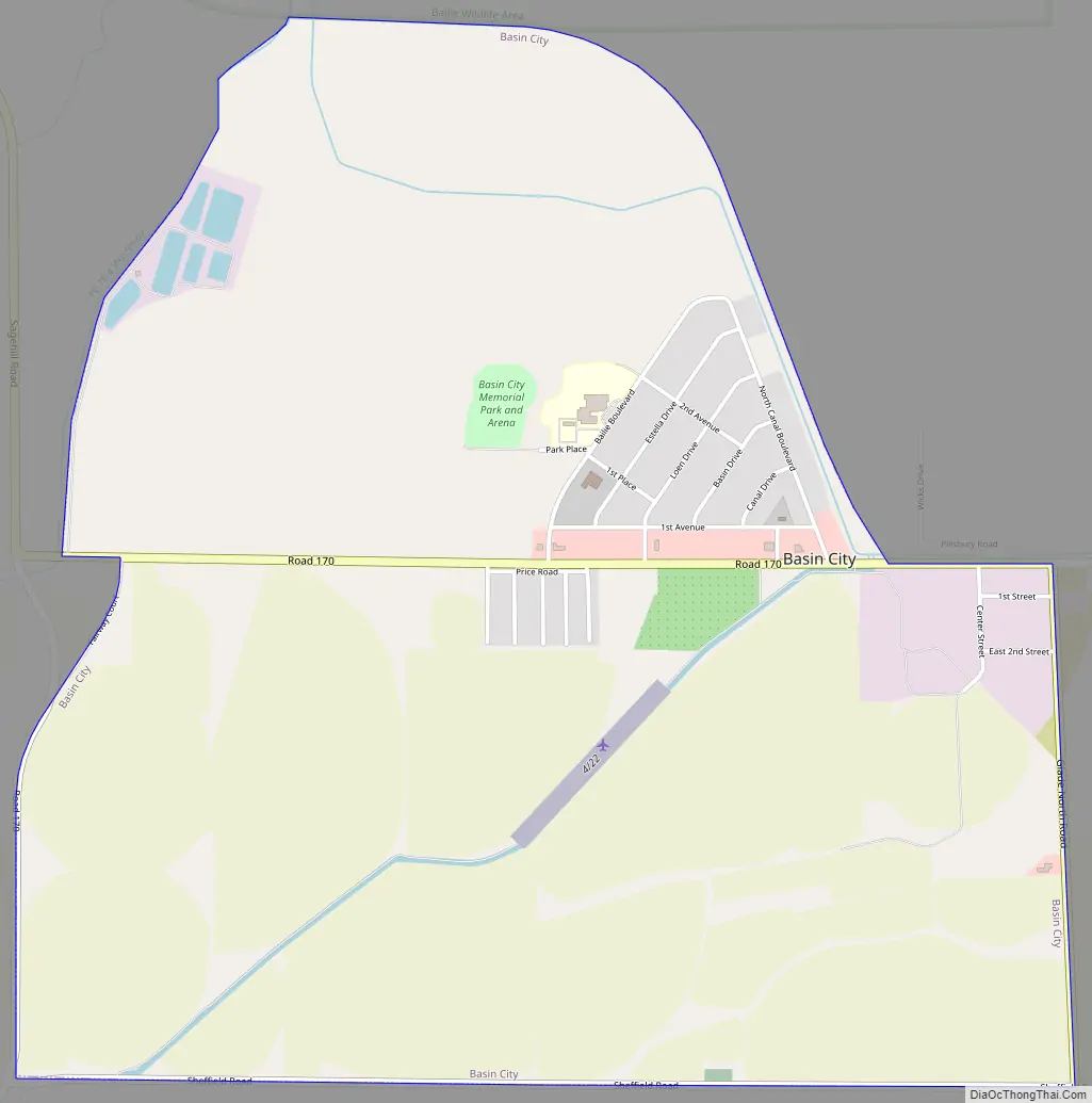
Basin City Road Map
Basin City city Satellite Map
Geography
Basin City is located in northwestern Franklin County at 46°35′29″N 119°8′58″W / 46.59139°N 119.14944°W / 46.59139; -119.14944 (46.591416, -119.149325). As the name implies, it lies in a basin. The land west of the town slopes gradually downward for about 2 miles (3 km) then rises abruptly by about 300 feet (90 m) at Basin Hill. Basin Hill extends about 6 miles (10 km) southwest of town to the Columbia River, where it forms the southern extent of the “White Bluffs” for which the town of White Bluffs was named. Basin Hill also extends 5–6 miles (8–10 km) to the north, where it is called Sage Hill and then rises a bit higher at Radar Hill, named for an old World War II radar base installed at the peak. A little further to the northwest lie the Saddle Mountains. The tallest peak visible from Basin City is Rattlesnake Mountain, about 25 miles (40 km) to the southwest on the opposite side of the Columbia River. However, from the top of nearby Basin Hill it is possible to see Mount Rainier, which lies approximately 125 miles (201 km) to the west in the Cascade Range. Bailie’s Lake, a small lake formed by irrigation runoff, lies to the northwest of town and provides opportunities for fishing and hunting.
According to the United States Census Bureau, the Basin City CDP has a total area of 3.2 square miles (8.3 km), all of it land. Although the CDP itself is quite small, it serves as the heart of a much larger agricultural community extending for miles in all directions.
See also
Map of Washington State and its subdivision:- Adams
- Asotin
- Benton
- Chelan
- Clallam
- Clark
- Columbia
- Cowlitz
- Douglas
- Ferry
- Franklin
- Garfield
- Grant
- Grays Harbor
- Island
- Jefferson
- King
- Kitsap
- Kittitas
- Klickitat
- Lewis
- Lincoln
- Mason
- Okanogan
- Pacific
- Pend Oreille
- Pierce
- San Juan
- Skagit
- Skamania
- Snohomish
- Spokane
- Stevens
- Thurston
- Wahkiakum
- Walla Walla
- Whatcom
- Whitman
- Yakima
- Alabama
- Alaska
- Arizona
- Arkansas
- California
- Colorado
- Connecticut
- Delaware
- District of Columbia
- Florida
- Georgia
- Hawaii
- Idaho
- Illinois
- Indiana
- Iowa
- Kansas
- Kentucky
- Louisiana
- Maine
- Maryland
- Massachusetts
- Michigan
- Minnesota
- Mississippi
- Missouri
- Montana
- Nebraska
- Nevada
- New Hampshire
- New Jersey
- New Mexico
- New York
- North Carolina
- North Dakota
- Ohio
- Oklahoma
- Oregon
- Pennsylvania
- Rhode Island
- South Carolina
- South Dakota
- Tennessee
- Texas
- Utah
- Vermont
- Virginia
- Washington
- West Virginia
- Wisconsin
- Wyoming