Bothell (/ˈbɒθəl/) is a city in King and Snohomish counties in the U.S. state of Washington. It is part of the Seattle metropolitan area, situated near the northeast end of Lake Washington. As of the 2020 census, it had a population of 48,161 residents.
| Name: | Bothell city |
|---|---|
| LSAD Code: | 25 |
| LSAD Description: | city (suffix) |
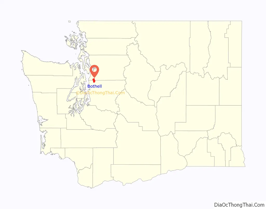
| State: | Washington |
| County: | King County, Snohomish County |
| Elevation: | 75 ft (23 m) |
| Total Area: | 13.64 sq mi (35.3 km²) |
| Land Area: | 13.64 sq mi (35.3 km²) |
| Water Area: | 0.00 sq mi (0.0 km²) |
| Total Population: | 48,161 |
| Population Density: | 3,530.87/sq mi (1,363.28/km²) |
| ZIP code: | 98011 (King), 98012, 98021 (Snohomish), 98041 (P.O. boxes) |
| Area code: | 425 |
| FIPS code: | 5307380 |
| GNISfeature ID: | 1512020 |
| Website: | bothellwa.gov |
Online Interactive Map
Click on ![]() to view map in "full screen" mode.
to view map in "full screen" mode.
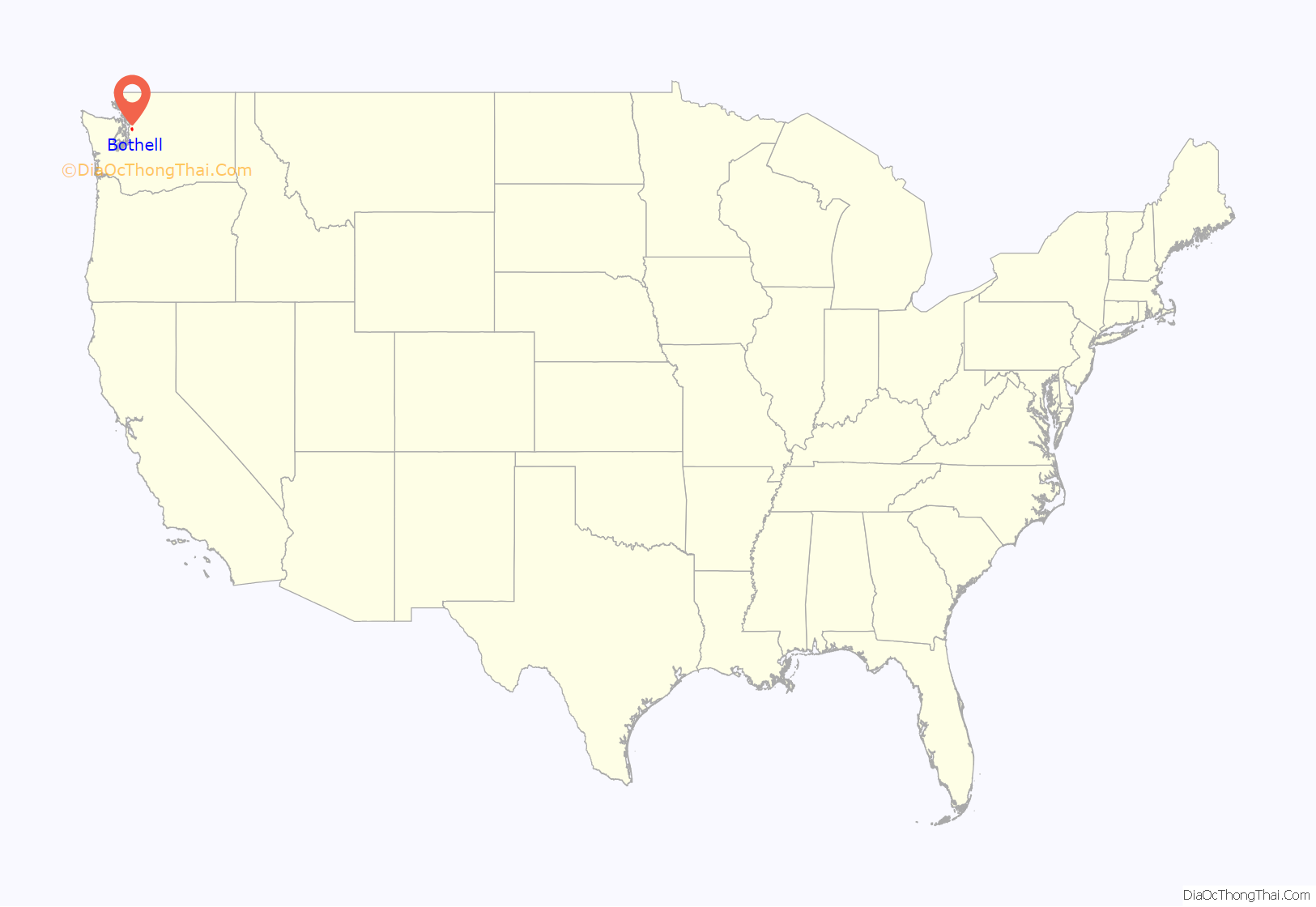
Bothell location map. Where is Bothell city?
History
The Sammamish River valley from Lake Washington to Issaquah Creek was historically inhabited by the indigenous Sammamish people (also known as the “s-tah-PAHBSH”, or “willow people”), a Coast Salish group with an estimated population of 80 to 200 by 1850. Among them were the “ssts’p-abc” (“meander dwellers”), who settled near the river’s mouth at two villages—the larger of which was “tlah-WAH-dees” between modern-day Kenmore and Bothell. The Sammamish were removed from their lands in 1856 following the Puget Sound War and moved to the Port Madison and Tulalip indian reservations.
The first American claims to the lower Sammamish River valley, then mostly a marshland, were filed in 1870 by Columbus S. Greenleaf and George R. Wilson. Eight families followed over the next six years. In 1876, Canadian George Brackett bought land and began commercial logging out of a camp located on the north bank of the Sammamish River in what is now the heart of downtown Bothell. A store, school, and sawmill followed over the next several years.
In 1885, Brackett sold 80 acres (32 ha) to David Bothell, a settler and American Civil War veteran from Pennsylvania. The town’s first postmaster, who bought his property from Bothell, named the town in his honor when it was platted in 1888. Later that same year, a local railroad was built through the town to transport coal from Issaquah. Bothell was officially incorporated on April 14, 1909.
Bothell continued to grow as logging expanded and boat traffic brought increasing amounts of goods and passengers up and down the river. As more people moved into the area, the Army Corps of Engineers decided to dredge and straighten the river in the years shortly after Bothell’s incorporation. Most boat traffic came to an abrupt end only a few years later when Lake Washington was lowered in 1917. Water transport also shifted to trucks after a brick road was built from Seattle. The logging economy declined quickly around the same time, and the local economy shifted to farming.
After World War II, better highways and a post-war boom brought suburban development to Bothell. These new neighborhoods and a series of annexations dramatically expanded Bothell’s population from about 1,000 in 1950 to over 45,000 as of 2017. A failed attempt to annex part of the adjacent community of Woodinville in the 1980s led to them incorporating as a separate city in 1993. In 1992, the city annexed an area in southern Snohomish County, becoming a dual-county city and adding 11,400 people. During the decade, the city’s population had increased by 144 percent to over 30,000. Bothell was mostly a bedroom community for people working in Seattle until the 1990s, when business development brought new jobs to create a regional employment center in Canyon Park with about 20,000 jobs, many in high technology sectors such as biotechnology and software development. In 1990, a campus of the University of Washington opened in Bothell.
In 2010, the city of Bothell began a $150 million program to redevelop downtown, including the demolition of 15 buildings, moving State Route 522, expanding the Bothell–Everett Highway, expanding a city park, and expanding the city hall. The realigned State Route 522 was opened in August 2013 and was followed by a redesign of Bothell Way (formerly State Route 527) in 2017 that created a wide boulevard with separate laneways for parking. The projects were originally planned to be funded with a $42 million property tax proposition that was rejected by voters in November 2014.
A major fire in downtown broke out at the Mercantile Building on July 22, 2016, damaging and closing more than 20 businesses. The fire hindered the redevelopment program and required state aid for rebuilding.
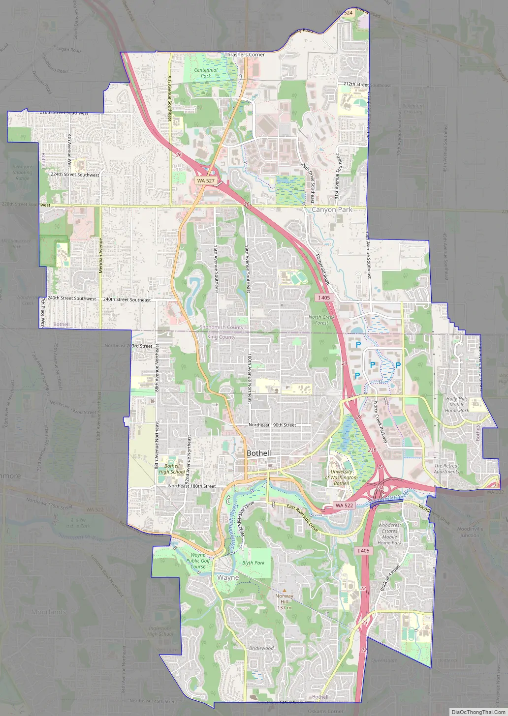
Bothell Road Map
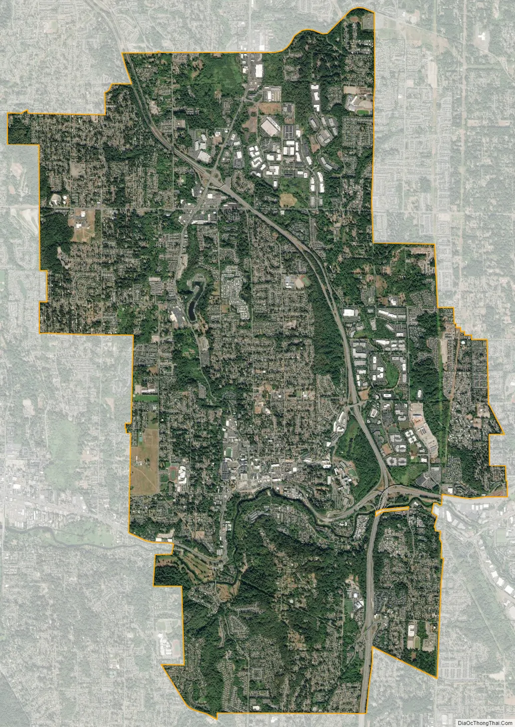
Bothell city Satellite Map
Geography
Bothell is located along the Sammamish River near its mouth at the northeast end of Lake Washington. It straddles King and Snohomish counties, which cross Bothell at Northeast 205th Street / 244th Street Southwest. Bothell is one of six cities in Washington that are in multiple counties. The city is bordered to the west by Kenmore, to the north by unincorporated North Creek, to the east by Woodinville, and to the south by Kirkland (including Juanita). According to the United States Census Bureau, the city of Bothell has a total area of 13.64 square miles (35.33 km), all of it classified as land.
Because most streets in Bothell are numbered and not named, streets that cross the county line often change numbers. For example, 104th Avenue NE in King County becomes 23rd Avenue SE when it crosses into Snohomish County.
Most of the city drains into the Sammamish River or one of its tributaries, such as North Creek and Swamp Creek. The area has several wetlands that are home to large groups of crows, up to 16,000 at a time, that commute from the Seattle region to roost in Bothell.
Subareas and neighborhoods
As part of the city’s comprehensive plan, first published in 1996, Bothell organizes neighborhoods and districts into planning subareas for zoning regulation purposes. When the plan was last updated in 2015, Bothell recognized 17 subareas, four of which were outside the current city limits; they include:
- Bloomberg Hill, a residential area on the eastern edge of the city, primarily in King County
- Brickyard Road/Queensgate, a residential area in the southeastern corner of the city
- Canyon Creek/39th Avenue SE, a residential area in the northeastern corner of the city proper
- Canyon Park, a residential and commercial area on the northern edge of the city proper
- Country Village/Lake Pleasant, a residential and commercial area situated along the Bothell-Everett Highway (formerly SR 527) between downtown and Canyon Park
- Damson/Logan, a residential area in the northwestern part of the city’s planning area, just outside the city proper and west of I-405
- Downtown Bothell, located mainly on the north side of the Sammamish River in an area originally settled by pioneers. It contains a business district along Main Street, and several blocks of residences at the foot of Beckstrom Hill. It also contains city hall and the police station, the Bothell Library, and Pop Keeney Stadium.
- Filbert/Winesap, a primarily residential area in the northwestern part of the city’s planning area, just outside the city proper and east of I-405
- Fitzgerald/35th Avenue SE, a residential area in the northeastern part of the city, just north of the King-Snohomish county line
- Locust/14th Avenue W, a primarily residential area in the northwestern part of the city, just outside the city proper to the north of Kenmore
- Maywood/Beckstrom Hill, a residential neighborhood on the hill extending from downtown north up to North Creek
- North Creek/NE 195th Street, a mixed residential, commercial, and light industrial area in the east-central part of the city, located mainly northeast of the interchange of I-405 and SR 522
- Queensborough/Brentwood/Crystal Springs, a residential neighborhood in the northwestern corner of the city proper
- Shelton View/Meridian/3rd Avenue SE, a residential neighborhood on the western edge of the city proper within Snohomish County
- Thrasher’s Corner/Red Hawk, a residential and commercial area in the northeastern corner of the city’s planning area, just outside the city proper. It is named for the Thrasher family, who opened a grocery store and gas station at the corner of the Bothell–Everett Highway and Filbert Road (now State Route 524) in 1928.
- Waynita/Simonds/Norway Hill, a residential area in the southern part of the city, roughly south of the Sammamish River. It is home to the former Wayne Golf Course, now a city-owned parkland.
- Westhill, a primarily residential area on the hill to the west of downtown
Climate
Bothell has a temperate oceanic climate, with mild summers and cool winters. Winter sees much more rainfall than summer and winters in Bothell (much like those in the rest of the Pacific Northwest) are very cloudy and overcast. Summers are drier and cool to warm.
See also
Map of Washington State and its subdivision:- Adams
- Asotin
- Benton
- Chelan
- Clallam
- Clark
- Columbia
- Cowlitz
- Douglas
- Ferry
- Franklin
- Garfield
- Grant
- Grays Harbor
- Island
- Jefferson
- King
- Kitsap
- Kittitas
- Klickitat
- Lewis
- Lincoln
- Mason
- Okanogan
- Pacific
- Pend Oreille
- Pierce
- San Juan
- Skagit
- Skamania
- Snohomish
- Spokane
- Stevens
- Thurston
- Wahkiakum
- Walla Walla
- Whatcom
- Whitman
- Yakima
- Alabama
- Alaska
- Arizona
- Arkansas
- California
- Colorado
- Connecticut
- Delaware
- District of Columbia
- Florida
- Georgia
- Hawaii
- Idaho
- Illinois
- Indiana
- Iowa
- Kansas
- Kentucky
- Louisiana
- Maine
- Maryland
- Massachusetts
- Michigan
- Minnesota
- Mississippi
- Missouri
- Montana
- Nebraska
- Nevada
- New Hampshire
- New Jersey
- New Mexico
- New York
- North Carolina
- North Dakota
- Ohio
- Oklahoma
- Oregon
- Pennsylvania
- Rhode Island
- South Carolina
- South Dakota
- Tennessee
- Texas
- Utah
- Vermont
- Virginia
- Washington
- West Virginia
- Wisconsin
- Wyoming


