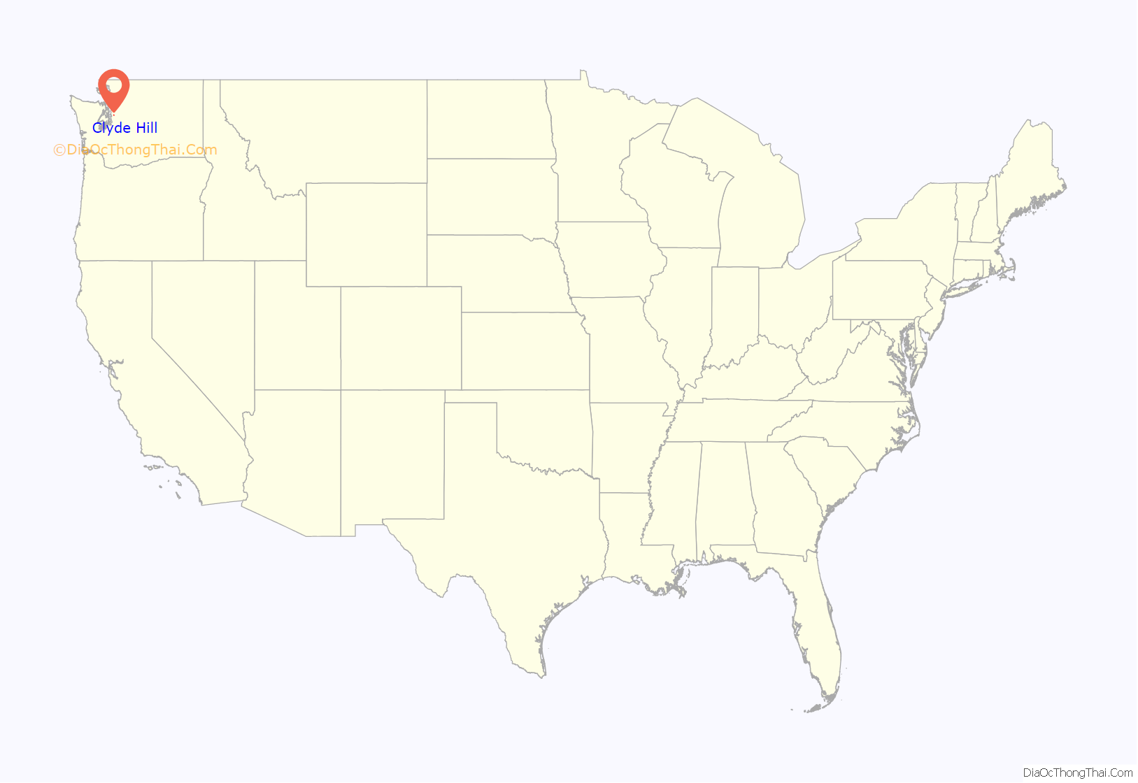
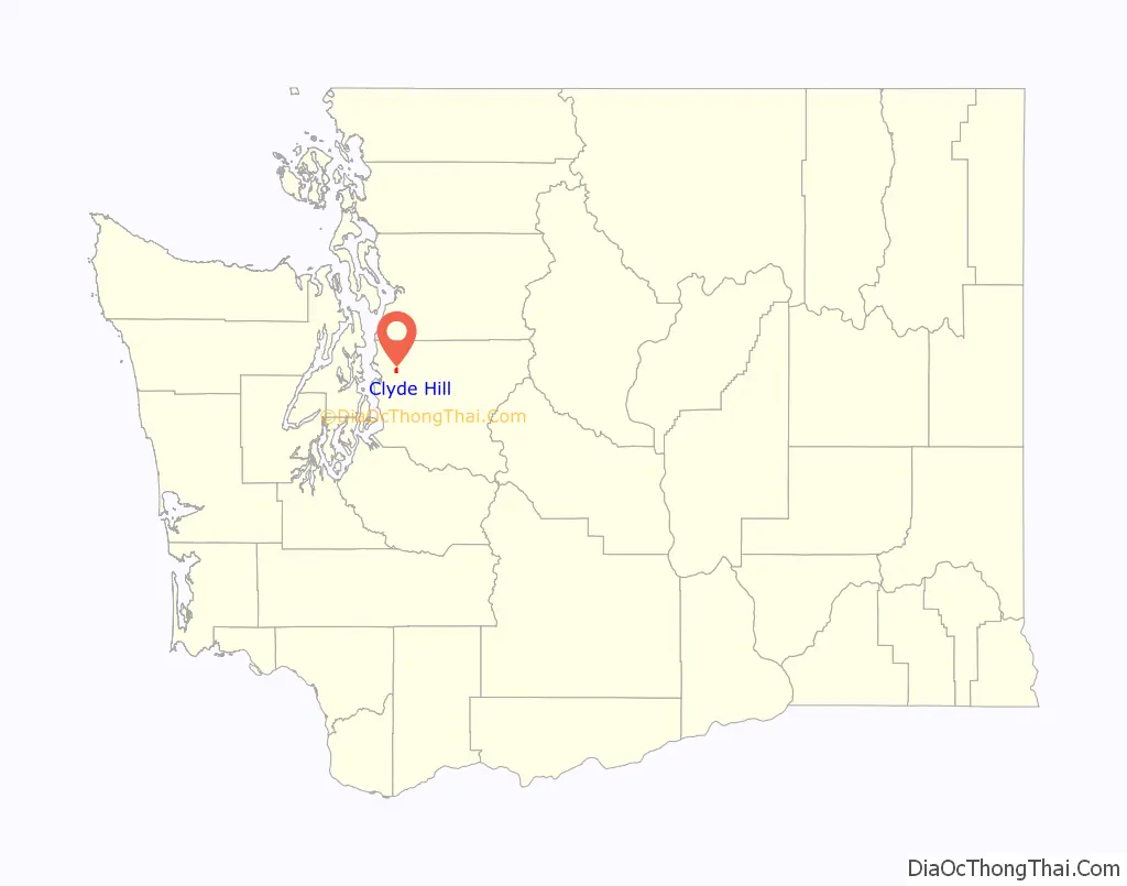
Clyde Hill is a city located in King County, Washington. It is part of the Eastside region, located to the east of Seattle, and is bordered by the cities and towns of Bellevue, Kirkland, Medina, Yarrow Point and Hunts Point. The population was 2,984 at the 2010 census.
Based on per capita income, Clyde Hill ranks 4th of 522 areas in the state of Washington to be ranked. In 2014, it was listed as the most affluent town in Washington State by Slate.
Clyde Hill is also ranked 10th in the United States for most landscapers hired per square mile, at about 1,000 households per mile.
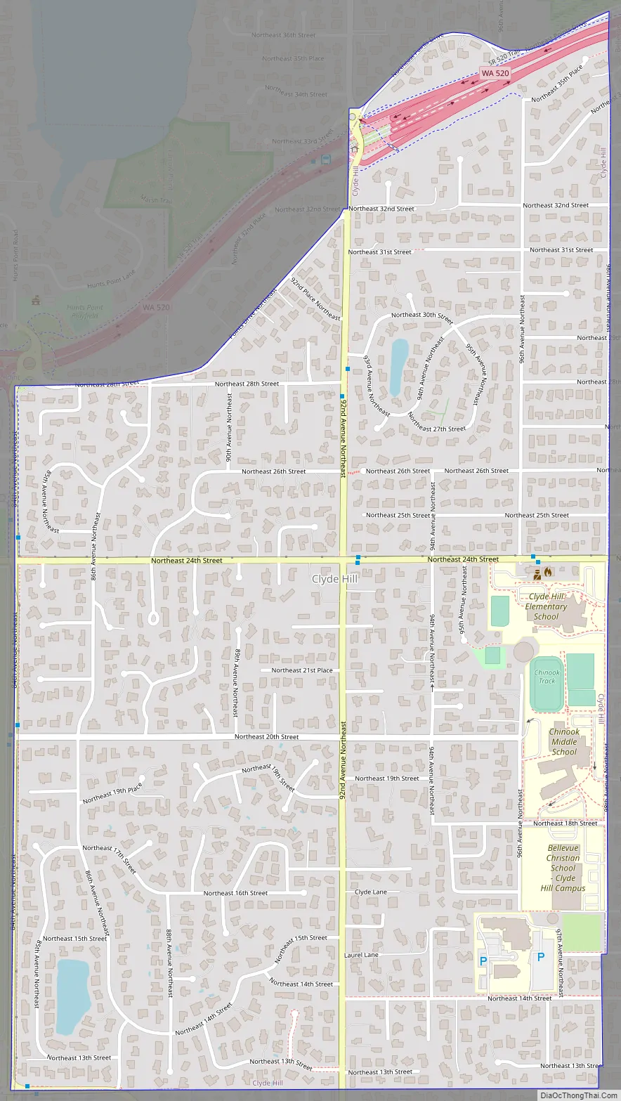
The majority of Clyde Hill is zoned for single-family use with the exception of two commercially zoned areas: a gas station and a coffee shop. In addition to a small government zone, the City is home to four schools: two public schools – Clyde Hill Elementary and Chinook Middle School; and two private schools: Bellevue Christian School and Sacred Heart School. The City’s minimum lot size is 20,000 square feet, although many smaller lots exist that pre-date the incorporation of the City.
| Name: | Clyde Hill city |
|---|---|
| LSAD Code: | 25 |
| LSAD Description: | city (suffix) |
| State: | Washington |
| County: | King County |
| Elevation: | 295 ft (90 m) |
| Total Area: | 1.05 sq mi (2.73 km²) |
| Land Area: | 1.05 sq mi (2.73 km²) |
| Water Area: | 0.00 sq mi (0.00 km²) |
| Total Population: | 2,984 |
| Population Density: | 3,209.48/sq mi (1,238.72/km²) |
| ZIP code: | 98004 |
| Area code: | 425 |
| FIPS code: | 5313365 |
| GNISfeature ID: | 1504034 |
| Website: | www.clydehill.org |
Online Interactive Map
Click on ![]() to view map in "full screen" mode.
to view map in "full screen" mode.
Clyde Hill location map. Where is Clyde Hill city?
History
Between 1946 and 1948, J. Gordon and Mary Schneidler subdivided and sold more than a dozen lots in a five-acre subdivision in Clyde Hill.
In response to the community’s desire to control land use development such as lot size and commercial zoning, Clyde Hill was officially incorporated as a Town on March 31, 1953. On November 10, 1998, the Council voted to organize Clyde Hill as a non-charter Code City.
In 1953 area residents voted to become an incorporated Town by a vote of 145 to 117. Ken Day defeated Don Clark for the first Clyde Hill Mayors position, 91 to 58. All initial Councilmembers were elected on write-in votes.
The first elected Councilmembers were: F. Lee Campbell, – Robert W. Glueck, – P.A. Jacobsen, Leslie M. Rudy and A.C. Thompson Sr.
John Woodin became the Town’s first Treasurer. Ken Day appointed Priscilla Alden Townsend as Police Judge and Roger Bryan as Marshall.
The 1975 Mayoral election in Clyde Hill brought with it suspense and the national media. The two candidates, the incumbent Liberino “Lib” Tufarolo and Miles Nelson finished the election in an even tie. The contest was ultimately decided by a coin toss, with Nelson unseating the incumbent as national and local media looked on.
Clyde Hill Road Map
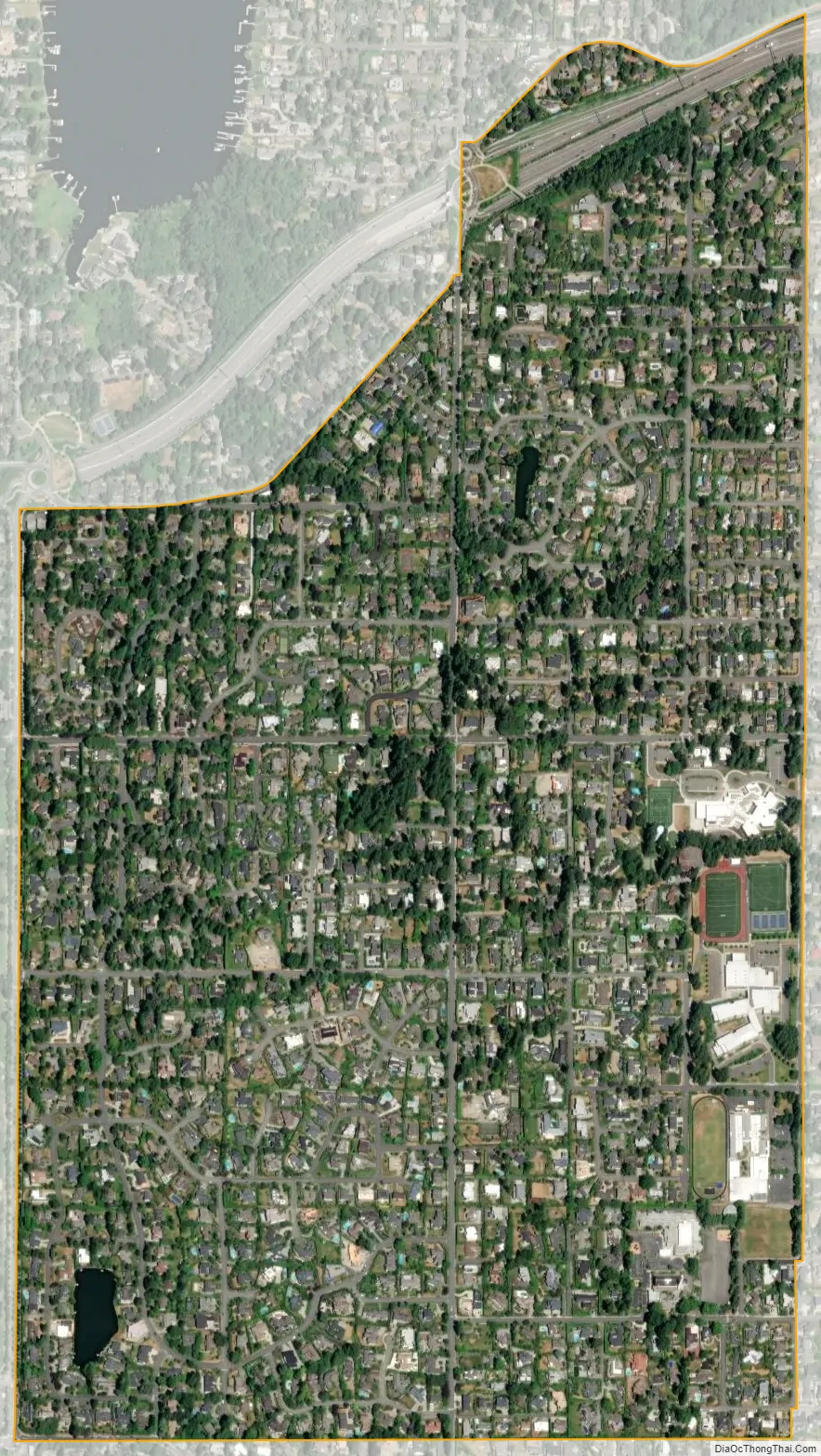
Clyde Hill city Satellite Map
Geography
Clyde Hill is located at 47°37′49″N 122°13′0″W / 47.63028°N 122.21667°W / 47.63028; -122.21667 (47.630171, -122.216559).
The top elevation is close to 375 feet. There are approximately 21 miles of public roadways in Clyde Hill.
According to the United States Census Bureau, the city has a total area of 1.06 square miles (2.75 km), all of it land.
See also
Map of Washington State and its subdivision:- Adams
- Asotin
- Benton
- Chelan
- Clallam
- Clark
- Columbia
- Cowlitz
- Douglas
- Ferry
- Franklin
- Garfield
- Grant
- Grays Harbor
- Island
- Jefferson
- King
- Kitsap
- Kittitas
- Klickitat
- Lewis
- Lincoln
- Mason
- Okanogan
- Pacific
- Pend Oreille
- Pierce
- San Juan
- Skagit
- Skamania
- Snohomish
- Spokane
- Stevens
- Thurston
- Wahkiakum
- Walla Walla
- Whatcom
- Whitman
- Yakima
- Alabama
- Alaska
- Arizona
- Arkansas
- California
- Colorado
- Connecticut
- Delaware
- District of Columbia
- Florida
- Georgia
- Hawaii
- Idaho
- Illinois
- Indiana
- Iowa
- Kansas
- Kentucky
- Louisiana
- Maine
- Maryland
- Massachusetts
- Michigan
- Minnesota
- Mississippi
- Missouri
- Montana
- Nebraska
- Nevada
- New Hampshire
- New Jersey
- New Mexico
- New York
- North Carolina
- North Dakota
- Ohio
- Oklahoma
- Oregon
- Pennsylvania
- Rhode Island
- South Carolina
- South Dakota
- Tennessee
- Texas
- Utah
- Vermont
- Virginia
- Washington
- West Virginia
- Wisconsin
- Wyoming


