Edgewood is a city in Pierce County, Washington, United States. The population was 12,327 at the 2020 census. Neighboring towns include Fife to the west, Milton to the northwest, Federal Way to the north, Sumner to the east, and Puyallup to the south.
| Name: | Edgewood city |
|---|---|
| LSAD Code: | 25 |
| LSAD Description: | city (suffix) |
| State: | Washington |
| County: | Pierce County |
| Elevation: | 354 ft (108 m) |
| Total Area: | 8.39 sq mi (21.74 km²) |
| Land Area: | 8.38 sq mi (21.72 km²) |
| Water Area: | 0.01 sq mi (0.02 km²) |
| Total Population: | 12,327 |
| Population Density: | 1,556.71/sq mi (601.06/km²) |
| ZIP code: | 98371, 98372, 98390 |
| Area code: | 253 |
| FIPS code: | 5320645 |
| GNISfeature ID: | 1512179 |
| Website: | cityofedgewood.org |
Online Interactive Map
Click on ![]() to view map in "full screen" mode.
to view map in "full screen" mode.
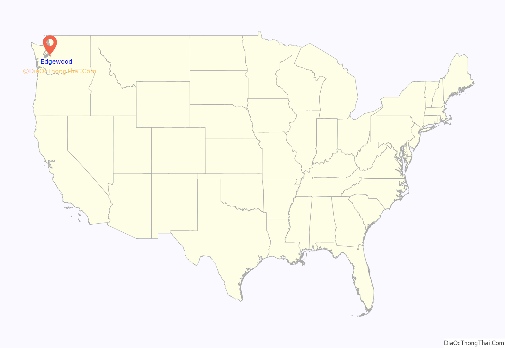
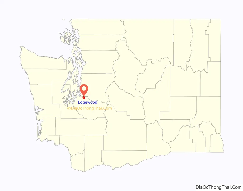
Edgewood location map. Where is Edgewood city?
History
The history of Edgewood can be traced to the Puyallup Indian tribe that lived along the Puyallup River. Dr. William Tolmie, a Scotsman working for the Hudson’s Bay Company, passed through Edgewood in 1833 soon after becoming Chief Trader at Fort Nisqually. Tolmie had arrived at Fort Vancouver by ship from Britain in May 1833. Trappers with Native American wives had moved to the area in the 1830s and settlers in the 1850s.
Washington’s first telegraph line paralleled Military Road that ran through the heart of Edgewood. Approximately 420 Americans (apart from Indians) resided in what is now Pierce County in 1858. By 1862, 681 non-Native Americans were reported to be residents of Pierce County. Evidence indicates that the first building on the North Hill (Surprise Lake) was a one-room log building formed as School District 27 in 1891. One of the first known residents in Edgewood was Peter Nyholm in 1895.
The first official run of the interurban line from Tacoma to Seattle, by the way of the valley, was in October 1902. The State Spiritualists, who had six churches in Western Washington, had a summer camp at Edgewood that was purchased in 1903. Construction of a campground hotel began in 1927, and before completion a fire destroyed it in 1948.
Edgewood was officially incorporated on February 28, 1996.
On April 28, 2010, Edgewood was the site of the murder of James Sanders.
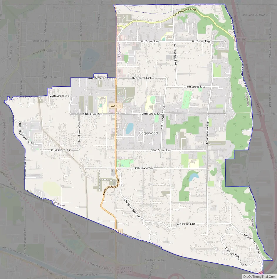
Edgewood Road Map
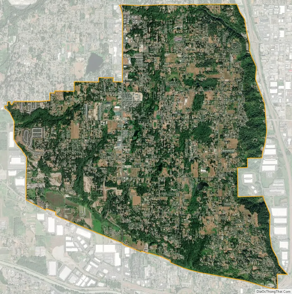
Edgewood city Satellite Map
Geography
The Edgewood and Milton areas are also known informally as North Hill. This contrasts with the South Hill area on the opposite side of the Puyallup River valley.
According to the United States Census Bureau, the city has a total area of 8.42 square miles (21.81 km), of which, 8.41 square miles (21.78 km) is land and 0.01 square miles (0.03 km) is water.
See also
Map of Washington State and its subdivision:- Adams
- Asotin
- Benton
- Chelan
- Clallam
- Clark
- Columbia
- Cowlitz
- Douglas
- Ferry
- Franklin
- Garfield
- Grant
- Grays Harbor
- Island
- Jefferson
- King
- Kitsap
- Kittitas
- Klickitat
- Lewis
- Lincoln
- Mason
- Okanogan
- Pacific
- Pend Oreille
- Pierce
- San Juan
- Skagit
- Skamania
- Snohomish
- Spokane
- Stevens
- Thurston
- Wahkiakum
- Walla Walla
- Whatcom
- Whitman
- Yakima
- Alabama
- Alaska
- Arizona
- Arkansas
- California
- Colorado
- Connecticut
- Delaware
- District of Columbia
- Florida
- Georgia
- Hawaii
- Idaho
- Illinois
- Indiana
- Iowa
- Kansas
- Kentucky
- Louisiana
- Maine
- Maryland
- Massachusetts
- Michigan
- Minnesota
- Mississippi
- Missouri
- Montana
- Nebraska
- Nevada
- New Hampshire
- New Jersey
- New Mexico
- New York
- North Carolina
- North Dakota
- Ohio
- Oklahoma
- Oregon
- Pennsylvania
- Rhode Island
- South Carolina
- South Dakota
- Tennessee
- Texas
- Utah
- Vermont
- Virginia
- Washington
- West Virginia
- Wisconsin
- Wyoming


