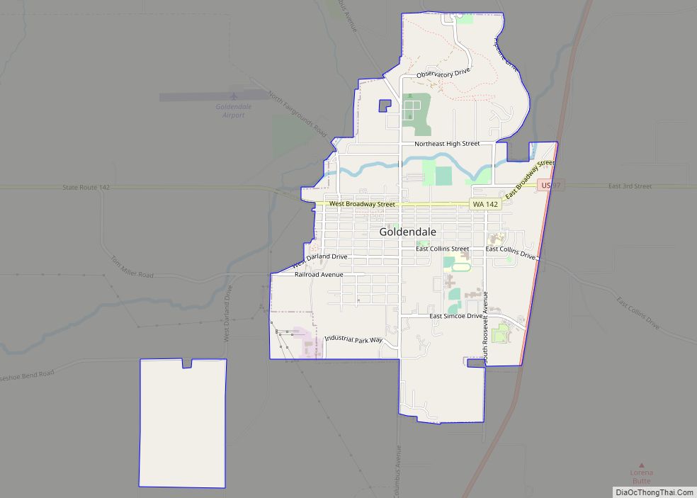
Goldendale is a city and county seat of Klickitat County, Washington, United States, near the Columbia River Gorge. The population within city limits was 3,760 at the 2000 census and 3,407 at the 2010 census, a 9.4% decrease. It is situated in a primarily agricultural area and is also near Goldendale Observatory State Park. The valley in which Goldendale is located offers views of the Cascade Mountains to the west and the Simcoe Hills to the north.
| Name: | Goldendale city |
|---|---|
| LSAD Code: | 25 |
| LSAD Description: | city (suffix) |
| State: | Washington |
| County: | Klickitat County |
| Elevation: | 1,637 ft (499 m) |
| Total Area: | 2.96 sq mi (7.67 km²) |
| Land Area: | 2.96 sq mi (7.67 km²) |
| Water Area: | 0.00 sq mi (0.00 km²) |
| Total Population: | 3,453 |
| Population Density: | 1,184.12/sq mi (457.16/km²) |
| ZIP code: | 98620 |
| Area code: | 509 |
| FIPS code: | 5327435 |
| GNISfeature ID: | 1505168 |
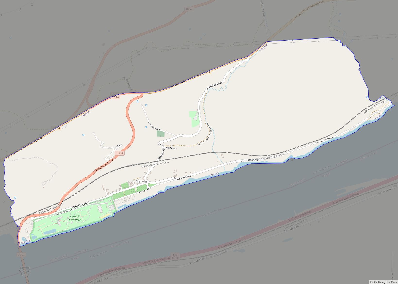
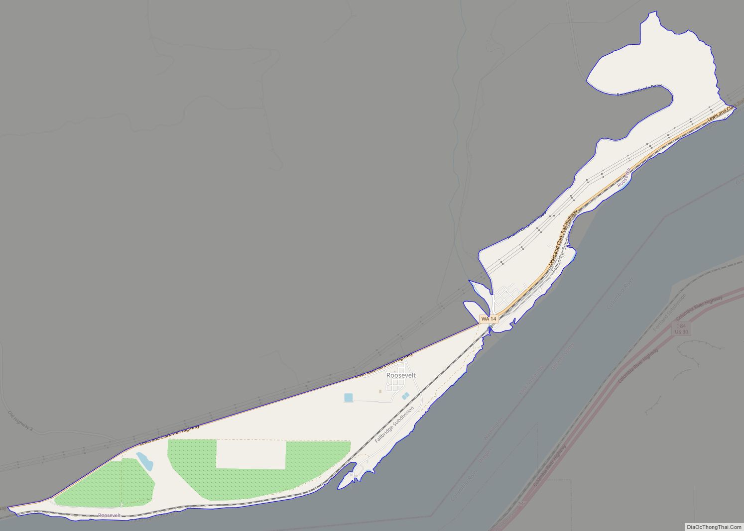
Online Interactive Map
Click on ![]() to view map in "full screen" mode.
to view map in "full screen" mode.
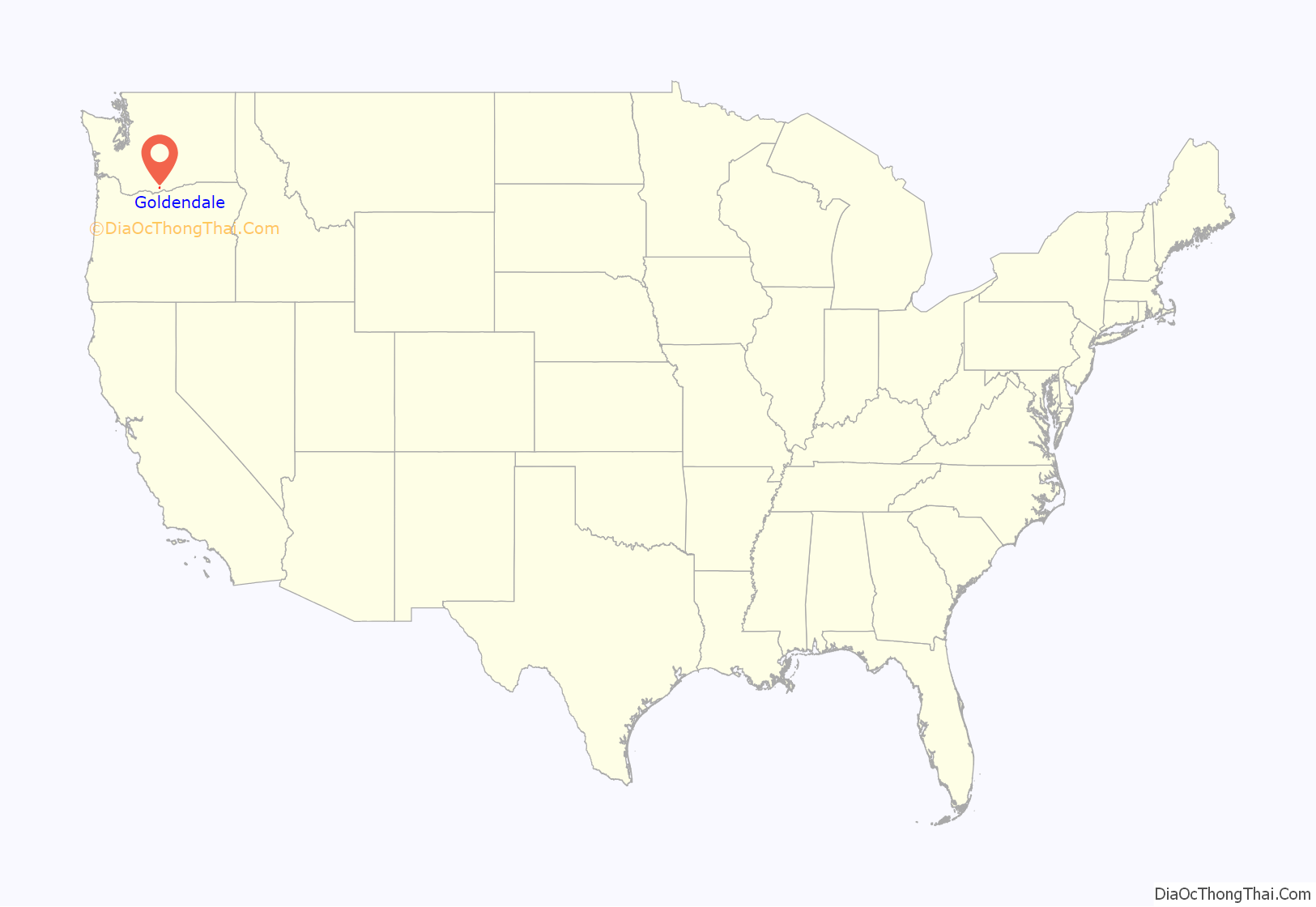
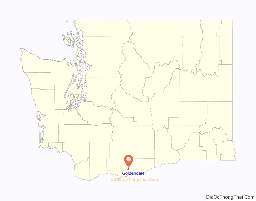
Goldendale location map. Where is Goldendale city?
History
In 1859 the town was given its name by the early homesteader John Golden, a Pennsylvania-born farmer who settled with his wife from Oregon. His home at Columbus Street and Collins Street remains standing in downtown Goldendale. The town was designated as the county seat of Klickitat County in 1878. Goldendale was officially incorporated on November 14, 1879. Much of the young town, including the county courthouse, was destroyed in a devastating fire on May 13, 1888.
On June 9, 1918, William Wallace Campbell, director of the Lick Observatory, and astronomer Heber Curtis journeyed to Goldendale to view a total solar eclipse. The purpose of the observation was to photograph the sun’s corona and the apparent distorted placement of stars due to the sun’s gravitational pull on those star’s rays while passing by the sun. Lacking proper equipment and instead only using multiple cameras Campbell and Curtis were unable to confirm stars’ deflection. However, by November 1919, their efforts would be vindicated by British astronomers and Einstein’s Theory of Relativity was confirmed. Goldendale was also under the path of totality for another total eclipse on February 26, 1979, which drew thousands of visitors to the Goldendale Observatory.
In 2008 Goldendale hosted the International Gravity Sports Association’s ‘Festival of Speed,’ on a segment of the historic Maryhill highway.
Goldendale has remained the employment, business, commercial and banking center for the valley and, as the county seat, is the location for Klickitat County’s courts and government offices. In recent years this small community has suffered from severe economic decline. After a local aluminum plant that once employed many residents closed, the small community struggled economically. The loss of tax base has taken its toll on the funds available for maintaining the city’s infrastructure. In recent years there has been an interest in installing wind turbines that would generate power. While it has provided some jobs, this industry has not been the economic solution for which many residents hoped.
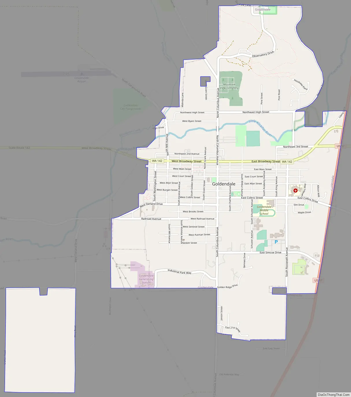
Goldendale Road Map
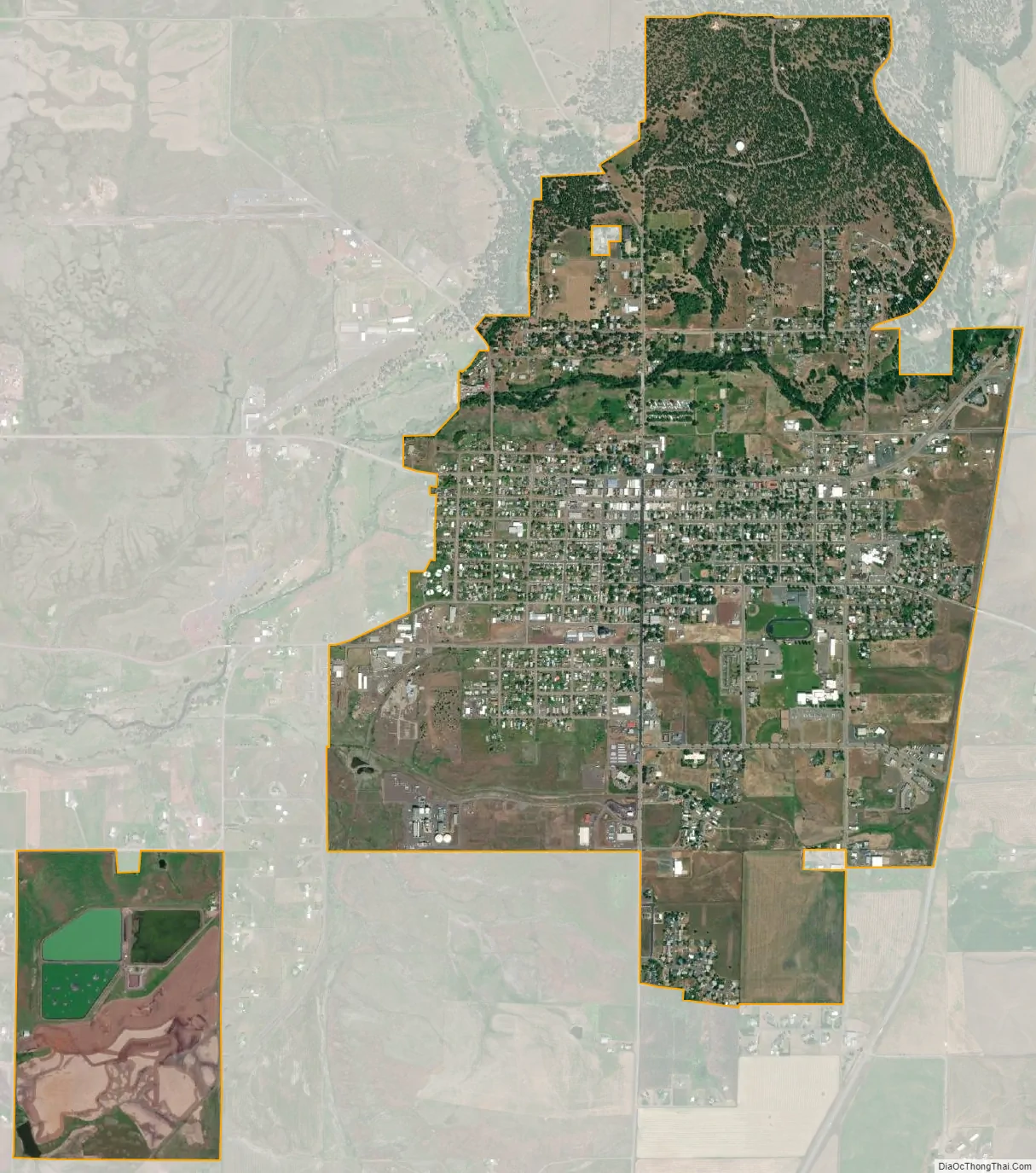
Goldendale city Satellite Map
Geography
Goldendale is located at 45°49′N 120°49′W / 45.817°N 120.817°W / 45.817; -120.817 (45.821, -120.821). According to the United States Census Bureau, the city has a total area of 2.52 square miles (6.53 km), all of it land.
Goldendale’s elevation at the County Courthouse is 498 meters (1,634 feet).
The Little Klickitat River flows roughly east-to-west across the northern portion of the city. Bloodgood Creek, an entirely spring-fed year-round water source, runs through the northwest part of town and intersects with the Little Klickitat just west of the city. Both are sources of rainbow trout as well as being home to waterfowl such as the great blue heron and several species of duck. Bloodgood Creek provides a portion of Goldendale’s drinking water and is capped at the source for that purpose.
U.S. Route 97 runs along the eastern boundary of the city and connects Goldendale with Interstate 84, 21 km (13 mi) south in the state of Oregon and State Route 14, which is 19 km (12 mi) south and runs along the Washington side of the Columbia River. State Route 142 creates a major east-west route through Goldendale, beginning at US 97 on the north end of town.
See also
Map of Washington State and its subdivision:- Adams
- Asotin
- Benton
- Chelan
- Clallam
- Clark
- Columbia
- Cowlitz
- Douglas
- Ferry
- Franklin
- Garfield
- Grant
- Grays Harbor
- Island
- Jefferson
- King
- Kitsap
- Kittitas
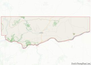
- Klickitat
- Lewis
- Lincoln
- Mason
- Okanogan
- Pacific
- Pend Oreille
- Pierce
- San Juan
- Skagit
- Skamania
- Snohomish
- Spokane
- Stevens
- Thurston
- Wahkiakum
- Walla Walla
- Whatcom
- Whitman
- Yakima
- Alabama
- Alaska
- Arizona
- Arkansas
- California
- Colorado
- Connecticut
- Delaware
- District of Columbia
- Florida
- Georgia
- Hawaii
- Idaho
- Illinois
- Indiana
- Iowa
- Kansas
- Kentucky
- Louisiana
- Maine
- Maryland
- Massachusetts
- Michigan
- Minnesota
- Mississippi
- Missouri
- Montana
- Nebraska
- Nevada
- New Hampshire
- New Jersey
- New Mexico
- New York
- North Carolina
- North Dakota
- Ohio
- Oklahoma
- Oregon
- Pennsylvania
- Rhode Island
- South Carolina
- South Dakota
- Tennessee
- Texas
- Utah
- Vermont
- Virginia
- Washington
- West Virginia
- Wisconsin
- Wyoming