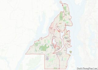
Hansville is an unincorporated community and census-designated place (CDP) in Kitsap County, Washington, United States. Its population was 3,858 as of the 2020 census. The coastal community is located at the northern end of the Kitsap Peninsula and is about 16 miles (26 km) northeast of Poulsbo, the nearest city.
| Name: | Hansville CDP |
|---|---|
| LSAD Code: | 57 |
| LSAD Description: | CDP (suffix) |
| State: | Washington |
| County: | Kitsap County |
| Elevation: | 20 ft (6 m) |
| Total Area: | 28.0 sq mi (72.6 km²) |
| Land Area: | 10.6 sq mi (27.4 km²) |
| Water Area: | 17.4 sq mi (45.1 km²) |
| Total Population: | 3,091 |
| Population Density: | 292/sq mi (112.6/km²) |
| ZIP code: | 98340 |
| Area code: | 360 |
| FIPS code: | 5329430 |
| GNISfeature ID: | 1512267 |
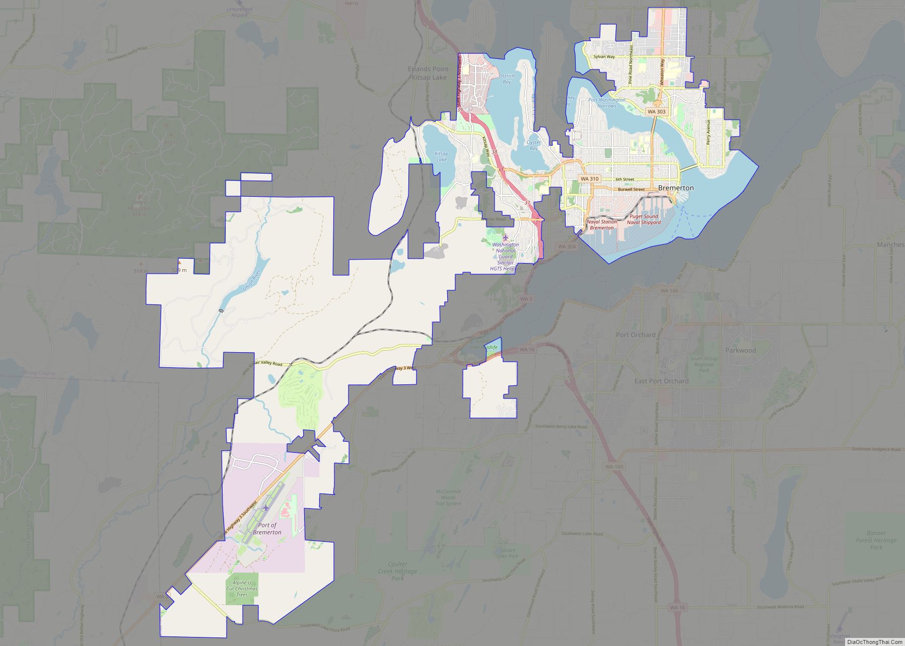
Online Interactive Map
Click on ![]() to view map in "full screen" mode.
to view map in "full screen" mode.
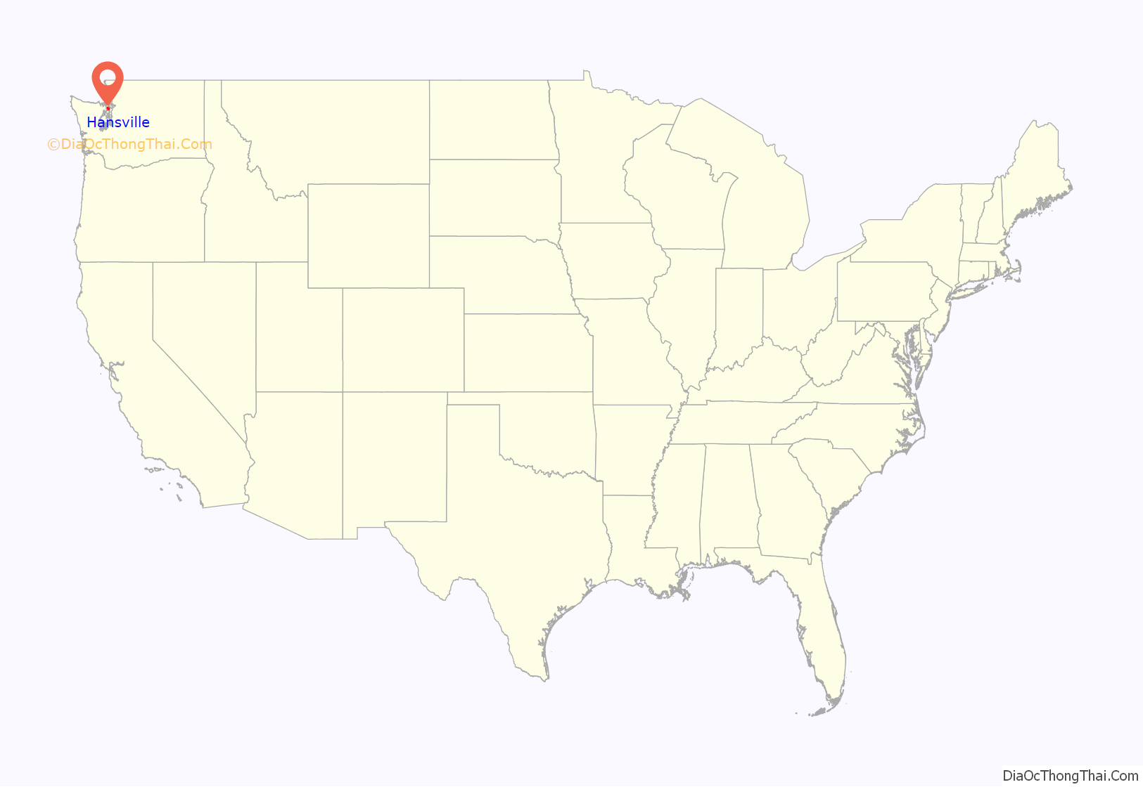
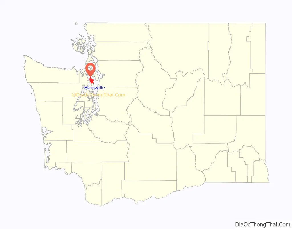
Hansville location map. Where is Hansville CDP?
History
19th century
Point No Point was first sighted by a European settler, and given its English name, during the United States Exploring Expedition of Puget Sound in 1841. Expedition leader Charles Wilkes gave the site its name because it appears much less of a promontory at close range than it does from a distance.
On January 25, 1855, Isaac Stevens, the governor of the newly organized Washington Territory, summoned a treaty council to Point No Point, which was attended by 1,200 American Indians of the Chimakum, Klallam, and Skokomish tribes, Point No Point being a central midpoint between the tribal centers. The Point No Point Treaty was signed between the United States and the delegates of the tribes the following day.
The first regular residents of Hansville were the lightkeepers of the Point No Point Light, which was constructed in 1879. In 1893 a Norwegian fisherman, the community’s first permanent settler not affiliated with the lighthouse, came to the area. He was soon followed by other Norwegian emigres, including Hans Zachariasen, for whom Hansville was ultimately named.
20th century
In 1900 the Hansville Community Church was founded, with the first permanent structure for the congregation built nine years later. Hansville was connected to Point No Point and its lighthouse by a road constructed in 1908. In 1924 another road was built 10 miles (16 km) south to Kingston, allowing access to the isolated community by means other than boat or trail for the first time. The addition of the road helped develop Hansville into a resort fishing destination, but a decline in the sports fishery in the 1960s led to the closure of the lodges. In 1962 Driftwood Key was platted with 59 lots on the west side of the peninsula, 1.5 miles (2.4 km) southwest of the original settlement of Hansville. By 2008 the homeowner association had grown to become the largest neighborhood in Hansville with 732 properties, approximately one-third of the residential lots in the community.
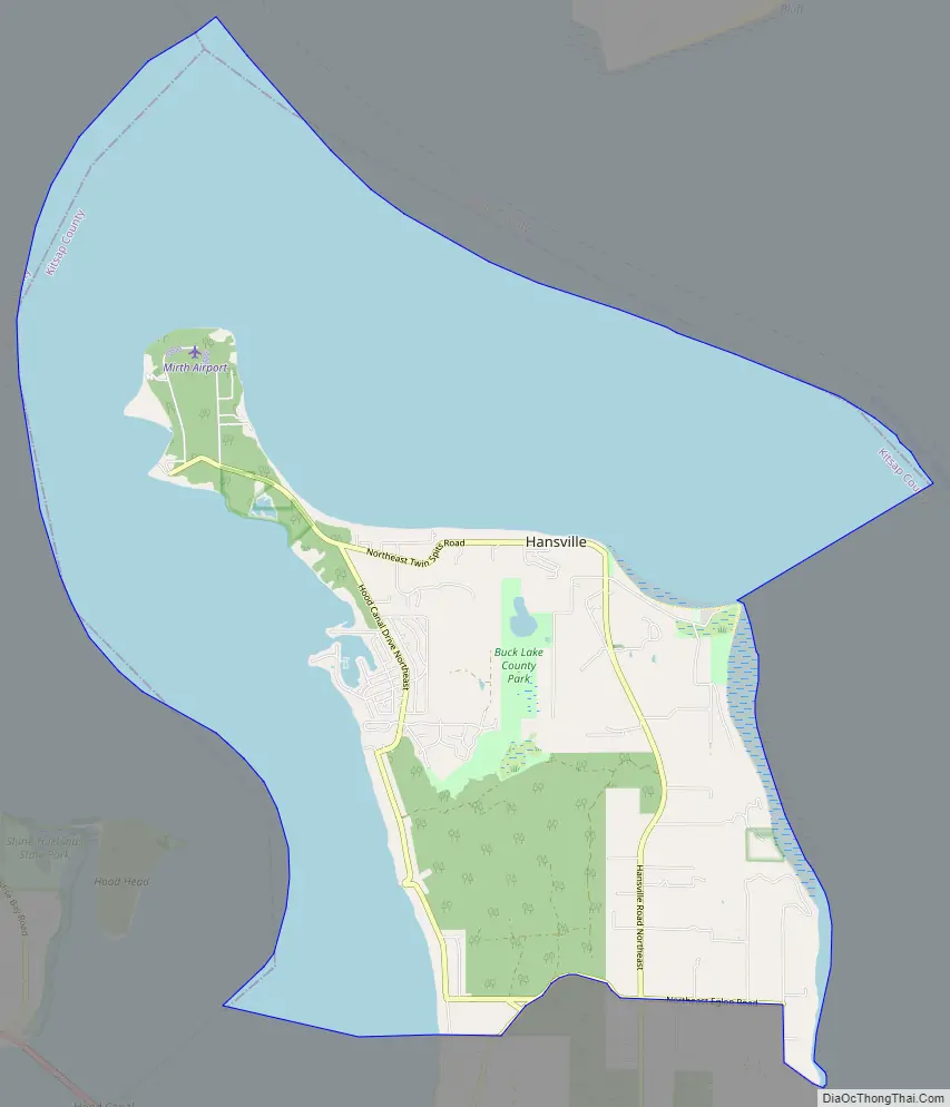
Hansville Road Map
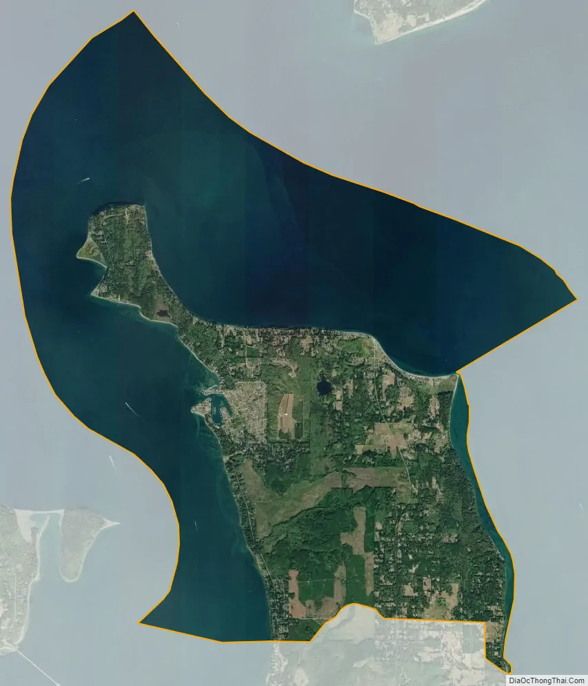
Hansville city Satellite Map
Geography
Hansville is situated at the north end of the Kitsap Peninsula, 10 miles (16 km) north of Kingston. On the west side of Hansville lies Hood Canal and Coon Bay. The Foulweather Bluff is a small elevated peninsula at the extreme northwest tip of the Kitsap Peninsula, while Point No Point resides to the east, facing Puget Sound. The Columbia Center in Seattle is distantly visible to the southeast.
The Hansville CDP is bordered to the south by the Port Gamble Tribal Community, to the west across Hood Canal by Jefferson County, and to the northeast across Admiralty Inlet by Whidbey Island in Island County.
See also
Map of Washington State and its subdivision:- Adams
- Asotin
- Benton
- Chelan
- Clallam
- Clark
- Columbia
- Cowlitz
- Douglas
- Ferry
- Franklin
- Garfield
- Grant
- Grays Harbor
- Island
- Jefferson
- King
- Kitsap
- Kittitas
- Klickitat
- Lewis
- Lincoln
- Mason
- Okanogan
- Pacific
- Pend Oreille
- Pierce
- San Juan
- Skagit
- Skamania
- Snohomish
- Spokane
- Stevens
- Thurston
- Wahkiakum
- Walla Walla
- Whatcom
- Whitman
- Yakima
- Alabama
- Alaska
- Arizona
- Arkansas
- California
- Colorado
- Connecticut
- Delaware
- District of Columbia
- Florida
- Georgia
- Hawaii
- Idaho
- Illinois
- Indiana
- Iowa
- Kansas
- Kentucky
- Louisiana
- Maine
- Maryland
- Massachusetts
- Michigan
- Minnesota
- Mississippi
- Missouri
- Montana
- Nebraska
- Nevada
- New Hampshire
- New Jersey
- New Mexico
- New York
- North Carolina
- North Dakota
- Ohio
- Oklahoma
- Oregon
- Pennsylvania
- Rhode Island
- South Carolina
- South Dakota
- Tennessee
- Texas
- Utah
- Vermont
- Virginia
- Washington
- West Virginia
- Wisconsin
- Wyoming