Kahlotus (/kəˈloʊdəs/) is a city in Franklin County, Washington, United States. The population was 193 at the 2010 census. The Washington State Office of Financial Management’s 2015 estimate placed the population at 190.
| Name: | Kahlotus city |
|---|---|
| LSAD Code: | 25 |
| LSAD Description: | city (suffix) |
| State: | Washington |
| County: | Franklin County |
| Elevation: | 902 ft (275 m) |
| Total Area: | 0.38 sq mi (0.98 km²) |
| Land Area: | 0.38 sq mi (0.98 km²) |
| Water Area: | 0.00 sq mi (0.00 km²) |
| Total Population: | 193 |
| Population Density: | 507.89/sq mi (196.26/km²) |
| ZIP code: | 99335 |
| Area code: | (509)282 |
| FIPS code: | 5334575 |
| GNISfeature ID: | 1505893 |
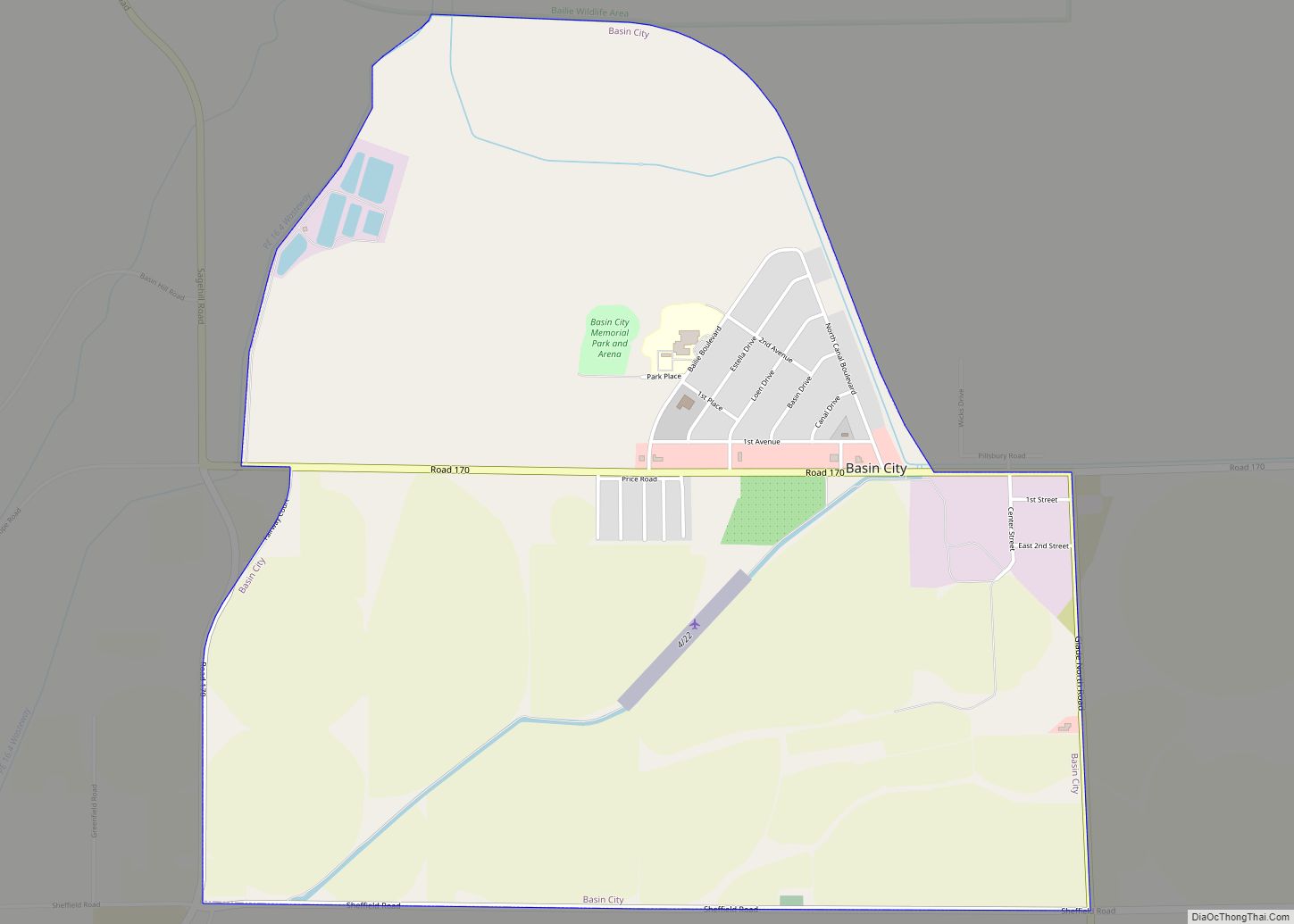
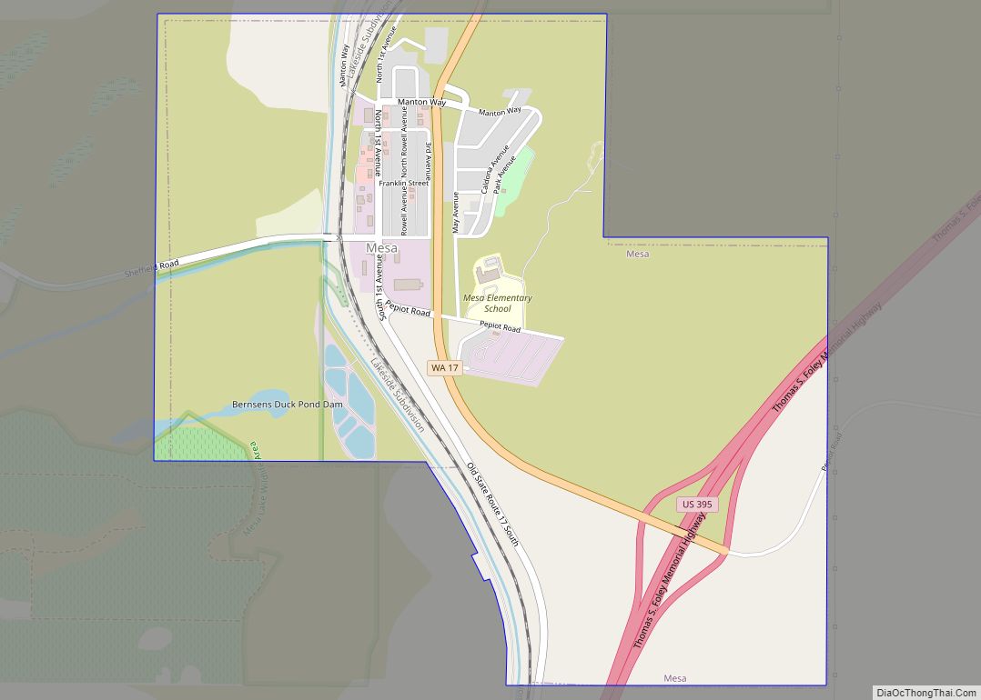
Online Interactive Map
Click on ![]() to view map in "full screen" mode.
to view map in "full screen" mode.
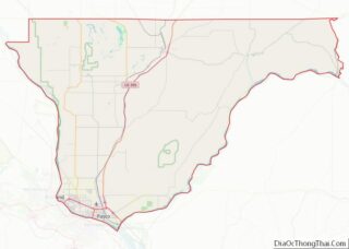
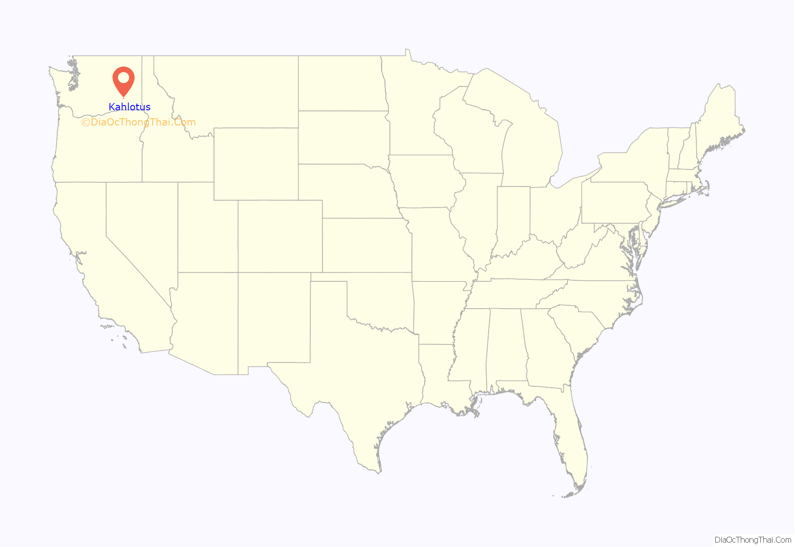
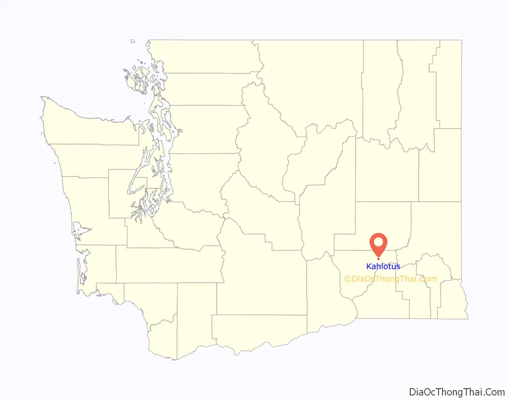
Kahlotus location map. Where is Kahlotus city?
History
The first organized settlement of Kahlotus was by German immigrants, imported by the railroads, in around 1880. Among these settlers were several locally recognized pioneer families, including Hans Harder, who first platted the town in 1902 under the name “Hardersburg”. The town was later renamed Kahlotus. The meaning of the word “Kahlotus” is uncertain. According to toponymist William Bright the name derives from the Sahaptin placename /kalúːt’as/. It is believed by many that it is a Native American word meaning “Hole in the ground. A third possibility is that the town was named for a Palouse tribal chief and signer of the Yakima Treaty of 1855. His name appeared with various spellings, including Kohlotus, Quillatose (by future governor Isaac Stevens), Qalatos, and Kahlatoose.
Harder’s platting of the town coincided with the reinstatement of service on the Oregon & Washington Railroad & Navigation line between LaCrosse and Palouse Junction (now Connell), crossing the north end of town parallel to present-day Highway 260. Soon after, the Spokane, Portland & Seattle Railroad began construction on a second railroad on the south shore of nearby Kahlotus lake, including tunnels through the basalt cliffs near the southeast corner of town. Kahlotus was officially incorporated on May 31, 1907. The town boomed during construction of the railroad, local legend claims that nearly 20 saloons, a bank, newspaper, brothels, and other businesses appeared to serve the rail crews.
Dryland farming has historically constituted the majority of the local economy. Relatively little irrigated agriculture occurs in the area, supported by local wells. The Columbia Basin Irrigation Project does not deliver water to Kahlotus.
In 1969, the initial phase of the Lower Monumental Dam was completed nearby, bringing more electricity and water for irrigation, but inundating the nearby Marmes Rockshelter. The dam also made the Snake River navigable, allowing grain to be barged downriver rather than being carried by train. Within a few years, the railroad through the north end of the valley was abandoned and removed. The Burlington Northern tracks along the south end of the lake bed and Devils Canyon were abandoned and removed in the late 1980s, and the right of way became part of the Columbia Plateau Trail State Park.
Kahlotus lake, near the east edge of town, was a highly alkaline, spring fed lake and was once a popular fishing spot full of bass and crappie. Several times in the early 20th century, the lake swelled with runoff and flooded the lower-lying portions of town. However, the lake shrank rapidly through the 1990s, and by 2000 only a small marshy area remained at the east end of the lake bed, far from town. Most likely, the lake disappeared due to a combination of several consecutive years of below average rainfall and increases in irrigation withdrawals within the valley.
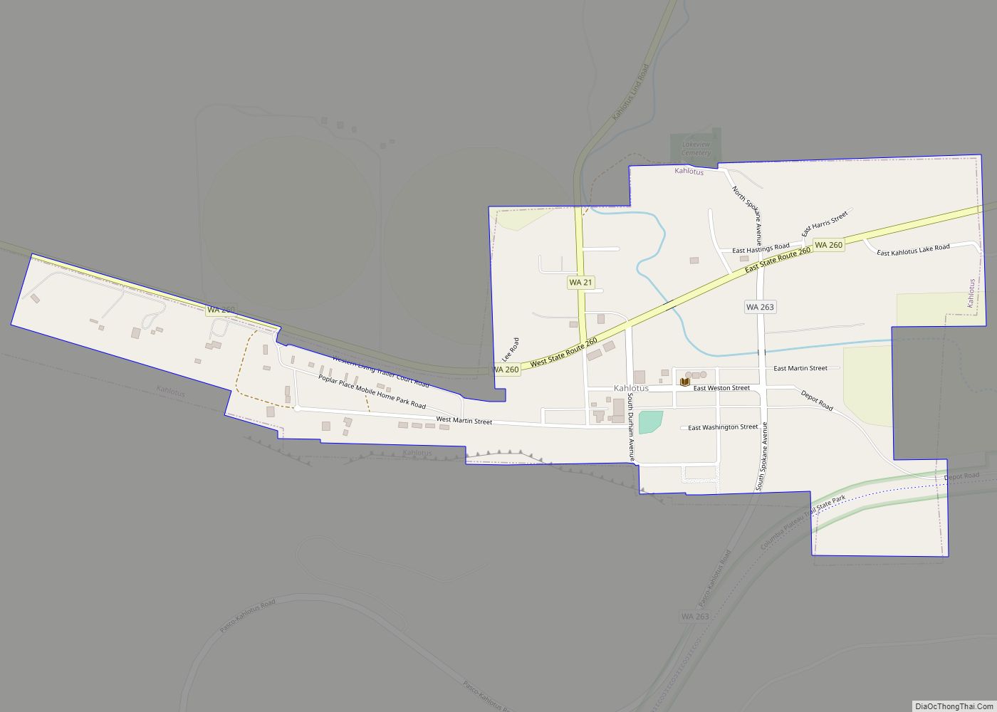
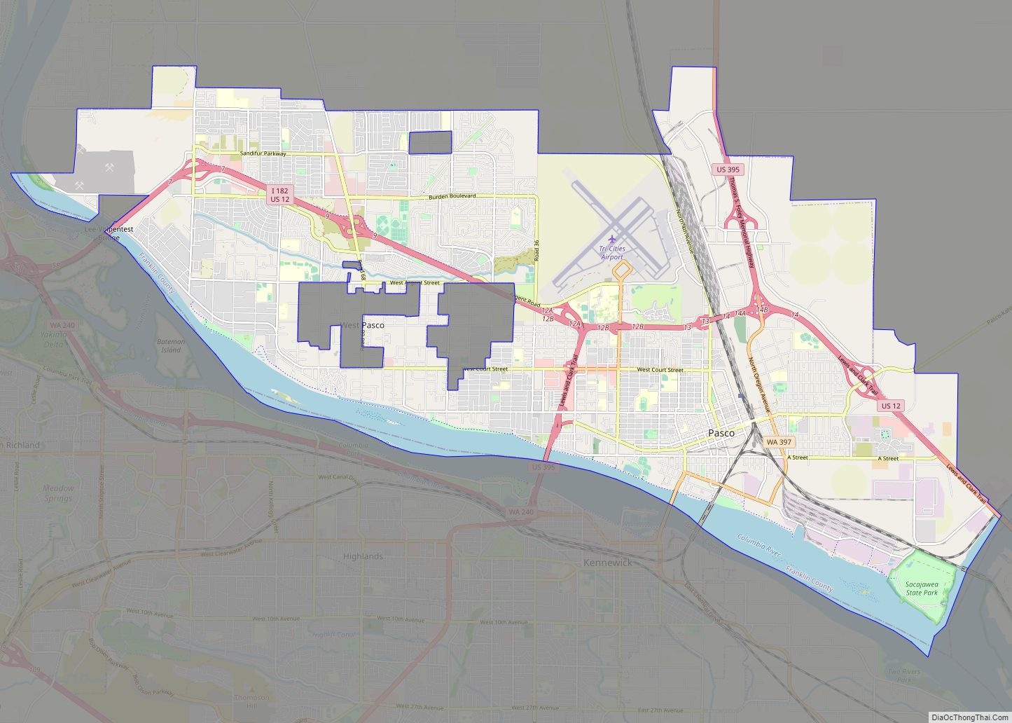
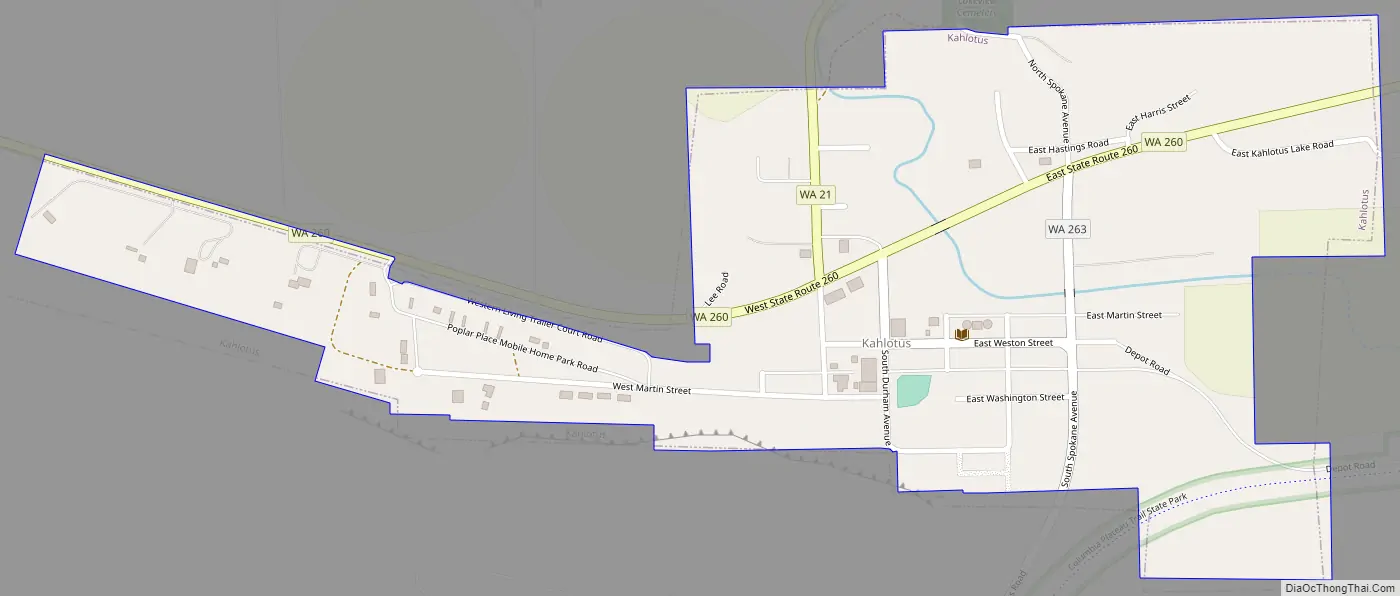
Kahlotus Road Map
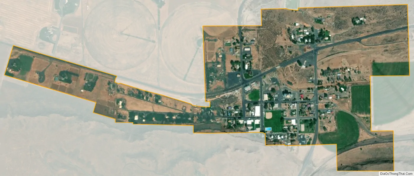
Kahlotus city Satellite Map
Geography
Kahlotus lies on the floor of Washtucna Coulee at the junction of three state highways. State Route 21 has its southern terminus in Kahlotus, from which it runs north all the way to the Canadian border. State Route 260 passes through Kahlotus as it follows the path of the coulee from Connell in the west to Washtucna in the east. State Route 263 has its northern terminus in Kahlotus, from which it extends through the Devils Canyon to the Lower Monumental Dam on the Snake River six miles south of the city. The Columbia Plateau Trail passes through Kahlotus, entering the city from the east along Washtucna Coulee before turning south into the Devils Canyon.
Being located on the floor of a coulee puts Kahlotus at relatively lower elevation than the surrounding terrain. The steep walls of the coulee rise hundreds of feet dramatically to the north and south of the city center.
According to the United States Census Bureau, the city has a total area of 0.47 square miles (1.22 km), all of it land.
Climate
According to the Köppen Climate Classification system, Kahlotus has a semi-arid climate, abbreviated “BSk” on climate maps.
See also
Map of Washington State and its subdivision:- Adams
- Asotin
- Benton
- Chelan
- Clallam
- Clark
- Columbia
- Cowlitz
- Douglas
- Ferry
- Franklin
- Garfield
- Grant
- Grays Harbor
- Island
- Jefferson
- King
- Kitsap
- Kittitas
- Klickitat
- Lewis
- Lincoln
- Mason
- Okanogan
- Pacific
- Pend Oreille
- Pierce
- San Juan
- Skagit
- Skamania
- Snohomish
- Spokane
- Stevens
- Thurston
- Wahkiakum
- Walla Walla
- Whatcom
- Whitman
- Yakima
- Alabama
- Alaska
- Arizona
- Arkansas
- California
- Colorado
- Connecticut
- Delaware
- District of Columbia
- Florida
- Georgia
- Hawaii
- Idaho
- Illinois
- Indiana
- Iowa
- Kansas
- Kentucky
- Louisiana
- Maine
- Maryland
- Massachusetts
- Michigan
- Minnesota
- Mississippi
- Missouri
- Montana
- Nebraska
- Nevada
- New Hampshire
- New Jersey
- New Mexico
- New York
- North Carolina
- North Dakota
- Ohio
- Oklahoma
- Oregon
- Pennsylvania
- Rhode Island
- South Carolina
- South Dakota
- Tennessee
- Texas
- Utah
- Vermont
- Virginia
- Washington
- West Virginia
- Wisconsin
- Wyoming