Mesa (/ˈmiːsə/) is a city in Franklin County, Washington, United States. The population was 489 at the 2010 census. The Washington State Office of Financial Management’s 2018 estimate placed the population at 513.
| Name: | Mesa city |
|---|---|
| LSAD Code: | 25 |
| LSAD Description: | city (suffix) |
| State: | Washington |
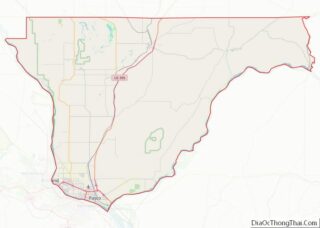
| County: | Franklin County |
| Elevation: | 689 ft (210 m) |
| Total Area: | 1.66 sq mi (4.29 km²) |
| Land Area: | 1.66 sq mi (4.29 km²) |
| Water Area: | 0.00 sq mi (0.00 km²) |
| Total Population: | 489 |
| Population Density: | 306.58/sq mi (118.39/km²) |
| ZIP code: | 99343 |
| Area code: | 509 |
| FIPS code: | 5345180 |
| GNISfeature ID: | 1512459 |
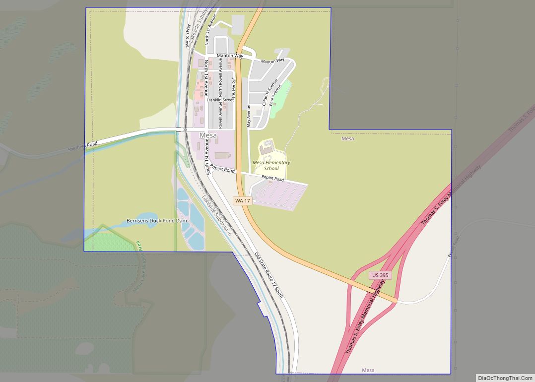
Online Interactive Map
Click on ![]() to view map in "full screen" mode.
to view map in "full screen" mode.
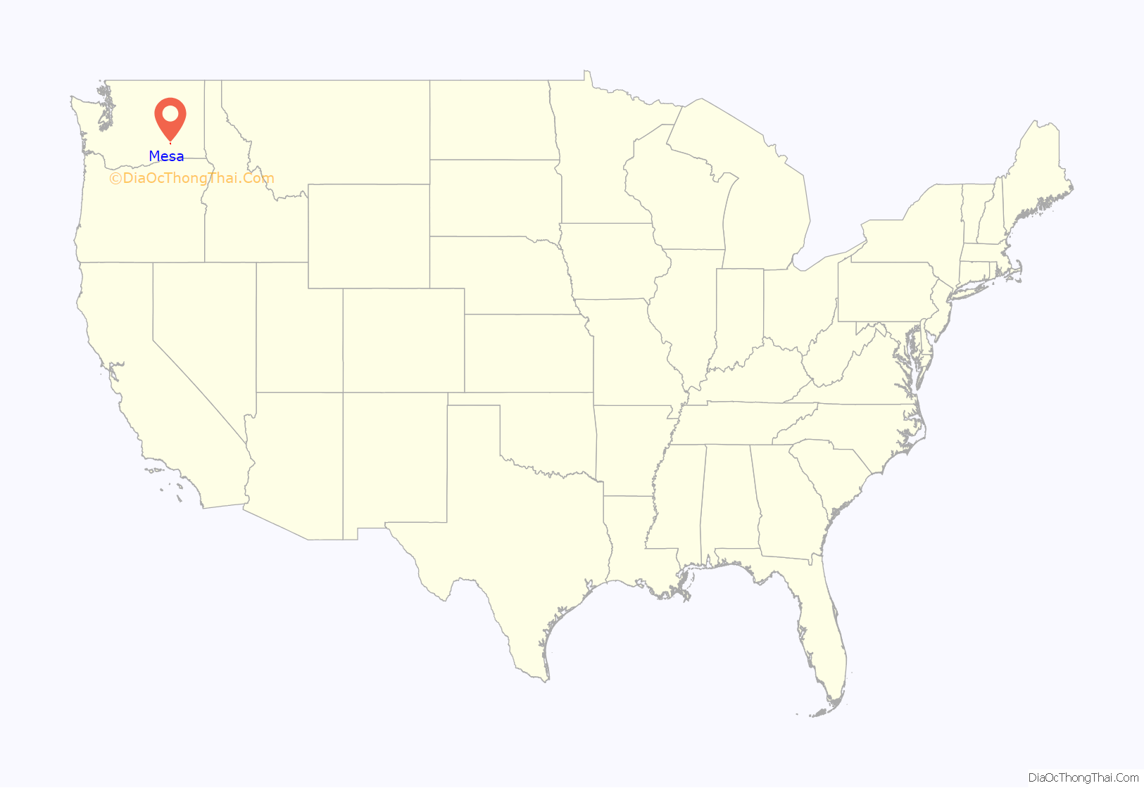
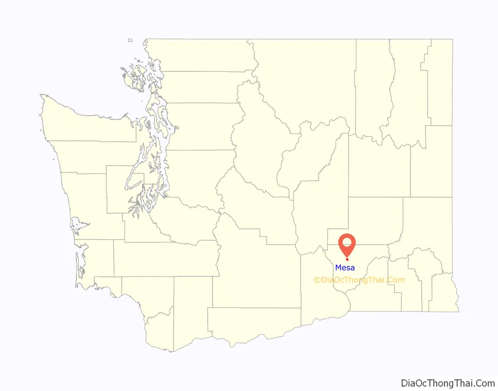
Mesa location map. Where is Mesa city?
History
Originally called Bluff Wells, then Judson, now Mesa was a stop on the Ainsworth (now Pasco) to Spokane branch of the Northern Pacific Railroad. It was the stop between Eltopia and Palouse Junction (now Connell). The station was established in 1883.
The Columbia Basin Irrigation Project brought water to the area in 1948. Prior to this development, people relied on either private wells or the railroad well at Mesa. Mesa was officially incorporated on June 23, 1955. Today, Mesa is a small town supported by dryland farming, irrigated farming, and livestock.
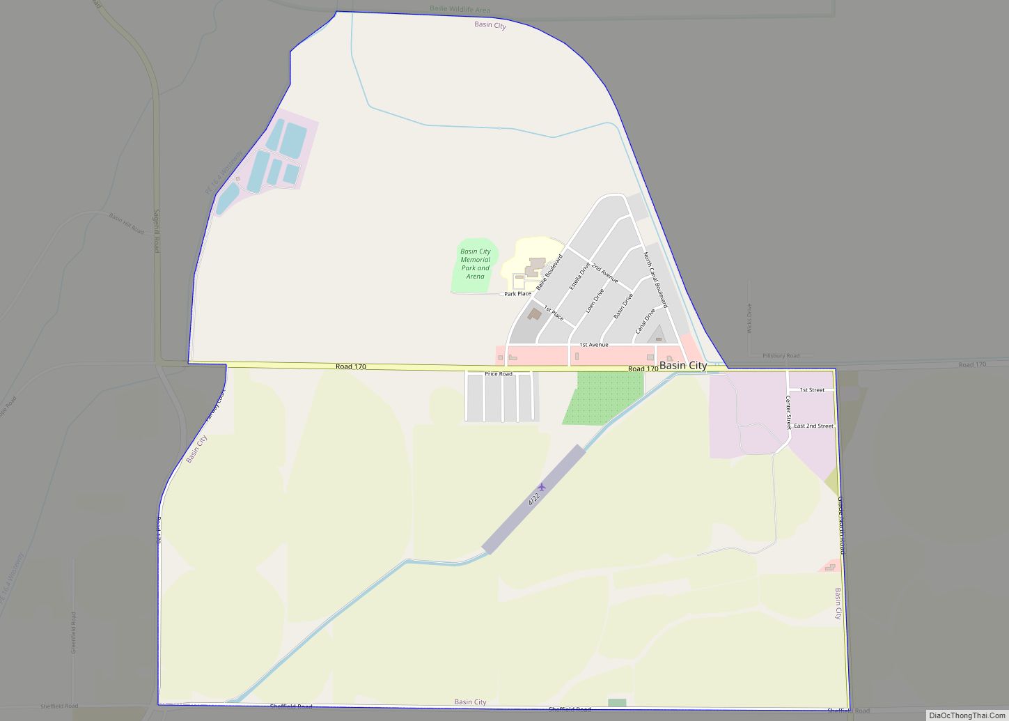
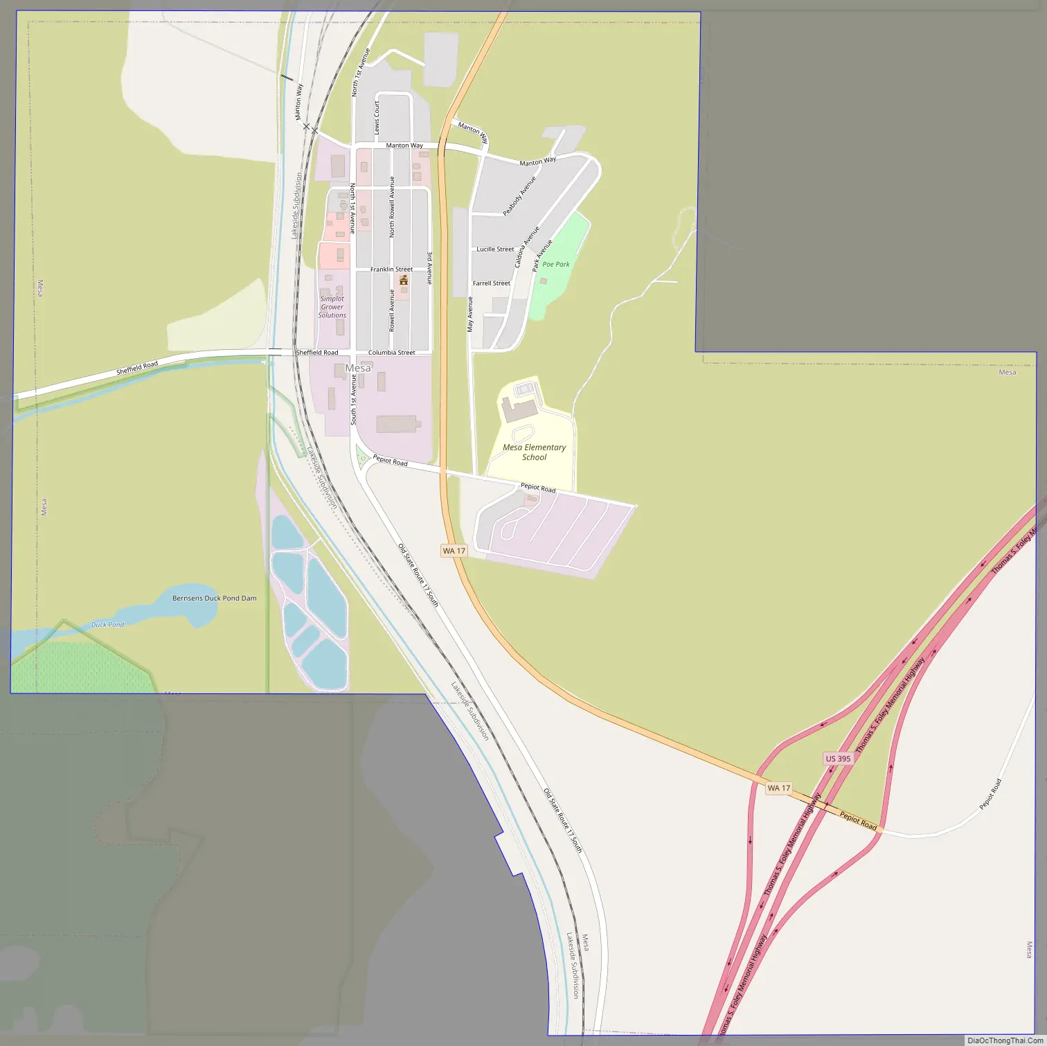
Mesa Road Map
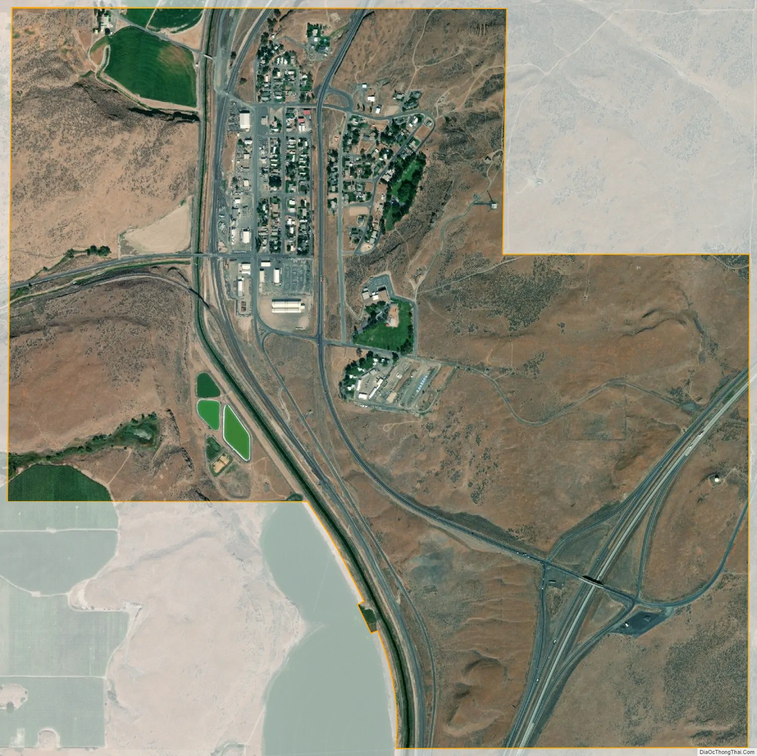
Mesa city Satellite Map
Geography
Mesa is located at 46°34′37″N 119°0′9″W / 46.57694°N 119.00250°W / 46.57694; -119.00250 (46.576963, -119.002516). The city is situated in Esquatzel Coulee at the junction of U.S. Route 395 and State Route 17, the latter of which has its southern terminus in Mesa. Route 395 connects Mesa with Interstate 82 in the Tri-Cities to the southwest and Interstate 90 in Ritzville to the northeast. Its location in a coulee means Mesa sits in a depression relative to the surrounding terrain, which rises a few hundred feet around the city.
According to the United States Census Bureau, the city has a total area of 1.64 square miles (4.25 km), all of it land.
See also
Map of Washington State and its subdivision:- Adams
- Asotin
- Benton
- Chelan
- Clallam
- Clark
- Columbia
- Cowlitz
- Douglas
- Ferry
- Franklin
- Garfield
- Grant
- Grays Harbor
- Island
- Jefferson
- King
- Kitsap
- Kittitas
- Klickitat
- Lewis
- Lincoln
- Mason
- Okanogan
- Pacific
- Pend Oreille
- Pierce
- San Juan
- Skagit
- Skamania
- Snohomish
- Spokane
- Stevens
- Thurston
- Wahkiakum
- Walla Walla
- Whatcom
- Whitman
- Yakima
- Alabama
- Alaska
- Arizona
- Arkansas
- California
- Colorado
- Connecticut
- Delaware
- District of Columbia
- Florida
- Georgia
- Hawaii
- Idaho
- Illinois
- Indiana
- Iowa
- Kansas
- Kentucky
- Louisiana
- Maine
- Maryland
- Massachusetts
- Michigan
- Minnesota
- Mississippi
- Missouri
- Montana
- Nebraska
- Nevada
- New Hampshire
- New Jersey
- New Mexico
- New York
- North Carolina
- North Dakota
- Ohio
- Oklahoma
- Oregon
- Pennsylvania
- Rhode Island
- South Carolina
- South Dakota
- Tennessee
- Texas
- Utah
- Vermont
- Virginia
- Washington
- West Virginia
- Wisconsin
- Wyoming