Moses Lake is a city in Grant County, Washington, United States. The population was 25,146 as of the 2020 census. Moses Lake is the largest city in Grant County. The city anchors the Moses Lake Micropolitan area, which includes all of Grant County and is part of the Moses Lake–Othello combined statistical area.
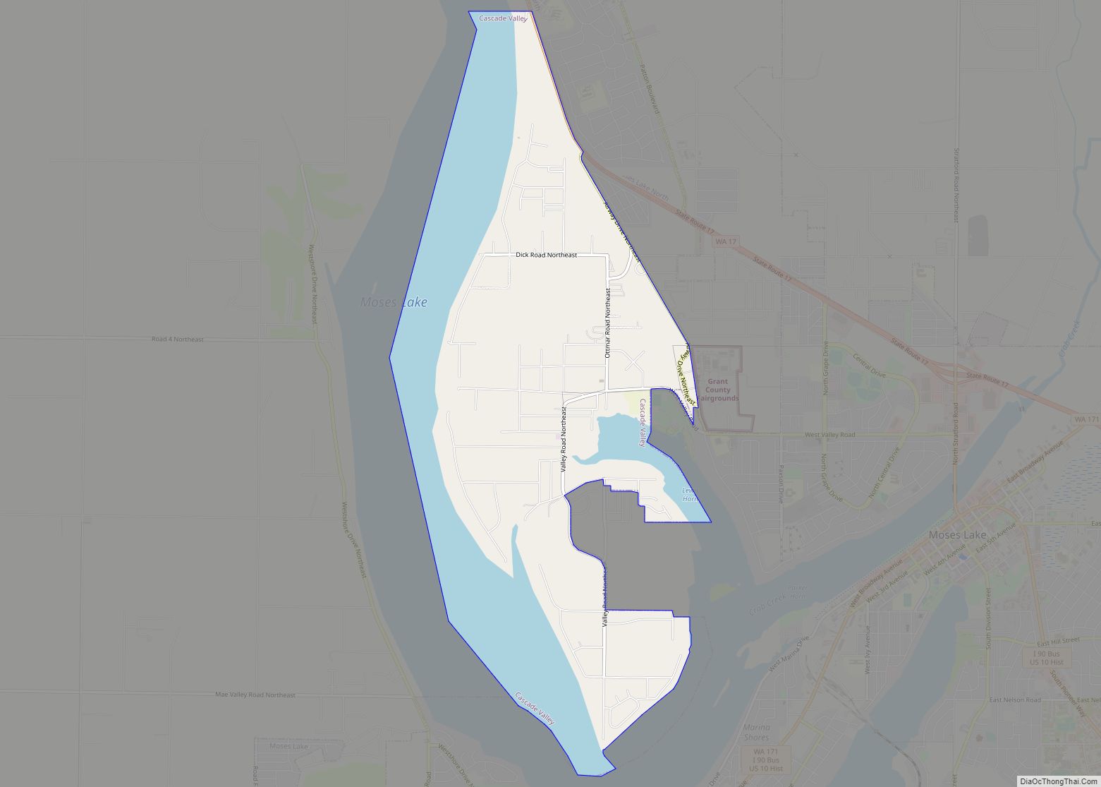
Moses Lake, on which the city lies, is made up of three main arms over 18 miles (29 km) long and up to one mile (1.6 km) wide. It is the largest natural body of fresh water in Grant County and has over 120 miles (190 km) of shoreline covering 6,500 acres (2,600 ha). Before it was dammed in the early 1900s and then incorporated into the Columbia Basin Project, Moses Lake was a smaller shallow lake. To the south of the town is the Potholes Reservoir and the Columbia National Wildlife Refuge that has a number of seep lakes and vast amounts of migratory birds and other fauna natural to the area.
| Name: | Moses Lake city |
|---|---|
| LSAD Code: | 25 |
| LSAD Description: | city (suffix) |
| State: | Washington |
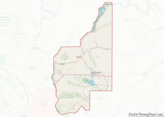
| County: | Grant County |
| Elevation: | 1,070 ft (326 m) |
| Land Area: | 17.95 sq mi (46.49 km²) |
| Water Area: | 2.96 sq mi (7.65 km²) |
| Population Density: | 1,341.76/sq mi (518.05/km²) |
| ZIP code: | 98837 |
| Area code: | 509 |
| FIPS code: | 5347245 |
| GNISfeature ID: | 1512481 |
| Website: | cityofml.com |
Online Interactive Map
Click on ![]() to view map in "full screen" mode.
to view map in "full screen" mode.
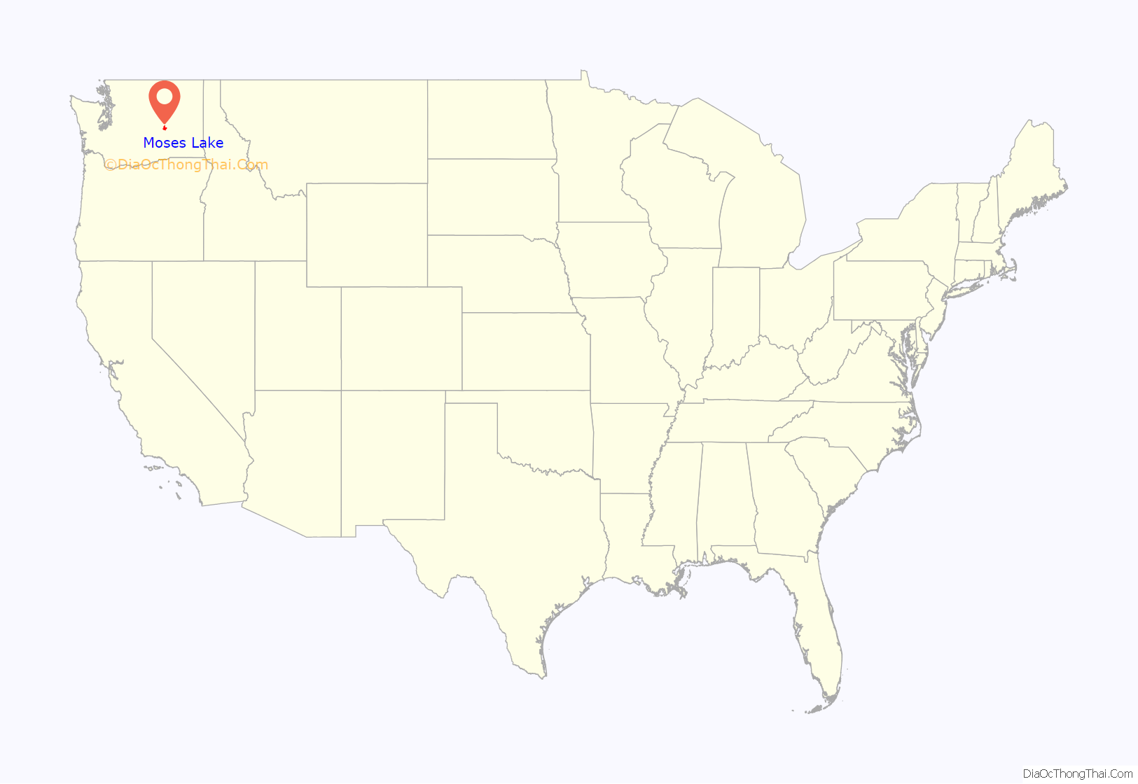
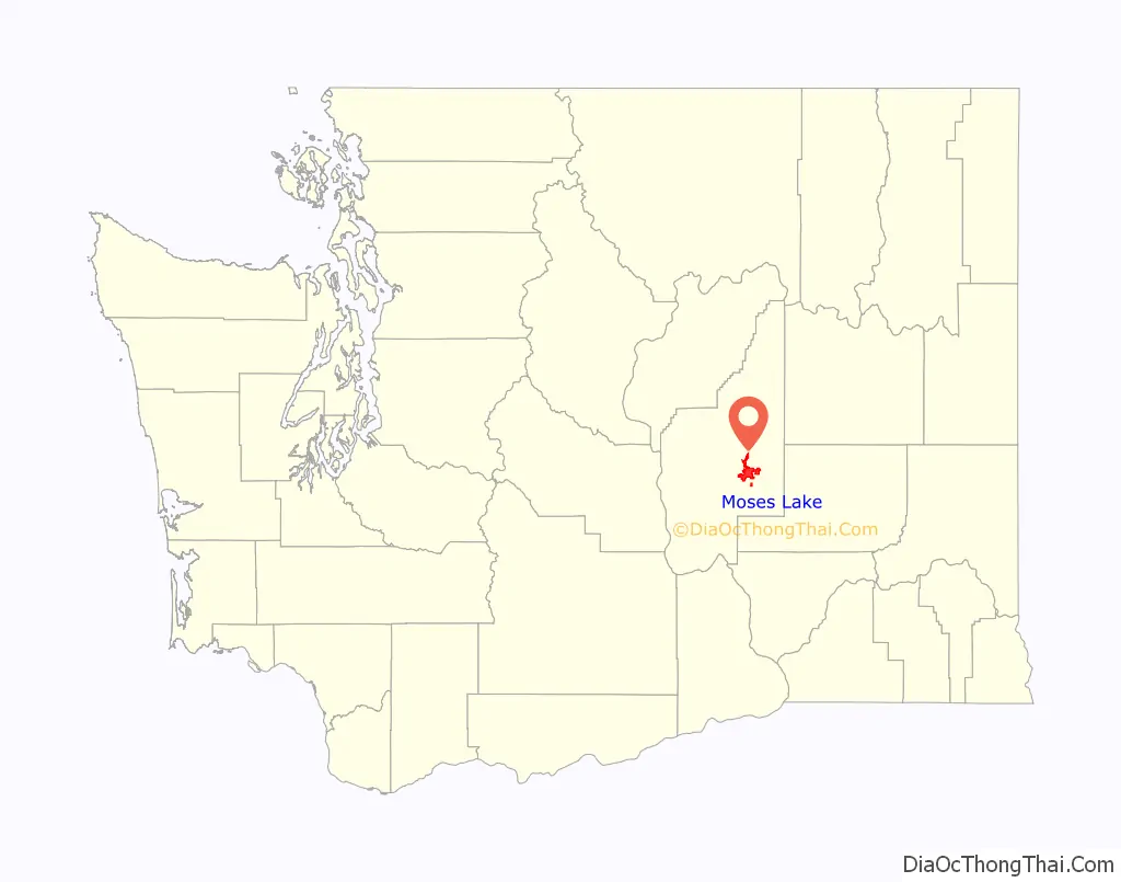
Moses Lake location map. Where is Moses Lake city?
History
Before the construction of Grand Coulee Dam on the Columbia River in 1941 and Moses Lake Army Air Base in 1942 the area was largely barren. Native Americans knew the area as Houaph, which meant willow. Chief Moses was leader of the Sinkiuse tribe from 1859 to 1899, and was forced to negotiate with white settlers who began to settle in the area in the 1880s. Under pressure from the government, Chief Moses traded the Columbia Basin land for a reservation that stretched from Lake Chelan north to the Canada–US border. The government later traded again for what is now the Colville Indian Reservation.
The new settlers named the lake in honor of Chief Moses. The city was originally named Neppel, after a town in Germany where one of the original settlers had lived. The first settlers established fisheries and farms — some of the first exported items were carp, jackrabbits and fruit — but irrigation attempts failed and settlers left at about the same rate as they came. When the town was incorporated and renamed Moses Lake in 1938, the population was estimated at 302 people.
The arrival of the air base in 1942 and irrigation water pumped from Grand Coulee Dam in 1955 offered newcomers a reason and a way to settle in an area that previously had little to offer other than good fishing and a place to water sheep and cattle. Moses Lake was quickly transformed into a hub for a vast region where transportation, agriculture and recreation came together.
The air base was built to train World War II pilots to fly the P-38 Lightning and B-17 Flying Fortress, two planes that were essential to the war effort. The base was closed after the war ended, but reopened in 1948 as a U.S. Air Force base and test area for Boeing’s B-47 Stratojet and B-50 Superfortress.
The B-47 tests led to development of modern commercial jetliners still used today. Fighter jets were stationed there to protect Grand Coulee Dam to the north and the Hanford site to the south. Boeing still uses the airport as a test and evaluation facility for its aircraft. Japan Airlines used the airport as a training area from November 1968 until March 2009. The old air base is now owned by the Port of Moses Lake and is home to Grant County International Airport, Big Bend Community College and several businesses.
Farmers, meanwhile, had developed new methods to irrigate water from the lake and from the Columbia River and began planting expansive irrigated acreage. When the Columbia Basin Project began to deliver water to the area in the mid-1950s, farms expanded by thousands of acres, growing potatoes, corn, onions, carrots and sugar beets.
In little more than a decade, Moses Lake’s population grew from 300 to 2,679 in 1950. Today, the population is 25,146 (2020 census).
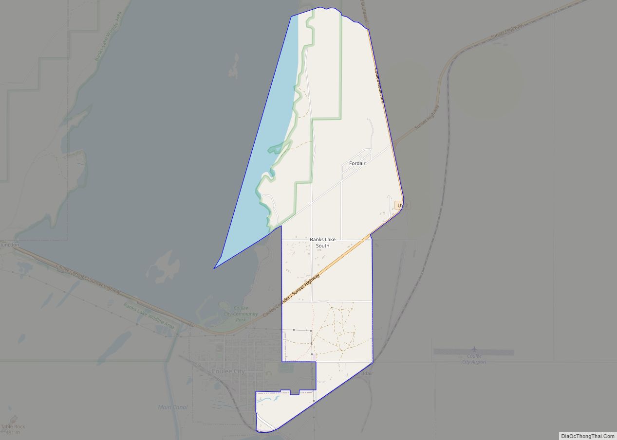
Moses Lake Road Map
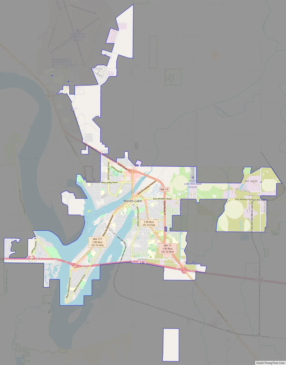
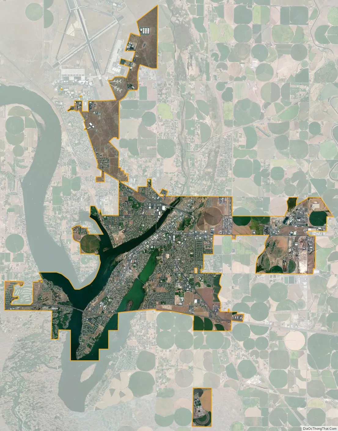
Moses Lake city Satellite Map
Geography
According to the United States Census Bureau, the city has a total area of 18.75 square miles (48.56 km), of which 15.75 square miles (40.79 km) is land and 3.00 square miles (7.77 km) is water.
Landscape
See also
Map of Washington State and its subdivision:- Adams
- Asotin
- Benton
- Chelan
- Clallam
- Clark
- Columbia
- Cowlitz
- Douglas
- Ferry
- Franklin
- Garfield
- Grant
- Grays Harbor
- Island
- Jefferson
- King
- Kitsap
- Kittitas
- Klickitat
- Lewis
- Lincoln
- Mason
- Okanogan
- Pacific
- Pend Oreille
- Pierce
- San Juan
- Skagit
- Skamania
- Snohomish
- Spokane
- Stevens
- Thurston
- Wahkiakum
- Walla Walla
- Whatcom
- Whitman
- Yakima
- Alabama
- Alaska
- Arizona
- Arkansas
- California
- Colorado
- Connecticut
- Delaware
- District of Columbia
- Florida
- Georgia
- Hawaii
- Idaho
- Illinois
- Indiana
- Iowa
- Kansas
- Kentucky
- Louisiana
- Maine
- Maryland
- Massachusetts
- Michigan
- Minnesota
- Mississippi
- Missouri
- Montana
- Nebraska
- Nevada
- New Hampshire
- New Jersey
- New Mexico
- New York
- North Carolina
- North Dakota
- Ohio
- Oklahoma
- Oregon
- Pennsylvania
- Rhode Island
- South Carolina
- South Dakota
- Tennessee
- Texas
- Utah
- Vermont
- Virginia
- Washington
- West Virginia
- Wisconsin
- Wyoming