Ocean Shores is a city in Grays Harbor County, Washington, United States. The population was 6,715 at the 2020 census.
| Name: | Ocean Shores city |
|---|---|
| LSAD Code: | 25 |
| LSAD Description: | city (suffix) |
| State: | Washington |
| County: | Grays Harbor County |
| Elevation: | 23 ft (7 m) |
| Total Area: | 13.78 sq mi (35.68 km²) |
| Land Area: | 8.52 sq mi (22.06 km²) |
| Water Area: | 5.26 sq mi (13.62 km²) |
| Total Population: | 6,715 |
| Population Density: | 762.30/sq mi (294.32/km²) |
| ZIP code: | 98569 |
| Area code: | 360 |
| FIPS code: | 5350570 |
| GNISfeature ID: | 1510681 |
| Website: | osgov.com |
Online Interactive Map
Click on ![]() to view map in "full screen" mode.
to view map in "full screen" mode.
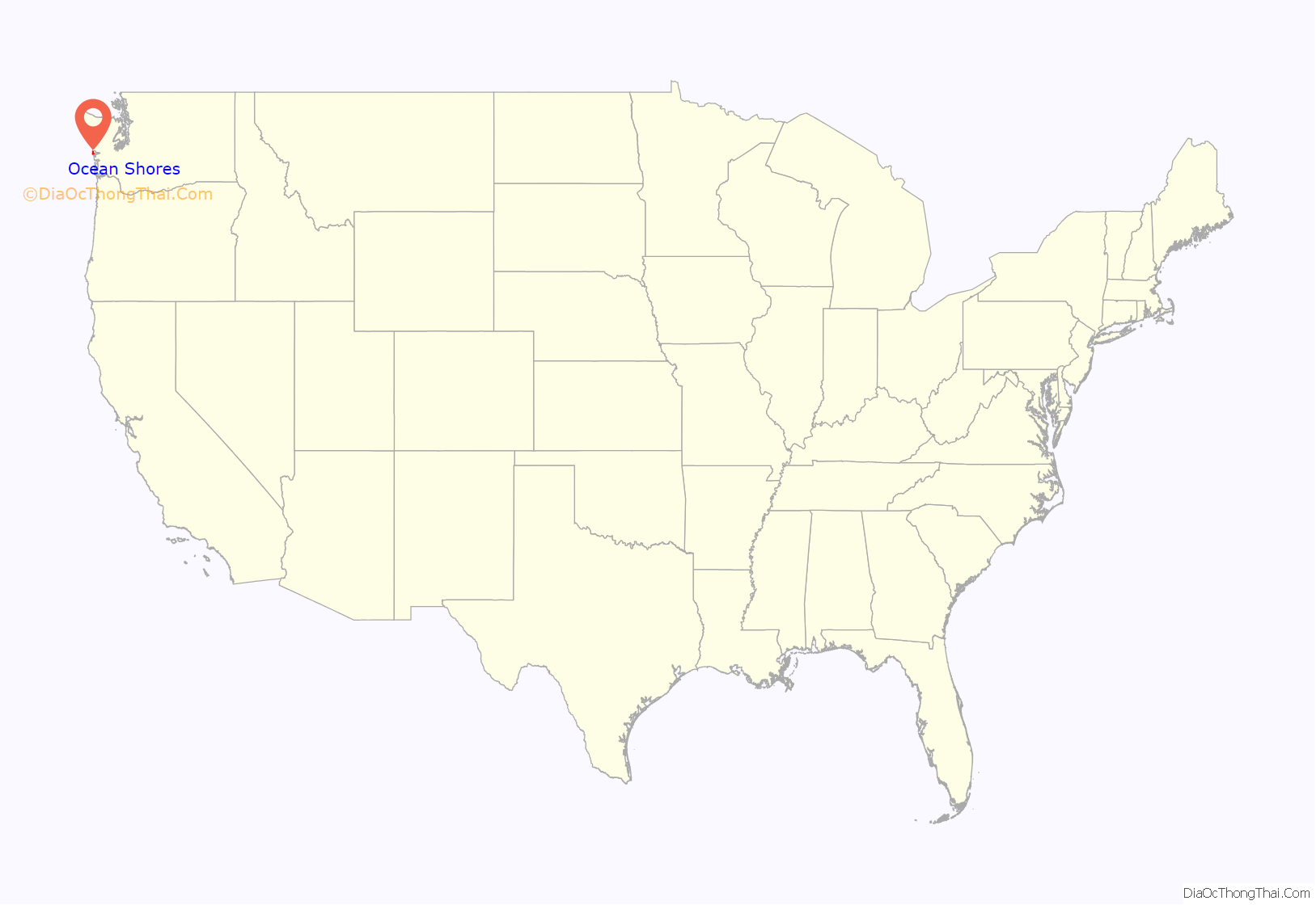
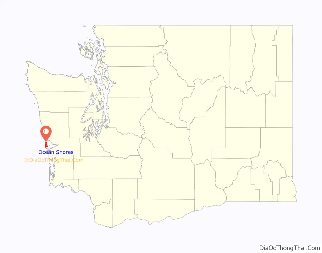
Ocean Shores location map. Where is Ocean Shores city?
History
The City of Ocean Shores occupies the Point Brown peninsula on the Washington coast. Long before the arrival of European explorers and settlers, the peninsula was used by the various local tribes for trading and other purposes. The Chinook, Chehalis, and Quinault tribes used the area, as well as others that now make up the Quinault Indian Nation.
On May 7, 1792, Captain Robert Gray sailed into the bay and named the area Bullfinch Harbor. Later, Captain George Vancouver renamed the area Grays Harbor after Captain Gray. The first established white settler on the Point was Matthew McGee, who settled in the early 1860s. He sold the southern portion of the peninsula to A.O. Damon in 1878 for a trading supply center whose dock extended into the Oyehut channel. A.O. Damon took over the entire peninsula from McGee, and the land was passed along to his grandson, Ralph Minard, who used the area as a cattle ranch from 1929 until he sold to the Ocean Shores Development Corporation in 1960 for $1,000,000.
At the time the Washington State legislature was considering legalizing some forms of gambling. In expectation of a huge casino development, the Ocean Shores Development Corporation opened their sale of lots in a travel trailer parked in the dunes. Soon the word spread about the California-style development of the place called Ocean Shores. Lots began at $595 and were sold sight unseen from the first plat maps. As the numbers of lots sold rose, the prices rose. Property lots were staked and numbered only as the road construction crews began to lay out the massive road system. Even though the first roads were only 20 miles (32 km) in length, the downtown area had mercury vapor lights to show that this was a booming city. In the first year 25 homes were constructed and their owners had charter membership certificates in the Ocean Shores Community Club.
As the development grew, the Ginny Simms Restaurant and Nightclub brought in the Hollywood set. In fact, on its opening night, chartered planes flew up a whole contingent of Hollywood stars, and 11,000 people turned out at Bowerman Basin to see the celebrities.
By December 1960, 25 miles (40 km) of canals were planned, a six-hole golf course was drawing players, and the mall shopping area was ready for the 1961 Ocean Shores Estates construction boom. The mall, 100 motel units, three restaurants and an airstrip sprang up from the sandy ground, with the marina opening in 1963. The SS Catala was brought up from California to become a “boatel” and charter fleet office. Two years later a southwest winter storm drove her into the sand and for many years she was the most famous shipwreck on the Washington Coast. In 1966 the gates to the city were installed.
Pat Boone became a local resident in 1967 as a stockholder in Ocean Shores Estates Incorporated, and promotion of the development was sped along by the Celebrity Golf tournaments hosted by Boone.
By 1969, Ocean Shores was declared the “richest little city” per capita in the country, with an assessed valuation of $35 million and 900 permanent residents. The following year the city was incorporated and a planning commission was formed to zone the city and codify streets. The city’s first school opened in 1971 and road paving began in earnest.
During the 1970s, the town struggled through many setbacks brought on mainly by the state’s economic recession. By the 1980s, the slump was over and construction of homes and businesses accelerated again.
Ocean Shores Road Map
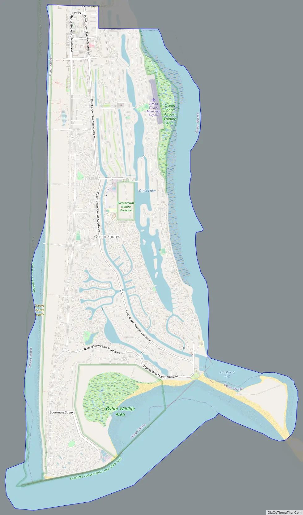
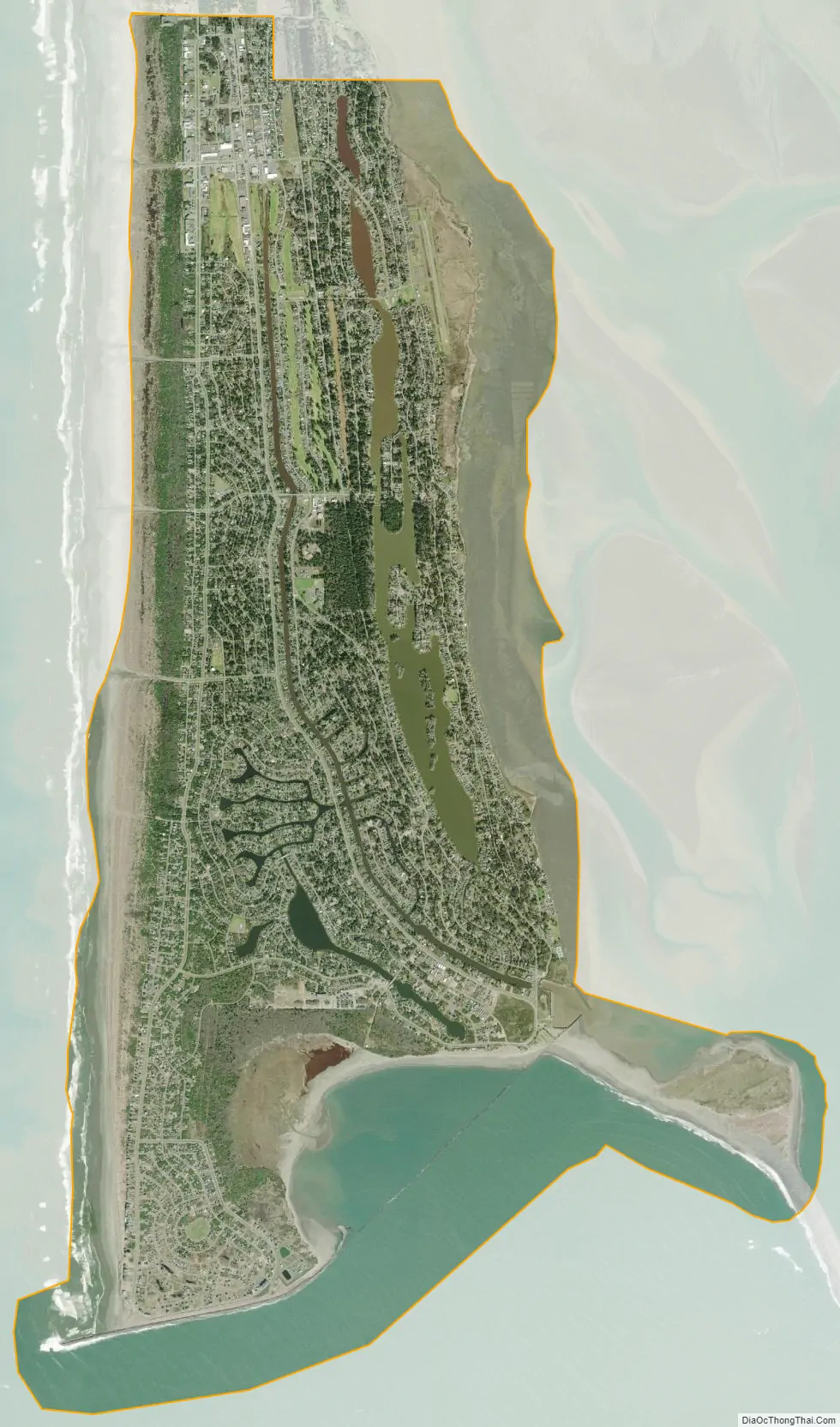
Ocean Shores city Satellite Map
Geography
According to the United States Census Bureau, the city has a total area of 12.40 square miles (32.12 km), of which 8.51 square miles (22.04 km) is land and 3.89 square miles (10.08 km) is water.
Climate
Ocean Shores experiences an oceanic climate (Köppen climate classification Cfb), with tendencies towards a Mediterranean (Köppen Csb), notably the pattern of a wetter winter and moderately drier summer.
The climate is similar to nearby Aberdeen, situated slightly farther inland, but Ocean Shores experiences a narrower range of temperatures and is significantly less susceptible to extremes of heat in the summer, caused by hotter, inland air masses being pushed into the region.
See also
Map of Washington State and its subdivision:- Adams
- Asotin
- Benton
- Chelan
- Clallam
- Clark
- Columbia
- Cowlitz
- Douglas
- Ferry
- Franklin
- Garfield
- Grant
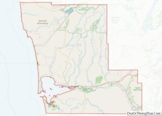
- Grays Harbor
- Island
- Jefferson
- King
- Kitsap
- Kittitas
- Klickitat
- Lewis
- Lincoln
- Mason
- Okanogan
- Pacific
- Pend Oreille
- Pierce
- San Juan
- Skagit
- Skamania
- Snohomish
- Spokane
- Stevens
- Thurston
- Wahkiakum
- Walla Walla
- Whatcom
- Whitman
- Yakima
- Alabama
- Alaska
- Arizona
- Arkansas
- California
- Colorado
- Connecticut
- Delaware
- District of Columbia
- Florida
- Georgia
- Hawaii
- Idaho
- Illinois
- Indiana
- Iowa
- Kansas
- Kentucky
- Louisiana
- Maine
- Maryland
- Massachusetts
- Michigan
- Minnesota
- Mississippi
- Missouri
- Montana
- Nebraska
- Nevada
- New Hampshire
- New Jersey
- New Mexico
- New York
- North Carolina
- North Dakota
- Ohio
- Oklahoma
- Oregon
- Pennsylvania
- Rhode Island
- South Carolina
- South Dakota
- Tennessee
- Texas
- Utah
- Vermont
- Virginia
- Washington
- West Virginia
- Wisconsin
- Wyoming