Oroville is a city located in the northern bulk of the Okanogan Highlands in north-central Washington, United States. Oroville is a member municipality of Okanogan County, Washington, situated between Omak and Penticton. The population was 1,686 at the 2010 census.
| Name: | Oroville city |
|---|---|
| LSAD Code: | 25 |
| LSAD Description: | city (suffix) |
| State: | Washington |
| County: | Okanogan County |
| Incorporated: | August 7, 1908 |
| Elevation: | 938 ft (286 m) |
| Total Area: | 1.85 sq mi (4.78 km²) |
| Land Area: | 1.69 sq mi (4.38 km²) |
| Water Area: | 0.16 sq mi (0.40 km²) |
| Total Population: | 1,686 |
| Population Density: | 991.12/sq mi (382.78/km²) |
| ZIP code: | 98844 |
| Area code: | 509 |
| FIPS code: | 5351970 |
| GNISfeature ID: | 1524077 |
Online Interactive Map
Click on ![]() to view map in "full screen" mode.
to view map in "full screen" mode.
Oroville location map. Where is Oroville city?


History
Oroville was first settled by Caucasian settlers in the late 1850s and known as ‘rag town.’ The settlement was named Oro, after the Spanish word for gold, in 1892 after the surrounding gold mines and in an attempt to attract prospectors and merchants. The Post Office objected to the name “Oro” because a town was already named “Oso” in Washington, so the name was changed to Oroville, in 1909. Oroville was a stop along the Spokane Falls and Northern Railway line from British Columbia to Spokane, via Molson and Chesaw. In 1914 a third branch south to Wenatchee was constructed to avoid the steep inclines on the original Spokane track.
Passenger train service to Oroville was operated by the Great Northern Railway until July 14, 1953, with freight operations continuing later.
Oroville started to become a tourist location; in the mid-2000s, large condo developments were proposed. The city had an economy peak in 2005–2007, but has continued suffering since to the ‘great recession.’ It is home to the Dorothy Scott Airport, an international municipal airport with U.S. Customs check, located two miles outside of the town center that was opened in August 1937.
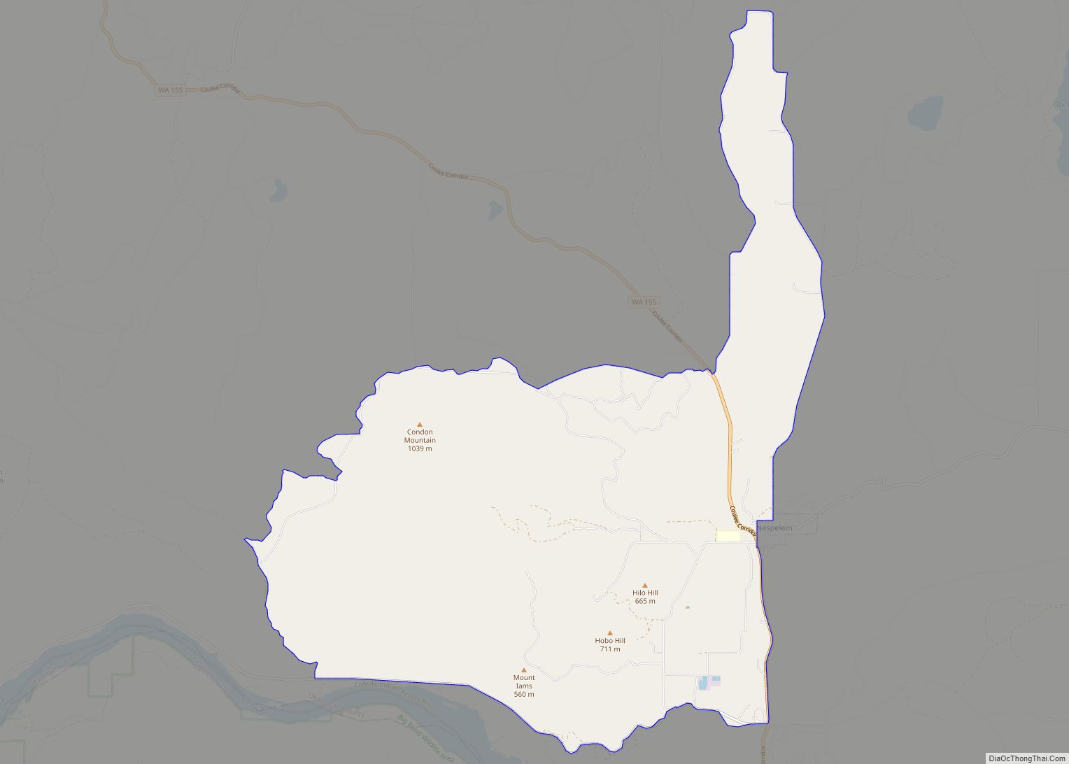
Oroville Road Map

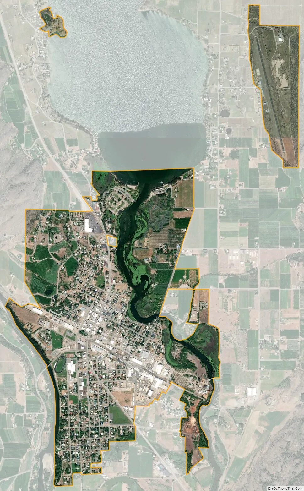
Oroville city Satellite Map
Geography
Oroville is located 4 miles (6.4 km) south of the Canada–US border, and features an official crossing into Osoyoos, British Columbia. It is located at the south end of Osoyoos Lake, which empties into the Okanogan River on the east side of the town; the town is bound to the west by the Similkameen River. U.S. Route 97 runs through Oroville.
According to the United States Census Bureau, the city has a total area of 1.68 square miles (4.35 km), of which, 1.64 square miles (4.25 km) is land and 0.04 square miles (0.10 km) is water.
Climate
Oroville lies in a climatic region that is typified by large seasonal temperature differences, with warm to hot summers and moderately cold winters. According to the Köppen climate classification system, Oroville has a humid continental climate, Dfb on climate maps.
See also
Map of Washington State and its subdivision:- Adams
- Asotin
- Benton
- Chelan
- Clallam
- Clark
- Columbia
- Cowlitz
- Douglas
- Ferry
- Franklin
- Garfield
- Grant
- Grays Harbor
- Island
- Jefferson
- King
- Kitsap
- Kittitas
- Klickitat
- Lewis
- Lincoln
- Mason
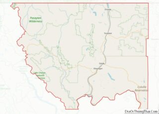
- Okanogan
- Pacific
- Pend Oreille
- Pierce
- San Juan
- Skagit
- Skamania
- Snohomish
- Spokane
- Stevens
- Thurston
- Wahkiakum
- Walla Walla
- Whatcom
- Whitman
- Yakima
- Alabama
- Alaska
- Arizona
- Arkansas
- California
- Colorado
- Connecticut
- Delaware
- District of Columbia
- Florida
- Georgia
- Hawaii
- Idaho
- Illinois
- Indiana
- Iowa
- Kansas
- Kentucky
- Louisiana
- Maine
- Maryland
- Massachusetts
- Michigan
- Minnesota
- Mississippi
- Missouri
- Montana
- Nebraska
- Nevada
- New Hampshire
- New Jersey
- New Mexico
- New York
- North Carolina
- North Dakota
- Ohio
- Oklahoma
- Oregon
- Pennsylvania
- Rhode Island
- South Carolina
- South Dakota
- Tennessee
- Texas
- Utah
- Vermont
- Virginia
- Washington
- West Virginia
- Wisconsin
- Wyoming