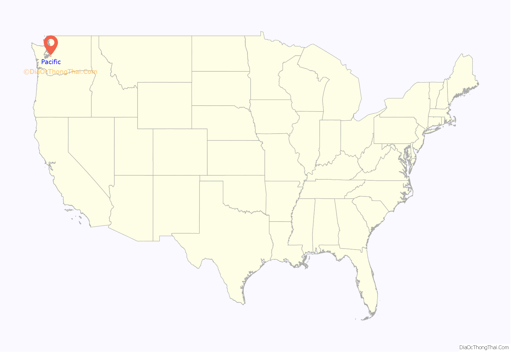
Pacific is a city in King and Pierce counties in the State of Washington. Located primarily in King County, the population was 7,235 at the 2020 census.
| Name: | Pacific city |
|---|---|
| LSAD Code: | 25 |
| LSAD Description: | city (suffix) |
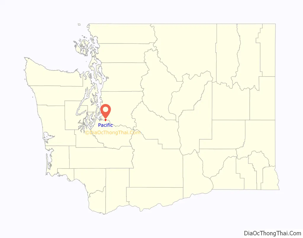
| State: | Washington |
| County: | King County, Pierce County |
| Elevation: | 79 ft (24 m) |
| Total Area: | 2.44 sq mi (6.31 km²) |
| Land Area: | 2.42 sq mi (6.27 km²) |
| Water Area: | 0.02 sq mi (0.05 km²) |
| Total Population: | 7,235 |
| Population Density: | 2,966.12/sq mi (1,145.35/km²) |
| ZIP code: | 98047 |
| Area code: | 253 |
| FIPS code: | 5352495 |
| GNISfeature ID: | 1512545 |
| Website: | pacificwa.gov |
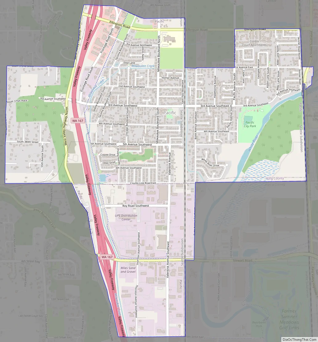
Online Interactive Map
Click on ![]() to view map in "full screen" mode.
to view map in "full screen" mode.
Pacific location map. Where is Pacific city?
History
Pacific was platted on April 10, 1906, by real estate promoter Clarence Dayton Hillman as “C.D. Hillman’s Pacific City Addition to the City of Seattle”. The development would take advantage of the nearby Puget Sound Electric Railway, which provided connections to Seattle and Tacoma. It was officially incorporated as a town on August 10, 1909.
In 1995, it annexed a portion of unincorporated Pierce County.
Record-breaking rains in November 2006 pushed the White River over its river banks along Pacific City Park, creating a temporary 25-acre (100,000 m) lake.
In January 2009, release of stormwaters from the Mud Mountain Dam caused even greater flooding, inundating more than a hundred homes.
Pacific Road Map
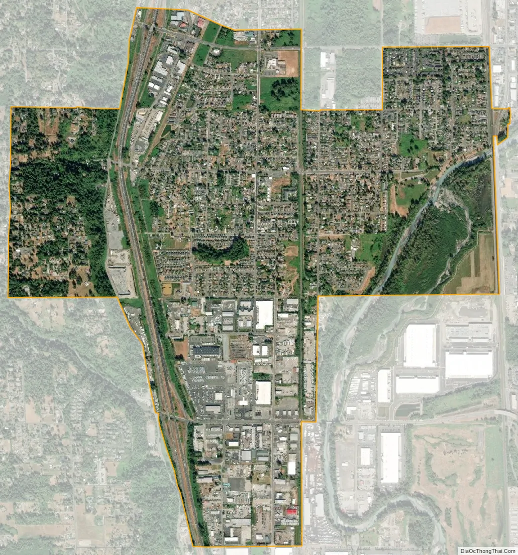
Pacific city Satellite Map
Geography
Pacific is located at 47°15′48″N 122°14′52″W / 47.26333°N 122.24778°W / 47.26333; -122.24778.
According to the United States Census Bureau, the city has a total area of 2.43 square miles (6.29 km), of which, 2.42 square miles (6.27 km) is land and 0.01 square miles (0.03 km) is water. The lower White River, also known as the Stuck River, runs through the east side of Pacific, between Auburn and Sumner.
See also
Map of Washington State and its subdivision:- Adams
- Asotin
- Benton
- Chelan
- Clallam
- Clark
- Columbia
- Cowlitz
- Douglas
- Ferry
- Franklin
- Garfield
- Grant
- Grays Harbor
- Island
- Jefferson
- King
- Kitsap
- Kittitas
- Klickitat
- Lewis
- Lincoln
- Mason
- Okanogan
- Pacific
- Pend Oreille
- Pierce
- San Juan
- Skagit
- Skamania
- Snohomish
- Spokane
- Stevens
- Thurston
- Wahkiakum
- Walla Walla
- Whatcom
- Whitman
- Yakima
- Alabama
- Alaska
- Arizona
- Arkansas
- California
- Colorado
- Connecticut
- Delaware
- District of Columbia
- Florida
- Georgia
- Hawaii
- Idaho
- Illinois
- Indiana
- Iowa
- Kansas
- Kentucky
- Louisiana
- Maine
- Maryland
- Massachusetts
- Michigan
- Minnesota
- Mississippi
- Missouri
- Montana
- Nebraska
- Nevada
- New Hampshire
- New Jersey
- New Mexico
- New York
- North Carolina
- North Dakota
- Ohio
- Oklahoma
- Oregon
- Pennsylvania
- Rhode Island
- South Carolina
- South Dakota
- Tennessee
- Texas
- Utah
- Vermont
- Virginia
- Washington
- West Virginia
- Wisconsin
- Wyoming


