Port Angeles East is a census-designated place (CDP) in Clallam County, Washington, United States. The population was 3,036 at the 2010 census. This unincorporated urban growth area bordering the city of Port Angeles is known by locals as the Gales Addition.
| Name: | Port Angeles East CDP |
|---|---|
| LSAD Code: | 57 |
| LSAD Description: | CDP (suffix) |
| State: | Washington |
| County: | Clallam County |
| Elevation: | 250 ft (80 m) |
| Total Area: | 4.6 sq mi (12.0 km²) |
| Land Area: | 3.8 sq mi (9.8 km²) |
| Water Area: | 0.8 sq mi (2.2 km²) |
| Total Population: | 3,036 |
| Population Density: | 806/sq mi (311.1/km²) |
| FIPS code: | 5355400 |
Online Interactive Map
Click on ![]() to view map in "full screen" mode.
to view map in "full screen" mode.
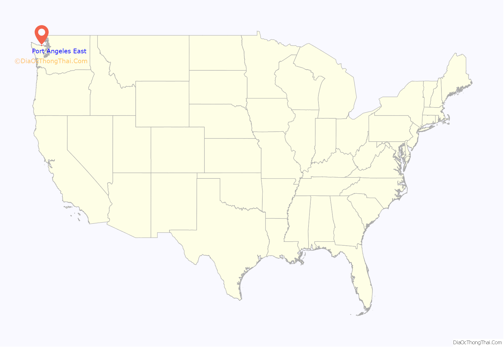
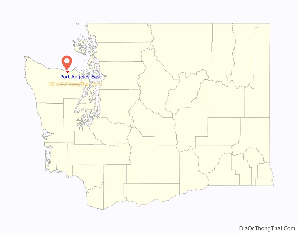
Port Angeles East location map. Where is Port Angeles East CDP?
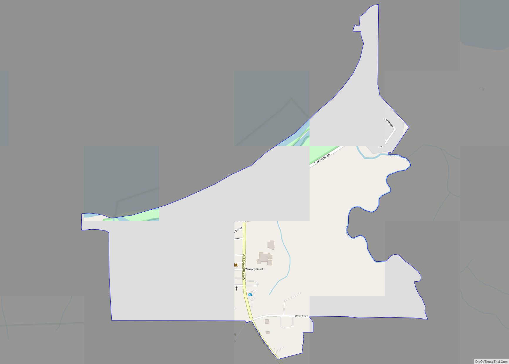
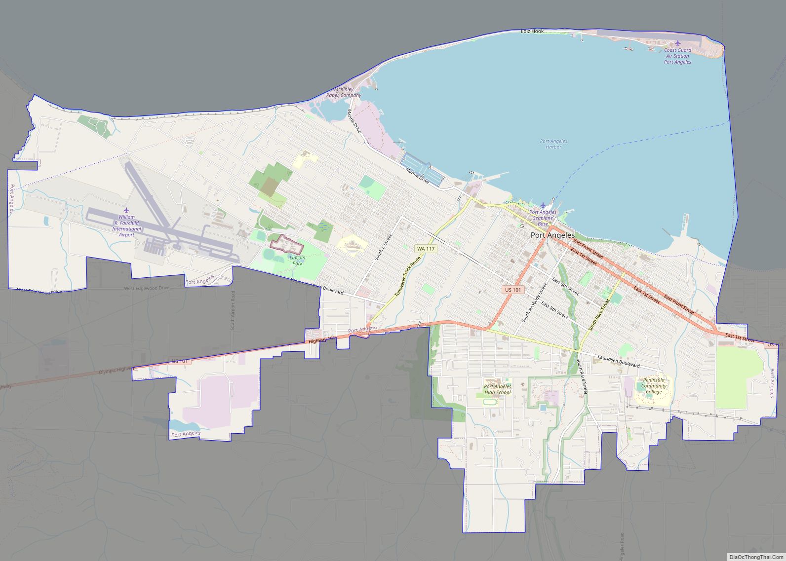
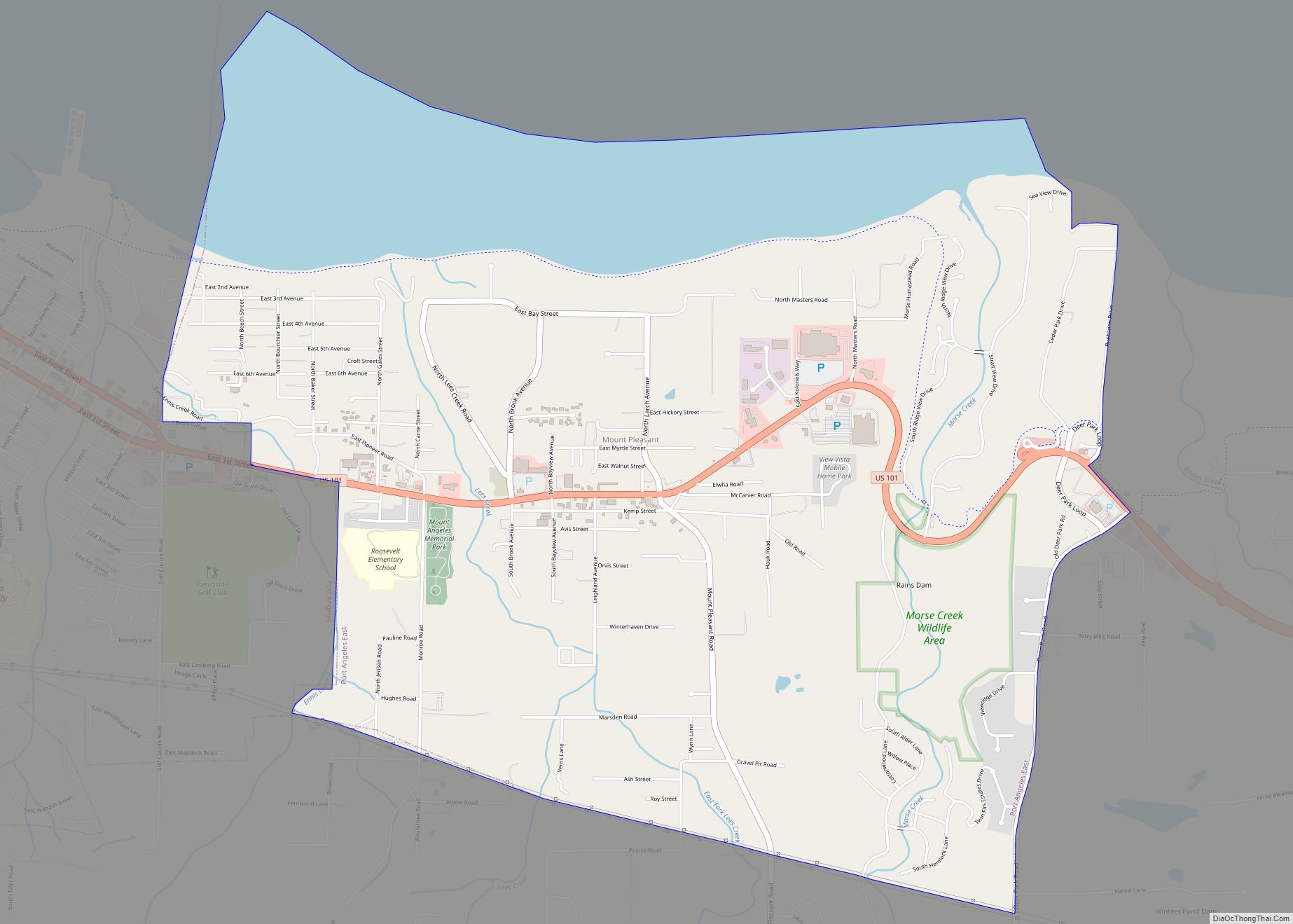
Port Angeles East Road Map
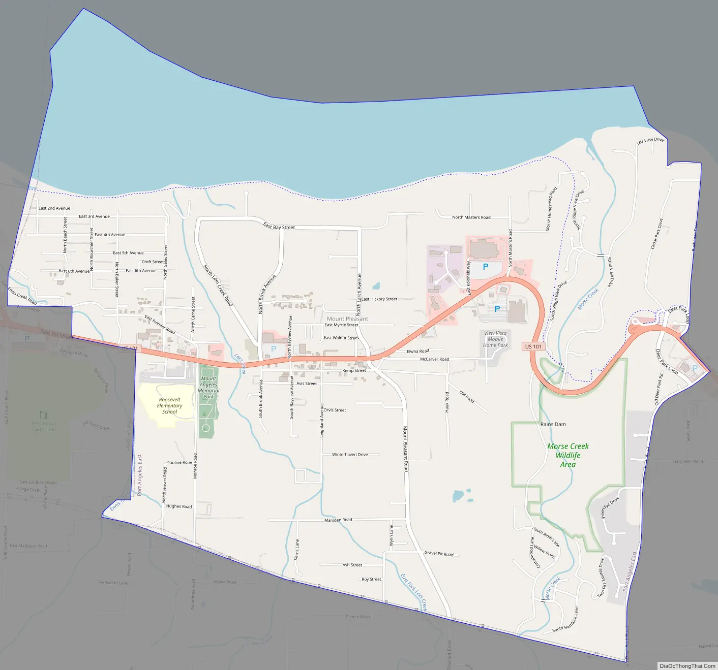
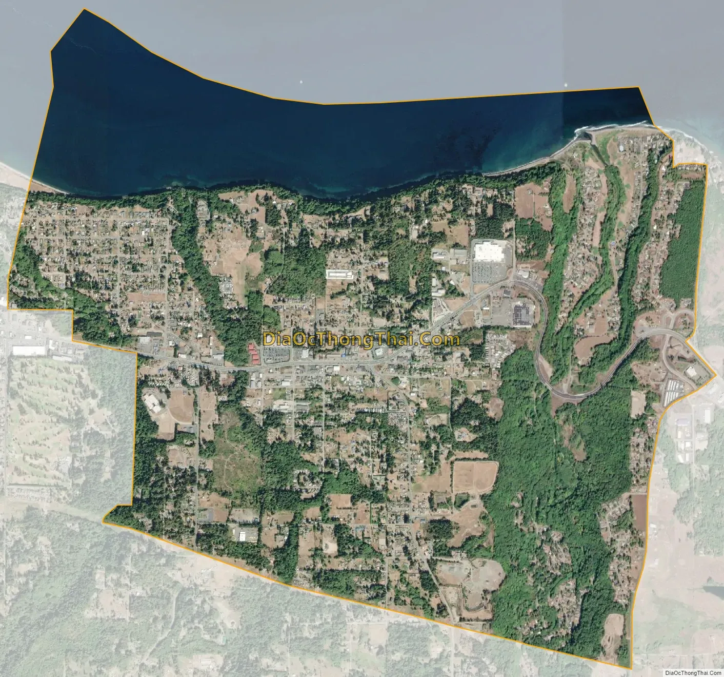
Port Angeles East city Satellite Map
Geography
Port Angeles East is located at 48°6′16″N 123°22′38″W / 48.10444°N 123.37722°W / 48.10444; -123.37722 (48.104420, -123.377296). The CDP extends west to the Port Angeles city limits, north to the Strait of Juan de Fuca and the entrance to Port Angeles Harbor, and east across Morse Creek to Deer Park Road. U.S. Route 101 passes through the community, leading west into Port Angeles and east 14 miles (23 km) to Sequim.
According to the United States Census Bureau, the Port Angeles East CDP has a total area of 4.6 square miles (12.0 km), of which 3.8 square miles (9.8 km) is land and 0.85 square miles (2.2 km), or 18.54%, is water.
See also
Map of Washington State and its subdivision:- Adams
- Asotin
- Benton
- Chelan
- Clallam
- Clark
- Columbia
- Cowlitz
- Douglas
- Ferry
- Franklin
- Garfield
- Grant
- Grays Harbor
- Island
- Jefferson
- King
- Kitsap
- Kittitas
- Klickitat
- Lewis
- Lincoln
- Mason
- Okanogan
- Pacific
- Pend Oreille
- Pierce
- San Juan
- Skagit
- Skamania
- Snohomish
- Spokane
- Stevens
- Thurston
- Wahkiakum
- Walla Walla
- Whatcom
- Whitman
- Yakima
- Alabama
- Alaska
- Arizona
- Arkansas
- California
- Colorado
- Connecticut
- Delaware
- District of Columbia
- Florida
- Georgia
- Hawaii
- Idaho
- Illinois
- Indiana
- Iowa
- Kansas
- Kentucky
- Louisiana
- Maine
- Maryland
- Massachusetts
- Michigan
- Minnesota
- Mississippi
- Missouri
- Montana
- Nebraska
- Nevada
- New Hampshire
- New Jersey
- New Mexico
- New York
- North Carolina
- North Dakota
- Ohio
- Oklahoma
- Oregon
- Pennsylvania
- Rhode Island
- South Carolina
- South Dakota
- Tennessee
- Texas
- Utah
- Vermont
- Virginia
- Washington
- West Virginia
- Wisconsin
- Wyoming