Sequim (/ˈskwɪm/ (listen) SKWIM) is a city in Clallam County, Washington, United States. It is located along the Dungeness River near the base of the Olympic Mountains. The 2020 census counted a population of 8,018, with an estimated population in 2021 of 8,241.
Sequim lies within the rain shadow of the Olympic Mountains and receives, on average, less than 16 inches (410 mm) of rain per year – about the same as Los Angeles, California – giving rise to the region’s local nickname of Sunny Sequim. However, the city is relatively close to some of the wettest temperate rainforests of the contiguous United States. This climate anomaly is sometimes called the “Blue Hole of Sequim”. Fogs and cool breezes from the Juan de Fuca Strait make Sequim’s climate more humid than would be expected from the low average rate of annual precipitation.
Some places have surprisingly luxuriant forests, dominated by Douglas-fir and western red cedar. Other trees growing in the area include black cottonwood, red alder, bigleaf maple, Pacific madrone, lodgepole pine and Garry oak, all of which can grow to a significant size. Historically, much of the area was an open, oak-studded prairie, supported by somewhat excessively-drained gravelly and sandy loam soil; agriculture and development of the Dungeness valley have changed this ecosystem. Most soils under Sequim have been placed in a series that is named after the city. This “Sequim series” is one of the few Mollisols in western Washington and its high base saturation, a characteristic of the Mollisol order, is attributed to the minimal leaching of bases caused by low annual rainfall.
The city and the surrounding area are particularly known for the commercial cultivation of lavender, supported by the unique climate. It makes Sequim the “Lavender Capital of North America”, rivaled only in France. The area is also known for its Dungeness crab.
Sequim is pronounced as one syllable, with the e elided: “skwim”. The name developed from the Klallam language.
| Name: | Sequim city |
|---|---|
| LSAD Code: | 25 |
| LSAD Description: | city (suffix) |
| State: | Washington |
| County: | Clallam County |
| Elevation: | 184 ft (56 m) |
| Total Area: | 6.40 sq mi (16.58 km²) |
| Land Area: | 6.32 sq mi (16.37 km²) |
| Water Area: | 0.08 sq mi (0.21 km²) |
| Total Population: | 8,018 |
| Population Density: | 1,252.81/sq mi (483.59/km²) |
| ZIP code: | 98382 |
| Area code: | 360 |
| FIPS code: | 5363385 |
| GNISfeature ID: | 1531505 |
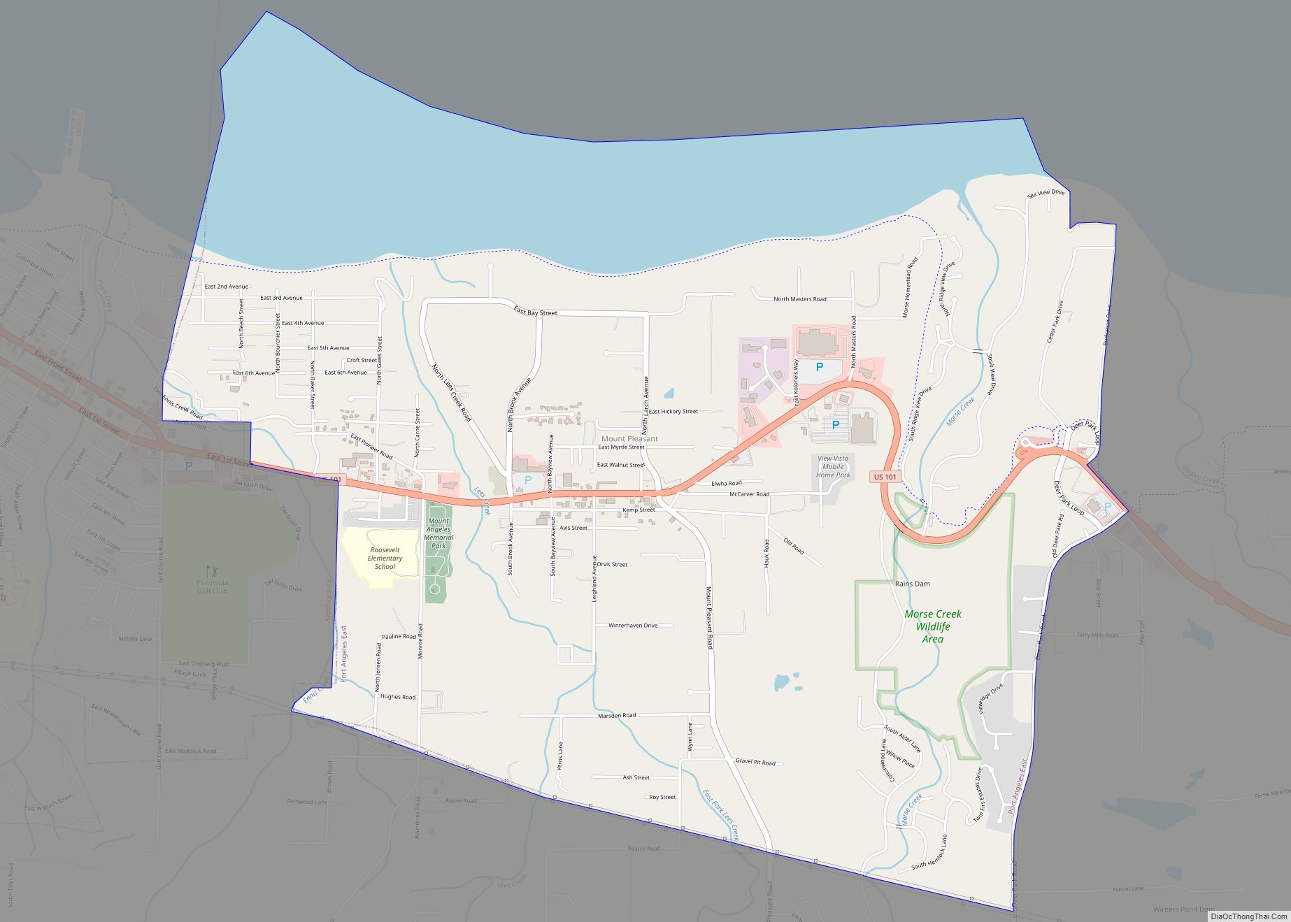
Online Interactive Map
Click on ![]() to view map in "full screen" mode.
to view map in "full screen" mode.
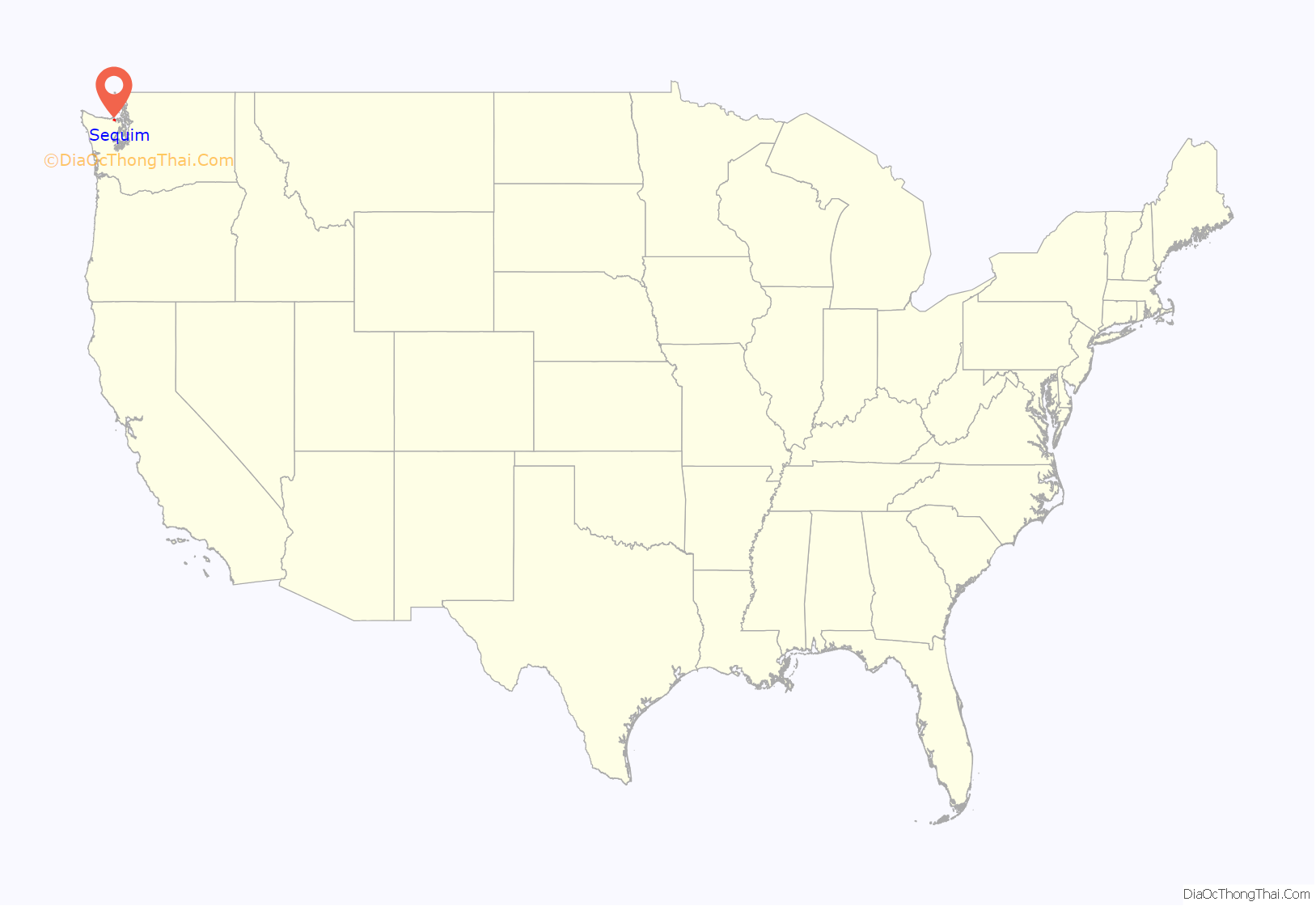
Sequim location map. Where is Sequim city?

History
Aboriginal inhabitants
Fossils discovered in the late 1970s – at a dig near Sequim known as the Manis Mastodon site, by Carl Gustafson, an archaeologist at Washington State University – included a mastodon bone with an embedded bone point, evidencing the presence of hunters in the area about 14,000 years ago. According to Michael R. Waters, an archaeologist at Texas A&M University, this is the first hunting weapon found that dates to the pre-Clovis period.
The S’Klallam tribe had inhabited the region prior to the arrival of the first Europeans. S’Klallam means “the strong people”. The band of S’Klallam Indians disbanded into their own individual federally recognized tribes in the early 1900s. The local tribe is the Jamestown S’Klallam tribe, named after one of their early leaders, Lord James Balch. According to other tales, the town Sequim in S’Klallam means “a place for going to shoot”, which represents the abundance of game and wildlife of the area.
Settlement
Manuel Quimper and George Vancouver explored the region’s coast in the 1790s. The first European settlers arrived in the Dungeness Valley in the 1850s, settling nearby Dungeness, Washington. While the lands along the river became fertile farmlands, the remainder of the area remained arid prairie, known as “the desert”. Irrigation canals first brought water to the prairie in the 1890s, allowing the expansion of farmlands.
Sequim was officially incorporated on October 31, 1913. For many decades small farms, mostly dairy farms, dotted the area around the small town. Near the end of World War I, Sequim became a stop for a railway that passed through from Port Angeles to Port Townsend, built primarily to carry wood products from the forests of the western Olympic Peninsula.
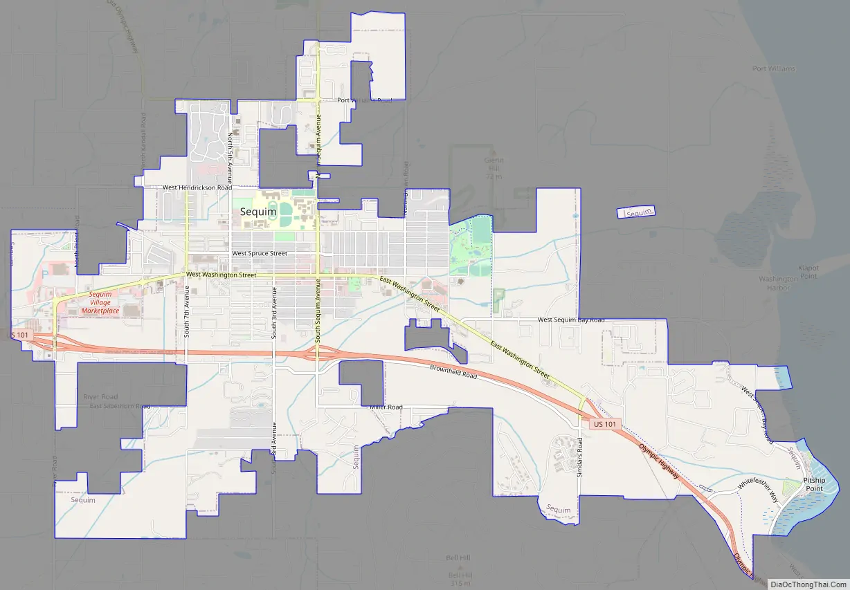
Sequim Road Map
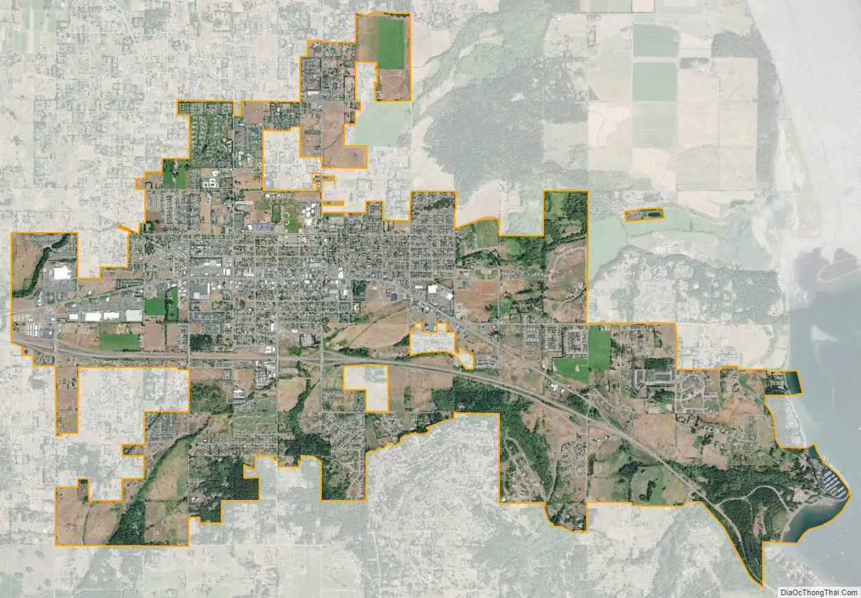
Sequim city Satellite Map
Geography
Sequim is located at 48°4′41″N 123°6′5″W / 48.07806°N 123.10139°W / 48.07806; -123.10139 (48.078002, -123.101427).
According to the United States Census Bureau, the city has a total area of 6.37 square miles (16.50 km), of which 6.31 square miles (16.34 km) is land and 0.06 square miles (0.16 km) is water.
Climate
Sequim experiences a warm-summer Mediterranean climate (Köppen climate classification Csb), sometimes classified as an oceanic climate owing to the relatively cool temperatures. Sequim is in the rain shadow of the Olympic Mountains, so annual precipitation is only 16 inches. Winters are mostly mild with very little snowfall. Many years there is no snow at all. The highest temperature recorded in Sequim was 99 °F (37.2 °C) on 16 July 1941, and the lowest −3 °F (−19.4 °C) on 19 January 1935.
See also
Map of Washington State and its subdivision:- Adams
- Asotin
- Benton
- Chelan
- Clallam
- Clark
- Columbia
- Cowlitz
- Douglas
- Ferry
- Franklin
- Garfield
- Grant
- Grays Harbor
- Island
- Jefferson
- King
- Kitsap
- Kittitas
- Klickitat
- Lewis
- Lincoln
- Mason
- Okanogan
- Pacific
- Pend Oreille
- Pierce
- San Juan
- Skagit
- Skamania
- Snohomish
- Spokane
- Stevens
- Thurston
- Wahkiakum
- Walla Walla
- Whatcom
- Whitman
- Yakima
- Alabama
- Alaska
- Arizona
- Arkansas
- California
- Colorado
- Connecticut
- Delaware
- District of Columbia
- Florida
- Georgia
- Hawaii
- Idaho
- Illinois
- Indiana
- Iowa
- Kansas
- Kentucky
- Louisiana
- Maine
- Maryland
- Massachusetts
- Michigan
- Minnesota
- Mississippi
- Missouri
- Montana
- Nebraska
- Nevada
- New Hampshire
- New Jersey
- New Mexico
- New York
- North Carolina
- North Dakota
- Ohio
- Oklahoma
- Oregon
- Pennsylvania
- Rhode Island
- South Carolina
- South Dakota
- Tennessee
- Texas
- Utah
- Vermont
- Virginia
- Washington
- West Virginia
- Wisconsin
- Wyoming