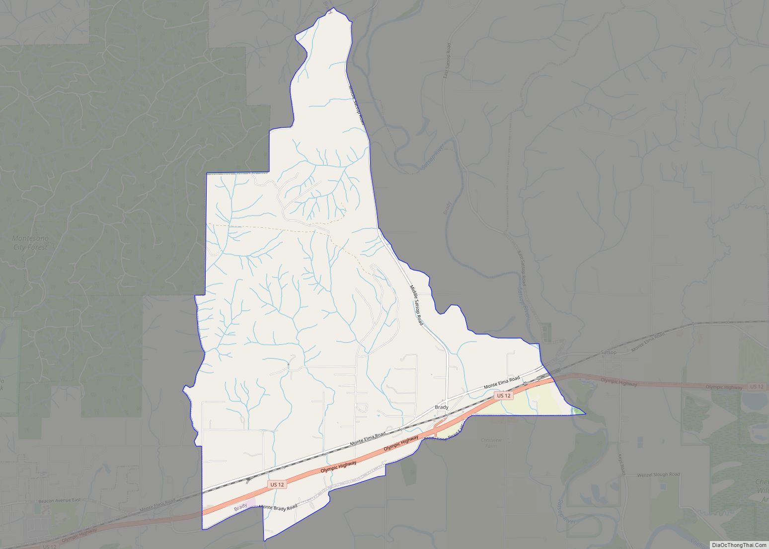
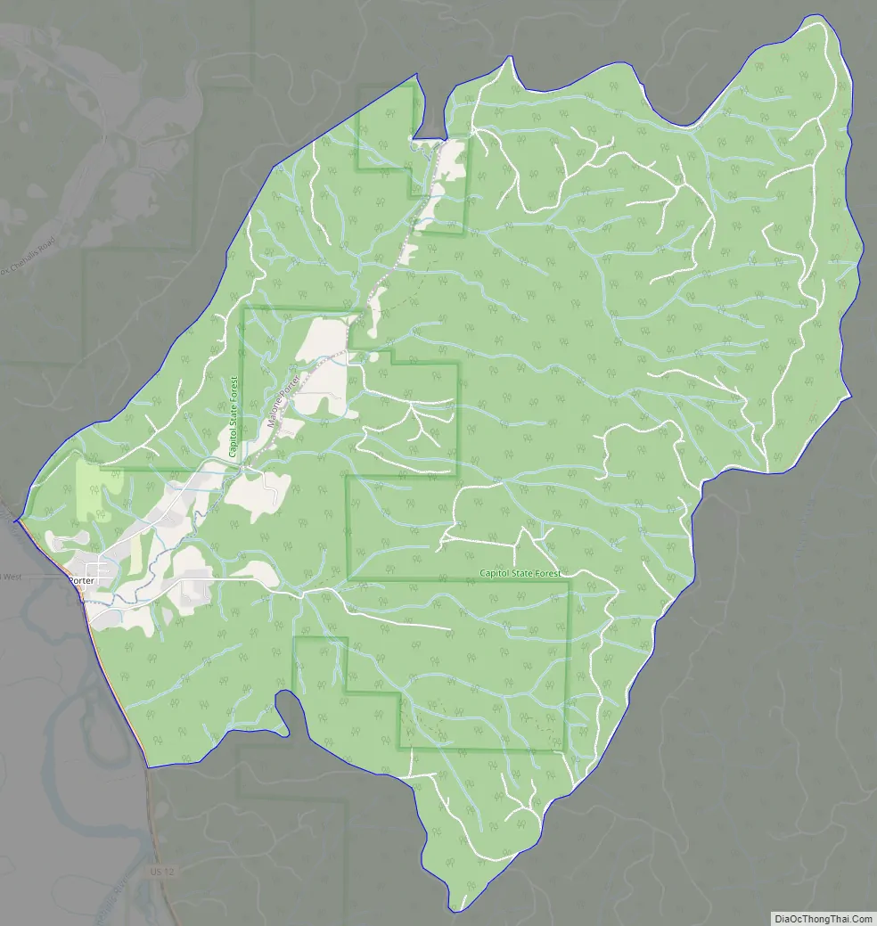
Porter is an unincorporated community and census-designated place (CDP) in Grays Harbor County, Washington, United States. The population was 207 at the 2010 census. Prior to 2010 it was part of the Malone-Porter CDP; Malone and Porter are now separate CDPs. They are located just off U.S. Route 12, southeast of Elma and northwest of Oakville, and along a shortline that is part of the Puget Sound and Pacific Railroad.
| Name: | Porter CDP |
|---|---|
| LSAD Code: | 57 |
| LSAD Description: | CDP (suffix) |
| State: | Washington |
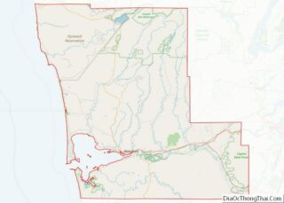
| County: | Grays Harbor County |
| Elevation: | 100 ft (30 m) |
| Total Area: | 8.9 sq mi (23.0 km²) |
| Land Area: | 8.9 sq mi (23.0 km²) |
| Water Area: | 0.0 sq mi (0.0 km²) |
| Total Population: | 207 |
| Population Density: | 23/sq mi (9.0/km²) |
| Area code: | 360 |
| FIPS code: | 5355540 |
Online Interactive Map
Click on ![]() to view map in "full screen" mode.
to view map in "full screen" mode.
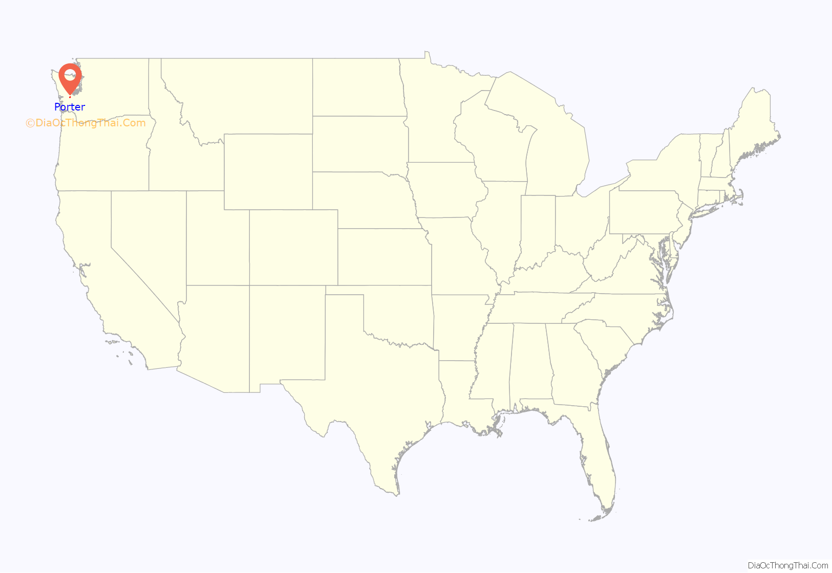
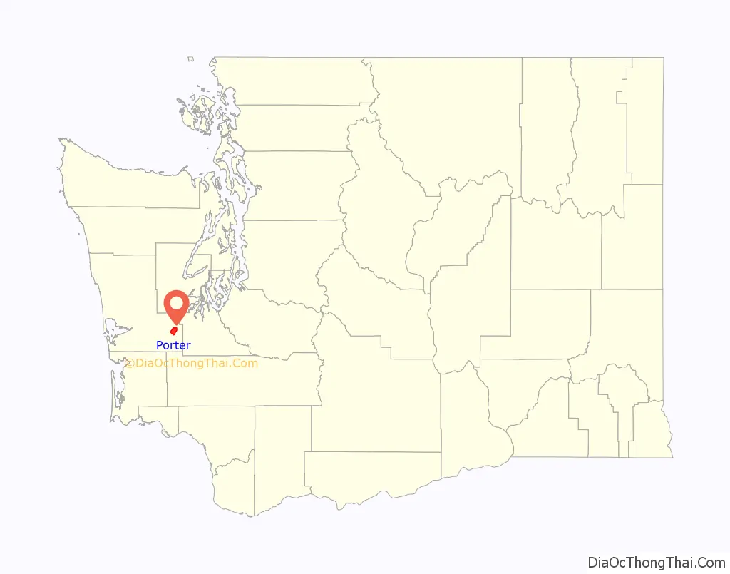
Porter location map. Where is Porter CDP?
History
Porter was named after Fairchild Porter, who settled in the area around 1860.
Much of Porter was destroyed by fire on January 31, 1924. Porter Saloon was re-built later that same year. When it re-opened in 1933 following the repeal of Prohibition, it was one of the first establishments to receive a liquor license in the state of Washington.
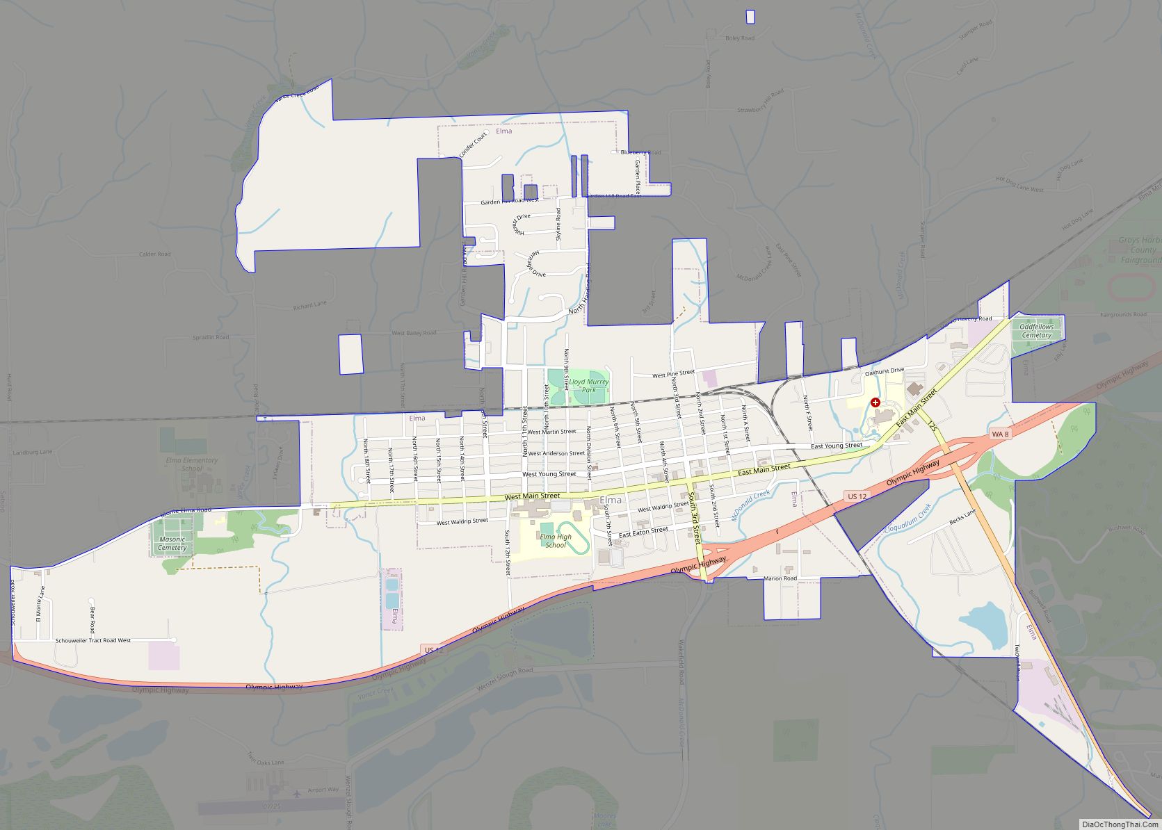
Porter Road Map
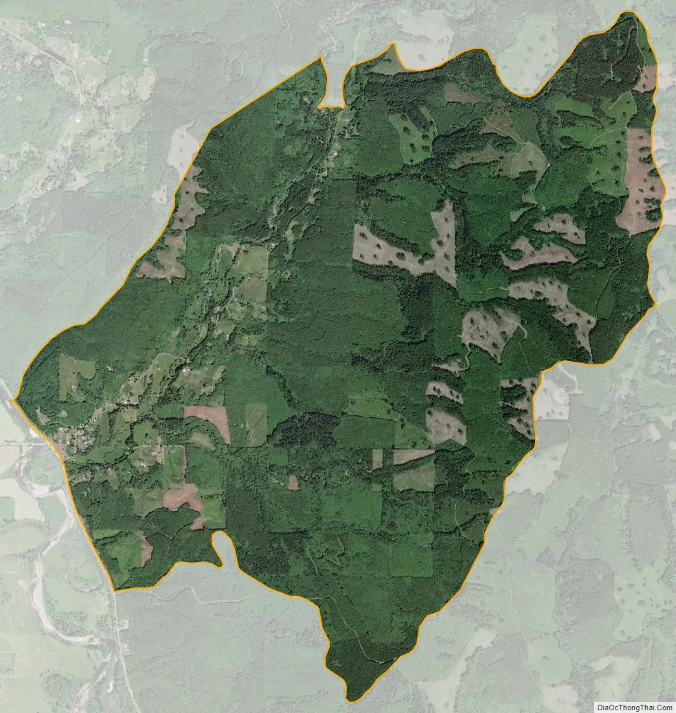
Porter city Satellite Map
Geography
Porter is located in southeastern Grays Harbor County, east of the Chehalis River valley near the mouth of Porter Creek. The CDP extends northeast up the Porter Creek valley and east to the first ridgecrest of the local Black Hills. It is bordered to the northwest by the Malone CDP and to the west by U.S. Route 12, which leads west 27 miles (43 km) to Aberdeen and southeast 19 miles (31 km) to Grand Mound and Interstate 5.
According to the United States Census Bureau, the Porter CDP has a total area of 8.9 square miles (23.0 km), all of it land.
See also
Map of Washington State and its subdivision:- Adams
- Asotin
- Benton
- Chelan
- Clallam
- Clark
- Columbia
- Cowlitz
- Douglas
- Ferry
- Franklin
- Garfield
- Grant
- Grays Harbor
- Island
- Jefferson
- King
- Kitsap
- Kittitas
- Klickitat
- Lewis
- Lincoln
- Mason
- Okanogan
- Pacific
- Pend Oreille
- Pierce
- San Juan
- Skagit
- Skamania
- Snohomish
- Spokane
- Stevens
- Thurston
- Wahkiakum
- Walla Walla
- Whatcom
- Whitman
- Yakima
- Alabama
- Alaska
- Arizona
- Arkansas
- California
- Colorado
- Connecticut
- Delaware
- District of Columbia
- Florida
- Georgia
- Hawaii
- Idaho
- Illinois
- Indiana
- Iowa
- Kansas
- Kentucky
- Louisiana
- Maine
- Maryland
- Massachusetts
- Michigan
- Minnesota
- Mississippi
- Missouri
- Montana
- Nebraska
- Nevada
- New Hampshire
- New Jersey
- New Mexico
- New York
- North Carolina
- North Dakota
- Ohio
- Oklahoma
- Oregon
- Pennsylvania
- Rhode Island
- South Carolina
- South Dakota
- Tennessee
- Texas
- Utah
- Vermont
- Virginia
- Washington
- West Virginia
- Wisconsin
- Wyoming