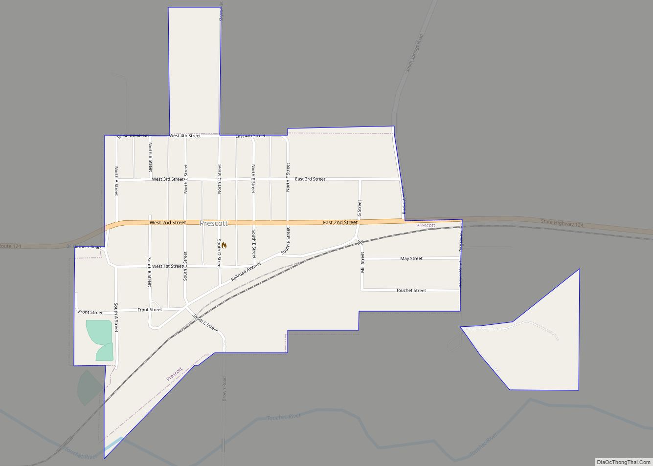
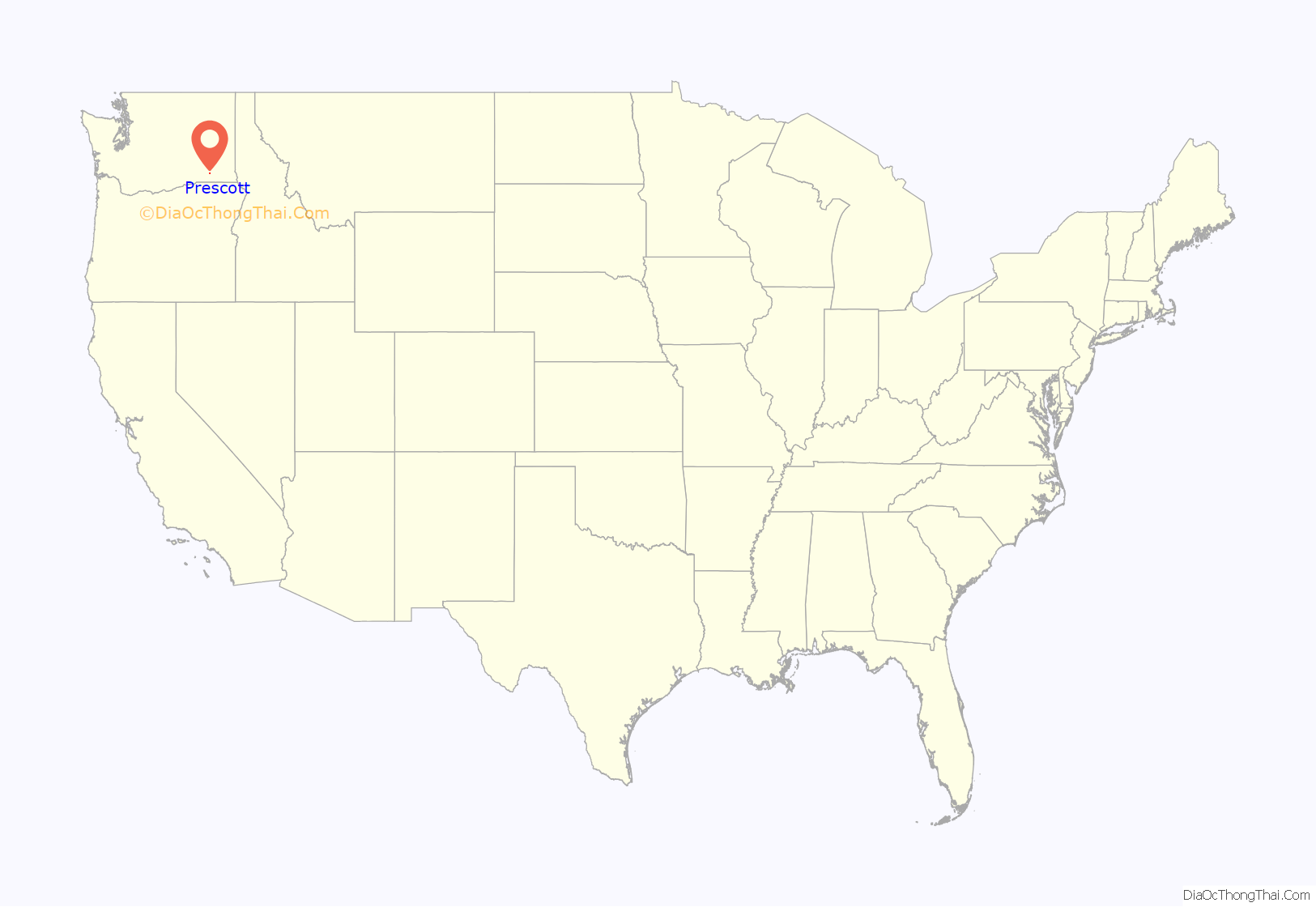
Prescott is a city in central Walla Walla County, Washington. The population was 318 at the 2010 census.
| Name: | Prescott city |
|---|---|
| LSAD Code: | 25 |
| LSAD Description: | city (suffix) |
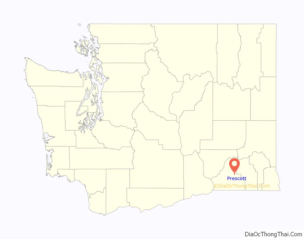
| State: | Washington |
| County: | Walla Walla County |
| Elevation: | 1,056 ft (322 m) |
| Total Area: | 0.40 sq mi (1.03 km²) |
| Land Area: | 0.40 sq mi (1.03 km²) |
| Water Area: | 0.00 sq mi (0.00 km²) |
| Total Population: | 318 |
| Population Density: | 764.41/sq mi (295.06/km²) |
| ZIP code: | 99348 |
| Area code: | 509 |
| FIPS code: | 5356240 |
| GNISfeature ID: | 1507623 |
| Website: | www.prescottwa.com |
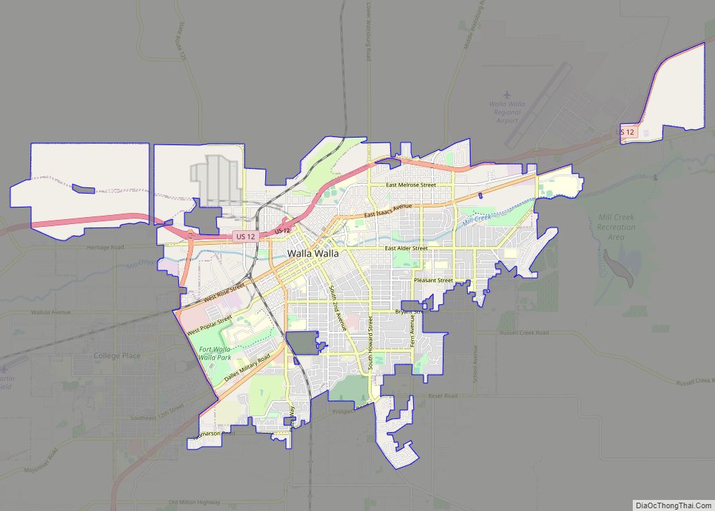
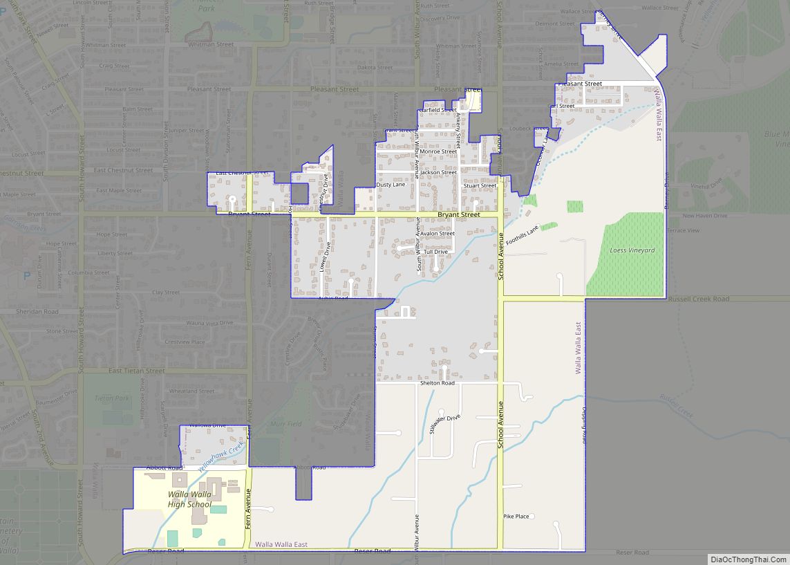
Online Interactive Map
Click on ![]() to view map in "full screen" mode.
to view map in "full screen" mode.
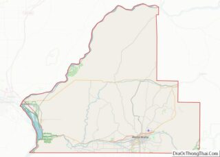
Prescott location map. Where is Prescott city?
History
A post office called Prescott has been in operation since 1881. The city was named after C.H. Prescott, a railroad official.
Prescott was officially incorporated on March 13, 1903.
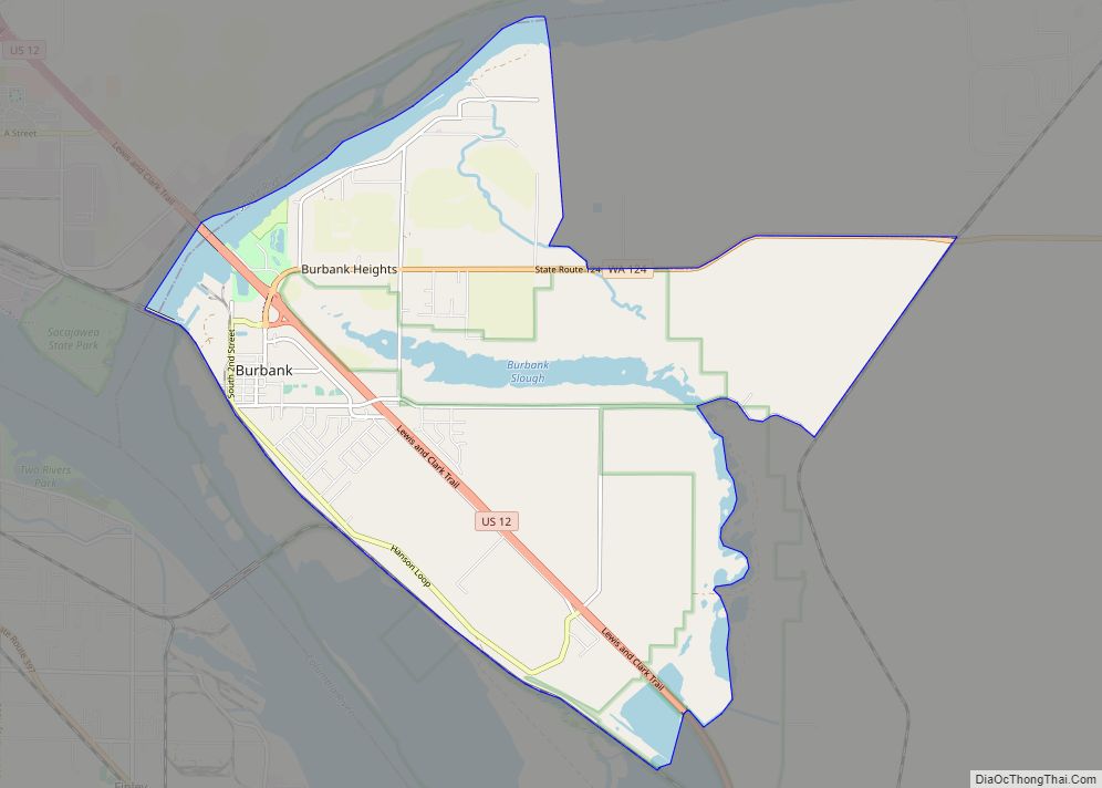
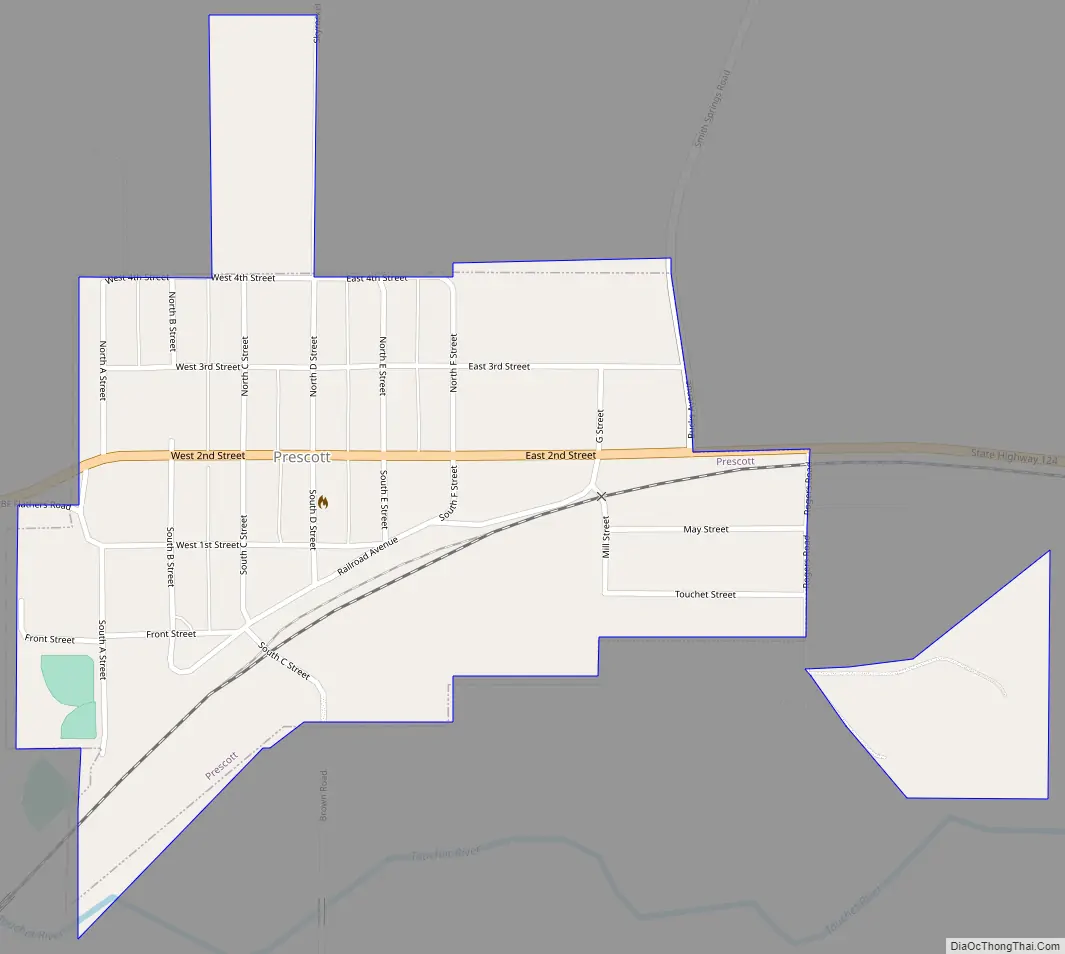
Prescott Road Map
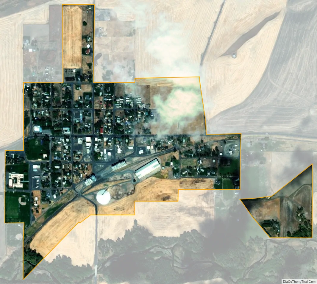
Prescott city Satellite Map
Geography
Prescott is located at 46°17′56″N 118°18′52″W / 46.29889°N 118.31444°W / 46.29889; -118.31444 (46.298872, -118.314408).
According to the United States Census Bureau, the city has a total area of 0.40 square miles (1.04 km), all of it land.
Climate
According to the Köppen Climate Classification system, Prescott has a semi-arid climate, abbreviated “BSk” on climate maps.
See also
Map of Washington State and its subdivision:- Adams
- Asotin
- Benton
- Chelan
- Clallam
- Clark
- Columbia
- Cowlitz
- Douglas
- Ferry
- Franklin
- Garfield
- Grant
- Grays Harbor
- Island
- Jefferson
- King
- Kitsap
- Kittitas
- Klickitat
- Lewis
- Lincoln
- Mason
- Okanogan
- Pacific
- Pend Oreille
- Pierce
- San Juan
- Skagit
- Skamania
- Snohomish
- Spokane
- Stevens
- Thurston
- Wahkiakum
- Walla Walla
- Whatcom
- Whitman
- Yakima
- Alabama
- Alaska
- Arizona
- Arkansas
- California
- Colorado
- Connecticut
- Delaware
- District of Columbia
- Florida
- Georgia
- Hawaii
- Idaho
- Illinois
- Indiana
- Iowa
- Kansas
- Kentucky
- Louisiana
- Maine
- Maryland
- Massachusetts
- Michigan
- Minnesota
- Mississippi
- Missouri
- Montana
- Nebraska
- Nevada
- New Hampshire
- New Jersey
- New Mexico
- New York
- North Carolina
- North Dakota
- Ohio
- Oklahoma
- Oregon
- Pennsylvania
- Rhode Island
- South Carolina
- South Dakota
- Tennessee
- Texas
- Utah
- Vermont
- Virginia
- Washington
- West Virginia
- Wisconsin
- Wyoming