Redmond is a city in King County, Washington, United States, located 15 miles (24 km) east of Seattle. The population was 73,256 at the 2020 census, up from 54,144 in 2010.
Redmond is best known as the home of Microsoft and Nintendo of America.
With an annual bike race on city streets and the state’s only velodrome, Redmond is also known as the “Bicycle Capital of the Northwest”.
| Name: | Redmond city |
|---|---|
| LSAD Code: | 25 |
| LSAD Description: | city (suffix) |
| State: | Washington |
| County: | King County |
| Elevation: | 43 ft (13 m) |
| Land Area: | 16.57 sq mi (42.91 km²) |
| Water Area: | 0.67 sq mi (1.73 km²) |
| Population Density: | 4,200/sq mi (1,600/km²) |
| ZIP code: | 98053, 98052, 98073, (98000–98099) |
| Area code: | 425 |
| FIPS code: | 5357535 |
| GNISfeature ID: | 1533331 |
Online Interactive Map
Click on ![]() to view map in "full screen" mode.
to view map in "full screen" mode.
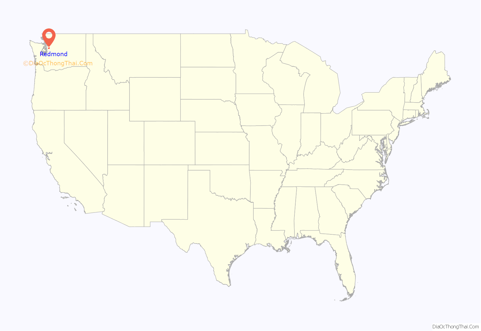
Redmond location map. Where is Redmond city?
History
Native Americans have lived in the Redmond area for about 10,000 years, based on artifacts discovered at the Redmond Town Center archaeological site and Marymoor Prehistoric Indian Site. The first European settlers arrived in the 1870s. Luke McRedmond filed a Homestead Act claim for land next to the Sammamish Slough on September 9, 1870, and the following year Warren Perrigo took up land adjacent to him. The rivers and streams had so many salmon that the settlement was initially named Salmonberg. More settlers came, and with the establishment of the first post office in 1881, the name of the community was changed to Melrose. The new name was derived from the Perrigos’ successful inn, Melrose House, which upset McRedmond. After becoming postmaster, he successfully petitioned to have the name changed to Redmond in 1883.
The abundant forests and fish of Redmond provided jobs for loggers and fishermen, and with those jobs came demand for goods and services, bringing in merchants. The logging industry expanded significantly in 1889 when the Seattle, Lake Shore and Eastern Railway built a station in the center of town. The first plat for Redmond was filed on May 11, 1891, encompassing much of the area now known as downtown. After reaching the necessary population of 300, Redmond was incorporated on December 31, 1912.
Redmond experienced an economic downturn in the 1920s. Prohibition forced saloons to close, cutting off a large portion of the city’s tax base. The forests were declining after heavy logging, causing lumber mills to shut down. The deforested land was suitable for farming. Agriculture became Redmond’s primary business, keeping residents fed during the Great Depression. When the U.S. entered World War II, shipyard jobs and other wartime work came to Redmond.
After the war, Redmond’s expansion began in earnest. The city expanded over thirty times larger in area through annexations between 1951 and 1967. From 1956 to 1965, Redmond was bordered by the town of East Redmond, which was formed by rural homeowners and later dissolved by the Washington Supreme Court. The completion of the Evergreen Point Floating Bridge across Lake Washington in 1963 allowed Redmond to flourish as a suburb of Seattle. In 1978, the U.S. Census Bureau proclaimed Redmond the fastest growing city in the state. Many technology companies made the city their home, and the increasing population demanded more retail shops. By the late 1980s, Downtown Redmond had become “a series of strip centers surrounded by parking lots”, sparking plans for a mixed-use revitalized downtown.
Redmond underwent a commercial boom during the 1990s, culminating in 1997 with the opening of Redmond Town Center, a major regional shopping center on the site of a long-defunct golf course. In recent years the city has seen rising traffic congestion as a result of its rapid expansion, particularly in areas of urban sprawl. To address these issues, SR 520 is undergoing expansion and light rail service via the East Link Extension from Seattle to Redmond is set to open in 2024.
Redmond Road Map
Redmond city Satellite Map
Geography
Redmond is bordered by Kirkland to the west, Bellevue to the southwest, and Sammamish to the southeast. Unincorporated King County lies to the north (with Woodinville a short distance beyond) and east. The city’s urban downtown lies just north of Lake Sammamish; residential areas lie north and west of the lake. Overlake, the city’s second urban center, is to the west of Lake Sammamish. The Sammamish River runs north from the lake along the west edge of the city’s downtown.
According to the United States Census Bureau, the city has a total area of 16.94 square miles (43.87 km), of which 16.28 square miles (42.17 km) are land and 0.66 square miles (1.71 km) are water.
Climate
Redmond, like most of the Pacific Northwest, has a mild climate for its latitude, but still gets all four seasons. Summers tend to be warm and dry, with low rainfall and sunny or partly sunny from June to September. Winters tend to be cool and wet, with November being the rainiest month. Snowfall is uncommon, with the most common cold air being in a form of a high pressure system, driving out the rains from the area. However, snowfall is not as rare as in other cities like Seattle near the moderating effects of Puget Sound. The average warmest month is August. The highest recorded temperature was 111 °F (44 °C) on June 28, 2021. On average, the coolest month is January. The lowest recorded temperature was −7 °F (−22 °C) in January 1950. The maximum average precipitation occurs in December.
Redmond has an Oceanic climate (Cfb).
See also
Map of Washington State and its subdivision:- Adams
- Asotin
- Benton
- Chelan
- Clallam
- Clark
- Columbia
- Cowlitz
- Douglas
- Ferry
- Franklin
- Garfield
- Grant
- Grays Harbor
- Island
- Jefferson
- King
- Kitsap
- Kittitas
- Klickitat
- Lewis
- Lincoln
- Mason
- Okanogan
- Pacific
- Pend Oreille
- Pierce
- San Juan
- Skagit
- Skamania
- Snohomish
- Spokane
- Stevens
- Thurston
- Wahkiakum
- Walla Walla
- Whatcom
- Whitman
- Yakima
- Alabama
- Alaska
- Arizona
- Arkansas
- California
- Colorado
- Connecticut
- Delaware
- District of Columbia
- Florida
- Georgia
- Hawaii
- Idaho
- Illinois
- Indiana
- Iowa
- Kansas
- Kentucky
- Louisiana
- Maine
- Maryland
- Massachusetts
- Michigan
- Minnesota
- Mississippi
- Missouri
- Montana
- Nebraska
- Nevada
- New Hampshire
- New Jersey
- New Mexico
- New York
- North Carolina
- North Dakota
- Ohio
- Oklahoma
- Oregon
- Pennsylvania
- Rhode Island
- South Carolina
- South Dakota
- Tennessee
- Texas
- Utah
- Vermont
- Virginia
- Washington
- West Virginia
- Wisconsin
- Wyoming
