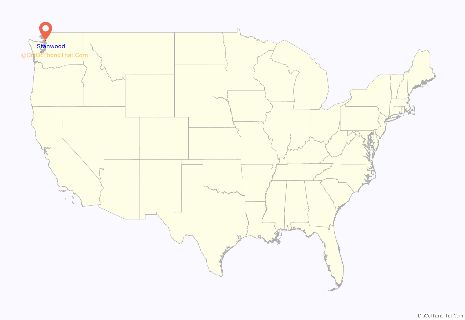
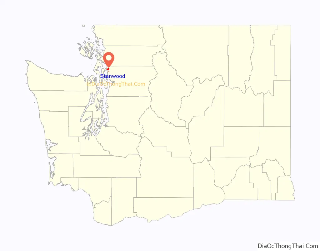
Stanwood is a city in Snohomish County, Washington, United States. The city is located 50 miles (80 km) north of Seattle, at the mouth of the Stillaguamish River near Camano Island. As of the 2010 census, its population is 6,231.
Stanwood was founded in 1866 as Centerville, adopting its current name in 1877 after the arrival of postmaster Daniel O. Pearson. It was platted in 1888 and incorporated as a city in 1903. The city was bypassed by the Great Northern Railway, which built a depot one mile (1.6 km) east that grew into its own separate town, incorporated in 1922 as East Stanwood. The two Stanwoods were civic rivals for several decades, until their governments were consolidated after a 1960 referendum was approved by voters.
The city was historically home to several food processing plants, which were its largest employers, and was mainly populated by Scandinavians. Since the 1990s, Stanwood has grown into a bedroom community for Seattle and Everett and has annexed uphill areas that were developed into suburban subdivisions. Stanwood is primarily served by State Route 532, which connects Camano Island to Interstate 5, and also has a train station that opened in 2009.
| Name: | Stanwood city |
|---|---|
| LSAD Code: | 25 |
| LSAD Description: | city (suffix) |
| State: | Washington |
| County: | Snohomish County |
| Incorporated: | October 19, 1903 |
| Elevation: | 7 ft (2 m) |
| Total Area: | 2.94 sq mi (7.62 km²) |
| Land Area: | 2.93 sq mi (7.59 km²) |
| Water Area: | 0.01 sq mi (0.03 km²) |
| Total Population: | 6,231 |
| Population Density: | 2,486.18/sq mi (959.82/km²) |
| ZIP code: | 98292 |
| Area code: | 360 |
| FIPS code: | 5367455 |
| GNISfeature ID: | 1512690 |
| Website: | stanwoodwa.org |
Online Interactive Map
Click on ![]() to view map in "full screen" mode.
to view map in "full screen" mode.
Stanwood location map. Where is Stanwood city?
History
Prior to European exploration and settlement in the 19th century, the Puget Sound region was inhabited by indigenous Coast Salish peoples. The modern-day site of downtown Stanwood was home to a Stillaguamish village named Sŭl-gwähs’, with an estimated 250 people and three large potlatch houses. The area’s first European Americans, George O. and G. L. Wilson, were led on a guided canoe expedition up the Stillaguamish River in 1851 and reported of its economic potential.
The first permanent American settlement at the mouth of the Stillaguamish River was Centerville, a trading post established in 1866 by Robert Fulton on the south side of the river. Centerville gained a post office in 1870, and the settlement was moved to the north side of the river three years later. The post office was renamed to Stanwood in 1877 by its sixth postmaster Daniel O. Pearson, after his wife Clara’s maiden name; Pearson also ran a general store and built a new steamboat wharf on the Stillaguamish River shortly after arriving. Pearson had arrived from Lowell, Massachusetts, in 1866; two of his sisters were among the original “Mercer Girls”.
The surrounding area was cleared by loggers and managed using a series of levees along the Stillaguamish River before being opened for settlement by farmers and ranchers. The establishment of a Norwegian Lutheran church in 1876, the first to be built in the Pacific Northwest, brought the area’s first wave of Scandinavian immigrants. The townsite’s plat was filed by W. R. Stockbridge in 1888, ahead of a failed attempt to petition the county commission for incorporation as a city. Stanwood suffered from a major fire on June 2, 1892, which destroyed the church and thirteen buildings and caused damages of approximately $26,100 (equivalent to $720,000 in 2021 dollars); several businesses and the town’s liquor supply were saved by volunteers from the town’s Good Templars lodge, who had been at a regular meeting. By the end of the decade, the town had rebuilt its main street and gained a weekly newspaper, cannery, horse racing track, creamery, and a shingle mill. Stanwood was officially incorporated on October 19, 1903, a month after the town’s men voted 74–16 in favor of becoming a city. Stanwood’s businesses relocated a block away from the riverfront in the 1920s and 1930s after the main flow of the Stillaguamish River shifted to another slough. The change in the river rendered the wharf too shallow for steamboats and damaged dikes after several major floods.
The Seattle and Montana Railroad (later absorbed into the Great Northern Railway) was constructed through the Stanwood area in 1891, but bypassed the town one mile (1.6 km) to the east, where it built a depot on ground that was less prone to flooding. Several businesses relocated to the area around the depot, including a bank and Washington state’s first cooperative general store. Merchants in the old town boycotted the railroad and acquired a steamboat, the City of Stanwood, in 1893; the ship was lost after catching fire on Port Susan the following year.
A short railroad, known as the Hall and Hall Railway, was constructed in 1904 between the depot and downtown Stanwood and would operate until 1938. The community around the depot was platted in 1906 as “East Stanwood”, but initially relied on a commercial club to govern in lieu of a formal town government. East Stanwood was incorporated on February 7, 1922, after a series of civic disputes highlighted the need for a city government. East Stanwood was eventually bisected by the Pacific Highway in the 1920s and connected to Stanwood and Camano Island by paved roads constructed a decade earlier.
The “Twin City” maintained separate government facilities, schools, banks, sawmills, creameries, and frozen food plants. The school systems for the two cities were merged in 1944, ending a decades-long football rivalry between the two high schools. By the early 1950s, the competitiveness between merchants and citizens of both Stanwoods had softened and groups cooperated on events and various initiatives. A formal merger of the two cities was proposed in 1954 and placed on the April 30 ballot; Stanwood voted in favor of the merger, but it failed to reach a majority in East Stanwood. The high cost of a modern sewage treatment system, required by the state government before further expansion could occur, spurred leaders in both cities to place a second consolidation referendum before voters on March 8, 1960. The referendum was passed by an overwhelming majority of voters in both cities and the merged government immediately approved a $520,000 sewer installation contract.
Development of a new suburban commercial center east of the city began in the 1980s, centered around the relocated Stanwood High School campus. A 55-acre (22 ha) farm at the intersection of State Route 532 and 72nd Avenue Northwest was redeveloped into a $50 million shopping and entertainment center. The commercial center opened in 1995 and has 50 businesses, 10 restaurants, office buildings, a movie theater, and an arcade. The development was later expanded to include multi-story condominiums and upscale apartments with ground-floor retail space. The area surrounding the center was developed into suburban subdivisions, contributing to a doubling of the city’s population to nearly 4,000 people by 2000. The subdivisions were annexed by the city government in the early 2000s, despite testimony from citizens against further growth. In 2005, the city rejected a bid by Wal-Mart to build a store in Stanwood after public outcry from supporters of downtown businesses.
The high school campus was replaced with a new building in 2021 that cost $147.5 million to construct. At an adjacent 22-acre (8.9 ha) site is planned to be developed into a large residential complex with 444 apartments and 72 townhomes. The complex is also planned to incorporate retail, amenity spaces, and expanded wetlands.
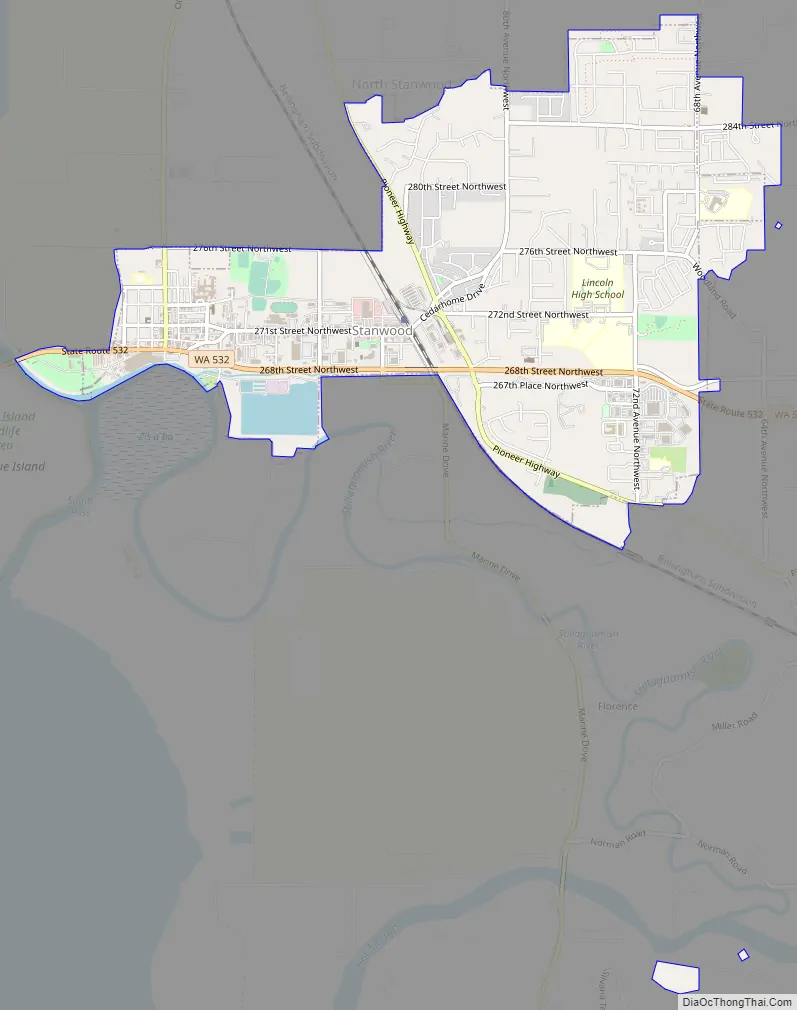
Stanwood Road Map
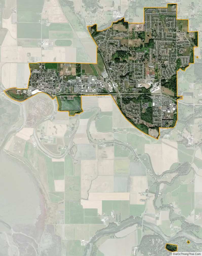
Stanwood city Satellite Map
Geography
According to the United States Census Bureau, the city of Stanwood has a total area of 2.84 square miles (7.36 km), of which 2.82 square miles (7.30 km) is land and 0.02 square miles (0.05 km) is water. The city is at the northwestern corner of Snohomish County, and is considered part of the Seattle metropolitan area. It is 13 miles (21 km) west of its nearest neighboring town, Arlington, and 20 miles (32 km) north of Everett, the county seat. The city is also 50 miles (80 km) north of Seattle and 17 miles (27 km) south of Mount Vernon.
Stanwood’s city limits are generally defined to the south by the Stillaguamish River; to the west by 104th Drive Northwest; to the north by 276th Street Northwest and 290th Street Northwest; and to the east by 68th Avenue Northwest. Approximately 59 percent of land within Stanwood city limits is used for housing, while 10 percent is zoned for commercial use and 7 percent for industrial uses. The urban growth area of Stanwood consists of an additional 425 acres (172 ha) outside city limits, including the unincorporated area of Northwest Stanwood.
The city is located at the mouth of the Stillaguamish River, where it flows into Port Susan, an arm of the Puget Sound, and Skagit Bay, the mouth of the Skagit River. To the west is Davis Slough, which separates Stanwood from Camano Island and forms the border between Snohomish and Island counties. Elevations in Stanwood range from 2 feet (0.61 m) above sea level near the Stillaguamish River to 190 feet (58 m) in the northeastern hills. The city is home to five creeks and drainage basins that flow into the Stillaguamish River and Puget Sound: Church Creek, Douglas Creek, Irvine Slough, the Skagit River, and the Stillaguamish River. The Stanwood area was formed during the Pleistocene glaciation and was further shaped through the rise and fall of the sea level as well as sedimentary deposits from the Skagit and Stillaguamish rivers.
Much of downtown Stanwood is located in a 100-year flood zone and is at risk of flooding from the Stillaguamish River, as well as the Skagit River. Much of the Stillaguamish delta was reclaimed using a series of levees and dikes that were built in the 1870s and improved by the Works Progress Administration in the 1930s and the city government in the 1990s. Some of the failure-prone dikes were later removed in the 2010s to restore habitat areas for native wildlife. Several civic buildings have also been relocated uphill from the downtown area to prevent floods from hampering the city’s vital functions. In 2020, the city government began construction of flood controls to redirect stormwater into the Stillaguamish River rather than the sloughs to prevent flooding. The project is expected to cost $11 million and take 10 years to complete over six phases.
See also
Map of Washington State and its subdivision:- Adams
- Asotin
- Benton
- Chelan
- Clallam
- Clark
- Columbia
- Cowlitz
- Douglas
- Ferry
- Franklin
- Garfield
- Grant
- Grays Harbor
- Island
- Jefferson
- King
- Kitsap
- Kittitas
- Klickitat
- Lewis
- Lincoln
- Mason
- Okanogan
- Pacific
- Pend Oreille
- Pierce
- San Juan
- Skagit
- Skamania
- Snohomish
- Spokane
- Stevens
- Thurston
- Wahkiakum
- Walla Walla
- Whatcom
- Whitman
- Yakima
- Alabama
- Alaska
- Arizona
- Arkansas
- California
- Colorado
- Connecticut
- Delaware
- District of Columbia
- Florida
- Georgia
- Hawaii
- Idaho
- Illinois
- Indiana
- Iowa
- Kansas
- Kentucky
- Louisiana
- Maine
- Maryland
- Massachusetts
- Michigan
- Minnesota
- Mississippi
- Missouri
- Montana
- Nebraska
- Nevada
- New Hampshire
- New Jersey
- New Mexico
- New York
- North Carolina
- North Dakota
- Ohio
- Oklahoma
- Oregon
- Pennsylvania
- Rhode Island
- South Carolina
- South Dakota
- Tennessee
- Texas
- Utah
- Vermont
- Virginia
- Washington
- West Virginia
- Wisconsin
- Wyoming


