Riverpoint is an unincorporated community and census-designated place (CDP) in east King County, Washington, United States. As of the 2020 census, it had a population of 774. At the 2010 census, the area was listed as the Tanner CDP and had a population of 1,018 over a larger area.
In 2010, the Tanner CDP ranked 46th out of 522 communities in the state of Washington for per capita income.
| Name: | Tanner CDP |
|---|---|
| LSAD Code: | 57 |
| LSAD Description: | CDP (suffix) |
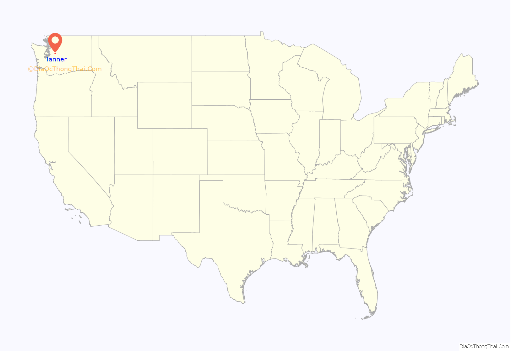
| State: | Washington |
| County: | King County |
| Elevation: | 522 ft (159 m) |
| Total Area: | 1.31 sq mi (3.38 km²) |
| Land Area: | 1.27 sq mi (3.28 km²) |
| Water Area: | 0.03 sq mi (0.09 km²) |
| Total Population: | 774 |
| FIPS code: | 5370315 |
| GNISfeature ID: | 2807188 |
Online Interactive Map
Click on ![]() to view map in "full screen" mode.
to view map in "full screen" mode.
Tanner location map. Where is Tanner CDP?
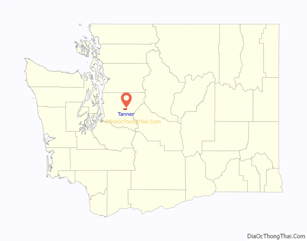
Tanner Road Map
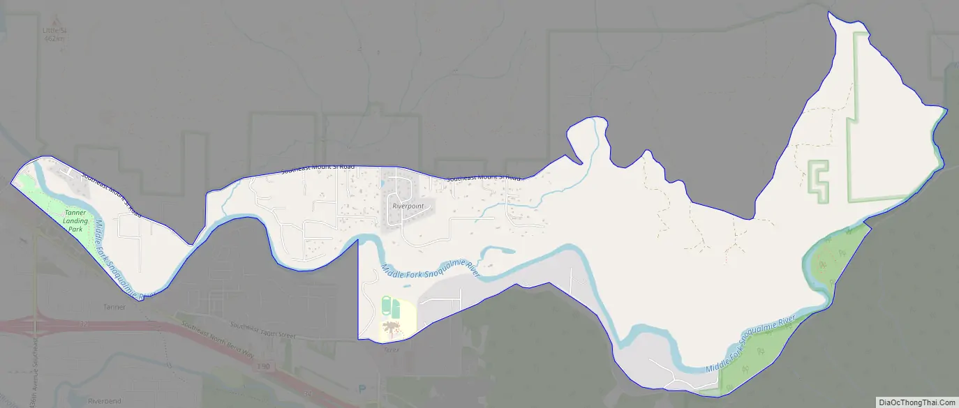
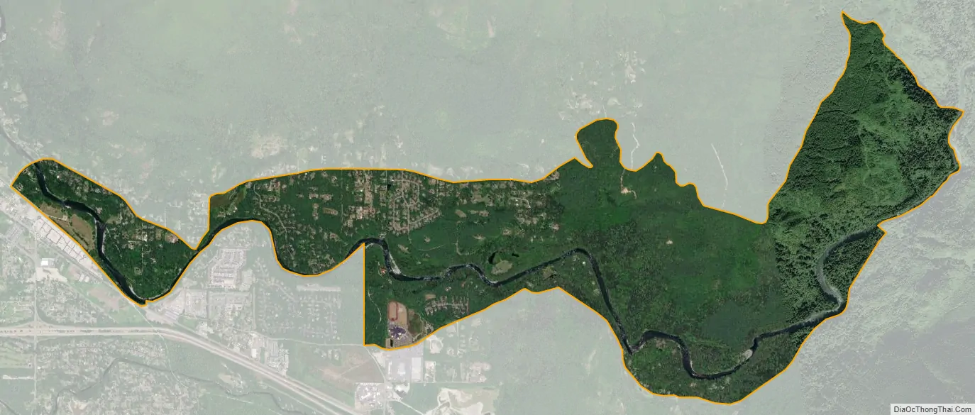
Tanner city Satellite Map
Geography
Riverpoint is located in the valley of the Middle and South Forks of the Snoqualmie River at 47°28′43″N 121°44′45″W / 47.47861°N 121.74583°W / 47.47861; -121.74583 (47.478658, -121.745715). It is bordered to the southwest by the city of North Bend.
According to the United States Census Bureau, the Riverpoint CDP has a total area of 1.31 square miles (3.38 km), of which 1.27 square miles (3.28 km) are land and 0.03 square miles (0.09 km), or 2.73%, are water. In 2010, the Tanner CDP had a total area of 4.03 square miles (10.45 km).
Riverpoint is served by Exit 32 on Interstate 90, at the base of Mount Si, which rises to the north. The community is surrounded by miles of hiking trails located in Washington State Forest Reserves. The most popular hiking trail in the area is the Mount Si Trail.
See also
Map of Washington State and its subdivision:- Adams
- Asotin
- Benton
- Chelan
- Clallam
- Clark
- Columbia
- Cowlitz
- Douglas
- Ferry
- Franklin
- Garfield
- Grant
- Grays Harbor
- Island
- Jefferson
- King
- Kitsap
- Kittitas
- Klickitat
- Lewis
- Lincoln
- Mason
- Okanogan
- Pacific
- Pend Oreille
- Pierce
- San Juan
- Skagit
- Skamania
- Snohomish
- Spokane
- Stevens
- Thurston
- Wahkiakum
- Walla Walla
- Whatcom
- Whitman
- Yakima
- Alabama
- Alaska
- Arizona
- Arkansas
- California
- Colorado
- Connecticut
- Delaware
- District of Columbia
- Florida
- Georgia
- Hawaii
- Idaho
- Illinois
- Indiana
- Iowa
- Kansas
- Kentucky
- Louisiana
- Maine
- Maryland
- Massachusetts
- Michigan
- Minnesota
- Mississippi
- Missouri
- Montana
- Nebraska
- Nevada
- New Hampshire
- New Jersey
- New Mexico
- New York
- North Carolina
- North Dakota
- Ohio
- Oklahoma
- Oregon
- Pennsylvania
- Rhode Island
- South Carolina
- South Dakota
- Tennessee
- Texas
- Utah
- Vermont
- Virginia
- Washington
- West Virginia
- Wisconsin
- Wyoming


