Touchet (/ˈtuːʃi/ TOO-shee) is a census-designated place (CDP) in Walla Walla County, Washington, United States. The population was 421 at the 2010 census.
| Name: | Touchet CDP |
|---|---|
| LSAD Code: | 57 |
| LSAD Description: | CDP (suffix) |
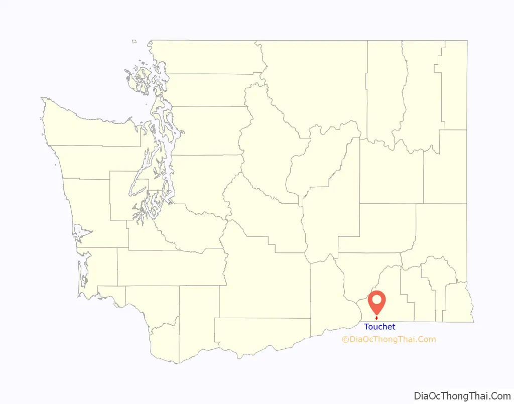
| State: | Washington |
| County: | Walla Walla County |
| Elevation: | 443 ft (135 m) |
| Total Area: | 1.2 sq mi (3.1 km²) |
| Land Area: | 1.2 sq mi (3.1 km²) |
| Water Area: | 0.0 sq mi (0.0 km²) |
| Total Population: | 421 |
| Population Density: | 326.1/sq mi (125.9/km²) |
| ZIP code: | 99360 |
| Area code: | 509 |
| FIPS code: | 5372030 |
| GNISfeature ID: | 1509053 |
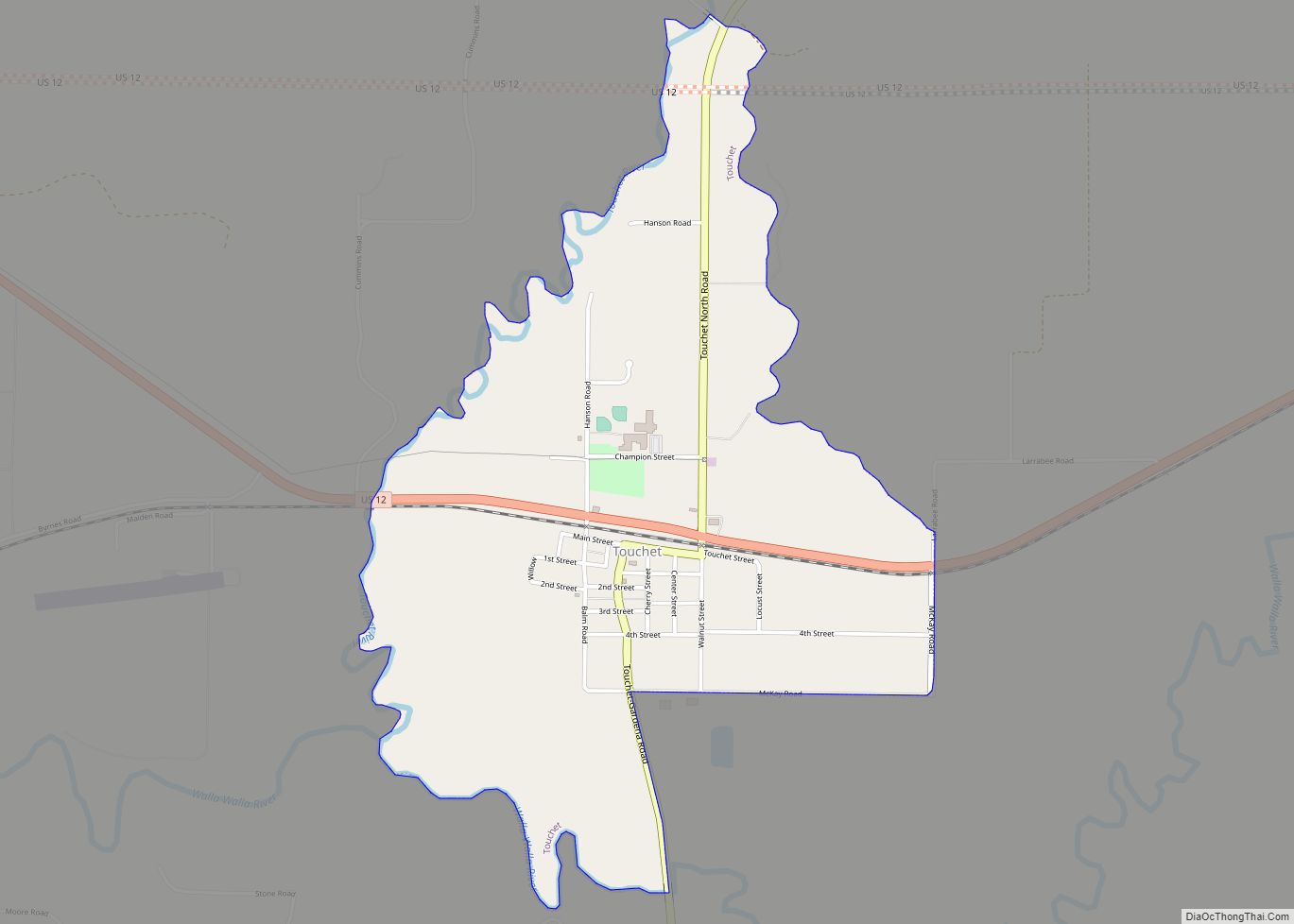
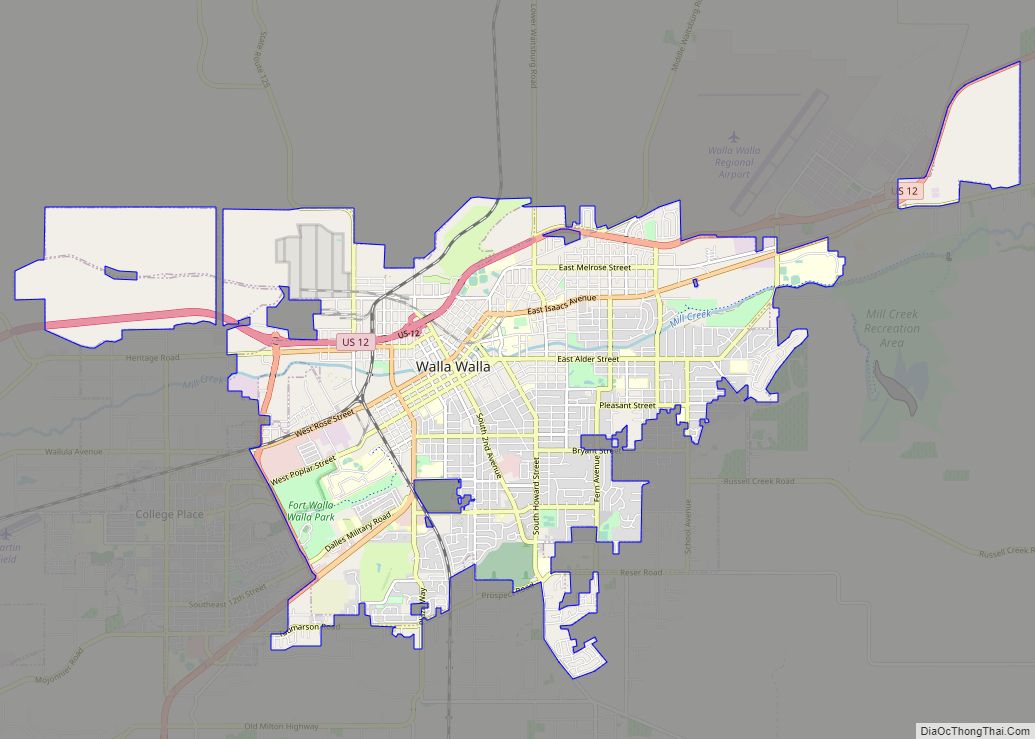
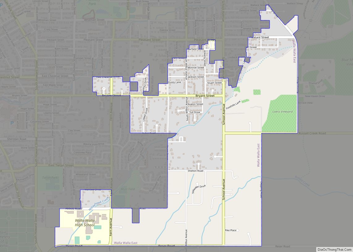
Online Interactive Map
Click on ![]() to view map in "full screen" mode.
to view map in "full screen" mode.
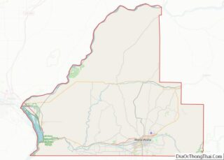
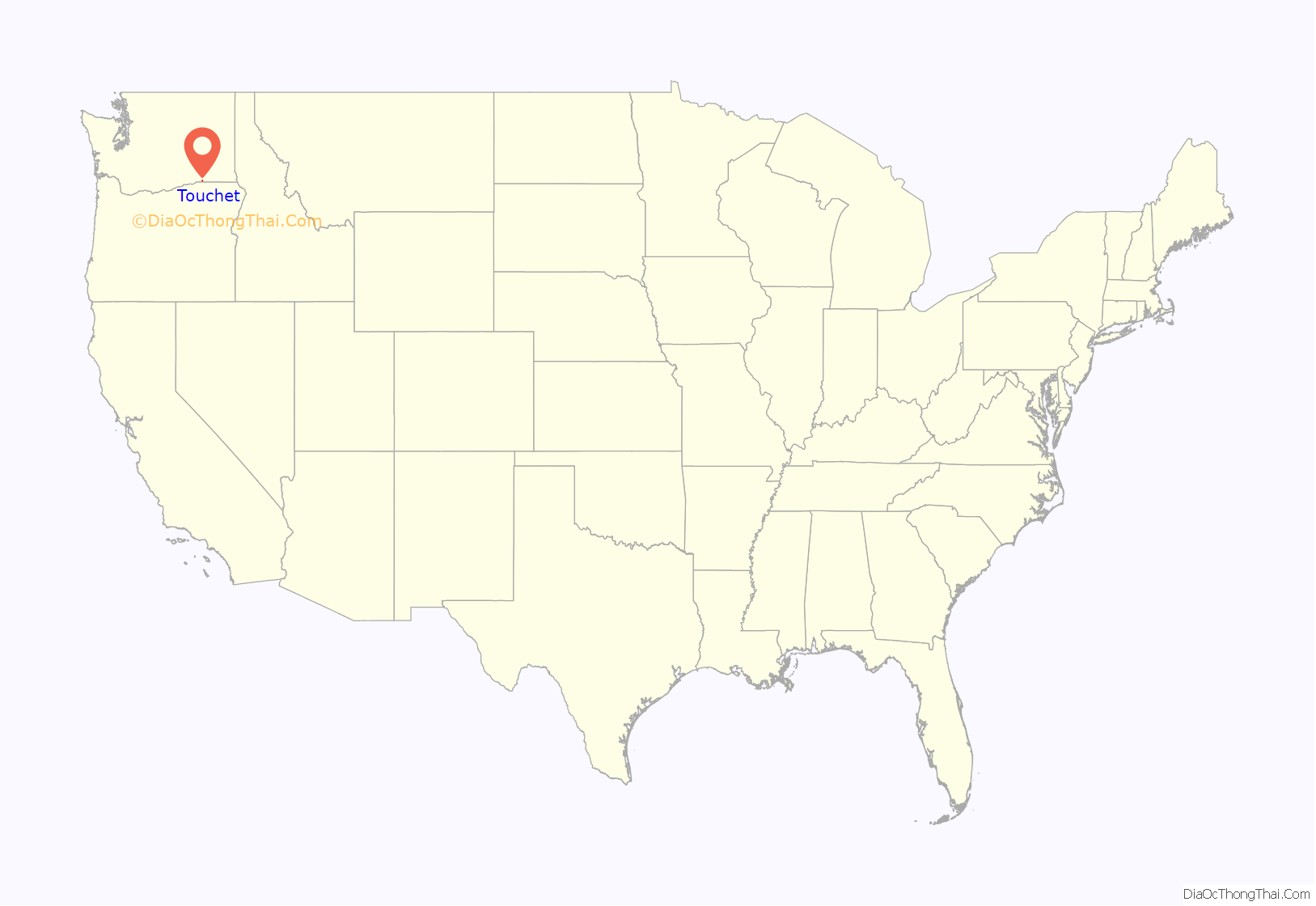
Touchet location map. Where is Touchet CDP?
History
Prior to removal to reservations, there was a village of Walla Walla people located near the present townsite. This site was called Tuushi, meaning “baking salmon on sticks over coals”, a name based on a coyote myth. Bands of Palouse, Yakamas, Umatilla, Walla Walla and Wanapum, that used this area were collectively called Nez Perce by Lewis and Clark when they passed through the Walla Walla Valley on their return journey in 1806.
Settlers from the east came to the valley in the early 1850s, but shortly left due to conflicts with the Native people. Homesteaders returned to the valley in 1859.
The Walla Walla & Columbia River Railroad from Wallula to Walla Walla was not completed until 1875, but by March 1874, 16 miles of track were completed up to Touchet. By the end of that year Touchet farmers shipped 4,000 tons of wheat and received 1,100 tons of merchandise.
Touchet has never been officially incorporated.
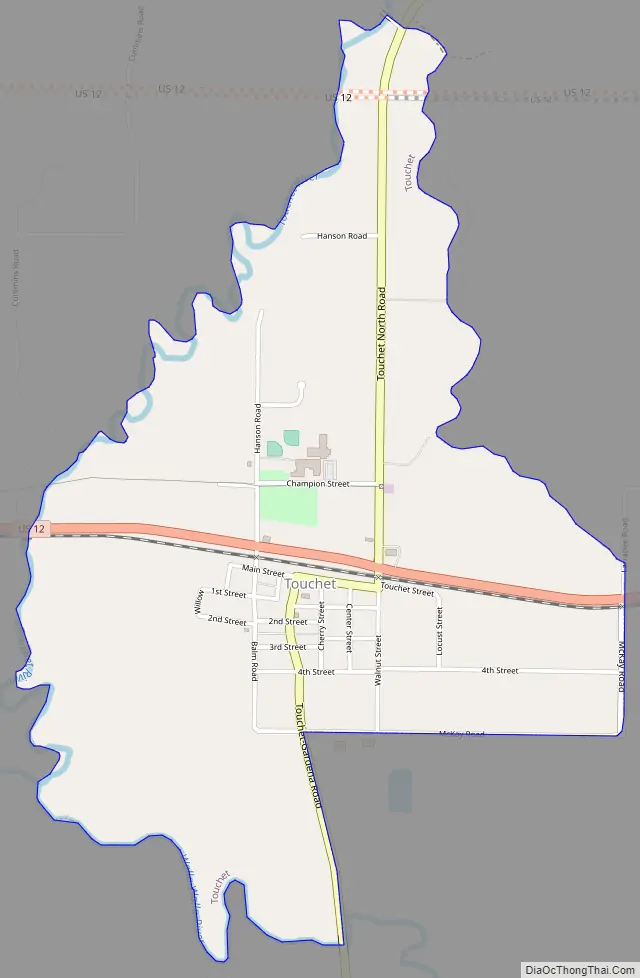
Touchet Road Map
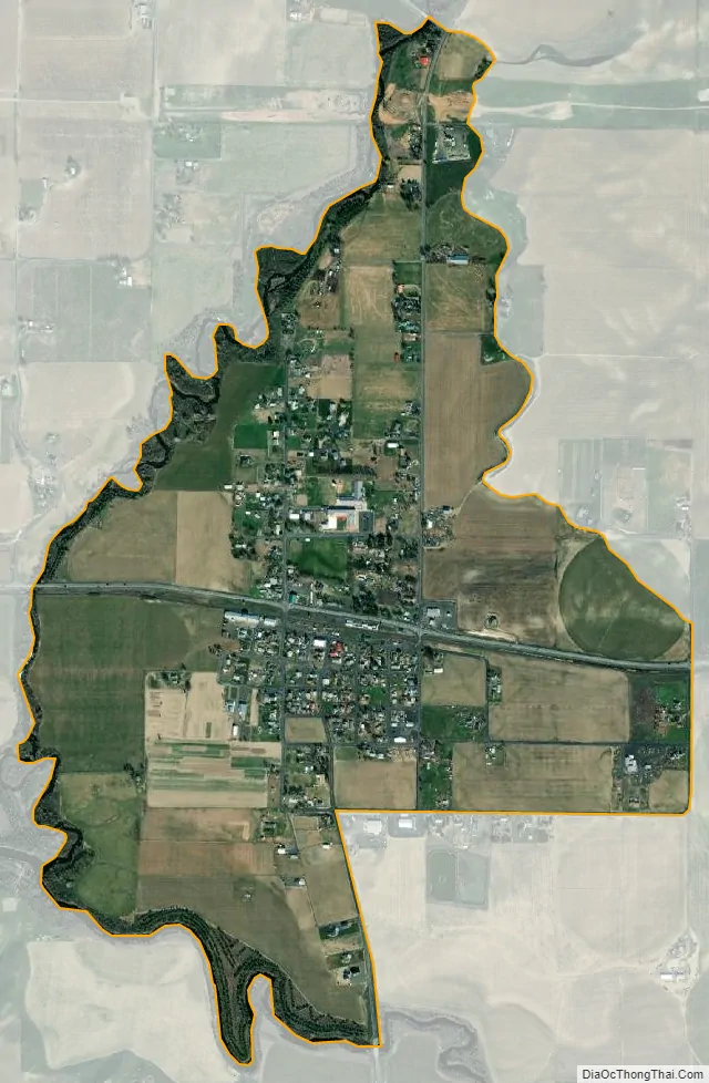
Touchet city Satellite Map
Geography
Touchet is located at 46°2′22″N 118°40′15″W / 46.03944°N 118.67083°W / 46.03944; -118.67083 (46.039402, -118.670971).
According to the United States Census Bureau, the CDP has a total area of 1.2 square miles (3.1 km), all of it land.
Climate
According to the Köppen Climate Classification system, Touchet has a warm-summer Mediterranean climate, abbreviated “Csa” on climate maps.
See also
Map of Washington State and its subdivision:- Adams
- Asotin
- Benton
- Chelan
- Clallam
- Clark
- Columbia
- Cowlitz
- Douglas
- Ferry
- Franklin
- Garfield
- Grant
- Grays Harbor
- Island
- Jefferson
- King
- Kitsap
- Kittitas
- Klickitat
- Lewis
- Lincoln
- Mason
- Okanogan
- Pacific
- Pend Oreille
- Pierce
- San Juan
- Skagit
- Skamania
- Snohomish
- Spokane
- Stevens
- Thurston
- Wahkiakum
- Walla Walla
- Whatcom
- Whitman
- Yakima
- Alabama
- Alaska
- Arizona
- Arkansas
- California
- Colorado
- Connecticut
- Delaware
- District of Columbia
- Florida
- Georgia
- Hawaii
- Idaho
- Illinois
- Indiana
- Iowa
- Kansas
- Kentucky
- Louisiana
- Maine
- Maryland
- Massachusetts
- Michigan
- Minnesota
- Mississippi
- Missouri
- Montana
- Nebraska
- Nevada
- New Hampshire
- New Jersey
- New Mexico
- New York
- North Carolina
- North Dakota
- Ohio
- Oklahoma
- Oregon
- Pennsylvania
- Rhode Island
- South Carolina
- South Dakota
- Tennessee
- Texas
- Utah
- Vermont
- Virginia
- Washington
- West Virginia
- Wisconsin
- Wyoming