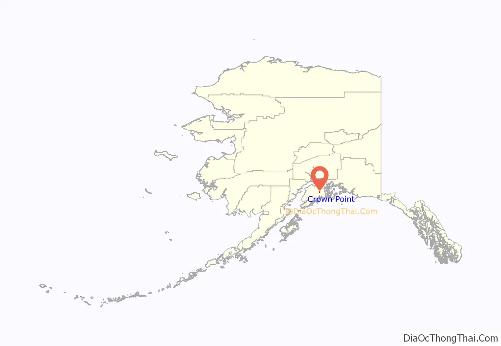
Crown Point is a census-designated place (CDP) in Kenai Peninsula Borough, Alaska, United States. The population was 74 at the 2010 census. Land access to this area is by either the Alaska Railroad or the Seward Highway.
| Name: | Crown Point CDP |
|---|---|
| LSAD Code: | 57 |
| LSAD Description: | CDP (suffix) |
| State: | Alaska |
| County: | Kenai Peninsula Borough |
| Elevation: | 912 ft (278 m) |
| Total Area: | 3.57 sq mi (9.26 km²) |
| Land Area: | 3.57 sq mi (9.26 km²) |
| Water Area: | 0.00 sq mi (0.00 km²) |
| Total Population: | 119 |
| Population Density: | 33.30/sq mi (12.85/km²) |
| Area code: | 907 |
| FIPS code: | 0217960 |
| GNISfeature ID: | 1417059 |
Online Interactive Map
Click on ![]() to view map in "full screen" mode.
to view map in "full screen" mode.
Crown Point location map. Where is Crown Point CDP?
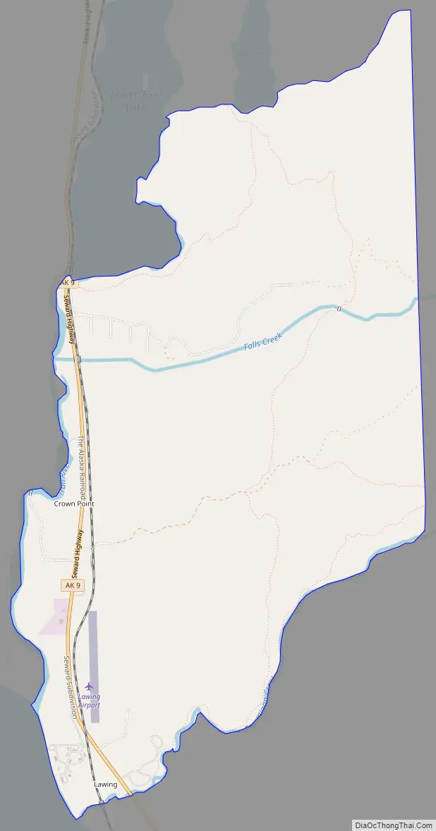
Crown Point Road Map
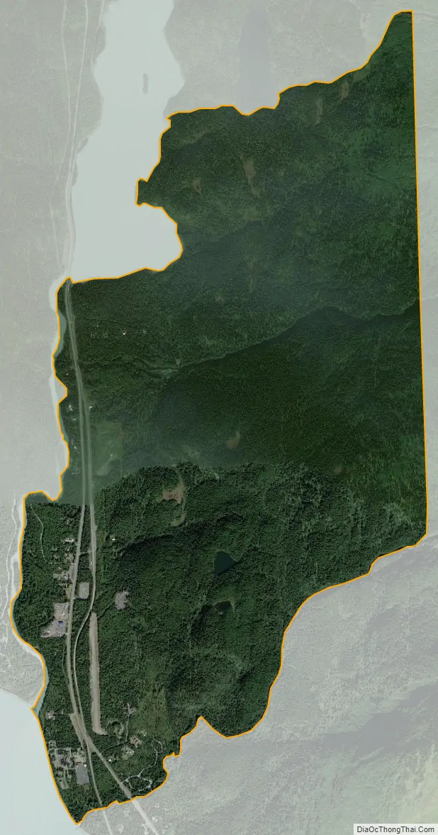
Crown Point city Satellite Map
Geography
Crown Point is located in the north-central part of the Kenai Peninsula at 60°25′8″N 149°21′19″W / 60.41889°N 149.35528°W / 60.41889; -149.35528 (60.418833, -149.355340), near the confluence of the Trail River and Kenai Lake. It is bordered to the north by Moose Pass and to the south by Primrose. Alaska Route 9, the Seward Highway, leads north from Crown Point 12 miles (19 km) to Alaska Route 1 at Tern Lake, and south 24 miles (39 km) to Seward. Portions of this CDP were once the settlement known as Lawing, which was centered around Alaska Nellie’s Homestead.
According to the United States Census Bureau, the Crown Point CDP has a total area of 3.6 square miles (9.3 km), all of it land.
See also
Map of Alaska State and its subdivision:- Aleutians East
- Aleutians West
- Anchorage
- Bethel
- Bristol Bay
- Denali
- Dillingham
- Fairbanks North Star
- Haines
- Juneau
- Kenai Peninsula
- Ketchikan Gateway
- Kodiak Island
- Lake and Peninsula
- Matanuska-Susitna
- Nome
- North Slope
- Northwest Arctic
- Prince of Wales-Outer Ketchi
- Sitka
- Skagway-Yakutat-Angoon
- Southeast Fairbanks
- Valdez-Cordova
- Wade Hampton
- Wrangell-Petersburg
- Yukon-Koyukuk
- Alabama
- Alaska
- Arizona
- Arkansas
- California
- Colorado
- Connecticut
- Delaware
- District of Columbia
- Florida
- Georgia
- Hawaii
- Idaho
- Illinois
- Indiana
- Iowa
- Kansas
- Kentucky
- Louisiana
- Maine
- Maryland
- Massachusetts
- Michigan
- Minnesota
- Mississippi
- Missouri
- Montana
- Nebraska
- Nevada
- New Hampshire
- New Jersey
- New Mexico
- New York
- North Carolina
- North Dakota
- Ohio
- Oklahoma
- Oregon
- Pennsylvania
- Rhode Island
- South Carolina
- South Dakota
- Tennessee
- Texas
- Utah
- Vermont
- Virginia
- Washington
- West Virginia
- Wisconsin
- Wyoming


