Moose Pass is a census-designated place (CDP) in Kenai Peninsula Borough, Alaska, United States. The population was 219 at the 2010 census, up from 206 in 2000.
| Name: | Moose Pass CDP |
|---|---|
| LSAD Code: | 57 |
| LSAD Description: | CDP (suffix) |
| State: | Alaska |
| County: | Kenai Peninsula Borough |
| Elevation: | 472 ft (144 m) |
| Total Area: | 17.88 sq mi (46.31 km²) |
| Land Area: | 17.71 sq mi (45.88 km²) |
| Water Area: | 0.17 sq mi (0.43 km²) |
| Total Population: | 228 |
| Population Density: | 12.87/sq mi (4.97/km²) |
| ZIP code: | 99631 |
| Area code: | 907 |
| FIPS code: | 0250190 |
| GNISfeature ID: | 1417076 |
Online Interactive Map
Click on ![]() to view map in "full screen" mode.
to view map in "full screen" mode.
Moose Pass location map. Where is Moose Pass CDP?

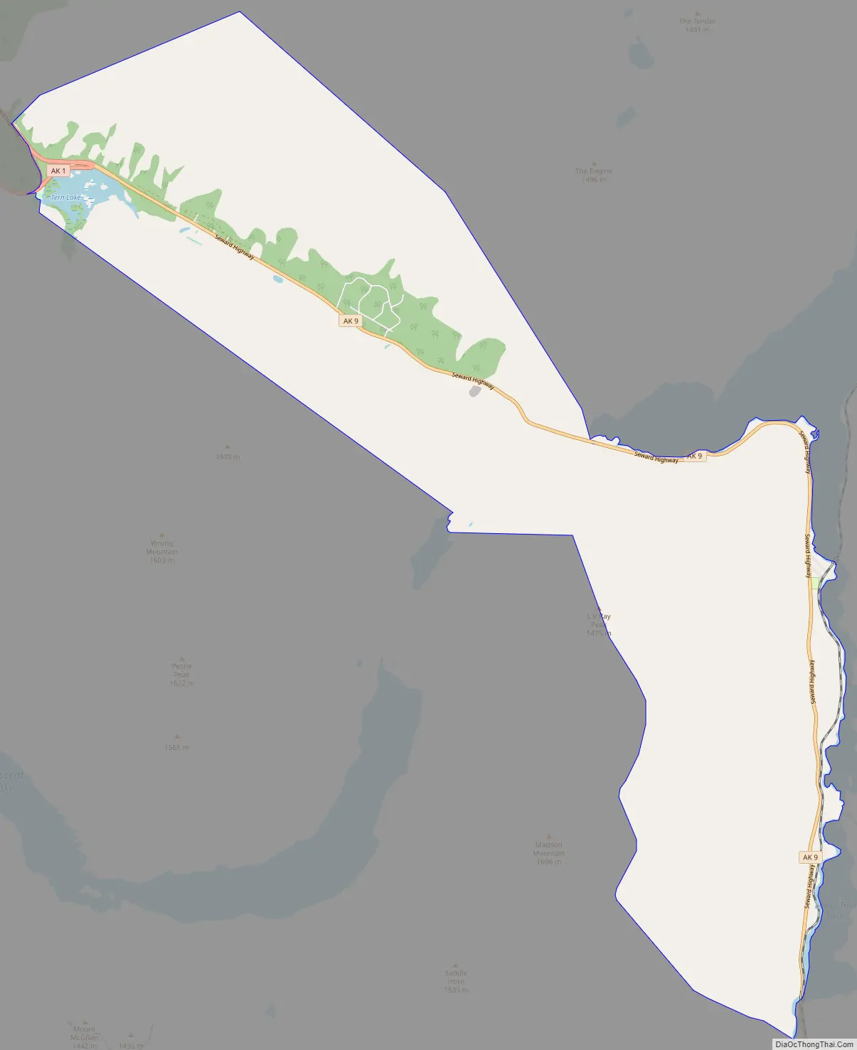
Moose Pass Road Map
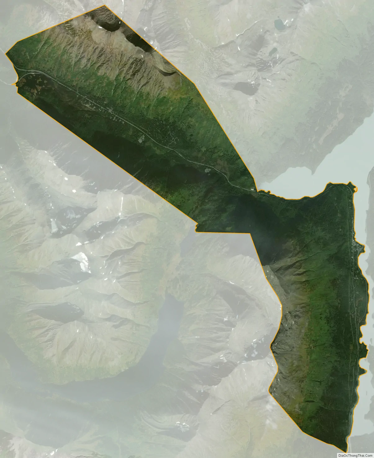
Moose Pass city Satellite Map
Geography
Moose Pass is located in the north-central part of the Kenai Peninsula at 60°29′16″N 149°22′15″W / 60.48778°N 149.37083°W / 60.48778; -149.37083 (60.487778, -149.370833). Surrounded by the Chugach National Forest, it is located 100 miles (160 km) south of Anchorage by road, and 30 miles (48 km) north of Seward on the Seward Highway along Upper Trail Lake. It is bordered to the south by Crown Point.
The CDP extends west 8 miles (13 km) along the Seward Highway to its junction with Alaska Route 1 (the Sterling Highway) at Tern Lake, from which point it is a further 56 miles (90 km) west to Soldotna, the borough seat.
According to the United States Census Bureau, the Moose Pass CDP has a total area of 17.9 square miles (46.3 km), of which 17.7 square miles (45.9 km) are land and 0.2 square miles (0.4 km), or 0.94%, are water.
Climate
Moose Pass has a dry-summer continental subarctic climate (Köppen Dsc).
Note
- ^ Mean monthly maxima and minima (i.e. the highest and lowest temperature readings during an entire month or year) calculated based on data at said location from 1991 to 2020.
See also
Map of Alaska State and its subdivision:- Aleutians East
- Aleutians West
- Anchorage
- Bethel
- Bristol Bay
- Denali
- Dillingham
- Fairbanks North Star
- Haines
- Juneau
- Kenai Peninsula
- Ketchikan Gateway
- Kodiak Island
- Lake and Peninsula
- Matanuska-Susitna
- Nome
- North Slope
- Northwest Arctic
- Prince of Wales-Outer Ketchi
- Sitka
- Skagway-Yakutat-Angoon
- Southeast Fairbanks
- Valdez-Cordova
- Wade Hampton
- Wrangell-Petersburg
- Yukon-Koyukuk
- Alabama
- Alaska
- Arizona
- Arkansas
- California
- Colorado
- Connecticut
- Delaware
- District of Columbia
- Florida
- Georgia
- Hawaii
- Idaho
- Illinois
- Indiana
- Iowa
- Kansas
- Kentucky
- Louisiana
- Maine
- Maryland
- Massachusetts
- Michigan
- Minnesota
- Mississippi
- Missouri
- Montana
- Nebraska
- Nevada
- New Hampshire
- New Jersey
- New Mexico
- New York
- North Carolina
- North Dakota
- Ohio
- Oklahoma
- Oregon
- Pennsylvania
- Rhode Island
- South Carolina
- South Dakota
- Tennessee
- Texas
- Utah
- Vermont
- Virginia
- Washington
- West Virginia
- Wisconsin
- Wyoming


