Happy Valley (Dena’ina: Shtuhtałent) is a census-designated place (CDP) in Kenai Peninsula Borough, Alaska, United States. At the 2010 census the population was 593, up from 489 in 2000.
| Name: | Happy Valley CDP |
|---|---|
| LSAD Code: | 57 |
| LSAD Description: | CDP (suffix) |
| State: | Alaska |
| County: | Kenai Peninsula Borough |
| Elevation: | 135 ft (41 m) |
| Total Area: | 88.20 sq mi (228.45 km²) |
| Land Area: | 88.20 sq mi (228.44 km²) |
| Water Area: | 0.00 sq mi (0.01 km²) |
| Total Population: | 713 |
| Population Density: | 8.08/sq mi (3.12/km²) |
| Area code: | 907 |
| FIPS code: | 0231710 |
| GNISfeature ID: | 1866949 |
Online Interactive Map
Click on ![]() to view map in "full screen" mode.
to view map in "full screen" mode.
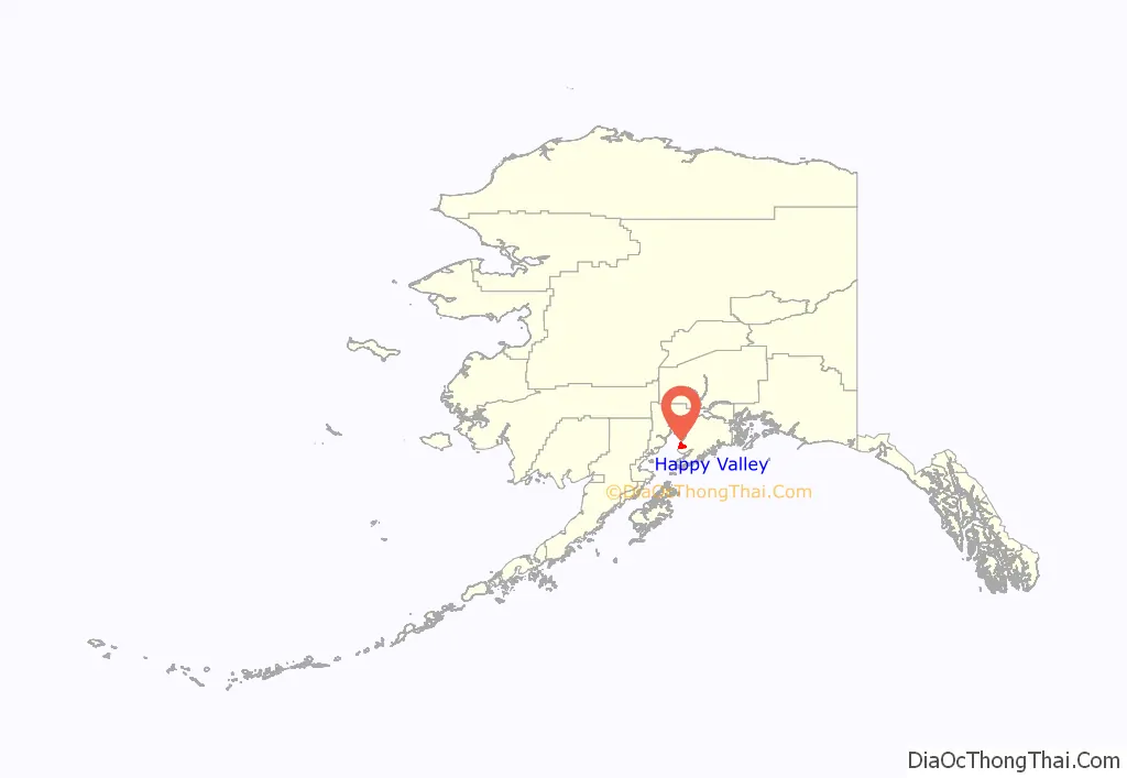
Happy Valley location map. Where is Happy Valley CDP?
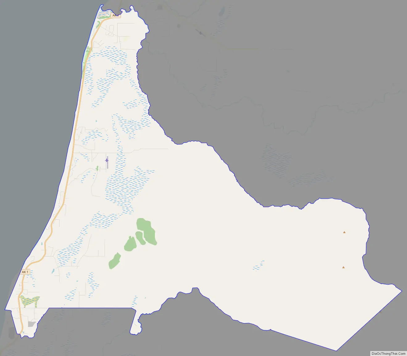
Happy Valley Road Map
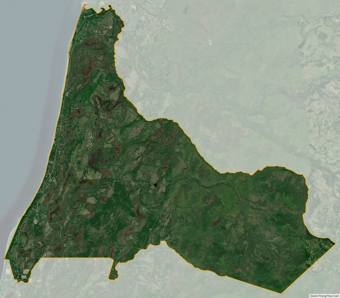
Happy Valley city Satellite Map
Geography
Happy Valley is located on the western side of the Kenai Peninsula at 59°56′54″N 151°43′7″W / 59.94833°N 151.71861°W / 59.94833; -151.71861 (59.948424, -151.718711). It is bordered to the north by Ninilchik, to the south by Anchor Point and Nikolaevsk, and to the west by Cook Inlet. Alaska Route 1 (Sterling Highway) runs through the CDP close to the shore of Cook Inlet; it leads north 47 miles (76 km) to Soldotna and south 27 miles (43 km) to Homer.
According to the United States Census Bureau, the Happy Valley CDP has a total area of 88.2 square miles (228.4 km), of which 1.9 acres (7,802 m), or 0.003%, are water.
See also
Map of Alaska State and its subdivision:- Aleutians East
- Aleutians West
- Anchorage
- Bethel
- Bristol Bay
- Denali
- Dillingham
- Fairbanks North Star
- Haines
- Juneau
- Kenai Peninsula
- Ketchikan Gateway
- Kodiak Island
- Lake and Peninsula
- Matanuska-Susitna
- Nome
- North Slope
- Northwest Arctic
- Prince of Wales-Outer Ketchi
- Sitka
- Skagway-Yakutat-Angoon
- Southeast Fairbanks
- Valdez-Cordova
- Wade Hampton
- Wrangell-Petersburg
- Yukon-Koyukuk
- Alabama
- Alaska
- Arizona
- Arkansas
- California
- Colorado
- Connecticut
- Delaware
- District of Columbia
- Florida
- Georgia
- Hawaii
- Idaho
- Illinois
- Indiana
- Iowa
- Kansas
- Kentucky
- Louisiana
- Maine
- Maryland
- Massachusetts
- Michigan
- Minnesota
- Mississippi
- Missouri
- Montana
- Nebraska
- Nevada
- New Hampshire
- New Jersey
- New Mexico
- New York
- North Carolina
- North Dakota
- Ohio
- Oklahoma
- Oregon
- Pennsylvania
- Rhode Island
- South Carolina
- South Dakota
- Tennessee
- Texas
- Utah
- Vermont
- Virginia
- Washington
- West Virginia
- Wisconsin
- Wyoming


