Kasilof (/kəˈsiːlɒf/ kə-SEE-lof; Dena’ina: Ggasilat, Russian: Касилов) is a census-designated place (CDP) in Kenai Peninsula Borough, Alaska, United States. At the 2020 census the population was 525, down from 549 in 2010.
| Name: | Kasilof CDP |
|---|---|
| LSAD Code: | 57 |
| LSAD Description: | CDP (suffix) |
| State: | Alaska |
| County: | Kenai Peninsula Borough |
| Elevation: | 125 ft (38 m) |
| Total Area: | 10.63 sq mi (27.52 km²) |
| Land Area: | 10.43 sq mi (27.00 km²) |
| Water Area: | 0.20 sq mi (0.52 km²) |
| Total Population: | 525 |
| Population Density: | 50.36/sq mi (19.44/km²) |
| ZIP code: | 99610 |
| Area code: | 907 |
| FIPS code: | 0238090 |
| GNISfeature ID: | 1413283 |
Online Interactive Map
Click on ![]() to view map in "full screen" mode.
to view map in "full screen" mode.
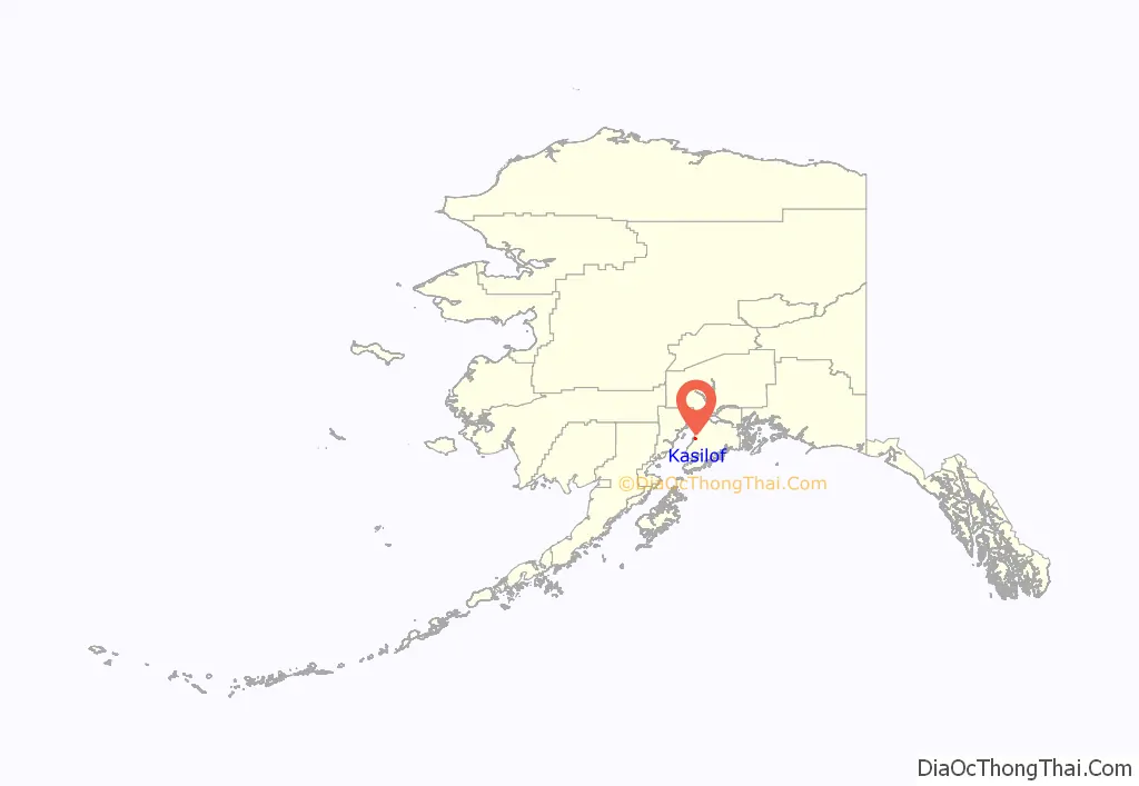
Kasilof location map. Where is Kasilof CDP?
History
In 1786 a detachment of Russians employed by the Lebedev-Lastochkin Company built an artel at the location of modern Kasilof for fishing operations. While it likely received expansions, it “never played a significant role in the history of the Russian colonies.” An agricultural settlement of Dena’ina people grew up around the stockade. During the establishment of the Russian-American Company, a fur monopoly in Russian America, the assets of the LLC were liquidated. The area became known as Kasilof after the Kasilof River in the 1800s. A partial excavation of the area in 1937 found 31 well-preserved houses from the settlement. As of 2011 most residents are non-Native.
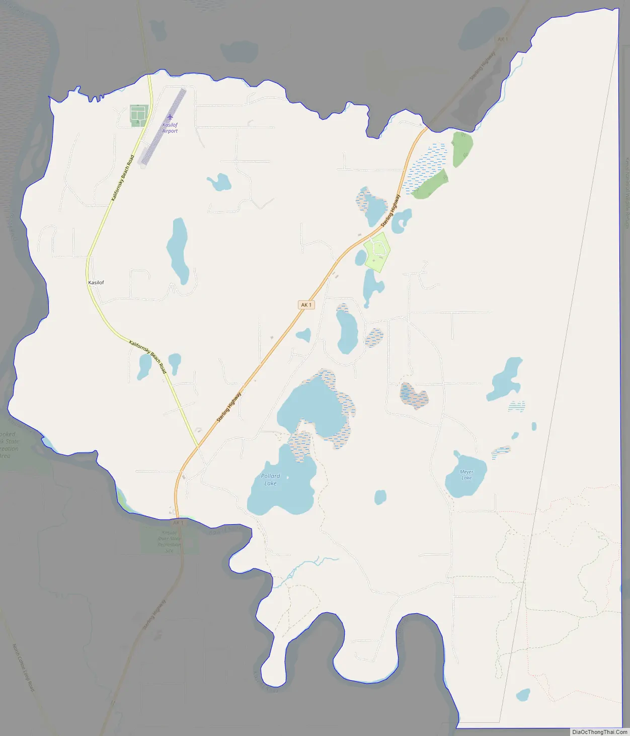
Kasilof Road Map
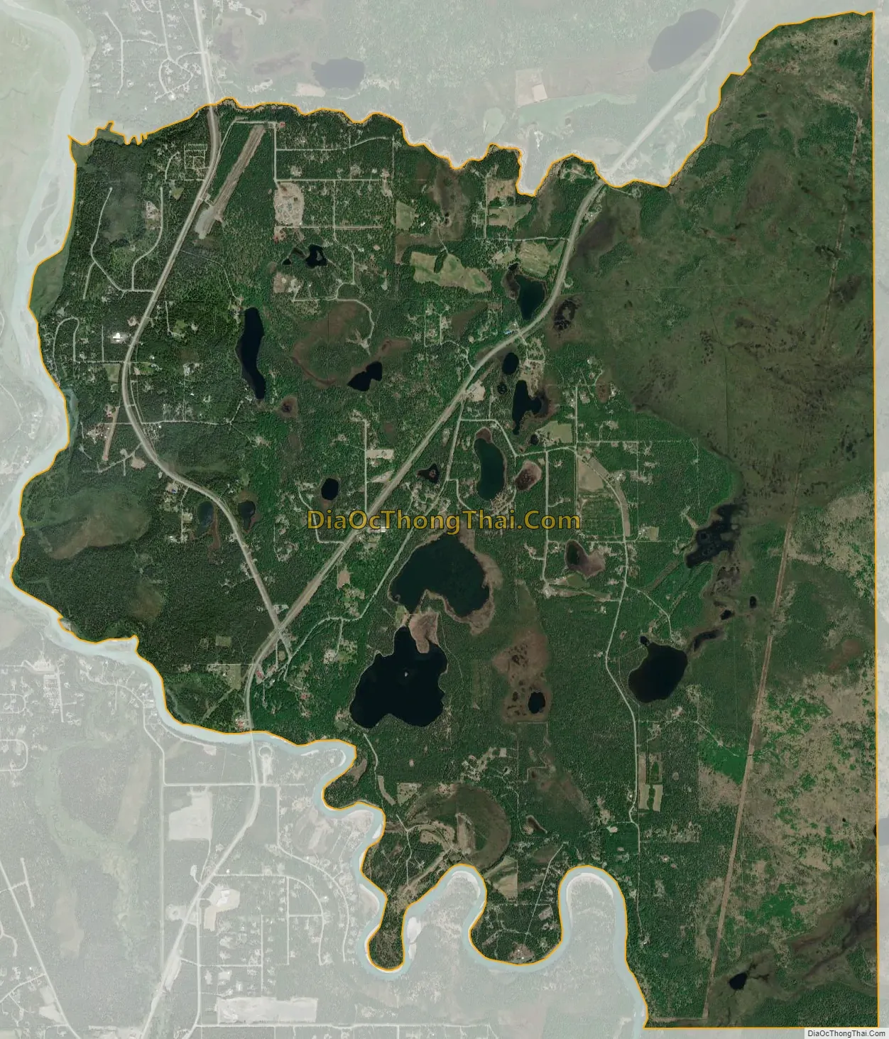
Kasilof city Satellite Map
Geography
Kasilof is located at 60°20′7″N 151°14′1″W / 60.33528°N 151.23361°W / 60.33528; -151.23361 (60.335274, -151.233594). It is on the east side of the Cook Inlet on the Kenai Peninsula, on the Sterling Highway, 19 km (12 mi) south Kenai and 62 miles (100 km) north of Homer. It is bordered to the southwest by the Kasilof River, across which is the community of Cohoe. To the north, across Coal Creek, is the community of Kalifornsky.
According to the United States Census Bureau, the Kasilof CDP has a total area of 10.6 square miles (27.5 km), of which 10.4 square miles (27.0 km) are land and 0.2 square miles (0.5 km), or 1.89%, are water.
See also
Map of Alaska State and its subdivision:- Aleutians East
- Aleutians West
- Anchorage
- Bethel
- Bristol Bay
- Denali
- Dillingham
- Fairbanks North Star
- Haines
- Juneau
- Kenai Peninsula
- Ketchikan Gateway
- Kodiak Island
- Lake and Peninsula
- Matanuska-Susitna
- Nome
- North Slope
- Northwest Arctic
- Prince of Wales-Outer Ketchi
- Sitka
- Skagway-Yakutat-Angoon
- Southeast Fairbanks
- Valdez-Cordova
- Wade Hampton
- Wrangell-Petersburg
- Yukon-Koyukuk
- Alabama
- Alaska
- Arizona
- Arkansas
- California
- Colorado
- Connecticut
- Delaware
- District of Columbia
- Florida
- Georgia
- Hawaii
- Idaho
- Illinois
- Indiana
- Iowa
- Kansas
- Kentucky
- Louisiana
- Maine
- Maryland
- Massachusetts
- Michigan
- Minnesota
- Mississippi
- Missouri
- Montana
- Nebraska
- Nevada
- New Hampshire
- New Jersey
- New Mexico
- New York
- North Carolina
- North Dakota
- Ohio
- Oklahoma
- Oregon
- Pennsylvania
- Rhode Island
- South Carolina
- South Dakota
- Tennessee
- Texas
- Utah
- Vermont
- Virginia
- Washington
- West Virginia
- Wisconsin
- Wyoming


